- Gratis verzending vanaf 30 euro
- Levert in Nederland, België etc.
- Meer dan 30.000 titels
- Vakkundige klantenservice
- Snelle levering
- Veilig en eenvoudig betalen

Direct contact?
Bel +31 (0)6 42428571
maandag t/m vrijdag
van 10 tot 17 uur
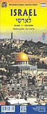
Wegenkaart - landkaart Tel Aviv - Jaffa en Centraal Israel | ITMB
Water- en scheurvaste wegenkaart

De ITMB kaarten kenmerken zich door een kleurrijke en volle cartografische weergave. Het zijn degelijke kaarten, zeker voor gebieden waarvoor kaarten lastig te krijgen zijn, met aanduidingen van onder andere nationale parken en natuurgebieden, vliegvelden, toeristische bezienswaardigheden en een goede aanduiding van het wegennet. Schaal wegenkaart 1:220.000. Daarnaast bevatten enkele kaarten ook stadsplattegronden (hoofdsteden of belangrijke centra). Bevat voor sommige landen ook aanduidingen in de orginele taal. Water- en scheurvaste wegenkaart. This map resulted from our visit to Israel a couple of years ago. We got lost in Tel Aviv and wasted a lot of time trying to find our way to where we were staying. Although quite good maps of Tel Aviv exist, most are in Hebrew and are very "Israeli". We decided to do a map that combined the newish city of Tel Aviv with its older and more exotic neighbour, Jaffa, which is currently dominated by those of a non-Jewish orientation. Jaffa is the ancient port used by Phoenicians, Greeks, Romans, and traders plying the Silk Road to China. Its old town is quite compact and a treat to explore. Tel Aviv is the practical capital of Israel, despite Trump's attempt to inflame passions by saying he will move the US embassy to Jerusalem. Israel is always a high-explosives-on-a-short-fuse kind of country; lovely to visit, but stressful. Tel Aviv is a cultured and sensible Mediterranean city with gorgeous beaches, modern buildings, and a feeling of prosperity. We found it to be a 'normal' city in comparison to other parts of the country that we visited. The other side of the sheet forms a detailed map of the central portion of Israel, from Haifa to Beersheba to the Dead Sea, so includes the West Bank and the Gaza Strip as well as Jerusalem, Bethlehem, Nazareth, the Sea of Galilee, and most sites of a religious nature, so satisfies pilgrims as well as the explorer. My favourite site was Acre, now called Akko, which is still a walled city.
Schaal: 1:12.000
Engelstalig
EAN: 9781771297967
Uitgeverij: ITMB (International Tavel Maps & Books)
Meest recente editie
Engelstalig


Op voorraad
Levertijd 3 dagen (Nederland)
- Vakkundige klantenservice
- Groot assortiment
- Gratis retourneren binnen 14 dagen
- Aangesloten bij WebwinkelKEUR
€ 13,50
Meer producten die interessant kunnen zijn
Wegenkaarten Israël
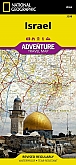
Wegenkaart - Landkaart Israel - Adventure Map National Geographic
Deze kaart is gemaakt van scheur- en watervast materiaal
€ 16,99
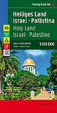
Wegenkaart - Landkaart Israel Palestina - World Mapping Project (Reise Know-How)
Water- en scheurvaste wegenkaart
€ 13,50
Stedengidsen Israël
Stedenreisgids Tel Aviv ANWB Extra
De kompakte reisgids met uitneembare kaart
€ 15,50
Tijdelijk niet leverbaar
Reisgidsen Israël
Koopjes Israël
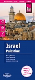
Wegenkaart - Landkaart Israel Palestina - World Mapping Project (Reise Know-How)
van 11.50 voor 4.99!
€ 4,99