- Gratis verzending vanaf 30 euro
- Levert in Nederland, België etc.
- Meer dan 30.000 titels
- Vakkundige klantenservice
- Snelle levering
- Veilig en eenvoudig betalen

Direct contact?
Bel +31 (0)6 42428571
maandag t/m vrijdag
van 10 tot 17 uur
Europa / Groot-Brittannië / Engeland / Midden-Engeland
Midden-Engeland bestsellers
Topografische Wandelkaart OL1 van Groot-Brittannië (1:25.000) Peak District - Dark Peak area - Explorer Map OL 1
Wandelkaart | Ordnance Survey (OS) Groot-Brittannië
18,99
|
Wegenkaart - Landkaart 5 Midlands & Central England - AA Road Map BritainOverzichtelijke wegenkaarten met een helder kaartbeeld. Wegnummers zijn weergegeven. Toerististische informatie door middel van pictogrammen. Campings, VVV, musea, grotten, picnic plekken, kastelen zijn onder andere aangegeven. Op de achterzijde staat een plaatsnamen register plus een aantal stadsplattegrondjes. Schaal: 1:200.000 |
8,99 |
|
Reisgids Norfolk & Suffolk Rough GuideDe Rough Guide is een zeer degelijke, uitgebreide en informatieve reisgids voor iedere type reiziger: van backpacker tot cultuurreiziger. De Rough Guide staat bekend om de degelijke en goed onderzochte achtergrondinformatie en de goede ordening van verschillende onderwerpen. Voor veel gebieden is de Rough Guide een goed, soms zelfs een beter, alternatief voor de populaire Lonely Planet. The Rough Guide to Norfolk & Suffolk focuses on one of the UK's most popular regions. In full colour throughout, with dozens of gorgeous photos, it will inspire you to explore t... |
19,99 Tijdelijk niet leverbaar |
|
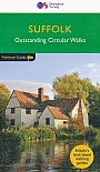
Wandelgids Suffolk Coast and Heath Walks | Cicerone | 3 long-distance routes in the AONBGuidebook to 3 long-distance routes exploring the varied landscapes of the Suffolk Coast and Heaths AONB. The Suffolk Coast Path covers 55 to 60 miles from Lowestoft to Felixstowe. The Stour and Orwell Walk is 40 miles from Felixstowe to Cattawade near Manningtree, while the Sandlings Walk is 59 miles from Ipswich to Southwold. all the routes can be walked at any time of year; summer is the busiest time and accommodation may be hard to find during the Aldeburgh Festival in June; spring and autumn are best for watching birds; winter has its own charm when you may find t... |
17,99 |
|
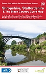
Fietskaart 22 Shropshire Staffordshire & the Black Country Cycle Map Sustrans Pocket Sized | van 9.99 voor 4.99!Mid-Wales South Cycle Map including the Ystwyth Trail, Elan Valley Trail, Lon Las Cymru, Lon Teifi, 3 day rides & 6 town centre maps. This is in the series of pocket sized, folded maps to the National Cycle Network which include clearly mapped on-road and traffic-free paths, easy to read contours and detailed town insets. The series is published by CycleCity Guides in partnership with Sustrans. 1:110,000 scale; folded. Schaal: 1:110.00 |
4,99 |
|
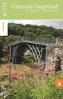
Reisgids Engeland Centraal DominicusDe Dominicus gidsen zijn zeer degelijke reisgidsen waar de nadruk vooral ligt op het bieden van achtergrondinformatie bij de reisbestemming. Op een persoonlijke wijze worden thema's behandeld als de ontwikkeling van de lokale economie, de kenmerken van de lokale bevolking, verschillende culturele uitingen (zoals religie, gebruiken en gewoonten) en de algemene geschiedenis. Daarnaast wordt er per regio, stad of gebied specifieke informatie gegeven over de belangrijkste kenmerken. Er is een sterke focus op de culturele bezienswaardigheden. De Dominicus is vloeiend geschr... |
22,99 Tijdelijk niet leverbaar |
|
Wandelgids 48 Suffolk Pathfinder Guide | Pathfinder Guide 48 | Met Ordanance Survey kaartenDeze Pathfinder Guide is een goed uitgevoerde gids met verschillende wandelingen in Groot-Britannië. De gids bevat naast goede topografische kaarten van de Britse topografische dienst (Ordanance Survey) ook beschrijvingen van het landschap, de cultuur en/of de flora en fauna. Verder is de gids voorzien van praktische informatie zoals startpunten, verwachte wandeltijd, restaurants en cafés voor onderweg. Suffolk's riverside meadows of the Stour valley remain as beautiful today as when Constable painted them two centuries ago. Similarly, the county's lonely expanses... |
17,99 |
|
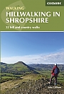
Wandelgids Hillwalking in Shropshire Cicerone Guidebooks | 32 hill and country walksGuidebook to 32 walks in the hills of Shropshire. The walks, which are graded easy, moderate or hard, range from 3 miles (5km) to 12 miles (19km) and can be walked in all seasons. The selected routes take in highlights such as The Wrekin, Wenlock Edge, Long Mynd and Stiperstones, Castle Ring and Bury Ditches. Featuring 1:50K OS mapping (shown at 1:40K for greater clarity), step-by-step route descriptions, as well as information on accommodation, getting around, bases for the Shropshire hills and history of the region, the guide details everything you need to walk in Sh... |
17,99 Tijdelijk niet leverbaar |
|
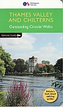
Wandelgids 25 Thames Valley and Chilterns Pathfinder Guide | Pathfinder Guide 25 | Met Ordanance Survey kaartenDeze Pathfinder Guide is een goed uitgevoerde gids met verschillende wandelingen in Groot-Britannië. De gids bevat naast goede topografische kaarten van de Britse topografische dienst (Ordanance Survey) ook beschrijvingen van het landschap, de cultuur en/of de flora en fauna. Verder is de gids voorzien van praktische informatie zoals startpunten, verwachte wandeltijd, restaurants en cafés voor onderweg. The Chilterns form part of the long line of chalk hills stretching intermittently across southern and eastern England. It is an area characterised by beech woods and ... |
17,99 |
|
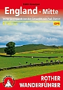
Wandelgids 252 Engeland Mitte | Rother Bergverlag | Im herzen von den Cotswols zum Peak District 52 wandelingenDe vermaarde wandelgiden van Rother Bergverlag zijn uitstekende wandelgidsen voor ieder niveau. Op een kaartje is de wandelroute aangegeven, maar deze is ook beschreven in een beknopte en heldere tekst. Daarnaast is ook de afstand, de verwachte wandeltijd, het niveau, de hoogte en andere praktische informatie aangegeven. Met deze degelijke wandelgids ontdek je de mooiste plekken van jouw bestemming en kun je de spannendste wandeluitdagingen zoeken. Im herzen von den Cotswols zum Peak District 52 wandelingen. |
14,90 |
|
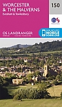
Topografische Wandelkaart 150 Worcester / The Malverns Evesham & Tewkesbury - Landranger Map | Wandelkaart & Fietskaart | Ordnance Survey (OS) Groot-BrittanniëDeze gedetailleerde en informatieve topografische kaart (stafkaart, schaal 1:50.000) van Groot-Brittannië bevat alle topografische elementen van het landschap en geeft daarmee een nauwkeurig beeld van het terrein. Daarnaast heeft Ordnance Survey (OS) ook toeristische informatie op de meeste kaart verwerkt, zoals de aanduiding voor campings en ingetekende wandelpaden . Deze kaart is ideaal voor wandelaars of fietsers, maar ook voor de scouting of sportverenigingen die activiteiten in Groot-Brittannië gaan uitvoeren. De kaarten zijn voorzien van een GPS aanduiding en e... Schaal: 1:50.000 |
18,99 |

|
Topografische Wandelkaart 139 Birmingham / Wolverhampton - Landranger Map | Wandelkaart & Fietskaart | Ordnance Survey (OS) Groot-BrittanniëDeze gedetailleerde en informatieve topografische kaart (stafkaart, schaal 1:50.000) van Groot-Brittannië bevat alle topografische elementen van het landschap en geeft daarmee een nauwkeurig beeld van het terrein. Daarnaast heeft Ordnance Survey (OS) ook toeristische informatie op de meeste kaart verwerkt, zoals de aanduiding voor campings en ingetekende wandelpaden . Deze kaart is ideaal voor wandelaars of fietsers, maar ook voor de scouting of sportverenigingen die activiteiten in Groot-Brittannië gaan uitvoeren. De kaarten zijn voorzien van een GPS aanduiding en e... Schaal: 1:50.000 |
18,99 |
|
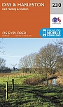
Topografische Wandelkaart 230 Diss / Harleston / East Harling / Stanton - Explorer Map | Wandelkaart & Fietskaart | Ordnance Survey (OS) Groot-BrittanniëDeze gedetailleerde en informatieve topografische kaart (stafkaart, schaal 1:25.000) van Groot-Brittannië bevat alle topografische elementen van het landschap en geeft daarmee een nauwkeurig beeld van het terrein. Daarnaast heeft Ordnance Survey (OS) ook toeristische informatie op de meeste kaart verwerkt, zoals de aanduiding voor campings en ingetekende wandelpaden . Deze kaart is ideaal voor wandelaars of fietsers, maar ook voor de scouting of sportverenigingen die activiteiten in Groot-Brittannië gaan uitvoeren. De kaarten zijn voorzien van een GPS aanduiding en e... Schaal: 1:25.000 |
18,99 |
|
Reisgids The Chilterns & the Thames Valley Slow Travel | BradtThis new title from Bradt forms part of its distinctive 'Slow Travel' series and is the only title available to cover the Chilterns and Thames Valley in depth. The Chilterns and the Thames Valley do not correspond to the specific boundaries of one county or region, old or new. Bedfordshire, Berkshire, Buckinghamshire, Hertfordshire and Oxfordshire all have a share. Divided into six easily manageable sections, Bradt's The Chilterns and Thames Valley lifts the lid on what makes this area so distinctive. Chalk grasslands, beech woods, streams and wooded ... |
17,99 |
|
Wandelgids Oost Engeland Ost England | Rother Bergverlag | 55 wandelingenDe vermaarde wandelgiden van Rother Bergverlag zijn uitstekende wandelgidsen voor ieder niveau. Op een kaartje is de wandelroute aangegeven, maar deze is ook beschreven in een beknopte en heldere tekst. Daarnaast is ook de afstand, de verwachte wandeltijd, het niveau, de hoogte en andere praktische informatie aangegeven. Met deze degelijke wandelgids ontdek je de mooiste plekken van jouw bestemming en kun je de spannendste wandeluitdagingen zoeken. 55 wandelingen. Kleine Fachwerkdorfer, blumengeschmuckte Pubs, alte Burgen und: Natur, Natur, Natur! Englands Osten ist ei... |
14,90 |
|
Wandelgids 21Somerset the Mendips Wiltshire Pathfinder Guide | Pathfinder Guide 21 | Met Ordanance Survey kaartenDeze Pathfinder Guide is een goed uitgevoerde gids met verschillende wandelingen in Groot-Britannië. De gids bevat naast goede topografische kaarten van de Britse topografische dienst (Ordanance Survey) ook beschrijvingen van het landschap, de cultuur en/of de flora en fauna. Verder is de gids voorzien van praktische informatie zoals startpunten, verwachte wandeltijd, restaurants en cafés voor onderweg. |
17,99 Tijdelijk niet leverbaar |
|
Wandelkaart Shropshire Way - National Trail Maps | Harvey Maps | Water- en scheurvaste wandelkaartDe Harvey Map is de wandelkaart voor het lange afstand wandelpad in het Groot-Brittannië. Duidelijke topografische wandelkaarten met praktische informatie van de route zoals overnachtingsmogelijkheden, eetgelegenheden en bezienswaardigheden. Deze wandelkaart is scheur- en watervast. Met GPS compatible (UTM-Grid). Schaal: 1:40.000 |
25,99 |
|
Reisgids Peak District slow travel Go Slow - Bradt Travel GuidesPrima reishandboek met veel praktische informatie: overnachtingsmogelijkheden, transport, eetgelegenheden, plattegrondjes, backpack informatie, suggesties voor een actieve vakantie. Betrouwbare achtergrond informatie over cultuur, land en bevolking. Met deze gids kun je van de platgetreden paden af en het avontuur tegemoet. Een geschikte gids voor toeristen luw gebied. |
18,99 Tijdelijk niet leverbaar |
|
Wandelgids 53 Lancashire Pathfinder Guide | Pathfinder Guide 53 | Met Ordanance Survey kaartenDeze Pathfinder Guide is een goed uitgevoerde gids met verschillende wandelingen in Groot-Britannië. De gids bevat naast goede topografische kaarten van de Britse topografische dienst (Ordanance Survey) ook beschrijvingen van het landschap, de cultuur en/of de flora en fauna. Verder is de gids voorzien van praktische informatie zoals startpunten, verwachte wandeltijd, restaurants en cafes voor onderweg. With its fen-like lowlands, its coastal scenery, the high fells of Bowland and the lush river valleys of the Ribble and Lune, Lancashire is a county of surprising ... |
17,99 |
|
Reisgids Shropshire slow travel | Bradt guidesPrima reishandboek met veel praktische informatie: overnachtingsmogelijkheden, transport, eetgelegenheden, plattegrondjes, backpack informatie, suggesties voor een actieve vakantie. Betrouwbare achtergrond informatie over cultuur, land en bevolking. Met deze gids kun je van de platgetreden paden af en het avontuur tegemoet. Een geschikte gids voor toeristen luw gebied. |
18,99 |
|
Wandelgids 42 Cheshire Pathfinder Guide | Pathfinder Guide 42 | Met Ordanance Survey kaartenDeze Pathfinder Guide is een goed uitgevoerde gids met verschillende wandelingen in Groot-Britannie. De gids bevat naast goede topografische kaarten van de Britse topografische dienst (Ordanance Survey) ook beschrijvingen van het landschap, de cultuur en/of de flora en fauna. Verder is de gids voorzien van praktische informatie zoals startpunten, verwachte wandeltijd, restaurants en cafes voor onderweg. 28 dagwandelingen. This walking guidebook for Cheshire contains 28 outstanding walks all tried and tested by experienced walkers. The routes range from extended strolls... |
17,99 |
|
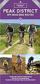
Fietsgids Cycling in the Peak District Cicerone Guide | 21 routes in and around the National ParkThe scenic Peak District boasts an abundance of country lanes, tracks, towpaths and railway trails that are perfect for two-wheeled exploration. This guidebook presents 20 graded day rides in the national park, along with a challenging 250km route, the five-day 'Tour de Peak District'. With a focus on quiet lanes, gratifying downhills and not overly technical bridleways, tracks and trails, the routes are ideal for gravel/adventure bikes (or hybrid/cross), though most can be easily adapted for road bikes. |
16,99 |
|
Wandelgids Walking in Essex | Cicerone Guidebooks25 dagwandelingen en een meerdaagde wandeltocht van 154 km. This guidebook describes 25 coastal and inland day walks covering the whole of the county of Essex, stretching from the Lea Valley in the west and the Thames in the south over to the North Sea and up to the River Stour in the north. Walks range from 4 to 18 miles and are mostly circular. Also included is a description of the Essex Way which crosses the county in 11 stages from Manor Park, on the fringes of London, to the port of Harwich - a distance of 96 miles. The walks are suitable for all abilities ... |
17,99 |
|
Wandelgids Walking on the North Wessex Downs | Cicerone | 30 walks exploring the AONBThis guidebook to 30 walks in the North Wessex Downs Area of Outstanding Natural Beauty (AONB) explore walking routes between 7 and 20km in length, through Berkshire, Hampshire, Wiltshire and Oxfordshire. The name 'Wessex' brings to mind Alfred the Great, Saxon hordes and chalk downs sculpted into ancient forts. And while that is all true, the North Wessex Downs are also accessible hills that rise above the towns and rural plains of southern England and roll gently west from Reading and Basingstoke to Swindon and down past Malborough to Andover. &... |
Tijdelijk niet leverbaar |
|
Wandelgids The Severn Way the UK's longest river from source to sea | CiceroneThe Severn Way is a 215 mile (348km) walk through the Welsh borders. Beginning at the River Severn's source in Powys, mid-Wales, this guidebook gives all the information needed to enjoy walking the route. The Severn Way meanders through superb landscapes, interesting towns and villages before finishing near Bristol, in south-west England. May to September should avoid both the usual periods of flooding and the glutinous aftermath they bring. Main centres are Worcester and Gloucester; marginally lesser centres are Newtown, Welshpool, Shrewsbury, Bridgnorth, Sto... |
21,99 |
|
Wandelgids 74 Malverns to Warwickshire Pathfinder Guide | Pathfinder Guide 01 | Met Ordanance Survey kaartenDeze Pathfinder Guide is een goed uitgevoerde gids met verschillende wandelingen in Groot-Britannië. De gids bevat naast goede topografische kaarten van de Britse topografische dienst (Ordanance Survey) ook beschrijvingen van het landschap, de cultuur en/of de flora en fauna. Verder is de gids voorzien van praktische informatie zoals startpunten, verwachte wandeltijd, restaurants en cafés voor onderweg. The area covered by this guide encompasses all the scenic features that are generally considered to be traditionally English. It is a landscape characterised by gentl... |
17,95 Tijdelijk niet leverbaar |
|
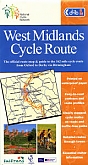
Fietskaart 16 Engeland Warwickshire & the South Midlands Cycle Map Sustrans Pocket SizedThis area map shows the National Cycle Network and local routes in this area. It covers the Warwickshire & South Midlands area of the Midlands region of England, including Warwick, Coventry, Rugby, Northampton and Kettering. This pocket-sized colour map shows clearly mapped on-road and traffic-free paths, easy to read contours, and detailed inset maps for the major towns and cities as well as recommended linking routes connecting the NCN with quiet roads. The map also features 5 day rides with directions and a description of the area, highlighting key cycle routes,... Schaal: 1:110.000 |
10,99 |

|
Stadsplattegrond Liverpool Pocket Map - Freytag & Berndt | Water- en scheurvaste stadsplattegrondEen overzichtelijke stadsplattegrond met stratenindex (achterzijde) en aanduiding van toeristische informatie en culturele instellingen zoals musea, monumenten, schouwburgen en sportaccomodaties. Daarnaast bevaten de meeste kaarten een heldere aanduiding van het openbaarvervoer (opstappunten van bijvoorbeeld de metro, tram of bus), parkeergelegenheden, postkantoren en andere praktische informatie. Schaal: 1:10.000 |
8,50 |
|
Fietskaart Derby To York NN6B Cycle Map | Sustrans | van 10.99 voor 3.99!Sustrans kaarten geven een goed overzicht van het National Cycle Network. 25.000 km lang is het fietsnetwerk inmiddels. De routes zijn bewegwijzerd, autoluw en fietsvriendelijk. Oude spoorwegen zijn omgetoverd in fietspaden of er wordt gebruik gemaakt van jaagpaden langs waterwegen. De cartografie is duidelijk met veel praktische informatie. Schaal: 1:100.000 |
3,99 |
|
Fietskaart South Midlands NN6A Cycle Map | Sustrans | van 10.99 voor 3.99!Sustrans kaarten geven een goed overzicht van het National Cycle Network. 25.000 km lang is het fietsnetwerk inmiddels. De routes zijn bewegwijzerd, autoluw en fietsvriendelijk. Oude spoorwegen zijn omgetoverd in fietspaden of er wordt gebruik gemaakt van jaagpaden langs waterwegen. De cartografie is duidelijk met veel praktische informatie. Schaal: 1:100.000 |
3,99 |
|
Fietskaart 13 East Anglia The Norfolk Broads Cycle Maps UK | Cordee | Water- en scheurvaste wandelkaart
Schaal: 1:100.000 |
13,95 |
|
Fietskaart 18 Peak District Cycle Maps UK | Cordee | Water- en scheurvaste fietskaart
Schaal: 1:100.000 |
13,95 |
|
Reisgids Slow Norfolk Bradt Travel Guide | Local, Characterful Guides To Britain's Special PlacesThis new, thoroughly updated, third edition of Bradt's Norfolk, part of Bradt's award-winning 'Slow travel' series of guides to UK regions, turns the spotlight on this county of contrasts, from the fine city of Norwich to the watery wilderness of the Broads and the sweeping beaches of the superlative north coast. As well as featuring all the main sights, experienced travel writer and local resident Laurence Mitchell ensures that Bradt's Norfolk covers places and aspects not detailed by other guidebooks and offers a special emphasis on car-free trave... |
21,50 |
|
|
Topografische Wandelkaart OL1 van Groot-Brittannië (1:25.000) Peak District - Dark Peak area - Explorer Map OL 1 | Wandelkaart | Ordnance Survey (OS) Groot-BrittanniëDeze gedetailleerde en informatieve topografische kaart (stafkaart, schaal 1:25.000) van Groot-Brittannië bevat alle topografische elementen van het landschap en geeft daarmee een nauwkeurig beeld van het terrein. Daarnaast heeft Ordnance Survey (OS) ook toeristische informatie op de meeste kaart verwerkt, zoals de aanduiding voor campings en ingetekende wandelpaden . Deze kaart is ideaal voor wandelaars of fietsers, maar ook voor de scouting of sportverenigingen die activiteiten in Groot-Brittannië gaan uitvoeren. De kaarten zijn voorzien van een GPS aanduid... Schaal: 1:25.000 |
18,99 |
|
Wegenkaart - Landkaart 4 East Anglia - AA Road Map BritainOverzichtelijke wegenkaarten met een helder kaartbeeld. Wegnummers zijn weergegeven. Toerististische informatie door middel van pictogrammen. Campings, VVV, musea, grotten, picnic plekken, kastelen zijn onder andere aangegeven. Op de achterzijde staat een plaatsnamen register plus een aantal stadsplattegrondjes. Schaal: 1:200.000 |
8,99 |
|
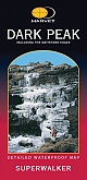
Wandelkaart Dark Peak - Walking Maps Superwalker | Harvey Maps | Water- en scheurvaste wandelkaartDe Harvey Map is de wandelkaart voor het wandelen in de mooiste natuurgebieden in het Groot-Brittannië. Duidelijke topografische wandelkaarten met praktische informatie van de route zoals overnachtingsmogelijkheden, eetgelegenheden en bezienswaardigheden. Deze wandelkaart is scheur- en watervast. Met GPS compatible (UTM-Grid). Detailed map for walking, scrambling and climbing Schaal: 1:25.000 |
17,99 |
|
Mountainbikekaart Peak District MTB map | GoldeneyeDe Goldeneye kaarten zijn uitstekende vrijetijdskaarten voor Groot-Brittannië, met name goed te gebruiken voor het fietsen door de overzichtelijke schaal. De De kaarten zijn helder, overzichtelijk en gedrukt op stevig papier. Deze Mountainbikekaarten zijn uniek voor Groot-Brittannië en bevatten paden die vrij liggen van drukke wegen en/of gemotoriseerd verkeer. Daarnaast bevat het ook ook de fietspaden van NCN (De Britse 'National Cycle Network') en andere fietspaden om je route vanuit een bepaald punt aan te kunnen fietsen. Een handig register met pl... Schaal: 1:37.700 |
12,50 |
|
Fietskaart West Midlands NN5B Cycle Map | Sustrans | van 10.99 voor 3.99!Sustrans kaarten geven een goed overzicht van het National Cycle Network. 25.000 km lang is het fietsnetwerk inmiddels. De routes zijn bewegwijzerd, autoluw en fietsvriendelijk. Oude spoorwegen zijn omgetoverd in fietspaden of er wordt gebruik gemaakt van jaagpaden langs waterwegen. De cartografie is duidelijk met veel praktische informatie. Schaal: 1:100.000 |
3,99 |
|
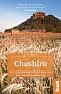
Reisgids Cheshire Slow Travel | Bradt TravelguideThis brand new title in Bradt's acclaimed UK regional Slow series is the only full guide to Cheshire, a county known for its abundance of black-and-white timbered buildings and which was put firmly on the map in the 1990s thanks to then-resident stars Posh and Becks. |
16,99 |
|
Wandelgids Peddars Way and Norfolk Coast Path Trailblazer | Knettishall Heath to Cromer
|
21,50 |
|
Wandelgids Ridgeway Cicerone Guidebooks | From Lyme Regis to HunstantonThis guidebook - which includes both a guide to the route and a separate OS map booklet - describes the Ridgeway National Trail, an 87 mile (139km) route through southern England from Avebury in Wiltshire to Ivinghoe Beacon in Buckinghamshire. Typically walked in 6 or 8 days, this is a low-level waymarked route suitable for all abilities and for year round walking. The guidebook details the trail in both directions, west to east and east to west. Step-by-step route descriptions are accompanied by 1:100,000 OS mapping and a separate OS 1:25,000 map booklet showing the e... |
17,99 |
|
Wandelgids Walking in Norfolk | Cicerone | 40 circular walks in the Broads, Brecks, Fens and along the coastThis book describes 40 easy-to-moderate circular day walks, grouped by area: Northeast coast and the Broads; South Norfolk, the Yare and the Waveney; North Norfolk and coast; Central Norfolk and Breckland and West Norfolk and Fens. Each walk is described step-by-step, illustrated with 1:40K OS map extracts and packed with historical, geological and other information about the landscape the route passes through. |
18,99 |
|
Wandelkaart Pennine Way South: Edale to Horton in Ribblesdale - National Trail Maps | Harvey Maps | Water- en scheurvaste wandelkaartDe Harvey Map is de wandelkaart voor het lange afstand wandelpad in het Groot-Brittannië. Duidelijke topografische wandelkaarten met praktische informatie van de route zoals overnachtingsmogelijkheden, eetgelegenheden en bezienswaardigheden. Deze wandelkaart is scheur- en watervast. Met GPS compatible (UTM-Grid). Compact and light - the map itself weighs just 60gms - a third of the weight of a laminated map, and much less bulky. And you can fold or refold it time and again, or stuff it in your back pocket and it won't fall to pieces. Schaal: 1:40.000 |
25,99 |
|
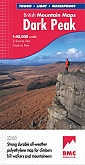
Wandelkaart Dark Peak - Mountain Map | Harvey Maps | Water- en scheurvaste wandelkaartDe Harvey Map is de wandelkaart voor het wandelen in de mooiste natuurgebieden in het Groot-Brittannië. Duidelijke topografische wandelkaarten met praktische informatie van de route zoals overnachtingsmogelijkheden, eetgelegenheden en bezienswaardigheden. Deze wandelkaart is scheur- en watervast. Met GPS compatible (UTM-Grid). Covering the popular highpoints of the Dark Peak. Printed on polyethylene - durable, tear-resistant and 100% waterproof. Made in cooperation with the British Mountaineering Council, colour shading for easy identification of hills and valleys. Le... Schaal: 1:40.000 |
28,99 |
|
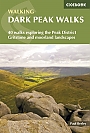
Wandelgids Dark Peak Walks | Cicerone Press | 40 wandelingenLocated in the Peak District and distinguished from the neighbouring White Peak by the layer of gritstone which covers its limestone bed, the Dark Peak features a wild landscape of sweeping moorland and big skies. Easily accessible from Sheffield, it boasts a wealth of natural, geological, historical and cultural interest – and some great walking. This guidebook describes 40 walks in the Dark Peak. Ranging from short strolls to full-day adventures, they showcase the region's unique character. Dramatic waterfalls, striking gritstone edges, heath and woodland a... |
17,99 Tijdelijk niet leverbaar |
|
Wandelgids 54 Hertfordshire and Bedfordshire Pathfinder Guide | Pathfinder Guide 54 | Met Ordanance Survey kaartenDeze Pathfinder Guide is een goed uitgevoerde gids met verschillende wandelingen in Groot-Britannië. De gids bevat naast goede topografische kaarten van de Britse topografische dienst (Ordanance Survey) ook beschrijvingen van het landschap, de cultuur en/of de flora en fauna. Verder is de gids voorzien van praktische informatie zoals startpunten, verwachte wandeltijd, restaurants en cafés voor onderweg 28 great country walks from 3 to 10 1/2 miles with lage scale OS maps. |
17,99 |
|
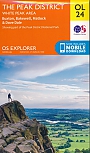
Topografische Wandelkaart OL24 van Groot-Brittannië (1:25.000) Peak District - White Peak area - Explorer Map OL 24 | Wandelkaart | Ordnance Survey (OS) Groot-BrittanniëDeze gedetailleerde en informatieve topografische kaart (stafkaart, schaal 1:25.000) van Groot-Brittannië bevat alle topografische elementen van het landschap en geeft daarmee een nauwkeurig beeld van het terrein. Daarnaast heeft Ordnance Survey (OS) ook toeristische informatie op de meeste kaart verwerkt, zoals de aanduiding voor campings en ingetekende wandelpaden . Deze kaart is ideaal voor wandelaars of fietsers, maar ook voor de scouting of sportverenigingen die activiteiten in Groot-Brittannië gaan uitvoeren. De kaarten zijn voorzien van een GPS aanduiding en e... Schaal: 1:25.000 |
18,99 |
|
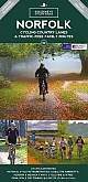
Fietskaart Norfolk cycling map | GoldeneyeDe Goldeneye kaarten zijn uitstekende vrijetijdskaarten voor Groot-Brittannië, met name goed te gebruiken voor het fietsen door de overzichtelijke schaal. De De kaarten zijn helder, overzichtelijk en gedrukt op stevig papier. De MapGuide-kaarten bevatten toeristische informatie op de achterzijde van de kaart. De CyclingMaps bevatten fietspaden die over het algemeen vrij liggen van drukke wegen en/of gemotoriseerd verkeer en daarnaast ook de fietspaden van NCN (De Britse 'National Cycle Network'). Een handig register met plaatsnamen maakt het eenvoudig om p... Schaal: 1:126.720 |
14,90 Tijdelijk niet leverbaar |
|
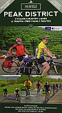
Fietskaart Peak District cycling map | Goldeneye | Water- en scheurvaste fietskaartDe Goldeneye kaarten zijn uitstekende vrijetijdskaarten voor Groot-Brittannië, met name goed te gebruiken voor het fietsen door de overzichtelijke schaal. De De kaarten zijn helder, overzichtelijk en gedrukt op stevig papier. De MapGuide-kaarten bevatten toeristische informatie op de achterzijde van de kaart. De CyclingMaps bevatten fietspaden die over het algemeen vrij liggen van drukke wegen en/of gemotoriseerd verkeer en daarnaast ook de fietspaden van NCN (De Britse 'National Cycle Network'). Een handig register met plaatsnamen maakt het eenvoudig om p... Schaal: 1:100.000 |
12,50 |
|
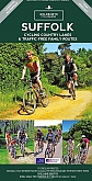
Fietskaart Suffolk cycling map | GoldeneyeDe Goldeneye kaarten zijn uitstekende vrijetijdskaarten voor Groot-Brittannië, met name goed te gebruiken voor het fietsen door de overzichtelijke schaal. De De kaarten zijn helder, overzichtelijk en gedrukt op stevig papier. De MapGuide-kaarten bevatten toeristische informatie op de achterzijde van de kaart. De CyclingMaps bevatten fietspaden die over het algemeen vrij liggen van drukke wegen en/of gemotoriseerd verkeer en daarnaast ook de fietspaden van NCN (De Britse 'National Cycle Network'). Een handig register met plaatsnamen maakt het eenvoudig om p... Schaal: 1:126.720 |
12,50 Tijdelijk niet leverbaar |
|
Wandelgids 14 Shropshire and Staffordshire Pathfinder Guide | Pathfinder Guide 14 | Met Ordanance Survey kaartenDeze Pathfinder Guide is een goed uitgevoerde gids met verschillende wandelingen in Groot-Britannie. De gids bevat naast goede topografische kaarten van de Britse topografische dienst (Ordanance Survey) ook beschrijvingen van het landschap, de cultuur en/of de flora en fauna. Verder is de gids voorzien van praktische informatie zoals startpunten, verwachte wandeltijd, restaurants en cafes voor onderweg. Britain's best loved walking guides brings you a brand new Pathfinder (R) Guide to Shropshire & Staffordshire Walks containing 28 fabulous walks exploring the unspo... |
17,99 Tijdelijk niet leverbaar |