- Gratis verzending vanaf 30 euro
- Levert in Nederland, België etc.
- Meer dan 30.000 titels
- Vakkundige klantenservice
- Snelle levering
- Veilig en eenvoudig betalen

Direct contact?
Bel +31 (0)6 42428571
maandag t/m vrijdag
van 10 tot 17 uur
Wandelgids Hillwalking in Shropshire Cicerone Guidebooks
32 hill and country walks

Guidebook to 32 walks in the hills of Shropshire. The walks, which are graded easy, moderate or hard, range from 3 miles (5km) to 12 miles (19km) and can be walked in all seasons. The selected routes take in highlights such as The Wrekin, Wenlock Edge, Long Mynd and Stiperstones, Castle Ring and Bury Ditches. Featuring 1:50K OS mapping (shown at 1:40K for greater clarity), step-by-step route descriptions, as well as information on accommodation, getting around, bases for the Shropshire hills and history of the region, the guide details everything you need to walk in Shropshire and more. From Neolithic standing stones, Bronze Age stone circles, and hilltop forts dating back to the Iron Age, Shropshire offers more than just picturesque landscapes and rewarding walking. Discover history on the hills as well as natural beauty, all within easy driving distance from Birmingham and Manchester. Activities
Walking, hiking Seasons
All the routes can be done in all seasons, with Autumn being best for those in woodland. August, when the heather is out, is best for Stiperstones and the Long Mynd. Centres
Llanymynech, Telford, Church Stretton, Craven Arms, Clun, Ludlow, Bridgnorth and Much Wenlock Difficulty
Shropshire's summits are generally easy to climb. Being such a fertile county its low level paths can become overgrown in Summer. Lightweight boots are the best footwear and if you're wearing shorts, take make sure you have waterproof trousers to protect your legs from nettles and dew covered long grasses. Must See
The volcanic peaks of Stiperstones and Caer Caradoc, steep-sided, crag-fringed Batches of the Long Mynd, numerous Iron and Bronze Age hilltop forts, and charming little towns and villages with half-timbered buildings and fascinating historical heritage make Shropshire a hillwalkers paradise.
Engelstalig
EAN: 9781852848071
Uitgeverij: Cicerone Press
Verschijningsdatum: 2016
Meest recente editie
Engelstalig


(Tijdelijk) niet leverbaar
- Vakkundige klantenservice
- Groot assortiment
- Gratis retourneren binnen 14 dagen
- Aangesloten bij WebwinkelKEUR
Meer producten die interessant kunnen zijn
Topografische kaarten Midden-Engeland
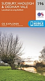
Topografische Wandelkaart 196 Sudbury / Hadleigh / Dedham Vale Lavenham & Long Melford - Explorer Map
Wandelkaart & Fietskaart | Ordnance Survey (OS) Groot-Brittannië
€ 18,99
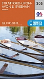
Topografische Wandelkaart 205 Stratford-upon-Avon / Evesham Alcester - Explorer Map
Wandelkaart & Fietskaart | Ordnance Survey (OS) Groot-Brittannië
€ 18,99

Topografische Wandelkaart 211 Bury St Edmunds / Stowmarket Debenham & Elmswell - Explorer Map
Wandelkaart & Fietskaart | Ordnance Survey (OS) Groot-Brittannië
€ 18,99
Tijdelijk niet leverbaar
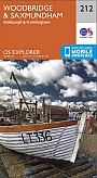
Topografische Wandelkaart 212 Woodbridge / Saxmundham Aldeburgh & Framlingham - Explorer Map
Wandelkaart & Fietskaart | Ordnance Survey (OS) Groot-Brittannië
€ 18,99
Reisgidsen Midden-Engeland


Reisgids Slow Norfolk Bradt Travel Guide
Local, Characterful Guides To Britain's Special Places
€ 21,50
Wegenkaarten Midden-Engeland


Fietskaarten Midden-Engeland