- Gratis verzending vanaf 30 euro
- Levert in Nederland, België etc.
- Meer dan 30.000 titels
- Vakkundige klantenservice
- Snelle levering
- Veilig en eenvoudig betalen

Direct contact?
Bel +31 (0)6 42428571
maandag t/m vrijdag
van 10 tot 17 uur
Wandelgids South Downs Way described east–west and west–east | Cicerone

Guidebook for walking the South Downs Way long-distance path that leads the walker along the 100 miles (160km) between Eastbourne and Winchester, high on the escarpment, exploring the Sussex Downs and East Hampshire Areas of Outstanding Natural Beauty. Details of the walk split into 12 daily stages, described in both directions. The South Downs Way National Trail is a glorious walk from Eastbourne to Winchester, exploring the Sussex Downs and East Hampshire Areas of Outstanding Natural Beauty. The official South Downs Way leads the walker along the 100 miles (160km) route following the northern escarpment for much of the way and rarely descends to habitation except where river valleys interrupt the regular course of the Downs. This guidebook describes the South Downs Way in 12 daily stages and is illustrated with OS mapping. The South Downs Way links many ancient and historical tracks, passing many sites of particular interest to those with a thirst for the past, but the main joy is the appreciation and recognition of this surprisingly secretive land that will please and delight any walker.
Seasons The South Downs Way can be walked at all times of year – this is one of the driest and warmest parts of England. Centres Eastbourne, Alfriston, Lewes, Amberley, Burint, Exton, Winchester Difficulty The South Downs Way is a waymarked bridleway; very few stiles. Few towns/villages en route. 12 daily stages (max length = 12 miles). Must See
Beachy Head, Long Man of Wilmington, Ditchling Beacon, Clayton Windmills, Butser Hill, Winchester
Engelstalig
EAN: 9781786311610
Uitgeverij: Cicerone Press
Serie: National Trail
Verschijningsdatum: 2023
Meest recente editie
Engelstalig
200 pagina's


Op voorraad
Levertijd 3 dagen (Nederland)
- Vakkundige klantenservice
- Groot assortiment
- Gratis retourneren binnen 14 dagen
- Aangesloten bij WebwinkelKEUR
€ 24,50
Verder in deze serie

- Wandelgids Ridgeway Cicerone Guidebooks
- Wandelgids St Oswald's Way and St Cuthbert's Way | Cicerone
- Wandelgids The Cotswolds Way Cicerone Guidebooks
- Wandelgids The Great Glen Way Cicerone Guidebooks
- Wandelgids The Great Glen Way | Cicerone
- Wandelgids The North Downs Way | Cicerone
- Wandelgids The South West Coast Path (Zoutpad) Cicerone Guidebooks
- Wandelgids The Speyside Way Cicerone Guidebooks
- Wandelgids The Thames Path Cicerone Guidebooks
- Wandelgids The West Highland Way Cicerone Guidebooks
- Wandelkaartgids South West Coast Path Map Booklet - Minehead to St Ives deel 1(Zoutpad) | Cicerone
- Wandelkaartgids South West Coast Path Map Booklet - Plymouth to Poole deel 3 (Zoutpad) | Cicerone
- Wandelkaartgids South West Coast Path Map Booklet - St Ives to Plymouth deel 2 (Zoutpad) | Cicerone
- Wandelkaartgids The North Downs Way Booklet | Cicerone
- Wandelkaartgids The Thames Path Map Booklet | Cicerone
- Wandelkaartgids Walking the Cotswold Way | Cicerone
- Wandelkaartgids West Highland Way Map Booklet | Cicerone
Meer producten die interessant kunnen zijn
Wegenkaarten Zuid-Oost Engeland / Kent
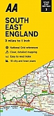

Wegenkaart - Landkaart 504 Zuid-Oost Engeland Kent Sussex - Michelin Regional
South East England, the Midlands, East Anglia 504
€ 11,50
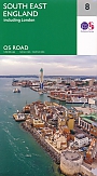
Topografische kaarten Zuid-Oost Engeland / Kent
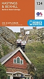
Topografische Wandelkaart 124 Hastings / Bexhill - Explorer Map
Wandelkaart & Fietskaart | Ordnance Survey (OS) Groot-Brittannië
€ 18,99
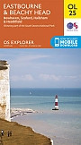
Topografische Wandelkaart OL25 van Groot-Brittannië (1:25.000) Eastbourne & Beachy Head Newhaven, Seaford Explorer Map OL 25
Wandelkaart | Ordnance Survey (OS) Groot-Brittannië
€ 18,99

Topografische Wandelkaart 136 High Weald / Royal Tunbridge Wells - Explorer Map
Wandelkaart & Fietskaart | Ordnance Survey (OS) Groot-Brittannië
€ 18,99
Topografische Wandelkaart 138 Dover / Folkstone / Hythe - Explorer Map
Wandelkaart & Fietskaart | Ordnance Survey (OS) Groot-Brittannië
€ 18,99
Reisgidsen Zuid-Oost Engeland / Kent

Fietskaarten Zuid-Oost Engeland / Kent

Fietskaart 5 Kent The High Weald and Kent Downs Cycle Maps UK | Cordee
Water- en scheurvaste fietskaart
Tijdelijk niet leverbaar