- Gratis verzending vanaf 30 euro
- Levert in Nederland, België etc.
- Meer dan 30.000 titels
- Vakkundige klantenservice
- Snelle levering
- Veilig en eenvoudig betalen

Direct contact?
Bel +31 (0)6 42428571
maandag t/m vrijdag
van 10 tot 17 uur
Wandelgids The Great Glen Way Cicerone Guidebooks
Two Way Trail guide

Guidebook to walking the Great Glen Way, one of Scotland’s Great Trails that runs along the Great Glen between Fort William and Inverness. The guidebook - which includes both a guide to the route and a separate OS map booklet – describes the route in both directions.
Ideal as an introduction to long-distance walking, the 79-mile Great Glen Way is split into six stages easily walked within a week, with high- and low-level options given for two of these. An alternative route past the northern side of Loch Oich (via Invergarry) is also described.
The guidebook includes practical information, 1:100,000 OS mapping, step-by-step route descriptions for every stage of the walk and lists the facilities found along the way. A separate booklet of 1:25,000 OS mapping provides all the mapping needed to walk the trail. The trail stretches alongside the scenic Caledonian Canal, which links Loch Lochy and Loch Oich with the famous Loch Ness. The route uses undulating forest tracks, lakeside paths, old drove roads and military roads, as well as contrasting stretches over heather moorlands or through city suburbs. The Great Glen is one of the most remarkable features in the Scottish landscape - a ruler-straight valley along an ancient fault line through the Highlands.
The route in this guidebook is described in both directions, and given the connection with the West Highland Way at Fort William there is no reason why both trails shouldn’t be walked together in one long journey between Glasgow and Inverness, or vice versa.
Engelstalig
EAN: 9781852848019
Auteur(s): Paddy dillon
Uitgeverij: Cicerone Press
Serie: National Trail
Verschijningsdatum: 2016
Meest recente editie
Engelstalig
192 pagina's


Op voorraad
Levertijd 4 dagen (Nederland)
- Vakkundige klantenservice
- Groot assortiment
- Gratis retourneren binnen 14 dagen
- Aangesloten bij WebwinkelKEUR
€ 19,99
Verder in deze serie

- Wandelgids Ridgeway Cicerone Guidebooks
- Wandelgids South Downs Way described east–west and west–east | Cicerone
- Wandelgids St Oswald's Way and St Cuthbert's Way | Cicerone
- Wandelgids The Cotswolds Way Cicerone Guidebooks
- Wandelgids The Great Glen Way | Cicerone
- Wandelgids The North Downs Way | Cicerone
- Wandelgids The South West Coast Path (Zoutpad) Cicerone Guidebooks
- Wandelgids The Speyside Way Cicerone Guidebooks
- Wandelgids The Thames Path Cicerone Guidebooks
- Wandelgids The West Highland Way Cicerone Guidebooks
- Wandelkaartgids South West Coast Path Map Booklet - Minehead to St Ives deel 1(Zoutpad) | Cicerone
- Wandelkaartgids South West Coast Path Map Booklet - Plymouth to Poole deel 3 (Zoutpad) | Cicerone
- Wandelkaartgids South West Coast Path Map Booklet - St Ives to Plymouth deel 2 (Zoutpad) | Cicerone
- Wandelkaartgids The North Downs Way Booklet | Cicerone
- Wandelkaartgids The Thames Path Map Booklet | Cicerone
- Wandelkaartgids Walking the Cotswold Way | Cicerone
- Wandelkaartgids West Highland Way Map Booklet | Cicerone
Meer producten die interessant kunnen zijn
Topografische kaarten Noord-Schotland
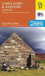
Topografische Wandelkaart OL57 van Groot-Brittannië (1:25.000) Cairn Gorm & Aviemore, Loch Morlich - Explorer Map OL 57
Wandelkaart | Ordnance Survey (OS) Groot-Brittannië
€ 18,99
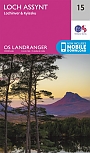
Topografische Wandelkaart 15 Loch Assynt Lochinver & Kylesku - Landranger Map
Wandelkaart & Fietskaart | Ordnance Survey (OS) Groot-Brittannië
€ 18,99
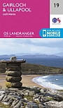
Topografische Wandelkaart 19 Gairloch / Ullapool (Loch Maree) - Landranger Map
Wandelkaart & Fietskaart | Ordnance Survey (OS) Groot-Brittannië
€ 18,99
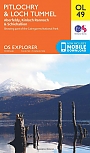
Topografische Wandelkaart OL49 van Groot-Brittannië (1:25.000) Pitlorchry & Loch Tummel / Aberfeldy - Explorer Map OL 49
Wandelkaart | Ordnance Survey (OS) Groot-Brittannië
€ 18,99
Wandelkaarten Noord-Schotland
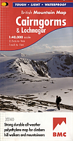
Wandelkaart Cairngorms and Lochnagar - Mountain Map | Harvey Maps
Water- en scheurvaste wandelkaart
€ 28,99
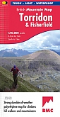
Wandelkaart Torridon & Fisherfield - Mountain Map | Harvey Maps
Water- en scheurvaste wandelkaart
€ 28,99