- Gratis verzending vanaf 30 euro
- Levert in Nederland, België etc.
- Meer dan 30.000 titels
- Vakkundige klantenservice
- Snelle levering
- Veilig en eenvoudig betalen

Direct contact?
Bel +31 (0)6 42428571
maandag t/m vrijdag
van 10 tot 17 uur
Wandelgids The North Downs Way | Cicerone
National trail from Farnham to Dover
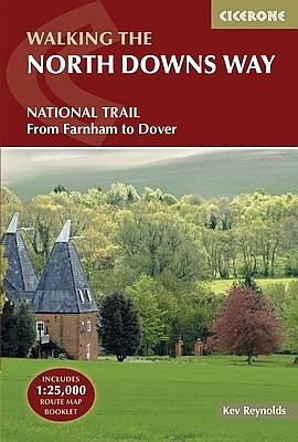
A guidebook to walking the North Downs Way National Trail, a 130 mile (208km) walk between the high downland of Farnham and the historic city of Dover on the Kent coast, with an optional visit to Canterbury. The route is described in 11 stages, and is fully illustrated with colour photographs and OS map extracts. The North Downs Way is one of the easier national trails with a modest number of steep (but short) ascents and descents and long sections with no noticeable height gain or loss. Several historic sites including Neolithic burial chambers, Roman roads and Norman churches are passed and much of the route follows The Pilgrims' Way. The area also boasts many literary connections with some of the most celebrated voices in English literature. A separate pocket-sized map booklet is included and shows the full route on 1:25,000 scale OS maps. Activities Walking, long distance hiking Seasons The North Downs Way can be walked at any time of the year, but is seen at its best between April and October Centres Beginning in Farnham, the North Downs Way passes close-to or through Guildford, Otford, Wrotham, Detling, Charing, Wye, Chilham, Canterbury, Patrixbourne and ends in Dover Difficulty Despite some reasonably short steep ascents and descents, the North Downs Way is one of the more gentle of National Trails and is suitable for first-time long distance walkers. Must See Passing through the Surrey and Kent Downs Areas of Outstanding Natural Beauty, the North Downs Way crosses Box Hill, visits Neolithic sites like the Coldrum Stones and Kits Coty House; passes below the remains of Thurnham Castle, visits Canterbury Cathedral, Dover Castle, and across Shakespeare Cliff, one of the White Cliffs of Dover.
EAN: 9781852848613
Uitgeverij: Cicerone Press
Serie: National Trail
Verschijningsdatum: 2017
Meest recente editie

Op voorraad
Levertijd 4 dagen (Nederland)
- Vakkundige klantenservice
- Groot assortiment
- Gratis retourneren binnen 14 dagen
- Aangesloten bij WebwinkelKEUR
€ 19,99
Verder in deze serie

- Wandelgids Ridgeway Cicerone Guidebooks
- Wandelgids South Downs Way described east–west and west–east | Cicerone
- Wandelgids St Oswald's Way and St Cuthbert's Way | Cicerone
- Wandelgids The Cotswolds Way Cicerone Guidebooks
- Wandelgids The Great Glen Way Cicerone Guidebooks
- Wandelgids The Great Glen Way | Cicerone
- Wandelgids The South West Coast Path (Zoutpad) Cicerone Guidebooks
- Wandelgids The Speyside Way Cicerone Guidebooks
- Wandelgids The Thames Path Cicerone Guidebooks
- Wandelgids The West Highland Way Cicerone Guidebooks
- Wandelkaart Walking the Cotswold Way | Cicerone
- Wandelkaartgids South West Coast Path Map Booklet - Minehead to St Ives deel 1(Zoutpad) | Cicerone
- Wandelkaartgids South West Coast Path Map Booklet - Plymouth to Poole deel 3 (Zoutpad) | Cicerone
- Wandelkaartgids South West Coast Path Map Booklet - St Ives to Plymouth deel 2 (Zoutpad) | Cicerone
- Wandelkaartgids The North Downs Way Booklet | Cicerone
- Wandelkaartgids The Thames Path Map Booklet | Cicerone
- Wandelkaartgids West Highland Way Map Booklet | Cicerone
Meer producten die interessant kunnen zijn
Wegenkaarten Zuid-Oost Engeland / Kent
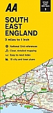

Wegenkaart - Landkaart 504 Zuid-Oost Engeland Kent Sussex - Michelin Regional
South East England, the Midlands, East Anglia 504
€ 11,50

Topografische kaarten Zuid-Oost Engeland / Kent
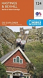
Topografische Wandelkaart 124 Hastings / Bexhill - Explorer Map
Wandelkaart & Fietskaart | Ordnance Survey (OS) Groot-Brittannië
€ 18,99

Topografische Wandelkaart OL25 van Groot-Brittannië (1:25.000) Eastbourne & Beachy Head Newhaven, Seaford Explorer Map OL 25
Wandelkaart | Ordnance Survey (OS) Groot-Brittannië
€ 18,99

Topografische Wandelkaart 136 High Weald / Royal Tunbridge Wells - Explorer Map
Wandelkaart & Fietskaart | Ordnance Survey (OS) Groot-Brittannië
€ 18,99
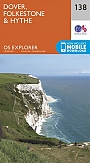
Topografische Wandelkaart 138 Dover / Folkstone / Hythe - Explorer Map
Wandelkaart & Fietskaart | Ordnance Survey (OS) Groot-Brittannië
€ 18,99
Reisgidsen Zuid-Oost Engeland / Kent

Fietskaarten Zuid-Oost Engeland / Kent

Fietskaart 5 Kent The High Weald and Kent Downs Cycle Maps UK | Cordee
Water- en scheurvaste fietskaart
Tijdelijk niet leverbaar