- Gratis verzending vanaf 30 euro
- Levert in Nederland, België etc.
- Meer dan 30.000 titels
- Vakkundige klantenservice
- Snelle levering
- Veilig en eenvoudig betalen

Direct contact?
Bel +31 (0)6 42428571
maandag t/m vrijdag
van 10 tot 17 uur
Europa / Groot-Brittannië / Cotswolds
Cotswolds bestsellers
Wandelkaart Cotswold Way - National Trail Maps | Harvey Maps
Water- en scheurvaste wandelkaart
25,99
|
Fietskaart Wegenkaart 8 The Cotswolds & Gloucestershire | Ordnance Survey Tour MapOverzichtelijke kaart van Ordnance Survey, de Britse topografische dienst. Deze Tour Maps met schaal 1:100.000 zijn prima kaarten voor het plannen van fietstochten. Alle wegen, grote en kleine zijn op de kaart vermeld. Eveneens staan de routes van het National Cycle Network op de kaart ingetekend. Verder zijn campings, jeugdherbergen en andere accommodaties vermeld. Schaal: 1:100.000 |
11,90 |
|
Reisgids Slow Cotswolds Bradt Travel Guide | Including Bath, Stratford-Upon-Avon & OxfordIn this new, thoroughly updated edition of Bradt s The Cotswolds (Slow Travel series), resident expert author Caroline Mills shares more of her favorite places in a region that remains as popular as ever. The area covered includes: the Cotswold AONB (Area of Outstanding Natural Beauty), the Cotswold escarpment, hills and valleys, the Wiltshire Cotswolds and the area known as the Four Shires, along with the lesser-known 'hidden' fringes of the Cotswolds. Also included are the three Cotswold 'gateways': Stratford-upon-Avon, Bath and Oxford. Caroline Mills has lived and w... |
17,99 Tijdelijk niet leverbaar |
|
Wandelgids Walking in the Cotswolds | Cicerone guides | 30 rondwandelingenA guidebook to 30 circular walks in the Cotswolds, the largest Area of Outstanding Natural Beauty in England. Ranging from 4 to 12 miles in length, the routes are graded from easy to strenuous, offering something for every walker. Fourteen of the routes described include sections of the Cotswold Way National Trail, a 102-mile walk that winds its way from Chipping Campden to Bath. Step-by-step route descriptions are accompanied by 1:50,000 mapping. There is plenty of information on the many points of interest passed en route, including Roman ruins, ancient stone ci... |
16,99 |
|
Reisgids Cotswolds (incl. Oxford & Stratford-Uppon-Avon) Rough GuideDe Rough Guide is een zeer degelijke, uitgebreide en informatieve reisgids voor iedere type reiziger: van backpacker tot cultuurreiziger. De Rough Guide staat bekend om de degelijke en goed onderzochte achtergrondinformatie en de goede ordening van verschillende onderwerpen. Voor veel gebieden is de Rough Guide een goed, soms zelfs een beter, alternatief voor de populaire Lonely Planet. The definitive handbook to one of the most beautiful and diverse vacation destinations in the UK. From stately homes and wildlife parks to modern art galleries, country walks, and adven... |
20,99 |
|
Topografische Wandelkaart OL45 van Groot-Brittannië (1:25.000) The Cotswolds - Explorer Map OL 45 | Wandelkaart | Ordnance Survey (OS) Groot-BrittanniëDeze gedetailleerde en informatieve topografische kaart (stafkaart, schaal 1:25.000) van Groot-Brittannië bevat alle topografische elementen van het landschap en geeft daarmee een nauwkeurig beeld van het terrein. Daarnaast heeft Ordnance Survey (OS) ook toeristische informatie op de meeste kaart verwerkt, zoals de aanduiding voor campings en ingetekende wandelpaden . Deze kaart is ideaal voor wandelaars of fietsers, maar ook voor de scouting of sportverenigingen die activiteiten in Groot-Brittannië gaan uitvoeren. De kaarten zijn voorzien van een GPS aanduid... Schaal: 1:25.000 |
18,99 |

|
Wandelgids 04 Cotswolds Pathfinder Guide (Short Walks) | 20 Korte wandelingen tot 8kmDeze Pathfinder Guide is een goed uitgevoerde gids met verschillende wandelingen in Groot-Britannië. De gids bevat naast goede topografische kaarten van de Britse topografische dienst (Ordanance Survey) ook beschrijvingen van het landschap, de cultuur en/of de flora en fauna. Verder is de gids voorzien van praktische informatie zoals startpunten, verwachte wandeltijd, restaurants en cafés voor onderweg. 20 Korte wandelingen tot 8km. This book contains 20 short circular walks, all rated by length and difficulty, that are carefully selected for the whole family to enjo... |
10,99 Tijdelijk niet leverbaar |
|
Wandelgids 06 Cotswolds Pathfinder Guide | Pathfinder Guide 6 | Met Ordanance Survey kaartenDeze Pathfinder Guide is een goed uitgevoerde gids met verschillende wandelingen in Groot-Britannie. De gids bevat naast goede topografische kaarten van de Britse topografische dienst (Ordanance Survey) ook beschrijvingen van het landschap, de cultuur en/of de flora en fauna. Verder is de gids voorzien van praktische informatie zoals startpunten, verwachte wandeltijd, restaurants en cafes voor onderweg. Pathfinder(R) Cotswolds covering parts of the Snowshill, Buckholt Wood and Burford. This selection offers interest, regional variety and balance of routes in the Cotswo... |
17,99 |
|
|
Wandelkaart Cotswold Way - National Trail Maps | Harvey Maps | Water- en scheurvaste wandelkaartDe Harvey Map is de wandelkaart voor het lange afstand wandelpad in het Groot-Brittannië. Duidelijke topografische wandelkaarten met praktische informatie van de route zoals overnachtingsmogelijkheden, eetgelegenheden en bezienswaardigheden. Deze wandelkaart is scheur- en watervast. Met GPS compatible (UTM-Grid). A leap forward in technical excellence: Tough, durable and 100% waterproof - virtually indestructible in normal use. Compact and light - the map itself weighs just 60gms - a third of the weight of a bulky laminated map. You can fold or refold it time and agai... Schaal: 1:40.000 |
25,99 |
|
Wandelgids The Cotswolds Way Cicerone Guidebooks | Two-way trail guide - Chipping Campden to BathGuidebook to walking the 102 mile (163km) Cotswold Way National Trail between Chipping Campden and Bath, across the Cotswolds AONB. The guidebook - which includes both a guide to the route and a separate OS 1:25,000 map booklet - describes the route in both directions. The route is described over 13 stages, each following the Cotswold escarpment, with dramatic and far-reaching views across the Severn Vale towards the Welsh hills, plunging down to visit honey-coloured villages, old market towns and the elegant and historic city of Bath. The longest of the 13 stage... |
23,50 |
|
Reisgids Bath,Bristol & Somerset Rough GuideDe Rough Guide is een zeer degelijke, uitgebreide en informatieve reisgids voor iedere type reiziger: van backpacker tot cultuurreiziger. De Rough Guide staat bekend om de degelijke en goed onderzochte achtergrondinformatie en de goede ordening van verschillende onderwerpen. Voor veel gebieden is de Rough Guide een goed, soms zelfs een beter, alternatief voor de populaire Lonely Planet. This Bath, Bristol & Somerset guidebook is perfect for independent travellers planning a longer trip. It features all of the must-see sights and a wide range of off-the-beaten... |
21,90 |
|
Wandelgids Heart of the Cotswolds Trail Rucksack Readers | Waterproof met spiraalbindingRucksack Readers zijn handig uitgevoerd in een klapper met ringband. Deze gids heeft een goede beschrijving van de lange afstands route met overzichtelijke kaarten doch zonder veel detail. De kracht van de Rucksack Readers is de uitgebreide achtergrondinformatie over de flora, fauna en geologische verschijnselen. Dit alles rijkelijk omkleed met kleurrijke foto's en praktische tips. Waterproof papier. |
21,50 |
|
Fietsgids Cotswold Cycling in the Cotswolds | Cicerone | Half- and full day routes and a 200 km tour of the CotswoldsPacked with routes right across the Cotswolds Area of Outstanding Natural Beauty, this guidebook is all you need to explore the lanes and tracks of this much-loved area on two wheels - off-road on your mountain bike or on-road on your road bike or a bit of both on hybrid/sturdy bike (most routes have an on-road alternative). 21 day routes ranging from 9 to 41 miles are included, illustrated with clear custom-drawn maps and profiles, as well as a 4-day 200km tour which takes in all the Cotswolds' best highlights. Routes are arranged by difficulty, ranging from easy,... |
17,99 |
|
Wandelgids Cotswold Way Trailblazer | Chipping Campden to BathAll-in-one hiking route guide and maps to the Cotswold Way, a 102-mile National Trail that runs from Chipping Campden to Bath, following the beautiful Cotswold escarpment for most of its course. The trail leads through quintessentially English countryside with little villages of honey-coloured stone to the well-known town of Bath. Includes 44 large-scale maps (3 1/8 inches to 1 mile); 9 town plans and 8 overview maps. Full details of all accommodations and campsites, restaurants and pubs; plus full public transport information. Plus day-walks.Fully revised and rewalked... Schaal: 1:40.000 |
20,95 |
|
Mountainbikekaart Cotswolds MTB map | GoldeneyeDe Goldeneye kaarten zijn uitstekende vrijetijdskaarten voor Groot-Brittannië, met name goed te gebruiken voor het fietsen door de overzichtelijke schaal. De De kaarten zijn helder, overzichtelijk en gedrukt op stevig papier. Deze Mountainbikekaarten zijn uniek voor Groot-Brittannië en bevatten paden die vrij liggen van drukke wegen en/of gemotoriseerd verkeer. Daarnaast bevat het ook ook de fietspaden van NCN (De Britse 'National Cycle Network') en andere fietspaden om je route vanuit een bepaald punt aan te kunnen fietsen. Een handig register met pl... Schaal: 1:47.700 |
12,50 |
|
Wandelkaartgids Walking the Cotswold Way | Cicerone | Handzaam wandelgidsje, alleen topografische kaarten met de wandelrouteAll the mapping you need to complete the Cotswold Way National Trail between Chipping Campden and Bath, across the Cotswolds AONB. An accompanying Cicerone guidebook The Cotswold Way‚ - describes the full route in both directions with lots of other practical and historical information. NOTE: The accompanying guidebook includes a copy of this map booklet. Following the Cotswold escarpment, the Cotswold Way provides dramatic and far-reaching views across the Severn Vale towards the Welsh hills, plunging down to visit honey-coloured villages,... Schaal: 1:25.000 |
13,50 |
|
Wandelgids 50 Walks in the Cotswolds | AA PublishingOverzichtelijke wandelgids met duidelijke beschrijvingen en wandelkaarten. Wandeltochten van 5 tot 13 kilometer. Walking is one of Britain's favourite leisure activities, and with "50 Walks in the Cotswolds" you can find a variety of mapped walks to suit all abilities - from the casual walker to the experienced hiker. The book features all the practical detail you need, accompanied by fascinating background reading on the history and wildlife of the area, as well as other local points of interest. All walks are annotated with places to vis... |
18,95 |
|
Fietskaart Costwolds mapguide | Goldeneye | Fietskaart mét reisinformatieDe Goldeneye kaarten zijn uitstekende vrijetijdskaarten voor Groot-Brittannië, met name goed te gebruiken voor het fietsen door de overzichtelijke schaal. De De kaarten zijn helder, overzichtelijk en gedrukt op stevig papier. De MapGuide-kaarten bevatten toeristische informatie op de achterzijde van de kaart. De CyclingMaps bevatten fietspaden die over het algemeen vrij liggen van drukke wegen en/of gemotoriseerd verkeer en daarnaast ook de fietspaden van NCN (De Britse 'National Cycle Network'). Een handig register met plaatsnamen maakt het eenvoudig om p... Schaal: 1:126.000 |
15,90 Tijdelijk niet leverbaar |
|
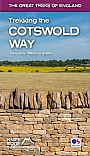
Wandelgids Trekking the Cotswold Way | Knife Edge | Two-Way trekking guideThe definitive two-way guide to the Cotswold Way: both southbound and northbound routes are described in full. |
20,50 |
Cotswolds charmeert met de pittoreske dorpjes zoals Bourton-on-the-Water en het historische Blenheim Palace. Duik in de geschiedenis in het Cotswold Motoring Museum en bewonder de natuurlijke pracht van Cotswold Hills. Verken het Cotswold Way wandelpad voor adembenemende uitzichten. Overnacht in gezellige herbergen zoals The Slaughters Manor House. Geniet van traditionele Britse gerechten in lokale pubs. Cotswolds biedt een perfecte balans tussen historische pracht, weelderige natuur, wandelmogelijkheden en charmante accommodaties, waardoor elke steen getuigt van een tijdloze schoonheid die de ziel van het Engelse platteland vangt.