
- Gratis verzending vanaf € 30 (NL)
- Levert in Nederland en België
- Meer dan 30.000 titels
- Vakkundige klantenservice
- Snelle levering
- Veilig en eenvoudig betalen

Direct contact?
Bel +31 (0)6 42428571
maandag t/m vrijdag
van 10 tot 17 uur

Wandelgidsen Groot-Brittannië
- Wandelen /
- Wandelgidsen /
- Europa /
- Groot-Brittannië
Duik in de uitgebreide collectie wandelgidsen voor Groot-Brittannië bij Landschap Reisboekwinkel. Verken adembenemende routes door het Engelse platteland en de Schotse Hooglanden. Onze gidsen bieden gedetailleerde kaarten, routebeschrijvingen en insider-tips voor wandelliefhebbers. Ontdek ongebaande paden en rijke landschappen, van het Lake District tot de ruige kusten van Wales. Perfect voor elke wandelaar die graag de Britse natuur intrekt.
Wandelgidsen Groot-Brittannië bestsellers



|
Wandelgids 50 Walks in Lake District | AA PublishingOverzichtelijke wandelgids met duidelijke beschrijvingen en wandelkaarten. Wandeltochten van 5 tot 13 kilometer. |
18,99 |

|
Wandelgids 29 Devon South Pathfinder Guide (Short Walks) | Pathfinder Guide 29 | Met Ordanance Survey kaartenDeze Pathfinder Guide is een goed uitgevoerde gids met verschillende wandelingen in Groot-Britannië. De gids bevat naast goede topografische kaarten van de Britse topografische dienst (Ordanance Survey) ook beschrijvingen van het landschap, de cultuur en/of de flora en fauna. Verder is de gids voorzien van praktische informatie zoals startpunten, verwachte wandeltijd, restaurants en cafés voor onderweg. South Devon is famed above all for its magnificent rugged coast, stretching from Plymouth in the west to Seaton in the east, a coastline of imposing sandsto... |
11,50 |

|
Wandelgids 39 Durham, North Pennines & Tyne & Wear Pathfinder Guide | Pathfinder Guide 39 | Met Ordanance Survey kaartenDeze Pathfinder Guide is een goed uitgevoerde gids met verschillende wandelingen in Groot-Britannie. De gids bevat naast goede topografische kaarten van de Britse topografische dienst (Ordanance Survey) ook beschrijvingen van het landschap, de cultuur en/of de flora en fauna. Verder is de gids voorzien van praktische informatie zoals startpunten, verwachte wandeltijd, restaurants en cafes voor onderweg. 28 dagwandelingen. This Pathfinder walking guide covers both the Cumbrian and Durham sides of the North Pennines, a designated Area of Outstanding Beauty, and also exte... |
17,99 |

|
Wandelgids 74 Malverns to Warwickshire Pathfinder Guide | Pathfinder Guide 01 | Met Ordanance Survey kaartenDeze Pathfinder Guide is een goed uitgevoerde gids met verschillende wandelingen in Groot-Britannië. De gids bevat naast goede topografische kaarten van de Britse topografische dienst (Ordanance Survey) ook beschrijvingen van het landschap, de cultuur en/of de flora en fauna. Verder is de gids voorzien van praktische informatie zoals startpunten, verwachte wandeltijd, restaurants en cafés voor onderweg. The area covered by this guide encompasses all the scenic features that are generally considered to be traditionally English. It is a landscape characterised by gentl... |
17,95 Tijdelijk niet leverbaar |

|
Wandelgids 50 Walks in the Peak District | AA PublishingOverzichtelijke wandelgids met duidelijke beschrijvingen en wandelkaarten. Wandeltochten van 5 tot 13 kilometer. Featuring all the practical detail you need, accompanied by fascinating background reading on the history and wildlife of the area with clear mapping for ease of use. Every route has been colour coded according to difficulty. All walks are annotated with local points of interest and places to stop for refreshments. |
18,99 |

|
Wandelgids Dorset & South Devon (South-West Coast Path Part 3) (Zoutpad) | TrailblazerThis guide covers the fouth and last section of the South West Coast Path, from Plymouth to Poole Harbour (203 miles). This beautiful route includes 95 miles within England’s only Natural World Heritage Site, the Jurassic Coast, and passes dramatic cliffs and headlands, Chesil Bank’s impressive spit and Lulworth Cove, winding through idyllic seaside villages such as Beer and Lyme Regis. |
19,90 |

|
Wandelgids 68 Devon North & Mid Pathfinder Guide | Pathfinder Guide 68 | Met Ordanance Survey kaartenDeze Pathfinder Guide is een goed uitgevoerde gids met verschillende wandelingen in Groot-Britannie. De gids bevat naast goede topografische kaarten van de Britse topografische dienst (Ordanance Survey) ook beschrijvingen van het landschap, de cultuur en/of de flora en fauna. Verder is de gids voorzien van praktische informatie zoals startpunten, verwachte wandeltijd, restaurants en cafes voor onderweg. 28 wandelingen. This walking guidebook contains 28 carefully selected walking routes around the North and mid Devon of three to eleven miles (5 to 18km), each tested by... |
17,99 |

|
Wandelgids Walking in Carmarthenshire | Cicerone | 20 day walks exploring the mountains, valleys and coastline of south-west WalesThis guidebook presents 30 contrasting day walks exploring the mountains, valleys and coastline of Carmarthernshire in south-west Wales. Ranging from 2 to 10 miles in length and suitable for walkers of all abilities, the routes introduce the varied walking on offer in this county, including parts of the Brecon Beacons and the Cambrian Mountains. Alongside detailed route descriptions and clear OS mapping, the book is packed with interesting information about the places and heritage encountered. Notes on landscape, geology and wildlife of the area are included, and fo... |
17,99 Tijdelijk niet leverbaar |

|
Wandelgids The Ceredigion and Snowdonia Coast Paths | Cicerone | the Ceredigion Coast Path and Snowdonia Coast PathAs part of the Wales Coast Path, the Ceredigion Coast Path and Snowdonia Coast Path trace a curve of 233km (145 miles) of coastal and inland walking down Cardigan Bay. This guidebook describes a 16-stage guide to the walk from Porthmadog to St Dogmaels covering the trail between the Llyn Peninsula and the Pembrokeshire Coast Path. .In 16 day stages from Porthmadog to St Dogmaels, this guidebook offers all the information walkers need to complete the 233km (145 miles) section of the Wales Coast Path that curve down Cardigan Bay, passing through a range of contrasting la... |
17,99 Tijdelijk niet leverbaar |

|
Wandelgids Jurassic Coast Dorset and East Devon: The walks, the rocks, the fossils | CiceroneThe Jurassic Coast of Devon and Dorset, stretching between Exeter and Bournemouth, is a geological wonderland. Natural wonders like Chesil Beach, Durdle Door and fossils so numerous you'll be tripping over them, combine with southern England's rolling Downs, tiny villages, beaches and sunny summers to provide a stunning and awe-inspiring landscape to explore. The 30 walks in this guide let walkers discover the best and most spectacular areas on the coast. The walks are between 5 and 25km (3 to 16 miles) and provide a range suitable for all abilities. The... |
18,99 |

|
Wandelgids Trekking the West Highland Way: Two-Way Trekking Guide | Knife EdgeThe definitive two-way guide to the West Highland Way: both northbound and southbound routes are described in full. |
21,90 |

|
Wandelgids 50 Walks in Yorkshire Dales | AA PublishingOverzichtelijke wandelgids met duidelijke beschrijvingen en wandelkaarten. Wandeltochten van 5 tot 13 kilometer. The books feature all the practical detail you need, accompanied by fascinating background reading on the history and wildlife of the area, and clear mapping for ease of use. Every route has been colour coded according to difficulty. All walks are annotated with local points of interest and places to stop for refreshments. |
18,99 |

|
Wandelgids 47 Edinburgh, Pentlands & the Lothians Pathfinder Guide | Pathfinder Guide 47 | Met Ordanance Survey kaartenDeze Pathfinder Guide is een goed uitgevoerde gids met verschillende wandelingen in Groot-Britannië. De gids bevat naast goede topografische kaarten van de Britse topografische dienst (Ordanance Survey) ook beschrijvingen van het landschap, de cultuur en/of de flora en fauna. Verder is de gids voorzien van praktische informatie zoals startpunten, verwachte wandeltijd, restaurants en cafes voor onderweg. This new edition of Pathfinder: Edinburgh, Pentlands & Lothians has been fully revised to include seven new walking routes, including a classic walk to the sum... |
17,99 |

|
Wandelgids Glyndwr's Way From Knighton to Welshpool Wales | CiceroneGuidebook to walking Glyndwr's Way, a long-distance National Trail through mid-Wales. The 135 mile route from Knighton via Machynlleth to Welshpool takes 9 days to walk, and 2 days (29 miles) to complete the loop down the Offa's Dyke Path to create a circular trail. A lovely trail through quiet hills, forests and rolling countryside. A complete guide to walking Glyndŵr's Way National Trail. This guidebook divides the 135 mile trail into nine day stages, starting at Knighton and ending at Welshpool. Days 10 and 11 follow the Offa's Dyke Path National Tr... |
21,99 |

|
Wandelgids The Southern Upland Way Scotland's coast to coast trail | CiceroneThe Southern Upland Way is Scotland's coast-to-coast walk and the longest of the nation's Great Trails. 215 miles long, it links the pretty harbour village of Portpatrick on the west coast with Cockburnspath, a little south of Dunbar, in the east. The walk is at times a strenuous one, crossing the remote high moorland of the Galloway Hills, Carsphairn range, Lowthers, Ettrick Hills and Lammermuirs, calling for competence, fitness and self-reliance. This guide presents advice on how best to plan and tackle this challenging but highly rewarding journey. The wayma... |
18,99 |

|
Wandelgids The Hebridean Way | Cicerone | Long-distance walking route through Scotland's Outer HebridesOfficially launched in 2017, the Hebridean Way offers walkers the opportunity to experience the magic of Scotland's Outer Hebrides in one inspirational journey. The waymarked route stretches 247km (155 miles) from Vatersay to Stornaway, linking ten major islands of the archipelago by means of causeways and two ferry crossings: Vatersay, Barra, Eriskay, South Uist, Benbecula, Grimsay, North Uist, Berneray, Harris and Lewis. Suitable for most walkers with a moderate level of fitness, it can be completed in 8-14 days and is rich in natural, historical and cultural int... |
19,99 |

|
Wandelgids Great Mountain Days in Scotland Cicerone Guidebooks | 50 classic hillwalking challengesThis guide has 50 testing walking routes spread across Scotland, a country with one of the wildest areas in Europe. Few global walking destinations are better suited to long and tough routes than the Scottish mountains. Settings including the Cairngorms and the Hebrides show the rich diversity and sheer quality of the country's finest peaks. Brodick, Crianlarich, Fort William, Glen Shiel, Torridon, Portree, Stornoway, Ullapool, Tongue, Aviemore, Braemar. |
25,99 |

|
Wandelgids 23 New Forest NP Pathfinder Guide (Short Walks) | Korte wandelingen tot 7.5 kmDeze Pathfinder Guide is een goed uitgevoerde gids met verschillende wandelingen in Groot-Britannie. De gids bevat naast goede topografische kaarten van de Britse topografische dienst (Ordanance Survey) ook beschrijvingen van het landschap, de cultuur en/of de flora en fauna. Verder is de gids voorzien van praktische informatie zoals startpunten, verwachte wandeltijd, restaurants en cafes voor onderweg. This book has 20 short walks from 1.5 to 5.5 miles in length exploring the New Forest National Park. Each walk includes turn by turn directions, information on parking ... |
11,50 |

|
Wandelgids 05 Cornwall Pathfinder Guide | Pathfinder Guide 5 | Met Ordanance Survey kaartenDeze Pathfinder Guide is een goed uitgevoerde gids met verschillende wandelingen in Groot-Britannië. De gids bevat naast goede topografische kaarten van de Britse topografische dienst (Ordanance Survey) ook beschrijvingen van het landschap, de cultuur en/of de flora en fauna. Verder is de gids voorzien van praktische informatie zoals startpunten, verwachte wandeltijd, restaurants en cafés voor onderweg. Each of the Jarrold Pathfinder titles features 28 circular routes, all tried and tested by seasoned walkers. The routes range from extended strolls to... |
17,99 |

|
Wandelgids North Downs Way | Trailblazer | 80 Large-Scale Walking Maps & Guides to 45 Towns & Villages - Planning, Places to Stay, PlacesPractical guide to walking the North Downs Way National Trail that runs from Farnham in Surrey to Dover in Kent, partly following the old Pilgrims' Way to the shrine of St Thomas a Becket at Canterbury. It winds its way through the protected landscape of the Surrey Hills and the Kent Downs, passing medieval churches, castles, Neolithic burial sites, vineyards and numerous WWII defences. There are literary associations with Swift, Cobbett, Dickens and Jane Austen. The guide includes: * 80 large-scale walking maps - at just under 1:20,000 - showing route times, place... |
21,95 |

|
Wandelgids Great Glen Way Rucksack ReadersDeze gids heeft een goede beschrijving van de lange afstands route met overzichtelijke kaarten doch zonder veel detail. De kracht van de Rucksack Readers is de uitgebreide achtergrondinformatie over de flora, fauna en geologische verschijnselen. Dit alles rijkelijk omkleed met kleurrijke foto's en praktische tips. The Great Glen Way runs for 78 miles (125 km) along Scotland’s historic Great Glen between Fort William and Inverness. It follows the historic Caledonian Canal and runs beside four of the Highlands’ loveliest lochs. These include Loch Ness, fa... |
23,95 |

|
Wandelgids Hadrian's Wall Path Rucksack ReadersHadrians Wall Path runs for 85 miles from coast to coast along the line of the Roman Wall completed in AD122 under the Emperor Hadrian. This National Trail crosses northern England from Irish Sea to North Sea and offers many chances to look at the forts, milecastles and interpretation centres within this UNESCO World Heritage Site. This guidebook contains all you need to plan and enjoy a classic week''s walking. The route is clearly waymarked and well supported by public transport. This guidebook is almost unique in giving equal priority to walking the route fr... |
17,90 |

|
Wandelgids Rob Roy Way Rucksack ReadersThe Rob Roy Way is one of Scotland's Great Trails and is very popular with both walkers and cyclists. It runs through many places linked with Scotland's most famous outlaw, Rob Roy MacGregor (1671-1734). The route starts at Drymen (near Glasgow) and ends at Pitlochry in the eastern Highlands, so it takes you away from the crowds following the West Highland Way to some of Scotland's finest lochs and glens. Its main spine runs for 79 miles (127 km) and is waymarked. There is an optional extra 17 miles if you take the wilderness extension through Glen Almond a... |
23,50 Tijdelijk niet leverbaar |

|
Wandelgids South Downs Way Rucksack ReadersRucksack Readers zijn handig uitgevoerd in een klapper met ringband. Deze gids heeft een goede beschrijving van de lange afstands route met overzichtelijke kaarten doch zonder veel detail. De kracht van de Rucksack Readers is de uitgebreide achtergrondinformatie over de flora, fauna en geologische verschijnselen. Dit alles rijkelijk omkleed met kleurrijke foto's en praktische tips. The South Downs Way is one of England’s popular National Trails. It runs for 100 miles (160 km) from the cathedral city of Winchester to the spectacular white cliffs of East Sussex... |
15,99 Tijdelijk niet leverbaar |

|
Wandelgids West Highland Way Rucksack ReadersDeze gids heeft een goede beschrijving van de lange afstands route met overzichtelijke kaarten doch zonder veel detail. De kracht van de Rucksack Readers is de uitgebreide achtergrondinformatie over de flora, fauna en geologische verschijnselen. Dit alles rijkelijk omkleed met kleurrijke foto's en praktische tips. The West Highland Way is the first and most famous of Scotland’s Great Trails. It stretches for 96 miles (154 km) of superb scenery, from Milngavie on the outskirts of Glasgow, Scotland’s largest city, through its first National Park, along th... |
23,95 |

|
Wandelgids Great Mountain Days in Snowdonia Cicerone Guidebooks | 40 Classic Routes exploring SnowdonioaInviting the reader to experience less well-known regions as much as those that are eternally popular, this inspirational guide offers 40 memorable excursions among the valleys and heights of Snowdonia. These mainly circular routes have been chosen to encourage independent exploration of the National Park, while offering the safe hand of guidance for those who prefer their walking days to be tailor-made. The walks are all graded, making the guide equally suitable for less experienced walkers looking for adventure, new discoveries and the joy of exploration. This title ... |
25,99 |

|
Wandelgids Scotland's Best Small Mountains Cicerone GuidebooksA guidebook to 40 of the best small mountains in Scotland under 3000ft. Explore the beautiful scenery of Sutherland and the far north, Torridon, Lochaber, the Great Glen, the Cairngorms, Glencoe, Arrochar, the Trossachs and the islands (Skye, Eigg, Mull, Arran). The day walks range from 5-25km and can be enjoyed in 2-8 hours. |
21,99 |

|
Wandelgids Walking in the Southern Uplands Cicerone | 44 best hill days in southern ScotlandGuidebook to 44 varied day walks and over 100 summits in the Southern Uplands of Scotland, stretching south-west from Edinburgh to the English border, including the Galloway and Pentland Hills. Between 2 and 29km, there is something for all seasons and all abilities in remote and rugged hill country. Newton Stewart and Glentrool, Nithsdale (Dumfriesshire), Biggar, Moffat, Peebles, Edinburgh, Kirk Yetholm. spring to autumn, plus winter days with good weather and snow conditions. hill walks below 900m, ranging from straightforward on good paths (Lowther Hill, Pentlands) ... |
20,99 |

|
Wandelgids 50 Walks in Brecon Beacons & South Wales | AA PublishingOverzichtelijke wandelgids met duidelijke beschrijvingen en wandelkaarten. Wandeltochten van 5 tot 13 kilometer. The books feature all the practical detail you need, accompanied by fascinating background reading on the history and wildlife of the area, and clear mapping for ease of use. Every route has been colour coded according to difficulty. All walks are annotated with local points of interest and places to stop for refreshments. |
18,99 |

|
Wandelkaartgids The North Downs Way Booklet | Cicerone | National trail from Farnham to DoverHandzaam kaartgidsje. Gedetailleerde topografische wandelkaarten gebonden in een handig boekje. Licht voor onderweg. Map of the 130 mile (208km) North Downs Way National Trail, between Farnham and Dover, including an optional visit to Canterbury. This booklet is included with the Cicerone guidebook to the trail and shows the full route on OS 1:25,000 maps. One of the easier National Trails, it can be comfortably walked in 11-12 days. Schaal: 1:25.000 |
13,99 |

|
Wandelgids South West Coast Path (Zoutpad) | Rother Bergverlag | 46 Etappen auf dem beliebten Weitwanderweg von Somerset nach Devon, Cornwall und DorsetDe vermaarde wandelgiden van Rother Bergverlag zijn uitstekende wandelgidsen voor ieder niveau. Op een kaartje is de wandelroute aangegeven, maar deze is ook beschreven in een beknopte en heldere tekst. Daarnaast is ook de afstand, de verwachte wandeltijd, het niveau, de hoogte en andere praktische informatie aangegeven. Met deze degelijke wandelgids ontdek je de mooiste plekken van jouw bestemming en kun je de spannendste wandeluitdagingen zoeken. Der South West Coast Path – kurz SWCP – im Südwesten Englands ist der Traum eines jeden Weitwa... |
18,90 |

|
Wandelgids 23 Loch Lomond, The Trossachs and Stirling Pathfinder Guide | Pathfinder Guide 23 | Met Ordanance Survey kaartenDeze Pathfinder Guide is een goed uitgevoerde gids met verschillende wandelingen in Groot-Britannië. De gids bevat naast goede topografische kaarten van de Britse topografische dienst (Ordanance Survey) ook beschrijvingen van het landschap, de cultuur en/of de flora en fauna. Verder is de gids voorzien van praktische informatie zoals startpunten, verwachte wandeltijd, restaurants en cafés voor onderweg. Walking in Scotland is quite different from walking south of the border. In England there are only eight summits that top 3000 ft, while in Scotland there a... |
17,99 |

|
Wandelgids Hadrian's Wall Path Cicerone Guidebooks | National Trail Two-way national trail descriptionThe essential guidebook to walking the 84-mile Hadrian"s Wall Path. One of the UK's most visited National Trails, it runs the length of the Roman Wall from Bowness-on-Solway in Cumbria to Wallsend, Newcastle. Schaal: 1:25.000 |
22,99 |

|
Wandelgids The Isle of Man Cicerone Guidebooks | 40 walks exploring the entire islandThis guidebook contains 40 walking routes on the Isle of Man. The routes range from 2 to 22km and cover diverse landscape from open moorland and wooded glens to beaches and bare mountain tops, all with OS maps. The emphasis is on short, easy to access walks but it is possible to join routes together for a longer trail. |
18,99 |

|
Wandelgids Walking the Munros Southern, Central and Western Highlands Volume 1 Cicerone GuidebooksHalf of a two-volume set describing challenging and inspiring routes to climb Scotland's 282 3000ft+ mountains, this guide covers the southern, central and western Highlands (south of the Great Glen), taking in stunning areas such as Glen Coe, Glen Shee, Lochaber and Mull. |
18,99 Tijdelijk niet leverbaar |

|
Wandelgids The North York Moors Cicerone Guidebooks | 50 walks throughout the National ParkThis guidebook offers 50 walks in seven regions throughout the North York Moors National Park, enabling walkers to discover and appreciate in turn the Tabular Hills, Hambleton Hills, Cleveland Hills, Northern Moors, High Moors, Eastern Moors and Cleveland Coast. For those walkers who like to rise to a challenge, the course of the classic Lyke Wake Walk is also offered, split over a four-day period to allow a more leisurely appreciation of the moors as it stretches across the national park from east to west. There are almost 750km (465 miles) of walking routes described... |
19,99 |

|
Wandelgids The Ribble Way Cicerone Guidebooks | A one-week walk across Lancashire into Yorkshire from Preston to the source
|
22,99 |

|
Wandelgids Walking on the Isle of Arran Cicerone Guidebooks | The best low level walks and challenging mountain routes, including the Arran Coastal WayThe 45 walking routes in this Isle of Arran guidebook range from easy 3km (2 miles) nature trails to long arduous mountain routes with scrambles (up to 32km) providing thorough coverage of Arran, including the ascent of Goatfell and nearby Holy Isle. Most routes are 10km to 15km long but many give opportunities to create longer cross island walks. This guidebook presents a selection of 45 day walks on the popular and accessible Isle of Arran. The routes are between 2 miles (3km) and 20 miles (32km) in length, from easy waymarked forest trails to more arduous mountain w... |
23,95 |

|
Wandelgids Ben Nevis and Glen Coe Cicerone Guidebooks | A Walking GuidebookGuidebook to walking in Scotland's Ben Nevis and Glen Coe region, featuring 100 graded walks of 2 to 21 miles. Routes include low-level, mid-level and high-level walks, with the high-level walks showcasing 44 Munro summits. Routes are organised by location, being in and around: Fort William and Glen Nevis; Ben Nevis and the Aonachs; Grey Corries and Spean Bridge; Mamores; Kinlochleven; Glen Coe; Bidean nam Bian; and Glen Etive. Home to some of the finest walking in the UK, the Ben Nevis and Glen Coe region offers the thrill of summiting many a Munro, as well innume... |
19,99 |

|
Wandelgids The Great Glen Way Cicerone Guidebooks | Two Way Trail guideGuidebook to walking the Great Glen Way, one of Scotland’s Great Trails that runs along the Great Glen between Fort William and Inverness. The guidebook - which includes both a guide to the route and a separate OS map booklet – describes the route in both directions. |
22,99 |
|
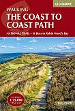
Wandelgids Coast to Coast Walk C2C Cicerone Guidebooks | From St Bees Head in Cumbria to Robin Hood’s Bay on Yorkshire’sFirst devised by Alfred Wainwright, the Coast to Coast Walk has emerged as a favourite among long-distance walkers. The route stretches some 185 miles (296km) from St Bees, an historic seaside village on Cumbria's west coast to Robin Hood's Bay in North Yorkshire. It is suitable for most fit walkers and can be comfortably walked in around a fortnight. This guidebook presents the full route from west to east in 13 stages of 10 ½-20 ¾ miles (16.8-33.2km), with summaries covering the opposite direction. Alongside step-by-step route description... |
24,99 |

|
Wandelgids East White Peak Walks: Peak District Cicerone GuidebooksThis guidebook provides 35 day walks and 7 longer walks and trails exploring the eastern section of Derbyshire's limestone area. The walks are spread across the area, starting in pleasant towns and villages including Bakewell, Tissington, Eyam and Middleton. Largely travelling along well-marked paths over gentle rolling landscapes, these walks are suitable for walkers of all abilities. The day walks range between 4 and 12 miles in length, and are illustrated with extracts of 1:50,000 OS mapping, while the longer walks and trails are covered by 1:100,000 scal... |
16,99 |

|
Wandelgids White Peak Walks: The Southern Dales Cicerone Guidebooks | 30 walks in Derbyshire and StaffordshireMark Richards' guide to walking the southern dales of the White Peak area of the Peak District, England UK, between Ashbourne, Matlock, Buxton and Leek. 30 easy circular routes cross the high plateau and follow the Dove, Manifold and Hamps rivers through the dales in the UK's first National Park. |
17,99 |

|
Wandelgids The Isle of Skye Cicerone Guidebooks | Graded walks and scrambles throughout Skye, including the CuillinThis third edition of Terry Marsh"s walking and scrambling guide to Skye, the Hebrides, northwest Scotland, updated using digital mapping and GPS. 87 walks and scrambles in Sleat and South-East Skye, Strath, Minginish, Duirinish, Waternish and Trotternish for all abilities. Each route describes local historical and geological points of interest. The fame of Skye, the most scenically awe-inspiring of Scotland's many islands, is widespread; you either love it, or hate it. There is no neutrality. For walkers and climbers this is the Promised Land, a place of raw ... |
19,99 |

|
Wandelgids Walking in the Isles of Scilly Cicerone Guidebooks | 11 walks and 4 boat trips exploring the best of the islandsThis guidebook to walking on the Scilly Isles at the south-western edge of Britain includes 11 day walks and 4 boat trips, perfect for a fortnight away from it all. The walks are between 2 and 16km long, and explore the larger islands such as Tresco, St Martin's, St Mary's, St Agnes and Bryher as well as smaller islands in the archipelago. Alongside the walks, which are suitable for walkers of all abilities, are 4 Boat Trips which explore Annet and the Western Rocks, the Norrard Rocks, St Helens and Teän as well as the Eastern Isles. With their m... |
12,99 |

|
The National Trails Complete Guide to Britain's National Trails | CiceroneThis inspirational guidebook looks at each of the UK's 19 National Trails, with information that allows ease of comparison and contrast, inspiring you to find out more and to take up a long-distance challenge. Some Trails are short and easy, others much longer, many have strong themes - they may follow a coastline, or traverse ranges of hills. All trails can be tackled throughout the year, though many of the northern and Scottish routes can be challenging in winter conditions. Avoid the Hadrian's Wall Path in winter, as the ground is soft and underlying archaeo... |
25,99 |

|
Wandelgids Cateran Trail Rucksack ReadersDeze gids heeft een goede beschrijving van de lange afstands route met overzichtelijke kaarten doch zonder veel detail. De kracht van de Rucksack Readers is de uitgebreide achtergrondinformatie over de flora, fauna en geologische verschijnselen. Dit alles rijkelijk omkleed met kleurrijke foto's en praktische tips. The Cateran Trail is one of Scotland’s Great Trails – a circular walk of 64 miles (104 km) starting in Blairgowrie, near Perth, following in the footsteps of cattle-rustlers (caterans). This waymarked Trail follows ancient paths through ... Schaal: 1:50.000 |
23,50 |

|
Wandelgids Loch Lomond and The Cowal Way with Isle of Bute Rucksack Readers | Waterproof met spiraalbindingDeze gids heeft een goede beschrijving van de lange afstands route met overzichtelijke kaarten doch zonder veel detail. De kracht van de Rucksack Readers is de uitgebreide achtergrondinformatie over de flora, fauna en geologische verschijnselen. Dit alles rijkelijk omkleed met kleurrijke foto's en praktische tips. Waterproof met spiraalbinding. The Cowal Way runs for 57 miles (92 km) across the Cowal peninsula, which lies west of Glasgow and has ferry links with the Isle of Bute. The route starts at Portavadie on Loch Fyne and ends at Inveruglas on Loch Lomond. The... |
19,90 |

|
Wandelgids Coast to Coast C2C Rucksack ReadersRucksack Readers zijn handig uitgevoerd in een klapper met ringband. Deze gids heeft een goede beschrijving van de lange afstands route met overzichtelijke kaarten doch zonder veel detail. De kracht van de Rucksack Readers is de uitgebreide achtergrondinformatie over de flora, fauna en geologische verschijnselen. Dit alles rijkelijk omkleed met kleurrijke foto's en praktische tips. This challenging walk of 184 miles (296 km) crosses the north of England from St Bees on the Irish Sea to Robin Hood's Bay on the North Sea. It passes through three National Parks - ... |
21,99 Tijdelijk niet leverbaar |

|
Wandelgids St Cuthbert's Way Rucksack ReadersRucksack Readers zijn handig uitgevoerd in een klapper met ringband. Deze gids heeft een goede beschrijving van de lange afstands route met overzichtelijke kaarten doch zonder veel detail. De kracht van de Rucksack Readers is de uitgebreide achtergrondinformatie over de flora, fauna en geologische verschijnselen. Dit alles rijkelijk omkleed met kleurrijke foto's en praktische tips. Follow the footsteps of St Cuthbert in this easy-going walk of 63 miles (101 km) from Melrose Abbey in the Scottish Borders to the Holy Island of Lindisfarne in Northumberland. St ... |
23,99 Tijdelijk niet leverbaar |

