
- Gratis verzending vanaf € 30 (NL)
- Levert in Nederland en België
- Meer dan 30.000 titels
- Vakkundige klantenservice
- Snelle levering
- Veilig en eenvoudig betalen

Direct contact?
Bel +31 (0)6 42428571
maandag t/m vrijdag
van 10 tot 17 uur

Wandelgidsen Groot-Brittannië
- Wandelen /
- Wandelgidsen /
- Europa /
- Groot-Brittannië
Duik in de uitgebreide collectie wandelgidsen voor Groot-Brittannië bij Landschap Reisboekwinkel. Verken adembenemende routes door het Engelse platteland en de Schotse Hooglanden. Onze gidsen bieden gedetailleerde kaarten, routebeschrijvingen en insider-tips voor wandelliefhebbers. Ontdek ongebaande paden en rijke landschappen, van het Lake District tot de ruige kusten van Wales. Perfect voor elke wandelaar die graag de Britse natuur intrekt.
Wandelgidsen Groot-Brittannië bestsellers


|
Wandelgids Lakeland Fellranger - Walking the Mid-Western Fells Cicerone GuidebooksLakeland Fellranger guidebook by Mark Richards covering 22 summits in the Mid-Western Fells of the Lake District, including a wide range of walks, old and new, in the triangle between Great Langdale, Borrowdale and Wasdale. The group centres on the two highest hills in England, the mighty Scafell Pike and Sca Fell, with their many wild dale approaches. Author Mark Richards combines his passion for the Lake District and artistic flair with all the information the experienced walker needs to explore and enjoy the Mid-Western Fells. For each of the 22 hills covered, this ... |
20,99 |

|
Wandelgids Lakeland Fellranger - Walking The Central Fells Cicerone GuidebooksThe Central Fells of the English Lake District comprise the high ground between Great Langdale and Keswick. The area is flanked to the west by Stake Pass, Langstrath, Borrowdale and Derwentwater, and to the east by Grasmere, Dunmail Raise and Thirlmere. While the finest scenic moments tend to be around its periphery, the interior also offers many great opportunities for delightful day walks. Author Mark Richards combines his passion for the Lake District and artistic flair with all the information the experienced walker needs to explore and enjoy the Central Fells. |
20,99 |

|
Wandelgids Walking in the Cairngorms | Cicerone Guidebooks | A Walking and Scrambling GuideThis guidebook contains over 100 routes for walking in the Scottish Cairngorms. It includes 18 Munro summits and smaller viewpoint hills. Walks range in length from 1 to 26 miles and are graded for difficulty. For the adventurous there are the best of the area's rocky scrambles, and the classic through-routes including the Lairig Ghru. For those looking for a more gentle alternative, there are easy, sandy trails wandering among the tall pines and along the banks of the great rivers Spey, Nethy and Dee. Britain's biggest mountain range is home to excep... |
22,99 |

|
Wandelgids Short Walks in Lakeland Book 3: West Lakeland Cicerone GuidebooksThe third and final guidebook book in the Short Walks in Lakeland trilogy, the series also covers walking routes in the South Lake District (book 1) and North Lake District (book 2). This guide covers 50 walking routes around the Duddon Valley and the coast, Eskdale, Wasdale, Ennerdale and the coast, Lorton Vale, Buttermere and the north-west. The walks described are generally between 4 and 8 miles - enough to pleasantly fill a good half-day, and ideal for day visitors and family walkers. Priority is given to the lower fells and dales, which include many worthwhile sum... |
17,99 |

|
Wandelgids Walking in the South Downs National Park Cicerone Guidebooks | 40 circular walks
|
19,99 |

|
Wandelgids The Pembrokeshire Coast Path Cicerone Guidebooks | From Amroth to St Dogmaelshis guidebook describes the Pembrokeshire Coast Path National Trail, a scenic 180-mile long-distance walk from Amroth, near Tenby, to St Dogmaels, north of Newport. The route, which takes roughly two weeks to complete, is divided into 14 stages of between 9 and 16 miles. Neither technically demanding nor difficult to navigate, the trail is suitable both for experienced distance walkers and those looking to cut their teeth on a long-distance route. ‚ Detailed two-way route instructions are accompanied by 1:100,000 OS mapping. A route summary table and compr... |
22,99 |

|
Wandelgids 13 North York Moors Pathfinder Guide (Short Walks) | 20 korte wandelingen 7.5 kmDeze Pathfinder Guide is een goed uitgevoerde gids met verschillende wandelingen in Groot-Britannie. De gids bevat naast goede topografische kaarten van de Britse topografische dienst (Ordanance Survey) ook beschrijvingen van het landschap, de cultuur en/of de flora en fauna. Verder is de gids voorzien van praktische informatie zoals startpunten, verwachte wandeltijd, restaurants en cafes voor onderweg. Short Walks North York Moors covering parts of Danby, Sutton Bank and Bridestone. This selection offers interest and regional variety in the North York Moors, providing... |
11,50 Tijdelijk niet leverbaar |

|
Wandelgids Walking the Wales coast path | Cicerone Guide | Llwybr Arfordir Cymru | 1400 km kustwandelpadThis guidebook explores the Welsh Coast Path which, at 1408km, is the longest trail in Britain, as it traces the coastline from Chester to Chepstow. This guide divides the Path into 9 geographical areas and 57 stages, ranging between 15 to 32km in length. The names of Anglesey, the Llyn Peninsula, Cardigan Bay, Pembrokeshire, and the Gower conjour ideas of spectacular scenery, world-famous geology, seabirds and wildlife, all of which can be explored with this guide. Â Opened in 2012, the entire coast is now accessible and waymarked; a true adventur... |
20,99 Tijdelijk niet leverbaar |

|
Wandelgids 19 Dumfries & Galloway Pathfinder Guide | Pathfinder Guide 19 | Met Ordanance Survey kaartenDeze Pathfinder Guide is een goed uitgevoerde gids met verschillende wandelingen in Groot-Britannië. De gids bevat naast goede topografische kaarten van de Britse topografische dienst (Ordanance Survey) ook beschrijvingen van het landschap, de cultuur en/of de flora en fauna. Verder is de gids voorzien van praktische informatie zoals startpunten, verwachte wandeltijd, restaurants en cafés voor onderweg. With 28 circular walks all created by experienced walkers, this Pathfinder walking guidebook for Dumfries and Galloway is ideal for both visitors and locals. The rout... |
17,99 |

|
Wandelgids 48 Suffolk Pathfinder Guide | Pathfinder Guide 48 | Met Ordanance Survey kaartenDeze Pathfinder Guide is een goed uitgevoerde gids met verschillende wandelingen in Groot-Britannië. De gids bevat naast goede topografische kaarten van de Britse topografische dienst (Ordanance Survey) ook beschrijvingen van het landschap, de cultuur en/of de flora en fauna. Verder is de gids voorzien van praktische informatie zoals startpunten, verwachte wandeltijd, restaurants en cafés voor onderweg. Suffolk's riverside meadows of the Stour valley remain as beautiful today as when Constable painted them two centuries ago. Similarly, the county... |
17,99 |

|
Wandelgids Hillwalking in Shropshire Cicerone Guidebooks | 32 hill and country walksGuidebook to 32 walks in the hills of Shropshire. The walks, which are graded easy, moderate or hard, range from 3 miles (5km) to 12 miles (19km) and can be walked in all seasons. The selected routes take in highlights such as The Wrekin, Wenlock Edge, Long Mynd and Stiperstones, Castle Ring and Bury Ditches. Featuring 1:50K OS mapping (shown at 1:40K for greater clarity), step-by-step route descriptions, as well as information on accommodation, getting around, bases for the Shropshire hills and history of the region, the guide details everything you need to walk in Sh... |
17,99 Tijdelijk niet leverbaar |

|
Wandelgids Walking on Rum and the Small Isles | Cicerone | Rum, Eigg, Muck, CannaGuidebook to Rum, Eigg, Muck and Canna with 25 coastal and mountain routes ranging from short rambles to an epic three-day, 25-mile (41km) round of the coast of Rum. The wild, rugged and beautiful islands of the Small Isles archipelago lie scattered off mainland Scotland’s Atlantic coast. From Rum’s towering volcanic Cuillin hills and the pitchstone crest of An Sgùrr on the Isle of Eigg to Canna’s awe-inspiring cliffs and Muck’s fascinating coastline, explore the hidden gems of the Hebrides with his essential guidebook for adventurous wal... Schaal: 1:50.000 |
21,50 |

|
Wandelgids Cumbria Way Rucksack ReadersDeze gids heeft een goede beschrijving van de lange afstands route met overzichtelijke kaarten doch zonder veel detail. De kracht van de Rucksack Readers is de uitgebreide achtergrondinformatie over de flora, fauna en geologische verschijnselen. Dit alles rijkelijk omkleed met kleurrijke foto's en praktische tips. The Cumbria Way begins at Ulverston and heads north through the Lake District for 73 miles (123 km) through unspoiled dales, passing stone-built farms, going around charming lakes and running beneath rugged fells. Busy tourist towns and villages contrast ... |
23,99 |

|
Wandelgids 25 Thames Valley and Chilterns Pathfinder Guide | Pathfinder Guide 25 | Met Ordanance Survey kaartenDeze Pathfinder Guide is een goed uitgevoerde gids met verschillende wandelingen in Groot-Britannië. De gids bevat naast goede topografische kaarten van de Britse topografische dienst (Ordanance Survey) ook beschrijvingen van het landschap, de cultuur en/of de flora en fauna. Verder is de gids voorzien van praktische informatie zoals startpunten, verwachte wandeltijd, restaurants en cafés voor onderweg. The Chilterns form part of the long line of chalk hills stretching intermittently across southern and eastern England. It is an area characterised by beech woods and ... |
17,99 |

|
Wandelgids 252 Engeland Mitte | Rother Bergverlag | Im herzen von den Cotswols zum Peak District 52 wandelingenDe vermaarde wandelgiden van Rother Bergverlag zijn uitstekende wandelgidsen voor ieder niveau. Op een kaartje is de wandelroute aangegeven, maar deze is ook beschreven in een beknopte en heldere tekst. Daarnaast is ook de afstand, de verwachte wandeltijd, het niveau, de hoogte en andere praktische informatie aangegeven. Met deze degelijke wandelgids ontdek je de mooiste plekken van jouw bestemming en kun je de spannendste wandeluitdagingen zoeken. Im herzen von den Cotswols zum Peak District 52 wandelingen. |
14,90 |

|
Wandelgids 14 Snowdonia Pathfinder Guide (Short Walks) | 20 korte wandelingen 7.5 kmDeze Pathfinder Guide is een goed uitgevoerde gids met verschillende wandelingen in Groot-Britannie. De gids bevat naast goede topografische kaarten van de Britse topografische dienst (Ordanance Survey) ook beschrijvingen van het landschap, de cultuur en/of de flora en fauna. Verder is de gids voorzien van praktische informatie zoals startpunten, verwachte wandeltijd, restaurants en cafes voor onderweg. Short Walks Snowdonia covering parts of Abergynolwyn, Conwy and Snowdon. This selection offers interest and regional variety in Snowdonia, providing the best short walk... |
11,50 |

|
Wandelgids Hadrian’s Wall Path map booklet Rucksack Readers | Pocket formaatHadrian’s Wall Path is a superb National Trail that runs for 85 miles beside the Roman wall between Bowness-on-Solway and Wallsend, near Newcastle. Experts can't agree whether it's better to walk it from west to east or vice versa, so this booklet uniquely maps it in both directions, scale 1:50,000, with miles correctly numbered each way. Schaal: 1:50.000 |
14,99 |

|
Wandelgids 29 Wye Valley & Forrest of Dean Pathfinder Guide | Pathfinder Guide 29 | Met Ordanance Survey kaartenDeze Pathfinder Guide is een goed uitgevoerde gids met verschillende wandelingen in Groot-Britannië. De gids bevat naast goede topografische kaarten van de Britse topografische dienst (Ordanance Survey) ook beschrijvingen van het landschap, de cultuur en/of de flora en fauna. Verder is de gids voorzien van praktische informatie zoals startpunten, verwachte wandeltijd, restaurants en cafes voor onderweg. 28 wandelingen. The Wye Valley and Forest of Dean Pathfinder guidebook contains 28 circular walks for all abilities. Walks are from 4km to 17km long, and each rout... |
17,99 |

|
Wandelgids Walking the John o' Groats Trail | Cicerone | Coastal walking from Inverness to John o' Groats
|
21,99 |

|
Wandelgids 32 Wales North & Snowdonia Pathfinder Guide | Pathfinder Guide 32 | Met Ordanance Survey kaartenDeze Pathfinder Guide is een goed uitgevoerde gids met verschillende wandelingen in Groot-Britannie. De gids bevat naast goede topografische kaarten van de Britse topografische dienst (Ordanance Survey) ook beschrijvingen van het landschap, de cultuur en/of de flora en fauna. Verder is de gids voorzien van praktische informatie zoals startpunten, verwachte wandeltijd, restaurants en cafes voor onderweg. 28 wandelingen. Discover far more than Wales' highest mountain with the Pathfinder guidebook for North Wales and Snowdonia. Routes include Great Orme, Tal Y Fan, th... |
17,99 Tijdelijk niet leverbaar |

|
Wandelgids the Pilgrims' Way To Canterbury from Winchester and London | CiceroneThis guidebook details the Pilgrims' Way, an historic pilgrimage route to Canterbury Cathedral in Kent, home of the shrine of the martyred archbishop, St Thomas Becket. The route is described both from Winchester in Hampshire (136 ½ miles) and London's Southwark Cathedral (90 ¼ miles), with an optional spur to Rochester Cathedral. With relatively easy walking on ancient byways, the route from Winchester is presented in 15 stages of 4 ¾-13 ½ miles: it can be comfortably completed in under a fortnight. It follows a major chalk r... |
17,99 |

|
Wandelkaartgids South West Coast Path Map Booklet - Minehead to St Ives deel 1(Zoutpad) | CiceroneHandzaam kaartgidsje. Gedetailleerde topografische wandelkaarten gebonden in een handig boekje. Licht voor onderweg. Map of the northern section of the 630 mile (1014km) South West Coast Path National Trail. Covers the trail from Minehead to St Ives along the north Devon and Cornish coastline. This convenient and compact booklet of Ordnance Survey 1:25,000 maps shows the route, providing all of the mapping you need to walk the trail in either direction. Schaal: 1:25.000 |
17,99 |

|
Wandelkaartgids South West Coast Path Map Booklet - St Ives to Plymouth deel 2 (Zoutpad) | CiceroneHandzaam kaartgidsje. Gedetailleerde topografische wandelkaarten gebonden in een handig boekje. Licht voor onderweg. Map of part of the southern section of the 630 mile (1014km) South West Coast Path National Trail. Covers the trail from St Ives to Plymouth along the west Cornwall and Devon coastline. This convenient and compact booklet of Ordnance Survey 1:25,000 maps shows the route, providing all of the mapping you need to walk the trail in either direction. Schaal: 1:25.000 |
17,99 |

|
Wandelkaartgids South West Coast Path Map Booklet - Plymouth to Poole deel 3 (Zoutpad) | CiceroneHandzaam kaartgidsje. Gedetailleerde topografische wandelkaarten gebonden in een handig boekje. Map of part of the southern section of the 630 mile (1014km) South West Coast Path National Trail. Covers the trail from Plymouth to Poole along the coastline of Devon and Dorset. This convenient and compact booklet of Ordnance Survey 1:25,000 maps shows the route, providing all of the mapping you need to walk the trail in either direction. Schaal: 1:25.000 |
16,99 |

|
Wandelkaartgids The Cleveland Way Map Booklet | CiceroneHandzaam kaartgidsje. Gedetailleerde topografische wandelkaarten gebonden in een handig boekje. Licht voor onderweg. Map booklet of the Cleveland Way National Trail, a 177km (110 mile) walk around the North York Moors National Park. This booklet is included with the Cicerone guidebook to the Cleveland Way and the Yorkshire Wolds Way, and shows the full route of the Cleveland Way on OS 1:25,000 maps. Schaal: 1:25.000 |
13,50 |

|
Wandelgids Wales Coast Path | Cicerone | Llwybr Arfordir CymruA guidebook to walking the Wales Coast Path (Llwybr Arfordir Cymru) between Chester and Chepstow. Covering 1398km (869 miles), this long-distance trek passing through two national parks, Eryri (Snowdonia) and the Pembrokeshire Coast, takes around 2–3 months to hike. The route is described from north to south in 57 stages between 16 and 30km (10–19 miles) in length. The stages are presented in 9 sections so the route can be easily broken down into shorter sections or day walks. |
25,99 |

|
Wandelgids St Oswald's Way and Northumberland Coast Path | Cicerone | Heavenfield and Cresswell to Holy Island
|
22,99 |
|
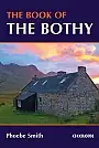
The Book of the Bothy | CiceroneA celebration of 26 of the author's favourite bothies, as she shares her memories of her favourite 'stone tents' all over the UK in remote and wild locations. Packed with expert advice on how to make use of these 'free, old, empty houses', from packing lists to bothy etiquette and the best walks into these remote locations. Wales: Snowdonia, Brecon Beacons, Devil's Bridge. England: Buttermere and Mosedale (Lake District), Dufton (Pennines), Kielder Forest Park (Northumberland). Scotland: Highlands and Isle of Skye, Glenduror Forest, Fort Augustus, Spean Bridge, Rannoch... |
17,99 |

|
Wandelkaartgids Two Moors Way Map Booklet | CiceroneHandzaam kaartgidsje. Gedetailleerde topografische wandelkaarten gebonden in een handig boekje. Licht voor onderweg. Map booklet for Devon's Coast to Coast, a 117 mile route incorporating the Two Moors Way and a section of the Erme-Plym Trail. This booklet is included with the Cicerone guide to the trail, and shows the full route on OS 1:25K maps. A perfect week-long holiday, the walk passes through the beautiful countryside of Dartmoor and Exmoor. Schaal: 1:25.000 |
9,99 Tijdelijk niet leverbaar |

|
Wandelgids The North Downs Way | Cicerone | National trail from Farnham to DoverA guidebook to walking the North Downs Way National Trail, a 130 mile (208km) walk between the high downland of Farnham and the historic city of Dover on the Kent coast, with an optional visit to Canterbury. The route is described in 11 stages, and is fully illustrated with colour photographs and OS map extracts. The North Downs Way is one of the easier national trails with a modest number of steep (but short) ascents and descents and long sections with no noticeable height gain or loss. Several historic sites including Neolithic burial chambers, Roman roads and Norman... |
22,99 |

|
Wandelgids Oost Engeland Ost England | Rother Bergverlag | 55 wandelingenDe vermaarde wandelgiden van Rother Bergverlag zijn uitstekende wandelgidsen voor ieder niveau. Op een kaartje is de wandelroute aangegeven, maar deze is ook beschreven in een beknopte en heldere tekst. Daarnaast is ook de afstand, de verwachte wandeltijd, het niveau, de hoogte en andere praktische informatie aangegeven. Met deze degelijke wandelgids ontdek je de mooiste plekken van jouw bestemming en kun je de spannendste wandeluitdagingen zoeken. 55 wandelingen. Kleine Fachwerkdorfer, blumengeschmuckte Pubs, alte Burgen und: Natur, Natur, Natur! Englands Osten ist ei... |
14,90 Tijdelijk niet leverbaar |

|
Wandelgids Heart of the Cotswolds Trail Rucksack ReadersDeze gids heeft een goede beschrijving van de lange afstands route met overzichtelijke kaarten doch zonder veel detail. De kracht van de Rucksack Readers is de uitgebreide achtergrondinformatie over de flora, fauna en geologische verschijnselen. Dit alles rijkelijk omkleed met kleurrijke foto's en praktische tips. Waterproof papier. The Cotswolds is the quintessential heart of England, with its rich cultural history, medieval ‘wool’ churches and charming domestic architecture of stone, slate and thatch. The book offers three options for walking circuits... |
24,90 |

|
Wandelgids 21Somerset the Mendips Wiltshire Pathfinder Guide | Pathfinder Guide 21 | Met Ordanance Survey kaartenDeze Pathfinder Guide is een goed uitgevoerde gids met verschillende wandelingen in Groot-Britannië. De gids bevat naast goede topografische kaarten van de Britse topografische dienst (Ordanance Survey) ook beschrijvingen van het landschap, de cultuur en/of de flora en fauna. Verder is de gids voorzien van praktische informatie zoals startpunten, verwachte wandeltijd, restaurants en cafés voor onderweg. |
17,99 Tijdelijk niet leverbaar |

|
Wandelgids Mountain Walks Ben Nevis | Vertebrate Publishing | 15 routes to enjoy on and around Ben Nevis15 routes to enjoy on and around Ben Nevis Schaal: 1:25.000 |
19,99 |

|
Wandelgids Dales Way Rucksack ReadersRucksack Readers zijn handig uitgevoerd in een klapper met ringband. Deze gids heeft een goede beschrijving van de lange afstands route met overzichtelijke kaarten doch zonder veel detail. De kracht van de Rucksack Readers is de uitgebreide achtergrondinformatie over de flora, fauna en geologische verschijnselen. Dit alles rijkelijk omkleed met kleurrijke foto's en praktische tips. |
15,99 Tijdelijk niet leverbaar |

|
Wandelgids 53 Lancashire Pathfinder Guide | Pathfinder Guide 53 | Met Ordanance Survey kaartenDeze Pathfinder Guide is een goed uitgevoerde gids met verschillende wandelingen in Groot-Britannië. De gids bevat naast goede topografische kaarten van de Britse topografische dienst (Ordanance Survey) ook beschrijvingen van het landschap, de cultuur en/of de flora en fauna. Verder is de gids voorzien van praktische informatie zoals startpunten, verwachte wandeltijd, restaurants en cafes voor onderweg. With its fen-like lowlands, its coastal scenery, the high fells of Bowland and the lush river valleys of the Ribble and Lune, Lancashire is a county of surprising ... |
17,99 |

|
Wandelgids 50 Walks in Snowdonia and North Wales | AA PublishingOverzichtelijke wandelgids met duidelijke beschrijvingen en wandelkaarten. Wandeltochten van 5 tot 13 kilometer. Featuring a variety of mapped walks to suit all abilities, this helpful guide features all the necessary practical details for a successful trip, including information on distance, gradient, level of difficulty, landscape, dog friendliness, parking availability, and restroom locations. Fascinating background on the history and wildlife of each area is provided, and local points of interest are indicated on accompanying full-color maps. All wa... |
18,99 |

|
Wandelgids 50 Walks in Cornwall | AA PublishingOverzichtelijke wandelgids met duidelijke beschrijvingen en wandelkaarten. Wandeltochten van 5 tot 13 kilometer. The books feature all the practical detail you need, accompanied by fascinating background reading on the history and wildlife of the area, and clear mapping for ease of use. Every route has been colour coded according to difficulty. All walks are annotated with local points of interest and places to stop for refreshments. |
18,99 |

|
Wandelgids 50 Walks in Dorset | AA PublishingOverzichtelijke wandelgids met duidelijke beschrijvingen en wandelkaarten. Wandeltochten van 5 tot 13 kilometer. |
18,99 |

|
Wandelgids Kanalinseln Kanaaleilanden Rother Wanderführer | Rother Bergverlag | 40 wandelingen| Jersey Guernsey Herm Sark AlderneyDe vermaarde wandelgiden van Rother Bergverlag zijn uitstekende wandelgidsen voor ieder niveau. Op een kaartje is de wandelroute aangegeven, maar deze is ook beschreven in een beknopte en heldere tekst. Daarnaast is ook de afstand, de verwachte wandeltijd, het niveau, de hoogte en andere praktische informatie aangegeven. Met deze degelijke wandelgids ontdek je de mooiste plekken van jouw bestemming en kun je de spannendste wandeluitdagingen zoeken. Vor der Küste der französischen Normandie, im Ärmelkanal zwischen England und Frankreich, liegen die ... |
16,90 |

|
Wandelgids 42 Cheshire Pathfinder Guide | Pathfinder Guide 42 | Met Ordanance Survey kaartenDeze Pathfinder Guide is een goed uitgevoerde gids met verschillende wandelingen in Groot-Britannie. De gids bevat naast goede topografische kaarten van de Britse topografische dienst (Ordanance Survey) ook beschrijvingen van het landschap, de cultuur en/of de flora en fauna. Verder is de gids voorzien van praktische informatie zoals startpunten, verwachte wandeltijd, restaurants en cafes voor onderweg. 28 dagwandelingen. This walking guidebook for Cheshire contains 28 outstanding walks all tried and tested by experienced walkers. The routes range from extended strolls... |
17,99 Tijdelijk niet leverbaar |

|
Wandelgids Walking the Dartmoor Way Cicerone Guidebooks
|
22,95 |

|
Wandelgids Walking in Essex | Cicerone Guidebooks25 dagwandelingen en een meerdaagde wandeltocht van 154 km. This guidebook describes 25 coastal and inland day walks covering the whole of the county of Essex, stretching from the Lea Valley in the west and the Thames in the south over to the North Sea and up to the River Stour in the north. Walks range from 4 to 18 miles and are mostly circular. Also included is a description of the Essex Way which crosses the county in 11 stages from Manor Park, on the fringes of London, to the port of Harwich - a distance of 96 miles. The walks are suitable for all abilities ... |
17,99 |

|
Wandelgids Walking in the New Forest | Cicerone | 30 Walks in the New Forest National ParkThis guidebook presents 30 walks in the New Forest in Hampshire and Wiltshire, Britain's smallest National Park. Easily accessible from Southampton, Bournemouth, Salisbury and Winchester, the New Forest encompasses varied landscapes, from ancient woodlands to open heaths, rivers and coastline. Routes of between 5 and 16km (3 and 10 miles) explore the Forest, mainly on fairly flat terrain, often on well-defined tracks and paths. Most walks are suitable for all the family and many can be combined to make longer outings. Each walk is described in detail, highlighting ... |
17,99 |

|
Wandelgids The Two Moors Way Devon's Coast to Coast | Cicerone | Devon and Coast to Coast: Wembury Bay to LynmouthThis guidebook to walking Coast to Coast across Devon, presents a 117 mile route incorporating the Two Moors Way and a section of the Erme-Plym Trail. Beginning at Wembury Bay on the south coast and finishing at Lynmouth, the 11-stage walk passes through the beautiful Devon countryside and across two of southwest England’s magnificent moorlands, Dartmoor and Exmoor. The schedule can be adjusted to give a one-week walk, or a more leisurely pace if preferred, and the book includes low-level bad-weather alternative routes for some moorland stretches. A full route de... |
24,50 |

|
Wandelgids Walking on the North Wessex Downs | Cicerone | 30 walks exploring the AONB30 walking routes exploring the North Wessex Downs Area of Outstanding Natural Beauty (AONB). The routes are between 7 and 20km through this peaceful rolling chalk landscape covering parts of four counties: Berkshire, Hampshire, Wiltshire and Oxfordshire, with descriptions to reach the highest points in each one. Seasons: All year round. Spring and early summer are best for wild flowers, butterflies and birds; in autumn the trees are splashed in golden-brown autumnal colours, while a frosty winter's day can give impressive clear views Centres: Marlborough, Lambourn... |
17,99 |

|
Wandelgids The Isle of Mull Cicerone Guidebooks | Mull, Ulva, Gometra, Iona & ErraidGuidebook describing over 40 walking routes on Scotland's beautiful Isle of Mull, as well as neighbouring Ulva, Gometra, Iona and Erraid. Walks range from 2 to 16 miles and from short circuits to demanding mountain traverses, but without technical difficulties. The Isle of Mull is wild, rugged and great for wildlife spotting. Activities walking Seasons walking possible throughout the year, although the winter months call for winter mountaineering skills and equipment on the higher mountains Centres Tobermory; smaller settlements at Dervaig, Salen, the... |
21,90 |

|
Wandelgids The Severn Way the UK's longest river from source to sea | CiceroneThe Severn Way is a 215 mile (348km) walk through the Welsh borders. Beginning at the River Severn's source in Powys, mid-Wales, this guidebook gives all the information needed to enjoy walking the route. The Severn Way meanders through superb landscapes, interesting towns and villages before finishing near Bristol, in south-west England. May to September should avoid both the usual periods of flooding and the glutinous aftermath they bring. Main centres are Worcester and Gloucester; marginally lesser centres are Newtown, Welshpool, Shrewsbury, Bridgnorth, Sto... |
21,99 |

|
Wandelgids Walking in the Wye Valley | Cicerone | 30 varied walks between Chepstow and PlynlimonGuidebook to 30 varied walks of 3 - 10 miles, in the valley of the Wye, the most scenic river in England and Wales, between Chepstow in the south and Plynlimon. Landscape ranges from open moorland to wooded gorges and is dotted with the sites of Iron Age hillforts and castles. Centres include Ross-on-Wye, Hereford, Hay-on-Wye and Rhayader.all walks can be enjoyed in any season, although care needs to be taken on the mountain and moorland walks in the upper valley in winter; risk of winter flooding between Hereford and Monmouth. Chepstow, Monmouth, Ross-on-Wye, Hereford... |
17,99 Tijdelijk niet leverbaar |

|
Wandelgids Best Day Walks Great Britain | Lonely Planet | Engelstalig
|
22,99 |

