- Gratis verzending vanaf 30 euro
- Levert in Nederland, België etc.
- Meer dan 30.000 titels
- Vakkundige klantenservice
- Snelle levering
- Veilig en eenvoudig betalen

Direct contact?
Bel +31 (0)6 42428571
maandag t/m vrijdag
van 10 tot 17 uur
Fietskaart NN21London to Brighton Cycle Map | Sustrans
Water- en scheurvaste fietskaart

The official map for the iconic 68-mile (109km) ride from the capital to the coast This linear map shows the route and immediate surrounding area over a series of separate map panels. The full colour map based on Ordnance Survey data shows clearly mapped cycle routes on traffic-free paths, quiet lanes and roads, with easy to read contours, route profiles and mile markers. Also features detailed inset maps for the major towns and cities, tourist info and cycle shop and hire information, and other local routes. The ride from London to Brighton has become one of the most popular cycles in Britain in recent years, and no wonder with so much to see and enjoy along the way. Starting on the banks of the River Thames in Greenwich in the shadow of the iconic tea clipper sailing ship Cutty Sark, and next to internationally-renowned landmarks such as the Royal Observatory and the National Maritime Museum, the route heads along National Cycle Network Routes 20 and 21 all the way to the famous Brighton Palace Pier. On leaving Greenwich the ride heads due south along the Ravensbourne and Pool Rivers to New Beckenham, from where you continue south to Elmers End and pass through the lovely South Norwood Country Park. The route then continues through the pretty Addington golf course and on to Addington Hill before heading through New Addington, Warlingham and past the pleasant Woldingham Golf Course before heading on to Caterham and Redhill. There are several traffic-free sections to enjoy along this section of the route with pleasant stretches through Holt Wood near Warlingham and Mercers Country Park near Redhill. From Redhill the route heads to Crawley, passing Horley before taking you on a unique traffic-free path which goes through Gatwick Airport. Beyond Crawley you enter the High Weald Area of Outstanding Natural Beauty, passing through Tilgate Forest and its golf course. The route continues to Handcross where you can see the pretty Nymans Gardens before passing through the villages of Staplefield, Bolney and Hickstead. A long traffic-free section then follows taking you to the outskirts of Brighton with views of the beautiful South Downs as you go. The final stretch takes you through Brighton passing the attractive Pavilion Gardens before finishing near the Sea Life Centre and famous Brighton Beach. Routes covered by this map: National Route 21 from London to Crawley National Route 20 from Crawley to Brighton
Schaal: 1:110.000
Engelstalig
EAN: 9781910845394
Uitgeverij: Sustrans (UK)
Meest recente editie
Engelstalig


Op voorraad
Vóór 17 uur besteld, morgen in huis (Nederland)
- Vakkundige klantenservice
- Groot assortiment
- Gratis retourneren binnen 14 dagen
- Aangesloten bij WebwinkelKEUR
€ 13,50
Meer producten die interessant kunnen zijn
Wegenkaarten Zuid-Engeland
Wegenkaart - Landkaart Zuid-Engeland Wales - World Mapping Project (Reise Know-How)
Water- en scheurvaste wegenkaart
€ 11,25
Wandelgidsen Zuid-Engeland

Wandelgids 67 Downs South NP & East Sussex Pathfinder Guide
Pathfinder Guide 67 | Met Ordanance Survey kaarten
€ 17,99
Wandelgids 27 Isle of Wight Pathfinder Guide (Short Walks)
Pathfinder Guide 27 | Met Ordanance Survey kaarten
€ 11,50
Reisgidsen Zuid-Engeland


Reisgids Engeland Zuid Cambridge - Canterbury - Brighton - Exeter - Oxford Trotter
De no-nonsensegids voor een allesomvattende trip.
€ 22,90
Topografische kaarten Zuid-Engeland
Topografische Wandelkaart 182 Weston-super-Mare Bridgwater & Wells - Landranger Map
Wandelkaart & Fietskaart | Ordnance Survey (OS) Groot-Brittannië
€ 18,99

Topografische Wandelkaart OL15 van Groot-Brittannië (1:25.000) Purbeck / South Dorset - Explorer Map OL 15
Wandelkaart | Ordnance Survey (OS) Groot-Brittannië
€ 18,99
Topografische Wandelkaart 141 Cheddar Gorge / Mendip Hills West - Explorer Map
Wandelkaart & Fietskaart | Ordnance Survey (OS) Groot-Brittannië
€ 18,99
Topografische Wandelkaart 155 Bristol / Bath - Explorer Map
Wandelkaart & Fietskaart | Ordnance Survey (OS) Groot-Brittannië
€ 18,99
Tijdelijk niet leverbaar
Wandelkaarten Zuid-Engeland
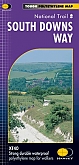
Wandelkaart South Downs Way - National Trail Maps | Harvey Maps
Water- en scheurvaste wandelkaart
€ 25,99