- Gratis verzending vanaf 30 euro
- Levert in Nederland, België etc.
- Meer dan 30.000 titels
- Vakkundige klantenservice
- Snelle levering
- Veilig en eenvoudig betalen

Direct contact?
Bel +31 (0)6 42428571
maandag t/m vrijdag
van 10 tot 17 uur
Europa / Groot-Brittannië / Engeland / Zuid-Engeland / Wandelen / Wandelgidsen
Zuid-Engeland Wandelgidsen bestsellers

Wandelgids 254 Zuid Engeland Süd | Rother
56 wandelingen Zwischen London, Dover, Jurassic Coast und Exmoor.
14,90

16,99
Wandelgids 27 Isle of Wight Pathfinder Guide (Short Walks)
Pathfinder Guide 27 | Met Ordanance Survey kaarten
11,50
|
Wandelgids 11 Dorset Pathfinder Guide | Pathfinder Guide 11 | Met Ordanance Survey kaartenDeze Pathfinder Guide is een goed uitgevoerde gids met verschillende wandelingen in Groot-Britannië. De gids bevat naast goede topografische kaarten van de Britse topografische dienst (Ordanance Survey) ook beschrijvingen van het landschap, de cultuur en/of de flora en fauna. Verder is de gids voorzien van praktische informatie zoals startpunten, verwachte wandeltijd, restaurants en cafés voor onderweg. Dorset must rank as one of the most unspoilt counties in England. Dominating the landscape are the chalk downs open, sweeping, grassy uplands that stretch f... |
17,99 Tijdelijk niet leverbaar |
|
|
Wandelgids 254 Zuid Engeland Süd | Rother | 56 wandelingen Zwischen London, Dover, Jurassic Coast und Exmoor.De vermaarde wandelgiden van Rother Bergverlag zijn uitstekende wandelgidsen voor ieder niveau. Op een kaartje is de wandelroute aangegeven, maar deze is ook beschreven in een beknopte en heldere tekst. Daarnaast is ook de afstand, de verwachte wandeltijd, het niveau, de hoogte en andere praktische informatie aangegeven. Met deze degelijke wandelgids ontdek je de mooiste plekken van jouw bestemming en kun je de spannendste wandeluitdagingen zoeken. 56 wandelingen. |
14,90 |

|
Wandelgids Thames Path Thames Head to the Thames Barrier | TrailblazerPraktische, alles-in-een gids voor het lopen van het Thames Path National Trail van de Costwolds naar de Thames Barrier in Londen, inclusief grootschalige wandelkaarten, verblijfplaatsen, plaatsen om te eten en informatie over het openbaar vervoer. De National Trail van The Thames Path loopt over 294 km van de bron bij Thames Head bij Kemble in de Cotswolds naar de Thames Barrier in Londen. Het landschap is prachtig gevarieerd, variërend van wilde en eenzame delen van de bovenloop van de rivier tot even indrukwekkende stedelijke vergezichten. Je komt langs zoveel ... |
18,95 |
|
Wandelgids the Pilgrims' Way To Canterbury from Winchester and London | CiceroneThis guidebook details the Pilgrims' Way, an historic pilgrimage route to Canterbury Cathedral in Kent, home of the shrine of the martyred archbishop, St Thomas Becket. The route is described both from Winchester in Hampshire (136 ½ miles) and London's Southwark Cathedral (90 ¼ miles), with an optional spur to Rochester Cathedral. |
17,99 |
|
|
Wandelkaartgids South West Coast Path Map Booklet - Plymouth to Poole deel 3 (Zoutpad) | CiceroneHandzaam kaartgidsje. Gedetailleerde topografische wandelkaarten gebonden in een handig boekje. Map of part of the southern section of the 630 mile (1014km) South West Coast Path National Trail. Covers the trail from Plymouth to Poole along the coastline of Devon and Dorset. This convenient and compact booklet of Ordnance Survey 1:25,000 maps shows the route, providing all of the mapping you need to walk the trail in either direction. Schaal: 1:25.000 |
16,99 |

|
Wandelgids 50 Walks in Dorset | AA PublishingOverzichtelijke wandelgids met duidelijke beschrijvingen en wandelkaarten. Wandeltochten van 5 tot 13 kilometer. |
18,99 Tijdelijk niet leverbaar |
|
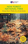
Wandelgids Walking in the New Forest | Cicerone | 30 Walks in the New Forest National ParkThis guidebook presents 30 walks in the New Forest in Hampshire and Wiltshire, Britain's smallest National Park. Easily accessible from Southampton, Bournemouth, Salisbury and Winchester, the New Forest encompasses varied landscapes, from ancient woodlands to open heaths, rivers and coastline. Routes of between 5 and 16km (3 and 10 miles) explore the Forest, mainly on fairly flat terrain, often on well-defined tracks and paths. Most walks are suitable for all the family and many can be combined to make longer outings. Each walk is described in detail, highlighting ... |
17,99 |
|
Wandelgids 23 New Forest NP Pathfinder Guide (Short Walks) | Korte wandelingen tot 7.5 kmDeze Pathfinder Guide is een goed uitgevoerde gids met verschillende wandelingen in Groot-Britannie. De gids bevat naast goede topografische kaarten van de Britse topografische dienst (Ordanance Survey) ook beschrijvingen van het landschap, de cultuur en/of de flora en fauna. Verder is de gids voorzien van praktische informatie zoals startpunten, verwachte wandeltijd, restaurants en cafes voor onderweg. This book has 20 short walks from 1.5 to 5.5 miles in length exploring the New Forest National Park. Each walk includes turn by turn directions, information on parking ... |
11,50 |
|
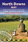
Wandelgids North Downs Way | Trailblazer | 80 Large-Scale Walking Maps & Guides to 45 Towns & Villages - Planning, Places to Stay, PlacesPractical guide to walking the North Downs Way National Trail that runs from Farnham in Surrey to Dover in Kent, partly following the old Pilgrims' Way to the shrine of St Thomas a Becket at Canterbury. It winds its way through the protected landscape of the Surrey Hills and the Kent Downs, passing medieval churches, castles, Neolithic burial sites, vineyards and numerous WWII defences. There are literary associations with Swift, Cobbett, Dickens and Jane Austen. The guide includes: * 80 large-scale walking maps - at just under 1:20,000 - showing route times, place... |
16,99 |

|
Wandelgids South Downs Way Rucksack ReadersRucksack Readers zijn handig uitgevoerd in een klapper met ringband. Deze gids heeft een goede beschrijving van de lange afstands route met overzichtelijke kaarten doch zonder veel detail. De kracht van de Rucksack Readers is de uitgebreide achtergrondinformatie over de flora, fauna en geologische verschijnselen. Dit alles rijkelijk omkleed met kleurrijke foto's en praktische tips. The South Downs Way is one of England’s popular National Trails. It runs for 100 miles (160 km) from the cathedral city of Winchester to the spectacular white cliffs of East Sussex, fi... |
15,99 |
|
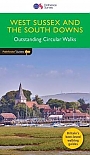
Wandelgids 66 West Sussex / South Downs Pathfinder Guide | Pathfinder Guide 66 | Met Ordanance Survey kaartenDeze Pathfinder Guide is een goed uitgevoerde gids met verschillende wandelingen in Groot-Britannie. De gids bevat naast goede topografische kaarten van de Britse topografische dienst (Ordanance Survey) ook beschrijvingen van het landschap, de cultuur en/of de flora en fauna. Verder is de gids voorzien van praktische informatie zoals startpunten, verwachte wandeltijd, restaurants en cafes voor onderweg. 28 dagwandelingen. Containing 28 circular, graded walks that have all been created and tested by experienced walkers, this walking guidebook is ideal for both visitors ... |
17,99 |

|
Wandelgids 50 Walks in Sussex and South Downs | AA PublishingOverzichtelijke wandelgids met duidelijke beschrijvingen en wandelkaarten. Wandeltochten van 5 tot 13 kilometer. A variety of mostly mapped walks to suit both the casual walker and the more serious hiker are contained in this illustrated guide. Detailed maps include information on the route - scenery, distance, terrain, places of interest - together with dog-friendly walks. Special features include: an introductory location map indicating the starting point of every walk; a summary of distance, time, gradient, level of difficulty, type of surface ... |
18,99 Tijdelijk niet leverbaar |
|
|
Wandelgids 27 Isle of Wight Pathfinder Guide (Short Walks) | Pathfinder Guide 27 | Met Ordanance Survey kaartenDeze Pathfinder Guide is een goed uitgevoerde gids met verschillende wandelingen in Groot-Britannië. De gids bevat naast goede topografische kaarten van de Britse topografische dienst (Ordanance Survey) ook beschrijvingen van het landschap, de cultuur en/of de flora en fauna. Verder is de gids voorzien van praktische informatie zoals startpunten, verwachte wandeltijd, restaurants en cafés voor onderweg. Short Walks Isle of Wight covering parts of Newtown, Tennyson Down and Bembridge.This selection offers interest and regional variety in the Isle of Wight, p... |
11,50 |
|
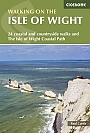
Wandelgids Walking on the Isle of Wight | Cicerone | The Isle of Wight Coastal Path and 24 coastal and countryside walksGuidebook to 33 walking routes on the beautiful Isle of Wight, from 4 to 18 miles long. The routes are suitable for all abilities and are accessible all year round. Includes a complete circuit of the island's spectacular coast as well as walks exploring forest trails and downland, and visiting the towns of Yarmouth, Cowes and Ventnor. The climate is more temperate than on the mainland. Late spring to autumn perfect for inland walks, coastal path quite appropriate for winter (wildness, drama….) Some inland walks can be very muddy in winter. Sandown, Shanklin, Vent... |
17,50 |
|
Wandelgids 67 Downs South NP & East Sussex Pathfinder Guide | Pathfinder Guide 67 | Met Ordanance Survey kaartenDeze Pathfinder Guide is een goed uitgevoerde gids met verschillende wandelingen in Groot-Britannie. De gids bevat naast goede topografische kaarten van de Britse topografische dienst (Ordanance Survey) ook beschrijvingen van het landschap, de cultuur en/of de flora en fauna. Verder is de gids voorzien van praktische informatie zoals startpunten, verwachte wandeltijd, restaurants en cafes voor onderweg. 28 dagwandelingen. The Pathfinder walking guidebook for East Sussex and the South Downs National Park has 28 carefully selected walking routes for all abilities. Routes... |
17,99 |
|
Wandelgids 12 New Forest, Hampshire and South Downs Pathfinder Guide | Pathfinder Guide 12 | Met Ordanance Survey kaartenDeze Pathfinder Guide is een goed uitgevoerde gids met verschillende wandelingen in Groot-Britannië. De gids bevat naast goede topografische kaarten van de Britse topografische dienst (Ordanance Survey) ook beschrijvingen van het landschap, de cultuur en/of de flora en fauna. Verder is de gids voorzien van praktische informatie zoals startpunten, verwachte wandeltijd, restaurants en cafés voor onderweg. From its chalk stream valleys and high downlands to its bluebell woods and wide purple heaths, Hampshire's varied landscapes make ideal walking country. The county's ... |
17,99 |