- Gratis verzending vanaf 30 euro
- Levert in Nederland, België etc.
- Meer dan 30.000 titels
- Vakkundige klantenservice
- Snelle levering
- Veilig en eenvoudig betalen

Direct contact?
Bel +31 (0)6 42428571
maandag t/m vrijdag
van 10 tot 17 uur
Wandelgids Walking in Lancashire | Cicerone Guide
40 walks throughout the county including the Forest of Bowland and Ribble Valley
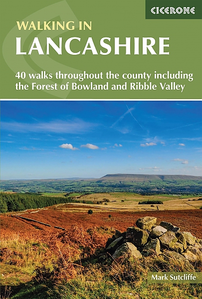
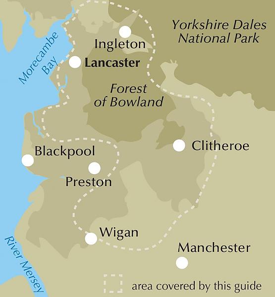
Guidebook of 40 walks exploring the dales, moors, uplands and coasts of Lancashire, including Morecambe Bay, the Forest of Bowland, Ribble Valley and the West Pennine Moors. With routes for all seasons of the year and for a variety of abilities, these walks are within easy reach of Preston, Blackburn, Burnley, Lancaster and Clitheroe. Seasons Most of these walks can be completed all year round. Some higher level routes are challenging in winter, while lower level routes may become waterlogged after heavy rain. Centres Walks in the Forest of Bowland, Ribble Valley and West Pennine Moors are all accessible from nearby towns and cities including Preston, Blackburn, Burnley, Chorley, Lancaster and Clitheroe. Difficulty Most of these walks are suitable for any walker with a reasonable level of fitness. Higher level routes that climb above 2,000ft and can be very challenging in winter conditions and require appropriate clothing and footwear, good navigational skills, and basic knowledge of mountain safety. Must See Ancient woodland and gritstone moors, historic Pendle and Pendle Hill, RSPB reserve at Leighton Moss, Neolithic Bleasdale Circle, Roman museum at Ribchester, tercet posts on the Lancashire Witches Way, Andy Goldsworthy's sculptures on Clougha Pike, the Inn at Whitewell, Jubilee Tower, the Abbey Lighthouse and Lancashire coast, Morecambe Bay, Gragareth.
Engelstalig
EAN: 9781786310033
Uitgeverij: Cicerone Press
Verschijningsdatum: 2021
Meest recente editie
Engelstalig
176 pagina's


Op voorraad
Levertijd 3 dagen (Nederland)
- Vakkundige klantenservice
- Groot assortiment
- Gratis retourneren binnen 14 dagen
- Aangesloten bij WebwinkelKEUR
€ 16,99
Meer producten die interessant kunnen zijn
Wegenkaarten Noord-Engeland


Wegenkaart - Landkaart 502 Noord-Engeland - Michelin Regional
Northern England, the Midlands 502
€ 11,50


Wegenkaart - Landkaart Northern Engeland Noord-Engeland & the Midlands - World Mapping Project (Reise Know-How)
Water- en scheurvaste wegenkaart
€ 13,50
Wandelkaarten Noord-Engeland

Wandelkaartgids Hadrian's Wall Path
All the Ordnance Survey mapping needed for Hadrian's Wall Path
€ 13,50

Wandelkaart Hadrian's Wall Path - National Trail Maps | Harvey Maps
Water- en scheurvaste wandelkaart
€ 25,99

Wandelkaart Cleveland Way - National Trail Maps | Harvey Maps
Water- en scheurvaste wandelkaart
€ 25,99

Wandelkaart Coast to Coast - St. Bees to Robin Hood's Bay - National Trail Maps | Harvey Maps
Water- en scheurvaste wandelkaart
€ 25,99
Topografische kaarten Noord-Engeland

Topografische Wandelkaart OL27 van Groot-Brittannië (1:25.000) North York Moors Eastern area - Explorer Map OL 27
Wandelkaart | Ordnance Survey (OS) Groot-Brittannië
€ 18,99

Topografische Wandelkaart 278 Sheffield / Barnsley Rotherham - Explorer Map
Wandelkaart & Fietskaart | Ordnance Survey (OS) Groot-Brittannië
€ 18,99
Tijdelijk niet leverbaar

Topografische Wandelkaart 290 York / Selby / Tadcaster - Explorer Map
Wandelkaart & Fietskaart | Ordnance Survey (OS) Groot-Brittannië
€ 18,99
Tijdelijk niet leverbaar

Topografische Wandelkaart 80 Cheviot Hills & Kielder Water - Landranger Map
Wandelkaart & Fietskaart | Ordnance Survey (OS) Groot-Brittannië
€ 18,99
Reisgidsen Noord-Engeland


Reisgids Slow North York Moors & Yorkshire Wolds Bradt Travel Guide
Moors, Dales And Coast, Including Yorklocal, Characterful Guides
€ 21,90

