- Gratis verzending vanaf 30 euro
- Levert in Nederland, België etc.
- Meer dan 30.000 titels
- Vakkundige klantenservice
- Snelle levering
- Veilig en eenvoudig betalen

Direct contact?
Bel +31 (0)6 42428571
maandag t/m vrijdag
van 10 tot 17 uur
Wandelgids Hadrian's Wall Path Cicerone Guidebooks
National Trail Two-way national trail description
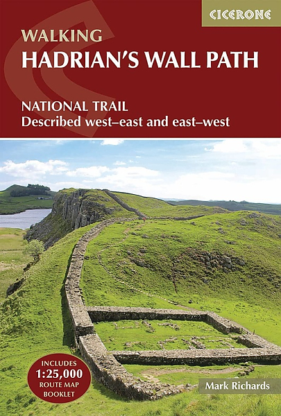
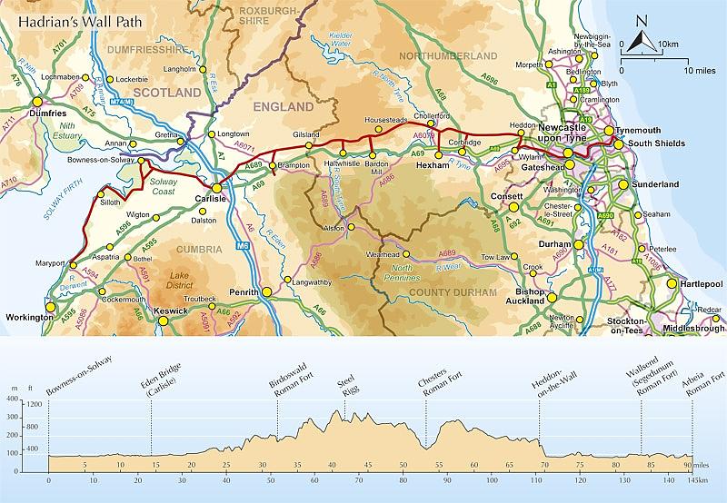
The essential guidebook to walking the 84-mile Hadrian"s Wall Path. One of the UK's most visited National Trails, it runs the length of the Roman Wall from Bowness-on-Solway in Cumbria to Wallsend, Newcastle.
Begun in AD122 and stretching from the River Tyne to the Solway Firth, Hadrian"s Wall was a massive feat of engineering and is the best preserved frontier from the classical Roman Empire. Today it is a World Heritage Site, with iconic scenery and fascinating archaeological remains like Birdoswald, Housesteads and Vindolanda, giving a glimpse into Roman life and power. The trail is presented here in 10 stages, with suggestions for five and eight-day itineraries. It is suitable for beginners, although a reasonable level of fitness is required if doing it as a multi-day trek. The route is described both west to east and east to west, and the guidebook also features extensions to Maryport on the far west coast of Cumbria and to South Shields on the east coast.
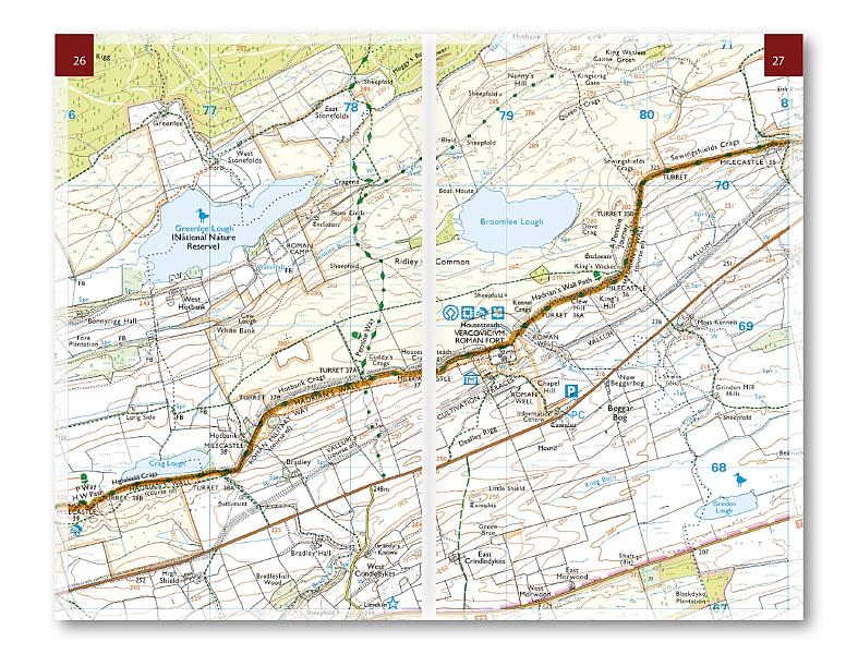
This full-colour guidebook contains a wealth of information on the history of the Wall, and a range of practical information for walkers, from accommodation and itinerary planning, to details on public transport and refreshments. Clear step-by-step route descriptions are accompanied by 1:100,000 OS map extracts. A compact booklet showing the route on a 1:25,000 scale OS map is included for added convenience.
Schaal: 1:25.000
Engelstalig
EAN: 9781786311504
Auteur(s): Richards, m.
Uitgeverij: Cicerone Press
Verschijningsdatum: 2023
Meest recente editie
Engelstalig
244 pagina's

Op voorraad
Vóór 17 uur besteld, morgen in huis (Nederland)
- Vakkundige klantenservice
- Groot assortiment
- Gratis retourneren binnen 14 dagen
- Aangesloten bij WebwinkelKEUR
€ 22,99
Meer producten die interessant kunnen zijn
Wegenkaarten Noord-Engeland


Wegenkaart - Landkaart 502 Noord-Engeland - Michelin Regional
Northern England, the Midlands 502
€ 11,50


Wegenkaart - Landkaart Northern Engeland Noord-Engeland & the Midlands - World Mapping Project (Reise Know-How)
Water- en scheurvaste wegenkaart
€ 13,50
Wandelkaarten Noord-Engeland

Wandelkaartgids Hadrian's Wall Path
All the Ordnance Survey mapping needed for Hadrian's Wall Path
€ 13,50

Wandelkaart Hadrian's Wall Path - National Trail Maps | Harvey Maps
Water- en scheurvaste wandelkaart
€ 25,99

Wandelkaart Cleveland Way - National Trail Maps | Harvey Maps
Water- en scheurvaste wandelkaart
€ 25,99

Wandelkaart Coast to Coast - St. Bees to Robin Hood's Bay - National Trail Maps | Harvey Maps
Water- en scheurvaste wandelkaart
€ 25,99
Topografische kaarten Noord-Engeland

Topografische Wandelkaart OL27 van Groot-Brittannië (1:25.000) North York Moors Eastern area - Explorer Map OL 27
Wandelkaart | Ordnance Survey (OS) Groot-Brittannië
€ 18,99

Topografische Wandelkaart 278 Sheffield / Barnsley Rotherham - Explorer Map
Wandelkaart & Fietskaart | Ordnance Survey (OS) Groot-Brittannië
€ 18,99
Tijdelijk niet leverbaar

Topografische Wandelkaart 290 York / Selby / Tadcaster - Explorer Map
Wandelkaart & Fietskaart | Ordnance Survey (OS) Groot-Brittannië
€ 18,99
Tijdelijk niet leverbaar

Topografische Wandelkaart 80 Cheviot Hills & Kielder Water - Landranger Map
Wandelkaart & Fietskaart | Ordnance Survey (OS) Groot-Brittannië
€ 18,99
Reisgidsen Noord-Engeland


Reisgids Slow North York Moors & Yorkshire Wolds Bradt Travel Guide
Moors, Dales And Coast, Including Yorklocal, Characterful Guides
€ 21,90

