- Gratis verzending vanaf 30 euro
- Levert in Nederland, België etc.
- Meer dan 30.000 titels
- Vakkundige klantenservice
- Snelle levering
- Veilig en eenvoudig betalen

Direct contact?
Bel +31 (0)6 42428571
maandag t/m vrijdag
van 10 tot 17 uur
Wandelgids Exmoor & North Devon Coast Path Trailblazer
South West Coast Path Part 1 Minehead to Bude

This new guide covers the coastal route from Minehead to Bude (125 miles), the first section of the 630 mile South West Coast Path. This spectacular route passes through the Exmoor National Park following the highest coastline in England (over 800ft), through numerous idyllic villages such as Lynton and Clovelly, around Barnstaple Bay and Hartland Point to the seaside resort of Bude just over the border with Cornwall. · 5 town plans and 53 large-scale walking maps – at just under 1:20,000 – showing route times, places to stay, places to eat, points of interest and much more. These are not general-purpose maps but fully-edited maps drawn by walkers for walkers. · Itineraries for all walkers – whether walking the route in its entirety over a week to 10 days or sampling the highlights on day walks and short breaks · Practical information for all budgets – camping, bunkhouses, hostels, B&Bs, pubs and hotels; where to stay, where to eat, what to see, plus detailed street plans
Engelstalig
EAN: 9781912716241
Auteur(s): Henry stedman & joel newton
Uitgeverij: Trailblazer
Verschijningsdatum: 2022
Meest recente editie
Engelstalig
212 pagina's


Op voorraad
Overmorgen in huis (Nederland)
- Vakkundige klantenservice
- Groot assortiment
- Gratis retourneren binnen 14 dagen
- Aangesloten bij WebwinkelKEUR
€ 18,95
Meer producten die interessant kunnen zijn
Reisgidsen Devon / Cornwall


Reisgids Slow Devon South & Dartmoor Bradt Travel Guide
Local, Characterful Guides To Britain's Special Places
€ 16,99
Tijdelijk niet leverbaar
Topografische kaarten Devon / Cornwall
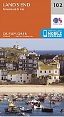
Topografische Wandelkaart 102 Land's End - Explorer Map
Wandelkaart & Fietskaart | Ordnance Survey (OS) Groot-Brittannië
€ 18,99
Topografische Wandelkaart OL28 van Groot-Brittannië (1:25.000) Dartmoor - Explorer Map OL 28
Wandelkaart | Ordnance Survey (OS) Groot-Brittannië
€ 18,99
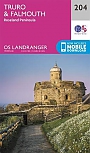
Topografische Wandelkaart 204 Truro / Falmouth Roseland Peninsula - Landranger Map
Wandelkaart & Fietskaart | Ordnance Survey (OS) Groot-Brittannië
€ 18,99
Topografische Wandelkaart 203 Land's End / Isles of Scilly St Ives & Lizard Point - Landranger Map
Wandelkaart & Fietskaart | Ordnance Survey (OS) Groot-Brittannië
€ 18,99
Wegenkaarten Devon / Cornwall


Wandelkaarten Devon / Cornwall
Wandelkaart South West Coast Path 1 Minehead to St Ives - National Trail Maps (Zoutpad) | Harvey Maps
Water- en scheurvaste wandelkaart
€ 25,99
Wandelkaart South West Coast Path 3 Plymouth to Poole Harbour - National Trail Maps (Zoutpad) | Harvey Maps
Water- en scheurvaste wandelkaart
€ 25,99

Wandelkaart South West Coast Path 2 St Ives - Plymouth - National Trail Maps (Zoutpad) | Harvey Maps
Water- en scheurvaste wandelkaart
€ 25,99
Tijdelijk niet leverbaar