- Gratis verzending vanaf 30 euro
- Levert in Nederland, België etc.
- Meer dan 30.000 titels
- Vakkundige klantenservice
- Snelle levering
- Veilig en eenvoudig betalen

Direct contact?
Bel +31 (0)6 42428571
maandag t/m vrijdag
van 10 tot 17 uur
Wandelgids The Two Moors Way Devon's Coast to Coast | Cicerone

This guidebook to walking Coast to Coast across Devon, presents a 117 mile route incorporating the Two Moors Way and a section of the Erme-Plym Trail. Beginning at Wembury Bay on the south coast and finishing at Lynmouth, the 11-stage walk passes through the beautiful Devon countryside and across two of southwest England’s magnificent moorlands, Dartmoor and Exmoor. The schedule can be adjusted to give a one-week walk, or a more leisurely pace if preferred, and the book includes low-level bad-weather alternative routes for some moorland stretches.
A full route description is given for walking the route from south to north, with a summary description for walking in the opposite direction. 1:50,000 map extracts show the route and there is lots of practical information on public transport, refreshments and accommodation to make day-by-day planning simple.
A map booklet showing the full route on OS 1:25K maps is included with this guide.
The county of Devon incorporates a wonderful range of landscapes, from the rolling fields of South Devon and the narrow-hedged lanes of Mid Devon to the wild, wide-open spaces of Dartmoor, home to hill ponies, granite tors and Bronze Age relics. To the north, Exmoor’s sandstone moorland sweeps down to the sea, and lofty coastal hills tower over the Bristol Channel.
Engelstalig
EAN: 9781852849917
Uitgeverij: Cicerone Press
Verschijningsdatum: 2019
Meest recente editie
Engelstalig

Op voorraad
Overmorgen in huis (Nederland)
- Vakkundige klantenservice
- Groot assortiment
- Gratis retourneren binnen 14 dagen
- Aangesloten bij WebwinkelKEUR
€ 21,99
Meer producten die interessant kunnen zijn
Reisgidsen Devon / Cornwall


Reisgids Slow Devon South & Dartmoor Bradt Travel Guide
Local, Characterful Guides To Britain's Special Places
€ 16,99
Tijdelijk niet leverbaar
Topografische kaarten Devon / Cornwall
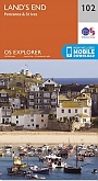
Topografische Wandelkaart 102 Land's End - Explorer Map
Wandelkaart & Fietskaart | Ordnance Survey (OS) Groot-Brittannië
€ 18,99
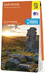
Topografische Wandelkaart OL28 van Groot-Brittannië (1:25.000) Dartmoor - Explorer Map OL 28
Wandelkaart | Ordnance Survey (OS) Groot-Brittannië
€ 18,99
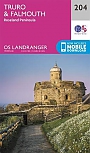
Topografische Wandelkaart 204 Truro / Falmouth Roseland Peninsula - Landranger Map
Wandelkaart & Fietskaart | Ordnance Survey (OS) Groot-Brittannië
€ 18,99
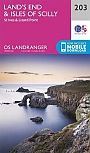
Topografische Wandelkaart 203 Land's End / Isles of Scilly St Ives & Lizard Point - Landranger Map
Wandelkaart & Fietskaart | Ordnance Survey (OS) Groot-Brittannië
€ 18,99
Wegenkaarten Devon / Cornwall


Wandelkaarten Devon / Cornwall
Wandelkaart South West Coast Path 1 Minehead to St Ives - National Trail Maps (Zoutpad) | Harvey Maps
Water- en scheurvaste wandelkaart
€ 25,99
Wandelkaart South West Coast Path 3 Plymouth to Poole Harbour - National Trail Maps (Zoutpad) | Harvey Maps
Water- en scheurvaste wandelkaart
€ 25,99

Wandelkaart South West Coast Path 2 St Ives - Plymouth - National Trail Maps (Zoutpad) | Harvey Maps
Water- en scheurvaste wandelkaart
€ 25,99