- Gratis verzending vanaf 30 euro
- Levert in Nederland, België etc.
- Meer dan 30.000 titels
- Vakkundige klantenservice
- Snelle levering
- Veilig en eenvoudig betalen

Direct contact?
Bel +31 (0)6 42428571
maandag t/m vrijdag
van 10 tot 17 uur
Europa / Groot-Brittannië
Groot-Brittannië bestsellers
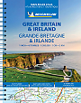
Wegenatlas Groot-Brittannië & Ierland Schotland Engeland Wales Ierland - Michelin Wegenatlassen
A4 Formaat met spiraalbinding
21,50
11,50
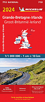
Wegenkaart - Landkaart 798 - Groot-Brittannië & Ierland - Michelin National
Water- en scheurvaste wegenkaart
12,50
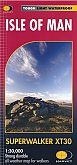
Wandelkaart Isle of Man - Walking Maps Superwalker | Harvey Maps
Water- en scheurvaste wandelkaart
23,99
|
Wandelgids 18 Brecon Beacons Pathfinder Guide | Pathfinder Guide 18 | Met Ordanance Survey kaarteneze Pathfinder Guide is een goed uitgevoerde gids met verschillende wandelingen in Groot-Britannië. De gids bevat naast goede topografische kaarten van de Britse topografische dienst (Ordanance Survey) ook beschrijvingen van het landschap, de cultuur en/of de flora en fauna. Verder is de gids voorzien van praktische informatie zoals startpunten, verwachte wandeltijd, restaurants en cafés voor onderweg. Within the boundaries of the Brecon Beacons National Park there are four separate mountain ranges: Black Mountain, the most westerly, Fforest Fawr, th... |
17,99 |
|
Wandelkaart Lake District East - Walking Maps Superwalker | Harvey Maps | Water- en scheurvaste wandelkaartDe Harvey Map is de wandelkaart voor het lange afstand wandelpad in het Groot-Brittannië. Duidelijke topografische wandelkaarten met praktische informatie van de route zoals overnachtingsmogelijkheden, eetgelegenheden en bezienswaardigheden. Deze wandelkaart is scheur- en watervast. Met GPS compatible (UTM-Grid). Features Helvellyn and High Street and fells east of the Kendal-Keswick road. The Kirkstone Pass, Ullswater, Haweswater and Kentmere are on this sheet. Schaal: 1:25.000 |
24,99 |
|
Wandelgids Wales | Rother BergverlagDe Rother wandelgids Wales beschrijft de 50 mooiste kust- en bergwandelingen in het westen van het Verenigd Koninkrijk - van Pembrokeshire tot Anglesey, van de Ierse Zee tot de grens met Engeland, in de bergachtige regio's, het binnenland en langs de kust. * Betrouwbare routebeschrijvingen * Gedetailleerde wandelkaarten * Informatieve hoogteprofielen * Downloadbare GPS Tracks |
18,99 |
|
Topografische Wandelkaart 125 Romney Marsh / Rye / Winchelsea - Explorer Map | Wandelkaart & Fietskaart | Ordnance Survey (OS) Groot-BrittanniëDeze gedetailleerde en informatieve topografische kaart (stafkaart, schaal 1:25.000) van Groot-Brittannië bevat alle topografische elementen van het landschap en geeft daarmee een nauwkeurig beeld van het terrein. Daarnaast heeft Ordnance Survey (OS) ook toeristische informatie op de meeste kaart verwerkt, zoals de aanduiding voor campings en ingetekende wandelpaden . Deze kaart is ideaal voor wandelaars of fietsers, maar ook voor de scouting of sportverenigingen die activiteiten in Groot-Brittannië gaan uitvoeren. De kaarten zijn voorzien van een GPS aanduiding en e... Schaal: 1:25.000 |
18,99 |
|
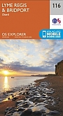
Topografische Wandelkaart 116 Lyme regis / Bridport - Explorer Map | Wandelkaart & Fietskaart | Ordnance Survey (OS) Groot-BrittanniëDeze gedetailleerde en informatieve topografische kaart (stafkaart, schaal 1:25.000) van Groot-Brittannië bevat alle topografische elementen van het landschap en geeft daarmee een nauwkeurig beeld van het terrein. Daarnaast heeft Ordnance Survey (OS) ook toeristische informatie op de meeste kaart verwerkt, zoals de aanduiding voor campings en ingetekende wandelpaden . Deze kaart is ideaal voor wandelaars of fietsers, maar ook voor de scouting of sportverenigingen die activiteiten in Groot-Brittannië gaan uitvoeren. De kaarten zijn voorzien van een GPS aanduiding en e... Schaal: 1:25.000 |
18,99 |

|
Topografische Wandelkaart 117 Cerne Abbas / Bere Regis - Explorer Map | Wandelkaart & Fietskaart | Ordnance Survey (OS) Groot-BrittanniëDeze gedetailleerde en informatieve topografische kaart (stafkaart, schaal 1:25.000) van Groot-Brittannië bevat alle topografische elementen van het landschap en geeft daarmee een nauwkeurig beeld van het terrein. Daarnaast heeft Ordnance Survey (OS) ook toeristische informatie op de meeste kaart verwerkt, zoals de aanduiding voor campings en ingetekende wandelpaden . Deze kaart is ideaal voor wandelaars of fietsers, maar ook voor de scouting of sportverenigingen die activiteiten in Groot-Brittannië gaan uitvoeren. De kaarten zijn voorzien van een GPS aanduiding en e... Schaal: 1:25.000 |
18,99 |
|
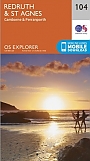
Topografische Wandelkaart 104 Redruth / St Agnes - Explorer Map | Wandelkaart & Fietskaart | Ordnance Survey (OS) Groot-BrittanniëDeze gedetailleerde en informatieve topografische kaart (stafkaart, schaal 1:25.000) van Groot-Brittannië bevat alle topografische elementen van het landschap en geeft daarmee een nauwkeurig beeld van het terrein. Daarnaast heeft Ordnance Survey (OS) ook toeristische informatie op de meeste kaart verwerkt, zoals de aanduiding voor campings en ingetekende wandelpaden . Deze kaart is ideaal voor wandelaars of fietsers, maar ook voor de scouting of sportverenigingen die activiteiten in Groot-Brittannië gaan uitvoeren. De kaarten zijn voorzien van een GPS aanduiding en e... Schaal: 1:25.000 |
18,99 |
|
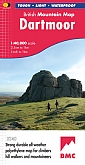
Wandelkaart Dartmoor - Mountain Map | Harvey Maps | Water- en scheurvaste wandelkaartDe Harvey Map is de wandelkaart voor het wandelen in de mooiste natuurgebieden in het Groot-Brittannië. Duidelijke topografische wandelkaarten met praktische informatie van de route zoals overnachtingsmogelijkheden, eetgelegenheden en bezienswaardigheden. Deze wandelkaart is scheur- en watervast. Met GPS compatible (UTM-Grid). This Harvey map has the whole of Dartmoor on one map and is printed in cooperation with the British Mountaineering Council. It also includes a geological map of the area specially designed by the British Geological Survey, climbing crags are... Schaal: 1:40.000 |
28,99 |
|
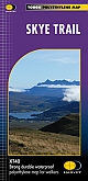
Wandelkaart Skye Trail | Harvey Maps | Water- en scheurvaste wandelkaartDe Harvey Map is de wandelkaart voor het wandelen in de mooiste natuurgebieden in het Groot-Brittannië. Duidelijke topografische wandelkaarten met praktische informatie van de route zoals overnachtingsmogelijkheden, eetgelegenheden en bezienswaardigheden. Deze wandelkaart is scheur- en watervast. Met GPS compatible (UTM-Grid). The Skye Trail is a challenging unofficial route through the island which is specifically aimed at experienced hillwalkers. The route follows much of the amazing Trotternish Ridge and passes beneath the peaks and pinnacles of the Cuillin, which ... Schaal: 1:40.000 |
25,99 |
|
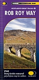
Wandelkaart Rob Roy Way | Harvey Maps | Water- en scheurvaste wandelkaartDe Harvey Map is de wandelkaart voor het wandelen in de mooiste natuurgebieden in het Groot-Brittannië. Duidelijke topografische wandelkaarten met praktische informatie van de route zoals overnachtingsmogelijkheden, eetgelegenheden en bezienswaardigheden. Deze wandelkaart is scheur- en watervast. Met GPS compatible (UTM-Grid). Rob Roy Way is a walk across part of the Southern Highlands of Scotland taking in some of the most beautiful countryside in the UK. Starting from Drymen it goes north east to finish in Pitlochry. The Way is 77mls or 94 mls (124Km or 151Km) depen... Schaal: 1:40.000 |
25,99 |
|
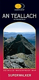
Wandelkaart An Teallach & Fisherfield - Walking Maps Superwalker | Harvey Maps | Water- en scheurvaste wandelkaartDe Harvey Map is de wandelkaart voor het wandelen in de mooiste natuurgebieden in het Groot-Brittannië. Duidelijke topografische wandelkaarten met praktische informatie van de route zoals overnachtingsmogelijkheden, eetgelegenheden en bezienswaardigheden. Deze wandelkaart is scheur- en watervast. Met GPS compatible (UTM-Grid). An Teallach and Fisherfield covers a spectacular group of remote northerly Munros popular with walkers and climbers. The map area includes 8 Munros, 5 Corbetts and 2 Grahams. Schaal: 1:25.000 |
18,99 Tijdelijk niet leverbaar |
|
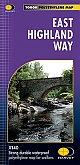
Wandelkaart East Highland Way | Harvey Maps | Water- en scheurvaste wandelkaartDe Harvey Map is de wandelkaart voor het wandelen in de mooiste natuurgebieden in het Groot-Brittannië. Duidelijke topografische wandelkaarten met praktische informatie van de route zoals overnachtingsmogelijkheden, eetgelegenheden en bezienswaardigheden. Deze wandelkaart is scheur- en watervast. Met GPS compatible (UTM-Grid). Compact and light - the map itself weighs just 60gms - a third of the weight of a laminated map, and much less bulky. And you can fold or refold it time and again, or stuff it in your back pocket and it won't fall to pieces. Shows the entire rou... Schaal: 1:40.000 |
25,99 |
|
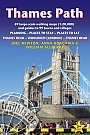
Wandelgids Thames Path Thames Head to the Thames Barrier | TrailblazerPraktische, alles-in-een gids voor het lopen van het Thames Path National Trail van de Costwolds naar de Thames Barrier in Londen, inclusief grootschalige wandelkaarten, verblijfplaatsen, plaatsen om te eten en informatie over het openbaar vervoer. De National Trail van The Thames Path loopt over 294 km van de bron bij Thames Head bij Kemble in de Cotswolds naar de Thames Barrier in Londen. Het landschap is prachtig gevarieerd, variërend van wilde en eenzame delen van de bovenloop van de rivier tot even indrukwekkende stedelijke vergezichten. Je komt langs zoveel ... |
18,95 |
|
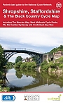
Fietskaart 22 Shropshire Staffordshire & the Black Country Cycle Map Sustrans Pocket Sized | van 9.99 voor 4.99!Mid-Wales South Cycle Map including the Ystwyth Trail, Elan Valley Trail, Lon Las Cymru, Lon Teifi, 3 day rides & 6 town centre maps. This is in the series of pocket sized, folded maps to the National Cycle Network which include clearly mapped on-road and traffic-free paths, easy to read contours and detailed town insets. The series is published by CycleCity Guides in partnership with Sustrans. 1:110,000 scale; folded. Schaal: 1:110.00 |
4,99 |
|
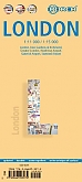
Stadsplattegrond London Borch Maps Kew Gardens & Richmond/Heathrow/Gatwick | Water- en scheurvaste stadsplattegrondDe kaarten van Borch zijn handzaam in gebruik, water- en scheurvast en hebben een heldere cartografie. Op de kaarten is toeristische informatie aangegeven zoals musea, ambassades, monumenten, kerken en andere praktische informatie. De kaart is ook voorzien van een uitgebreide legenda, kleine en overzichtelijke stadsplattegronden en regionale uitvergrotingen. De kaarten bevatten daarnaast ook uitstekende aanduiding voor het openbaarvervoer (zoals metroverbindingen). Schaal: 1:11.000 |
9,99 |
|
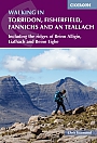
Wandelgids Walking in Torridon Fisherfield Fannichs and An Teallach Cicerone Guidebooks | Including the ridges of Beinn Alligin, Liathach and Beinn Eighe
|
21,99 |
|
Topografische Wandelkaart OL22 van Groot-Brittannië (1:25.000) Brighton & Hove, Lewes & Burgess Hill - Explorer Map OL 11 | Wandelkaart | Ordnance Survey (OS) Groot-BrittanniëDeze gedetailleerde en informatieve topografische kaart (stafkaart, schaal 1:25.000) van Groot-Brittannië bevat alle topografische elementen van het landschap en geeft daarmee een nauwkeurig beeld van het terrein. Daarnaast heeft Ordnance Survey (OS) ook toeristische informatie op de meeste kaart verwerkt, zoals de aanduiding voor campings en ingetekende wandelpaden . Deze kaart is ideaal voor wandelaars of fietsers, maar ook voor de scouting of sportverenigingen die activiteiten in Groot-Brittannië gaan uitvoeren. De kaarten zijn voorzien van een GPS aanduid... Schaal: 1:25.000 |
18,99 |
|
Topografische Wandelkaart OL12 van Groot-Brittannië (1:25.000) Explorer Brecon Beacons NP West- Explorer Map OL 12 | Wandelkaart | Ordnance Survey (OS) Groot-BrittanniëDeze gedetailleerde en informatieve topografische kaart (stafkaart, schaal 1:25.000) van Groot-Brittannië bevat alle topografische elementen van het landschap en geeft daarmee een nauwkeurig beeld van het terrein. Daarnaast heeft Ordnance Survey (OS) ook toeristische informatie op de meeste kaart verwerkt, zoals de aanduiding voor campings en ingetekende wandelpaden . Deze kaart is ideaal voor wandelaars of fietsers, maar ook voor de scouting of sportverenigingen die activiteiten in Groot-Brittannië gaan uitvoeren. De kaarten zijn voorzien van een GPS aanduiding en e... Schaal: 1:25.000 |
18,99 |
|
Reisgids Slow Devon South & Dartmoor Bradt Travel Guide | Local, Characterful Guides To Britain's Special PlacesThis new second edition of South Devon and Dartmoor is part of Bradt's distinctive 'Slow travel' series of guides to UK regions, offering in-depth exploration of one of England's most popular areas. Written by resident experts Hilary Bradt and Janice Booth, it is the essential companion guide to discovering not just the obvious and most popular sites, but also for getting off the beaten track and understanding what makes this gorgeous part of the country tick. Much of the information in Bradt's South Devon and Dartmoor has appeared in no othe... |
16,99 Tijdelijk niet leverbaar |
|
Wandelgids Arran Coastal Way Rucksack ReadersDeze gids heeft een goede beschrijving van de lange afstands route met overzichtelijke kaarten doch zonder veel detail. De kracht van de Rucksack Readers is de uitgebreide achtergrondinformatie over de flora, fauna en geologische verschijnselen. Dit alles rijkelijk omkleed met kleurrijke foto's en praktische tips. The Arran Coastal Way is perhaps Scotland's finest circular long-distance trail, running 65 miles (105 km) around the Isle of Arran in a memorable week-long hike from Brodick. It's accessible from near Glasgow by the Ardrossan ferry. Famous as`Sco... |
21,50 |
|
Wandelgids Walking on Harris and Lewis Cicerone Guidebooks | 30 day walks on the Isles of Harris and LewisThis guidebook describes 30 day walks all over the Isles of Harris and Lewis, in the Outer Hebrides. The walks range from 2 and 14 miles (4 to 22km) in length, and are easily accessible from Stornaway or Tarbet. Routes vary from short strolls to long wilderness hikes, high-level and low-level, and include the An Cliseam horseshoe, visits to ancient historic monuments like the stone circles of Calanais and the famous Butt of Lewis lighthouse, all illustrated with OS 1:50,000 maps and dramatic photography. |
21,99 |
|
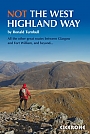
Wandelgids Not the West Highland Way Cicerone GuidebooksThe West Highland Way is one of the finest of Britain's long-distance paths. It passes through six separate mountain ranges, from the tall elegant cone of Ben Lomond and the crag towers of grim Glen Coe to the seductive Mamores. But does it go onto those enticing Stobs and Bens? It does not. It runs along Glens Falloch and Finnan, close to the Highlands' second busiest main road and the West Highland Railway. It may be Scotland's best long-distance path: but this book intends to do better. So here they are: the mountains alongside the way. When the sun shin... |
19,99 |
|
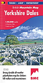
Wandelkaart Yorkshire Dales - Mountain Map | Harvey Maps | Water- en scheurvaste wandelkaartDe Harvey Map is de wandelkaart voor het wandelen in de mooiste natuurgebieden in het Groot-Brittannië. Duidelijke topografische wandelkaarten met praktische informatie van de route zoals overnachtingsmogelijkheden, eetgelegenheden en bezienswaardigheden. Deze wandelkaart is scheur- en watervast. Met GPS compatible (UTM-Grid). Double-sided waterproof mountain map of the Yorkshire Dales from Harvey at 1:40,000, with a geological map of the region on the reverse, and advice on navigating the region safely. Schaal: 1:40.000 |
28,99 |
|
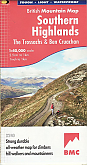
Wandelkaart Southern Highlands - Mountain Map | Harvey Maps | Water- en scheurvaste wandelkaartDe Harvey Map is de wandelkaart voor het wandelen in de mooiste natuurgebieden in het Groot-Brittannië. Duidelijke topografische wandelkaarten met praktische informatie van de route zoals overnachtingsmogelijkheden, eetgelegenheden en bezienswaardigheden. Deze wandelkaart is scheur- en watervast. Met GPS compatible (UTM-Grid). This Harvey BMC mountain map for the Southern Highlands covers 63 hills over 2,000 feet. It is printed on polyethylene - durable, tear-proof and 100% waterproof with colour shading for easy identification of hills and valleys. It includes names ... Schaal: 1:40.000 |
28,99 |
|
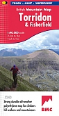
Wandelkaart Torridon & Fisherfield - Mountain Map | Harvey Maps | Water- en scheurvaste wandelkaartDe Harvey Map is de wandelkaart voor het wandelen in de mooiste natuurgebieden in het Groot-Brittannië. Duidelijke topografische wandelkaarten met praktische informatie van de route zoals overnachtingsmogelijkheden, eetgelegenheden en bezienswaardigheden. Deze wandelkaart is scheur- en watervast. Met GPS compatible (UTM-Grid). The giants of Torridon and the remote hills of Fisherfield on one sheet at scale 1:40,000 scale. Schaal: 1:40.000 |
28,99 |
|
Wandelkaart Snowdonia South - Mountain Map | Harvey Maps | Water- en scheurvaste wandelkaartDe Harvey Map is de wandelkaart voor het wandelen in de mooiste natuurgebieden in het Groot-Brittannië. Duidelijke topografische wandelkaarten met praktische informatie van de route zoals overnachtingsmogelijkheden, eetgelegenheden en bezienswaardigheden. Deze wandelkaart is scheur- en watervast. Met GPS compatible (UTM-Grid). Waterproof mountain map of Snowdonia South from Harvey at 1:40,000, with a geological map of the region on the reverse, as well as an extension to the main map covering Aberdovey and advice on navigating the region safely. Schaal: 1:40.000 |
28,99 |
|
Topografische Wandelkaart OL9 van Groot-Brittannië (1:25.000) Exmoor Barnstaple, Lynton, Minehead & Dulverto - Explorer Map OL 9 | Wandelkaart | Ordnance Survey (OS) Groot-BrittanniëDeze gedetailleerde en informatieve topografische kaart (stafkaart, schaal 1:25.000) van Groot-Brittannië bevat alle topografische elementen van het landschap en geeft daarmee een nauwkeurig beeld van het terrein. Daarnaast heeft Ordnance Survey (OS) ook toeristische informatie op de meeste kaart verwerkt, zoals de aanduiding voor campings en ingetekende wandelpaden . Deze kaart is ideaal voor wandelaars of fietsers, maar ook voor de scouting of sportverenigingen die activiteiten in Groot-Brittannië gaan uitvoeren. De kaarten zijn voorzien van een GPS aanduiding en e... Schaal: 1:25.000 |
18,99 |
|
Topografische Wandelkaart OL43 van Groot-Brittannië (1:25.000) Hadrian's Wall / Haltwhistle / Hexham - Explorer Map OL 43 | Wandelkaart | Ordnance Survey (OS) Groot-BrittanniëDeze gedetailleerde en informatieve topografische kaart (stafkaart, schaal 1:25.000) van Groot-Brittannië bevat alle topografische elementen van het landschap en geeft daarmee een nauwkeurig beeld van het terrein. Daarnaast heeft Ordnance Survey (OS) ook toeristische informatie op de meeste kaart verwerkt, zoals de aanduiding voor campings en ingetekende wandelpaden . Deze kaart is ideaal voor wandelaars of fietsers, maar ook voor de scouting of sportverenigingen die activiteiten in Groot-Brittannië gaan uitvoeren. De kaarten zijn voorzien van een GPS aanduid... Schaal: 1:25.000 |
18,99 |
|
Wandelkaart Cairn Gorm Ben Avon - Walking Maps Superwalker | Harvey Maps | Water- en scheurvaste wandelkaartDe Harvey Map is de wandelkaart voor het wandelen in de mooiste natuurgebieden in het Groot-Brittannië. Duidelijke topografische wandelkaarten met praktische informatie van de route zoals overnachtingsmogelijkheden, eetgelegenheden en bezienswaardigheden. Deze wandelkaart is scheur- en watervast. Met GPS compatible (UTM-Grid). Detailed map of the Cairngorms for walking and climbing Schaal: 1:25.000 |
25,99 |
|
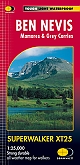
Wandelkaart Ben Nevis - Walking Maps Superwalker | Harvey Maps | Water- en scheurvaste wandelkaartDe Harvey Map is de wandelkaart voor het wandelen in de mooiste natuurgebieden in het Groot-Brittannië. Duidelijke topografische wandelkaarten met praktische informatie van de route zoals overnachtingsmogelijkheden, eetgelegenheden en bezienswaardigheden. Deze wandelkaart is scheur- en watervast. Met GPS compatible (UTM-Grid). Detailed map of Ben Nevis for walkers and climbers Schaal: 1:25.000 |
25,99 |
|
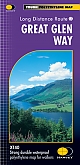
Wandelkaart Great Glen Way - National Trail Maps | Harvey Maps | Water- en scheurvaste wandelkaartDe Harvey Map is de wandelkaart voor het lange afstand wandelpad in het Groot-Brittannië. Duidelijke topografische wandelkaarten met praktische informatie van de route zoals overnachtingsmogelijkheden, eetgelegenheden en bezienswaardigheden. Deze wandelkaart is scheur- en watervast. Met GPS compatible (UTM-Grid). 117km (73 miles) from Fort William to Inverness via Fort Augustus along the Caledonian Canal and the north side of Loch Ness. Schaal: 1:40.000 |
25,99 |
|
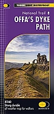
Wandelkaart Offa's Dyke Path National Trail Maps | Harvey Maps | Water- en scheurvaste wandelkaartDe Harvey Map is de wandelkaart voor het lange afstand wandelpad in het Groot-Brittannië. Duidelijke topografische wandelkaarten met praktische informatie van de route zoals overnachtingsmogelijkheden, eetgelegenheden en bezienswaardigheden. Deze wandelkaart is scheur- en watervast. Met GPS compatible (UTM-Grid). 285 kilometer van Chepstow in het zuiden naar Prestatyn in het noorden van Wales. Schaal: 1:40.000 |
25,99 |
|
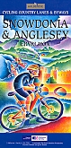
Fietskaart Snowdonia & Anglesey cycling map | GoldeneyeDe Goldeneye kaarten zijn uitstekende vrijetijdskaarten voor Groot-Brittannië, met name goed te gebruiken voor het fietsen door de overzichtelijke schaal. De De kaarten zijn helder, overzichtelijk en gedrukt op stevig papier. De MapGuide-kaarten bevatten toeristische informatie op de achterzijde van de kaart. De CyclingMaps bevatten fietspaden die over het algemeen vrij liggen van drukke wegen en/of gemotoriseerd verkeer en daarnaast ook de fietspaden van NCN (De Britse 'National Cycle Network'). Een handig register met plaatsnamen maakt het eenvoudig om plaatsen op t... Schaal: 1:126.720 |
10,99 |
|
Fietskaart Kent cycling map | GoldeneyeDe Goldeneye kaarten zijn uitstekende vrijetijdskaarten voor Groot-Brittannië, met name goed te gebruiken voor het fietsen door de overzichtelijke schaal. De De kaarten zijn helder, overzichtelijk en gedrukt op stevig papier. De MapGuide-kaarten bevatten toeristische informatie op de achterzijde van de kaart. De CyclingMaps bevatten fietspaden die over het algemeen vrij liggen van drukke wegen en/of gemotoriseerd verkeer en daarnaast ook de fietspaden van NCN (De Britse 'National Cycle Network'). Een handig register met plaatsnamen maakt het eenvoudig om p... Schaal: 1:126.720 |
12,50 |
|
Topografische Wandelkaart OL23 van Groot-Brittannië (1:25.000) Cadair Idris / Llyn Tegid - Explorer Map OL 23 | Wandelkaart | Ordnance Survey (OS) Groot-BrittanniëDeze gedetailleerde en informatieve topografische kaart (stafkaart, schaal 1:25.000) van Groot-Brittannië bevat alle topografische elementen van het landschap en geeft daarmee een nauwkeurig beeld van het terrein. Daarnaast heeft Ordnance Survey (OS) ook toeristische informatie op de meeste kaart verwerkt, zoals de aanduiding voor campings en ingetekende wandelpaden . Deze kaart is ideaal voor wandelaars of fietsers, maar ook voor de scouting of sportverenigingen die activiteiten in Groot-Brittannië gaan uitvoeren. De kaarten zijn voorzien van een GPS aanduid... Schaal: 1:25.000 |
18,99 |
|
Wandelgids 28 North York Moors Pathfinder Guide | Pathfinder Guide 28 | Met Ordanance Survey kaartenDeze Pathfinder Guide is een goed uitgevoerde gids met verschillende wandelingen in Groot-Britannië. De gids bevat naast goede topografische kaarten van de Britse topografische dienst (Ordanance Survey) ook beschrijvingen van het landschap, de cultuur en/of de flora en fauna. Verder is de gids voorzien van praktische informatie zoals startpunten, verwachte wandeltijd, restaurants en cafés voor onderweg. A total of 175 miles of superb walking in the North York Moors National Park. |
17,99 |
|
Wandelgids Walking on Dartmoor Cicerone Guidebooks | National Park and surrounding areasA guidebook to 39 day walks and one two-day Ten Tors challenge across the Dartmoor National Park and its surrounding area. The guide contains low-level shorter walks and higher level more strenuous and challenging routes, therefore there's a walk suitable for all abilities, allowing you to explore all of what Devon's national park has to offer. Each walk contains a detailed route description, 1:50,000 OS maps and colour photography, alongside practical information on public transport links and refreshment stops on each walk. Dartmoor, a National Park sin... |
19,99 |
|
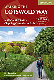
Wandelgids The Cotswolds Way Cicerone Guidebooks | Two-way trail guide - Chipping Campden to BathGuidebook to walking the 102 mile (163km) Cotswold Way National Trail between Chipping Campden and Bath, across the Cotswolds AONB. The guidebook - which includes both a guide to the route and a separate OS 1:25,000 map booklet - describes the route in both directions. The route is described over 13 stages, each following the Cotswold escarpment, with dramatic and far-reaching views across the Severn Vale towards the Welsh hills, plunging down to visit honey-coloured villages, old market towns and the elegant and historic city of Bath. The longest of the 13 stage... |
23,50 |
|
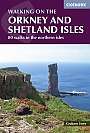
Wandelgids Walking on the Orkney and Shetland Isles Cicerone Guidebooks | 80 WalksA guidebook to 80 walking routes on Scotland's Northern Isles of Orkney and Shetland. Routes are described on the islands of Orkney (Orkney Mainland, Hoy, South Ronaldsay, Burray, Rousay, Eday, Westray, Papa Westray, North Ronaldsay) and the islands of Shetland (Shetland Mainland, West Burra, East Burra, Foula, Fair Isle, Isle of Noss, Bressay, Whalsay, Papa Stour, Muckle Roe, Out Skerries, Esha Ness, Yell, Fetlar and Unst). Â Routes vary in length from 1 mile to 16 miles, with something to suit all abilities. Offering a variety of landscapes t... |
19,99 |
|
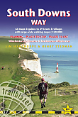
Wandelgids South Downs Way Trailblazer | Winchester to EastbourneDe South Downs Way is een 160 km lange nationale route die de lijn van krijtheuvels volgt die zich uitstrekt van Winchester in Hampshire over Sussex naar Eastbourne. Langs de Downs lopen is de beste manier om dit prachtige landschap te ervaren met zijn mix van glooiende heuvels, steile hangende bossen en winderige velden. Je passeert ook dorpjes met ansichtkaarten met gastvrije pubs, huisjes met rieten daken en typisch Engelse landtuinen. |
20,90 Tijdelijk niet leverbaar |
|
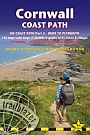
Wandelgids Cornwall Coast Path (Zoutpad) Part 2 Bude to Falmouth TrailblazerThis fully revised new edition has now been considerably expanded to cover the full length of the Cornwall coast, 280 miles. This second part of the South West Coast Path around the south-western tip of Britain, includes some of the best coastal walking in Europe. With constantly changing scenery, the footpath takes in secluded coves, tiny fishing villages, rocky headlands, bustling resorts, wooded estuaries and golden surf-washed beaches. It is an area rich in wildlife with seabirds, wild flowers, dolphins and seals. 15 town plans and 130 large-scale walking maps &nda... |
19,90 Tijdelijk niet leverbaar |
|
Reisgids Groot-Brittannië CapitoolDe Capitool reisgidsen zijn kleurrijke en goed geillustreerde reisgidsen. Met gedetailleerde tekeningen, heldere kaarten, talrijke foto's en overzichtelijke achtergrondbeschrijvingen kun je niets missen op je reisbestemming. Een prettige gids voor diegene die lekker op vakantie is en veel cultuur (of natuur) wil mee pakken zonder overladen te worden met details. Vol historie en landschappen |
39,99 |
|
Wandelkaart Knoydart, Kintail & Glen Affric - Mountain Map | Harvey Maps | Water- en scheurvaste wandelkaartDe Harvey Map is de wandelkaart voor het wandelen in de mooiste natuurgebieden in het Groot-Brittannië. Duidelijke topografische wandelkaarten met praktische informatie van de route zoals overnachtingsmogelijkheden, eetgelegenheden en bezienswaardigheden. Deze wandelkaart is scheur- en watervast. Met GPS compatible (UTM-Grid). This Harvey BMC map shows Britain's last wilderness mapped in detail, showing Knoydart, Kintail and Glen Affric. Schaal: 1:40.000 |
28,99 |
|
Reisgids Suffolk Slow Travel Bradt Travel Guide
|
21,50 |
|
Wandelgids Walking in Pembrokeshire Cicerone Guide | 40 circular walks in and around the Pembrokeshire Coast National ParkGuidebook to 40 circular walks in Pembrokeshire in Wales. Routes take in the dramatic beauty of the national park and its coast, the Daugleddau and the Preseli Hills, while exploring wooded gorges, prehistoric hillforts and medieval castles. Walks range from 1 to 12 miles and route descriptions are accompanied by 1:50,000 OS map extracts. |
16,99 |
|
Reisgids Engeland Centraal DominicusDe Dominicus gidsen zijn zeer degelijke reisgidsen waar de nadruk vooral ligt op het bieden van achtergrondinformatie bij de reisbestemming. Op een persoonlijke wijze worden thema's behandeld als de ontwikkeling van de lokale economie, de kenmerken van de lokale bevolking, verschillende culturele uitingen (zoals religie, gebruiken en gewoonten) en de algemene geschiedenis. Daarnaast wordt er per regio, stad of gebied specifieke informatie gegeven over de belangrijkste kenmerken. Er is een sterke focus op de culturele bezienswaardigheden. De Dominicus is vloeiend geschr... |
22,99 Tijdelijk niet leverbaar |
|
Wandelgids 03 Lake District Pathfinder Guide (Short Walks) | 20 korte wandelingen 3 tot 9km.Deze Pathfinder Guide is een goed uitgevoerde gids met verschillende wandelingen in Groot-Britannie. De gids bevat naast goede topografische kaarten van de Britse topografische dienst (Ordanance Survey) ook beschrijvingen van het landschap, de cultuur en/of de flora en fauna. Verder is de gids voorzien van praktische informatie zoals startpunten, verwachte wandeltijd, restaurants en cafes voor onderweg. Short Walks Lake District covering parts of Keswick, Patterdale and Hawkshead. This selection offers interest and regional variety in the Lake District, providing the b... |
11,50 Tijdelijk niet leverbaar |
|
Wandelgids Pembrokeshire Coast Path Amroth to Cardigan Trailblazer | Amroth to CardiganAll-in-one hiking route guide, maps and accommodations for the Pembrokeshire Coast Path that follows a 186-mile National Trail around the coastline in south-west Wales. Includes 96 large-scale walking maps & guides to 47 towns and villages along the way plus planning, places to stay, places to eat, public transport information; downloadable GPS waypoints. Practical guidebook to walking the Pembrokeshire Coast Path. The walk follows a National Trail around the coastline in south-west Wales. Includes maps, accommodation, pubs and restaurants, and what to see along th... |
19,50 |
|
Wandelgids The Wye Valley Walk Cicerone Guidebooks | Official guidebook to the trailThe Wye Valley Walk is river and hill walking at its finest, with beautiful and interesting landscape every step of the way. This, the official guide to the Way, has been produced in conjunction with the Wye Valley Walk Partnership. The partnership works to conserve and enhance the natural beauty of the area, and team works hard to maintain the area's beauty for future generations. Passing sites such as Tintern Abbey, Goodrich Castle, Hereford Cathedral and Hay-on-Wye, the walk is accessible throughout the year and is suitable for all walkers with a reasonable level of... |
16,99 Tijdelijk niet leverbaar |
|
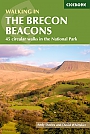
Wandelgids Walking on the Brecon Beacons Cicerone Guidebooks45 circular day walks are described in this guidebook to the Brecon Beacons National Park. From west to east, Mynydd Du, Fforest Fawr, the Brecon Beacons and the Black Mountains these mountain and valley routes offer many options, highlighting the natural features. The walks described explore dramatic waterfalls, wooded gorges and upland valleys. all year round walking if properly equipped; high summits and ridge walks best in winter; wooded valleys best in springtime or autumn when flowers are out or leaves are turning. Llandovery, Brecon, Crickhowell, Abergavenny and... |
18,99 |