- Gratis verzending vanaf 30 euro
- Levert in Nederland, België etc.
- Meer dan 30.000 titels
- Vakkundige klantenservice
- Snelle levering
- Veilig en eenvoudig betalen

Direct contact?
Bel +31 (0)6 42428571
maandag t/m vrijdag
van 10 tot 17 uur
Spanje Wandelgidsen bestsellers
Wandelgids Kantabrien Cantabrië Rother Wanderführer | Rother Bergverlag
50 wandelingen | Nordspanien: Von der Küste bis zu den Picos de Europa
16,90
Wandelgids 291 Costa Blanca Rother Wanderführer | Rother Bergverlag
53 Touren Denia Calp Benidorm Alcoi Alicante Orihuela
14,90
|
Wandelgids The Andalucian Coast to Coast Walk | Cicerone Guide | From the Mediterranean to the Atlantic through the Baetic MountainsGuidebook to the Andalucian Coast to Coast Walk, a 416km, 21-day route from Maro on the Mediterranean coast to Bolonia, on the Atlantic. The route, which passes through 7 Natural Parks, links some of Andalucía's most beautiful villages and passes historical sites of both Roman and Moorish origins, including Ronda and Tarifa. Frigiliana, Cómpeta, Alcaucín, Riogordo, Villanueva de la Concepción, El Chorro, Carratraca, El Burgo, Ronda, Montejaque, Cortes de la Frontera, Jimena de la Frontera, Castillo de Castellar, Los Barrios, Tarifa. The ... |
18,99 |
|
Wandelgids Menorca Sunflower Car tours and walksSunflower reisgidsen zijn handige handzame gidsen. Een combinatie van autotochten en wandeltochten. Rondwandelingen en lijnwandelingen. De lengte van de wandelingen variërend van 4 tot 20 kilometer. Moeilijkheidsgraad van de wandeling staat vermeldt. Met gedetailleerde kaartjes. Degelijk informatie over de bezienswaardigheden onderweg. Schaal: 1:50.000 |
20,50 |
|
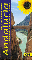
Wandelgids Andalucia Costa del Sol and Sierras Sunflower Car tours and Walks | 55 wandelingenSunflower reisgidsen zijn handige handzame gidsen. Een combinatie van autotochten en wandeltochten. Rondwandelingen en lijnwandelingen. De lengte van de wandelingen variërend van 4 tot 20 kilometer. Moeilijkheidsgraad van de wandeling staat vermeldt. Met gedetailleerde kaartjes. Degelijk informatie over de bezienswaardigheden onderweg. Schaal: 1:50.000 |
21,90 Tijdelijk niet leverbaar |
|
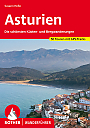
Wandelgids Asturie Asturias Rother Wanderführer | Rother Bergverlag | 50 wandelingenDe vermaarde wandelgiden van Rother Bergverlag zijn uitstekende wandelgidsen voor ieder niveau. Op een kaartje is de wandelroute aangegeven, maar deze is ook beschreven in een beknopte en heldere tekst. Daarnaast is ook de afstand, de verwachte wandeltijd, het niveau, de hoogte en andere praktische informatie aangegeven. Met deze degelijke wandelgids ontdek je de mooiste plekken van jouw bestemming en kun je de spannendste wandeluitdagingen zoeken. Sattgrüne Almen, aromatisch duftende Matten, freundliches Kuhglockengeläut zwischen schroffen Gipfeln. Fri... |
16,90 |
|
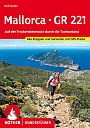
Wandelgids Mallorca - GR221 Trockensteinroute durch Tramuntana Rother Wanderführer | Rother Bergverlag | Alle Etappen und VariantenDe vermaarde wandelgiden van Rother Bergverlag zijn uitstekende wandelgidsen voor ieder niveau. Op een kaartje is de wandelroute aangegeven, maar deze is ook beschreven in een beknopte en heldere tekst. Daarnaast is ook de afstand, de verwachte wandeltijd, het niveau, de hoogte en andere praktische informatie aangegeven. Met deze degelijke wandelgids ontdek je de mooiste plekken van jouw bestemming en kun je de spannendste wandeluitdagingen zoeken. Ein außergewöhnlicher Weitwanderweg verläuft durch den Nordwesten Mallorcas: der GR 221. Die sogenan... |
16,90 |
|
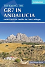
Wandelgids Walking the GR7 in Andalucia | Cicerone | From Tarifa to Puebla de don FabriqueWith its white sandy beaches, pine forests, snow-capped peaks, traditional villages, lush river valleys and olive groves, the GR7 in Andalucía takes you on a journey through the most geographically diverse region on the Iberian peninsula. This wonderfully varied route starts at the southernmost tip of Spain at Tarifa, and meanders through the provinces of Cádiz and Málaga before dividing. The northern route heads through Córdoba and Jaén provinces (711km in total), whilst the southern route passes through Almería and Granada (7... |
24,99 |
|
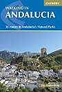
Wandelgids Walking in Andalucia - Andalusië | Cicerone Guidebooks | Guidebook to 36 walks in AndaluciaThis guidebook explores six of Andalucía's most beautiful Natural Parks, the Sierra Nevada regions of Aracena, Grazalema, Los Alcornocales and the Gaucín, La Axarquía, the Alpujarras and Cazorla, along the great belt of the Cordillera Bética mountains. The thirty-six half-day and full-day mostly circular walks are evenly split within these six regions, and range in length from 4 to 21km. Walks are graded and some involve steep ascents and descents, all within the capabilities of a reasonably fit walker. |
20,99 |
|
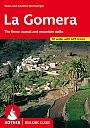
Wandelgids 298 La Gomera Rother Walking Guide | Rother Bergverlag | 70 wandelingenDe vermaarde wandelgiden van Rother Bergverlag zijn uitstekende wandelgidsen voor ieder niveau. Op een kaartje is de wandelroute aangegeven, maar deze is ook beschreven in een beknopte en heldere tekst. Daarnaast is ook de afstand, de verwachte wandeltijd, het niveau, de hoogte en andere praktische informatie aangegeven. Met deze degelijke wandelgids ontdek je de mooiste plekken van jouw bestemming en kun je de spannendste wandeluitdagingen zoeken. |
14,90 |
|
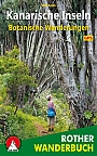
Natuurwandelgids Canarische eilanden - Kanarische Inseln Botanische Wanderungen | Rother Bergverlag | 35 wandelingen35 wandelingen langs bijzondere flora op de Canarische Eilanden. Sieben auf einen Streich! Dieses Rother Wanderbuch stellt 35 botanische Wanderungen auf allen sieben grossen Kanareninseln vor. Touren durch die subtropischen Lorbeerwalder von Teneriffa und La Gomera sind darin genauso enthalten wie Wanderungen durch die Vulkanlandschaft von Lanzarote, in der jedes entdeckte Pflanzchen einer Sensation gleicht. Fast wie in der Sahara mutet ein Spaziergang im Suden Gran Canarias uber die Dunen von Maspalomas an. Im Bergland von Fuerteventura uberrascht eine Palmenoa... |
17,99 |
|
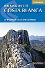
Wandelgids Walking on the Costa Blanca | Cicerone Guidebooks | 50 mountain walks and scrambles50 circular walks and scrambles that explore the Costa Blanca mountains, around the resorts of Alicante, Benidorm and Calp, a popular European winter sun adventure destination. From 1500m peaks and knife edge ridges to deep gorges, the walks range from gentle strolls to demanding days with steep climbs, and from 3 to 20km in distance. The perfect escape from British snow and rain. The Costa Blanca Mountains are at their best during the late autumn, winter and early spring when they are covered in wildflowers and blossom and walkers enjoy T-shirt days under blue skies. ... |
22,99 |
|
Wandelgids Walking in the Cordillera Cantabrica Cicerone Guidebooks | A mountaineering guideWalking in the Cordillera Cantabrica is a mountaineering guide to one of Spain"s premier ranges, and includes detailed descriptions for 60 routes spread around the whole of this magnificent mountain chain. Based on selected valley bases, the routes are readily accessed, thus minimising travel time. All of the routes can be done in a day and all are circular, whilst in difficulty they vary from straightforward, half-day outings to strenuous, full-day ascents demanding fitness, good overall mountain skills, and the ability to deal with short sections of scrambling. Â... |
20,99 Tijdelijk niet leverbaar |
|
Wandelgids Fuerteventura Sunflower Car tours and WalksSunflower reisgidsen zijn handige handzame gidsen. Een combinatie van autotochten en wandeltochten. Rondwandelingen en lijnwandelingen. De lengte van de wandelingen variërend van 4 tot 20 kilometer. Moeilijkheidsgraad van de wandeling staat vermeldt. Met gedetailleerde kaartjes. Degelijk informatie over de bezienswaardigheden onderweg. Fuerteventura is different from all the other islands in the Canaries. Being the closest to Africa, there’s a definite taste of the Sahara about it. The countryside is lonely but warm, bleak but friendly and, in its own way, b... Schaal: 1:50.000 |
17,99 Tijdelijk niet leverbaar |

|
Wandelgids 296 Fuerteventura Rother Wanderführer | Rother Bergverlag | 40 Wandelingen | Die schönsten Küsten- und BergwanderungenDe vermaarde wandelgiden van Rother Bergverlag zijn uitstekende wandelgidsen voor ieder niveau. Op een kaartje is de wandelroute aangegeven, maar deze is ook beschreven in een beknopte en heldere tekst. Daarnaast is ook de afstand, de verwachte wandeltijd, het niveau, de hoogte en andere praktische informatie aangegeven. Met deze degelijke wandelgids ontdek je de mooiste plekken van jouw bestemming en kun je de spannendste wandeluitdagingen zoeken. Im Kanarischen Archipel ist Fuerteventura die Bade- und Surfinsel schlechthin. Keine andere der Nachbarinseln kann e... |
16,90 |
|
Wandelgids The GR1 the Sendero Historico Cicerone guide | Northern Spain - Picos to the MediterraneanThis guidebook is for trekkers aiming to tackle all or part of the GR1 or Sendero Historico – 1250km of waymarked route across northern Spain through the Pyrenean foothills from Puerto to Tarna at the western end to near L"Escala on the Mediterranean coast. Broken into 7 sections and 53 stages, the walking goes through remote landscapes, but accommodation is accessible at the end of every day, and the terrain is not difficult. All sections are suitable for novice and experienced walkers alike. Providing all the information trekkers will need, th... |
22,99 |
|
Wandelgids Coastal walks in Andalucia | Cicerone | Mediterranean and Atlantic coastsA guidebook to 40 half and full day coastal walks in Andalucia. The graded routes, which are suitable for any reasonably fit walker, range from 6km to 19.5km and can be walked all year round. The walks are located in seven of the region’s most beautiful National Parks and protected areas (including La Brena y las Marismas, Los Alcornocales y del Estrecho, La Sierra de las Nieves and Nijar-Cabo de Gata) and are mostly circular in nature, negating the need for any logistical legwork. |
19,99 Tijdelijk niet leverbaar |
|
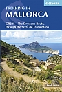
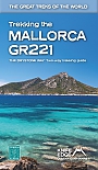
Wandelgids Mallorca, Trekking in Mallorca GR221 Cicerone Guidebooks | The Drystone Route
|
22,90 |
|
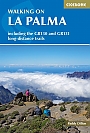
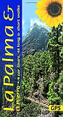
Wandelgids Walking on La Palma | Cicerone | 45 day walks and long distance trails including the GR130 and GR131A walking guidebook for exploring La Palma in the Canary Isles. The 45 routes include both day walks and long distance trails including the GR130 and GR131. The routes vary in terrain ranging from trails in Caldera de Taburiente national park to mule tracks and pilgrim trails in Santa Cruz. Includes routes that suit all abilities. best between November and May, as the summer months are too hot, but it can sometimes snow on the higher parts; spring is especially colourful. Santa Cruz de La Palma, Los Llanos, Fuencaliente, Refugio del Pilar, Tijarafe, Puntagorda, Garaf&s... |
18,99 |
|
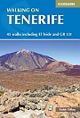
Wandelgids Walking on Tenerife | Cicerone Guide | 45 walks including El Teide and GR 131
|
22,99 |
|
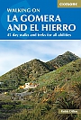
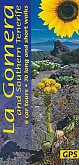
Wandelgids Walking on La Gomera and El Hierro | Cicerone | Day walks and long distance trailsWalking guide to La Gomera and El Hierro, in the Canaries, with day walks and long-distance trails including Camino de La Virgen, GR132 around La Gomera and part of GR131 across the Canary Islands. Routes in Garajonay National Park and from San Sebastien and Valverde. Rugged mountain treks, coastal walks and easier expeditions. The two smallest of the Canary Islands are no less rugged than their volcanic neighbours, offering a wide variety of little-known walking terrain from steep-sided barrancos and dramatic cliffs to the gentler slopes inland cloaked in laurasilva a... |
18,99 |
|
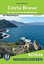
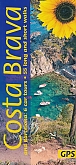
Wandelgids Costa Brava van Cap de Creus tot Montserrat Rother | 67 WandelingenDe Rother wandelgids Costa Brava bevat 67 wandelingen voor zowel de beginnende als de ervaren wandelaar. Met: * Betrouwbare routebeschrijvingen * Gedetailleerde kaarten * Informatieve hoogteprofielen * Downloadbare GPS Tracks |
18,99 |
|
Wandelgids La Palma & El Hierro Sunflower Car tours and WalksSunflower reisgidsen zijn handige handzame gidsen. Een combinatie van autotochten en wandeltochten. Rondwandelingen en lijnwandelingen. De lengte van de wandelingen variërend van 4 tot 20 kilometer. Moeilijkheidsgraad van de wandeling staat vermeldt. Met gedetailleerde kaartjes. Degelijk informatie over de bezienswaardigheden onderweg. La Palma: 3 car tours, 36 long and short walks, 22 picnic suggestions, El Hierro: 1 car tour, 12 long and short walks, 8 picnic suggestions. Schaal: 1:50.000 |
19,99 |
|
Wandelgids La Gomera & Southern Tenerife Sunflower Car tours and WalksSunflower reisgidsen zijn handige handzame gidsen. Een combinatie van autotochten en wandeltochten. Rondwandelingen en lijnwandelingen. De lengte van de wandelingen variërend van 4 tot 20 kilometer. Moeilijkheidsgraad van de wandeling staat vermeldt. Met gedetailleerde kaartjes. Degelijk informatie over de bezienswaardigheden onderweg. Schaal: 1:50.000 |
17,99 Tijdelijk niet leverbaar |
|
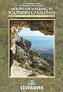
Wandelgids Mountain Walking in Southern Catalunya Tarragona Cicerone guideA dramatic coastal mountain region of remarkable natural beauty and diversity, Southern Catalunya Mountains of Tarragona is mysteriously unknown outside of Spain. In the mountains, limestone crags with well-established paths overlook the orange and olive groves perfect for day walks with a long-distance path that runs along the coast for those wanting to walk a little further. The walks all vary in difficulty, from coastal trails to hands-on scrambles, but all are clearly marked at the start of each route for route finding, scrambling and exposure. |
16,99 Tijdelijk niet leverbaar |
|
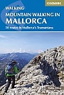
Wandelgids Mountain Walking in Mallorca Cicerone Guidebooks | Classic Mountain Walks in Mallorcathe island. Whilst the region promises breathtaking scenery and some fantastic walks, there is also some potentially challenging terrain, making guidance when choosing, planning and walking routes all the more valuable. As many involve steep ground, navigational challenge and hands-on scrambling, they are primarily geared towards those with some experience of mountain walking. |
18,99 |
|
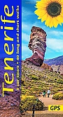
Wandelgids Tenerife Sunflower Car tours and WalksSunflower reisgidsen zijn handige handzame gidsen. Een combinatie van autotochten en wandeltochten. Rondwandelingen en lijnwandelingen. De lengte van de wandelingen variërend van 4 tot 20 kilometer. Moeilijkheidsgraad van de wandeling staat vermeldt. Met gedetailleerde kaartjes. Degelijk informatie over de bezienswaardigheden onderweg. Schaal: 1:50.000 |
19,50 |
|
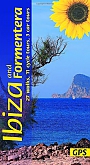
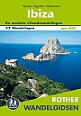
Wandelgids Ibiza & Formentera Sunflower Car tours and Walks | 27 Walks, 11 Cycle Tours, 3 Car ToursSunflower reisgidsen zijn handige handzame gidsen. Een combinatie van autotochten en wandeltochten. Rondwandelingen en lijnwandelingen. De lengte van de wandelingen variërend van 4 tot 20 kilometer. Moeilijkheidsgraad van de wandeling staat vermeldt. Met gedetailleerde kaartjes. Degelijk informatie over de bezienswaardigheden onderweg. The go-to Ibiza walking guide for over 30 years. Strap on your boots and discover Ibiza and Formentera on foot with the Sunflower Ibiza travel guide. And on the days when your feet may have had enough, enjoy some spectacular scenery... |
19,99 |
|
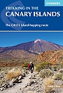
Wandelgids Trekking in the Canary Islands: The GR131 Island Hopping Route | Cicerone GuidesWandelgids voor de GR131, een eilandhoppenpad dat van kust tot kust loopt over elk van de 7 Canarische eilanden, een subtropische Spaanse archipel. Beschreven over 32 etappes, begint de route op Lanzarote, eindigt op El Hierro, 560 km (348 mijl) een gemiddelde wandelaar zou er ongeveer 1 maand over doen. Het grootste deel van de route maakt gebruik van rustige wegen, paden en oude muilezelpaden van dorp naar dorp, maar er zijn enkele afgelegen stukken, evenals af en toe steile en rotsachtige bergpaden die aandacht nodig hebben. De route is goed gemarkeerd, maar sommige... |
21,99 |
|
Wandelgids Trekking the Mallorca GR221 | Knife Edge | The Drystone way: Two-way trekking guide GR 221
|
20,99 |
|
Wandelgids Costa Brava Sunflower Car tours and WalksSunflower reisgidsen zijn handige handzame gidsen. Een combinatie van autotochten en wandeltochten. Rondwandelingen en lijnwandelingen. De lengte van de wandelingen variërend van 4 tot 20 kilometer. Moeilijkheidsgraad van de wandeling staat vermeldt. Met gedetailleerde kaartjes. Degelijk informatie over de bezienswaardigheden onderweg. Schaal: 1:50.000 |
17,99 |
|
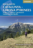
Wandelgids Catalunya - Girona Pyrenees | Cicerone | 35 hikes in Garrotxa Cadí-Moixeró Natural Park and Ripollès
|
22,99 |
|
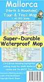
Wandelkaart Mallorca North and Mountains Tour and Trail Map | Discovery Walking | Water- en scheurvaste wandelkaartGeplastificeerde wandelkaart van de Mallorca Noord met hoogtelijnen en ingetekende wandelroutes. Map of the very popular Mallorca North & Mountains Tour & Trail Map. Updates include all the new walking routes, and revisions, from Walk! Mallorca North & Mountains 3rd edition by Charles Davis plus we have extended the map area westwards to include the new 'GR221 Mallorca's Long Distance Hiking Route' - see Charles Davis new GR221 book - along with a number of routes from Walk! Mallorca West guide book. Digital editions of this map are available fo... Schaal: 1:40.000 |
16,50 |
|
Wandelgids Tenerife Teneriffa Hikeline Esterbauer | Wandertouren auf der Vulkaninsel | GPS-Tracks und Live-UpdatesDeze compacte en handzame wandelgids bevat duidelijke kaarten, hoogteprofielen en additionele wandel- en verblijfsinformatieve. Interessante plekken, zoals bezienswaardigheden en het natuurschoon, worden kort toegelicht. De gids is voorzien van watervast papier en spiraalbinding. 50 wandelingen. Das vorliegende Buch beschreibt 50 Touren, die sich uber die ganze Inselflache verteilen, jedoch in den Hauptwandergebieten konzentriert sind. Die Touren sind zwischen 7 und 17 Kilometer lang und beinhalten, abgesehen von zwei reinen Abstiegswanderungen, zwischen 200 und 1... Schaal: 1:50.000 |
11,99 |

|
Wandelgids Wandelkaart Picos de Europa National Park | CNIGDegelijke topografische wandelkaarten. Set van 4, drie wandelkaarten en een wandelgids. Met ingetekende wandelroutes en Mountainbikeroutes. Engelstalige wandelgids met beschreven wandelroutes. Schaal: 1:25.000 |
17,50 |
|
Wandelgids Wandelkaart Teide National Park Tenerife | CNIGDegelijke topografische wandelkaarten. Set van 3, twee wandelkaarten en een wandelgids. Met ingetekende wandelroutes en Mountainbikeroutes. Wandelgids met 41 beschreven wandelroutes. Spaanstalig. Schaal: 1:25.000 |
15,99 |
|
Wandelgids Gran Canaria Walking on Gran Canaria Cicerone Guidebooks | 45 wandelingen met de GR131Gran Canaria may be primarily known as holiday destination for its sun-kissed beaches, but beyond the resorts, the island offers many peaceful and charming country and hill opportunities for walkers. The central area is protected as a Parque Natural, with lush green terraces climbing up to the rocky towers of Roque Nublo and Roque Bentayga. The walks also explore deep barrancos, extensive pine and laurisilva forests and the islands towns. There are walks suitable for those of all abilities, ranging in landscape from coastal clifftops to the dramatic volcanic mou... |
18,99 |
|
Wandelgids Walking on Lanzarote and Fuerteventura | Cicerone Guidebooks | 45 walks including on isle of GraciosaOne of Paddy Dillon's five-volume series to the Canaries, this book offers 45 walks on Lanzarote and Fuerteventura, including 14 walks on the long-distance GR 131 trail, which crosses both islands. Lanzarote has a fascinating volcanic national park; Fuerteventura has famous golden beaches. Both islands are crossed by new trails. |
20,99 |
|
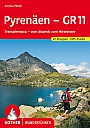
Wandelgids 151 Pyreneeen Pyrenäen - GR 11 Rother Bergverlag | Transpirinaica vom Atlantik zum MittelmeerDe vermaarde wandelgiden van Rother Bergverlag zijn uitstekende wandelgidsen voor ieder niveau. Op een kaartje is de wandelroute aangegeven, maar deze is ook beschreven in een beknopte en heldere tekst. Daarnaast is ook de afstand, de verwachte wandeltijd, het niveau, de hoogte en andere praktische informatie aangegeven. Met deze degelijke wandelgids ontdek je de mooiste plekken van jouw bestemming en kun je de spannendste wandeluitdagingen zoeken. Majestatisch ragen schneebedeckte Gipfel auf, vertraumt liegen Bergseen in stillen Landschaften, wie von der Zeit vergesse... |
16,90 Tijdelijk niet leverbaar |
|
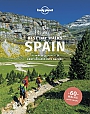
Wandelgids Best Day Walks Spain | Lonely Planet | 60 wandelingenLonely Planet's Best Day Walks Spainis your passport to 60 easy escapes into nature. Stretch your legs away from the city by picking a walk that works for you, from just a couple of hours to a full day, from easy to hard. Marvel at the Pyrenees, hike along the Mediterranean coast, and experience island walks in Mallorca. |
22,50 |

|
Wandelgids Waling in the Picos de Europa | Cicerone | 42 walks and treks in Spain's first National Park
|
23,90 |
|
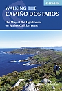
Wandelgids Camino dos Faros | Cicerone Press | The Way of the Lighthouses on Spain's Galician coastThis guidebook explores the Camino dos Faros (the Way of the Lighthouses), a 200km hike around the remote northwest corner of Spain. Starting in the old whaling town of Malpica and ending in Fisterra (Spain's Land's End), the eight day hike along the Costa da Morte follows a path that sticks limpet-like to the Atlantic coast. It's a spectacular walk along dramatic cliffs and around deep, verdant river estuaries, exploring the rich Galician culture and history. With stages between 18 and 29km per day, this is a hike suitable for walkers willing to undertake ... |
18,99 |
|
Wandelgids Ibiza Rother Wandelgids | 32 wandelingenDe Rother wandelgids Ibiza bevat 32 wandelingen voor zowel de beginnende als de ervaren wandelaar. Betrouwbare routebeschrijvingen. Gedetailleerde kaarten. Informatieve hoogteprofielen. Downloadbare GPS Tracks. |
18,99 |
|
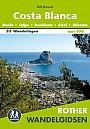
Wandelgids Costa Blanca Rother Wandelgids | 53 wandelingen Denia Calp Benidorm Alcoi AlicanteDe Rother wandelgids Costa Blanca bevat 53 wandelingen voor zowel de beginnende als de ervaren wandelaar. Dénia, Calpe, Benidorm, Alcoi, Alicante. Betrouwbare routebeschrijvingen. Gedetailleerde kaarten. Informatieve hoogteprofielen. Downloadbare GPS Tracks. |
18,99 |
|
|
Wandelgids Kantabrien Cantabrië Rother Wanderführer | Rother Bergverlag | 50 wandelingen | Nordspanien: Von der Küste bis zu den Picos de EuropaDe vermaarde wandelgiden van Rother Bergverlag zijn uitstekende wandelgidsen voor ieder niveau. Op een kaartje is de wandelroute aangegeven, maar deze is ook beschreven in een beknopte en heldere tekst. Daarnaast is ook de afstand, de verwachte wandeltijd, het niveau, de hoogte en andere praktische informatie aangegeven. Met deze degelijke wandelgids ontdek je de mooiste plekken van jouw bestemming en kun je de spannendste wandeluitdagingen zoeken. Ursprünglich, abwechslungsreich und wild – so lässt sich die Wanderregion Kantabrien im Norden Spani... |
16,90 |
|
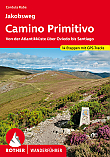
Wandelgids Jakobsweg Camino Primitivo Rother Wanderführer | Rother Bergverlag | Von der Atlantikküste über Oviedo bis SantiagoDe vermaarde wandelgiden van Rother Bergverlag zijn uitstekende wandelgidsen voor ieder niveau. Op een kaartje is de wandelroute aangegeven, maar deze is ook beschreven in een beknopte en heldere tekst. Daarnaast is ook de afstand, de verwachte wandeltijd, het niveau, de hoogte en andere praktische informatie aangegeven. Met deze degelijke wandelgids ontdek je de mooiste plekken van jouw bestemming en kun je de spannendste wandeluitdagingen zoeken. Der Camino Primitivo, der älteste aller Jakobswege, birgt eine noch wahre Ursprünglichkeit. Der 350 K... |
16,90 |