- Gratis verzending vanaf 30 euro
- Levert in Nederland, België etc.
- Meer dan 30.000 titels
- Vakkundige klantenservice
- Snelle levering
- Veilig en eenvoudig betalen

Direct contact?
Bel +31 (0)6 42428571
maandag t/m vrijdag
van 10 tot 17 uur
Wandelen / Wandelgidsen / Europa
Wandelgidsen Europa bestsellers
Wandelgids Walking in the Alps Cicerone Guidebooks
A comprehensive guide to walking and trekking throughout the Alps
31,99
Wandelgids Europe's High Points Cicerone Guidebooks
Reaching the summit of every country in Europe
23,99
|
Wandelgids Rheinsteig Hikeline Esterbauer | Von Bonn über Koblenz nach Wiesbaden. Fernwanderweg, 311km | GPS-Tracks und Live-UpdatesDeze compacte en handzame wandelgids bevat duidelijke kaarten, hoogteprofielen en additionele wandel- en verblijfsinformatieve. Interessante plekken, zoals bezienswaardigheden en het natuurschoon, worden kort toegelicht. Der Rheinsteig führt durch drei Bundesländer: Start ist in Bonn in Nordrhein-Westfalen, der größte Weganteil liegt in Rheinland-Pfalz und das Ziel ist Wiesbaden, die Hauptstadt von Hessen. Insgesamt beträgt die Weglänge zwischen Bonn und Wiesbaden ca. 321 Kilometer und 11.000 Aufstiegshöhenmeter, aufgeteilt auf 20 Et... Schaal: 1:35.000 |
11,99 |
|
Wandelgids Fränkischer Gebirgsweg Hikeline Esterbauer | Vom Naturpark Frankenwald über das Fichtelgebirge und die Fränkische Schweiz in die Frankenalb, 1:35.000, 440 kmDeze compacte en handzame wandelgids bevat duidelijke kaarten, hoogteprofielen en additionele wandel- en verblijfsinformatieve. Interessante plekken, zoals bezienswaardigheden en het natuurschoon, worden kort toegelicht. Der Fränkische Gebirgsweg ist neben dem Frankenweg, dem Rennsteig, dem Blauen Kammweg und dem Saale-Orla-Weg der fünfte Fernwanderweg des Wanderparadieses Franken. Die 421 Kilometer lange Route verläuft von Blankenstein an der Saale durch den Frankenwald, das Fichtelgebirge und die Fränkische Schweiz nach Hersbruck in der Frank... Schaal: 1:35.000 |
13,90 |
|
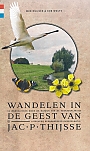
Wandelgids Wandelen in de geest van Jac. P. Thijsse | Gegarandeerd Onregelmatig | 13 wandelingen door de natuur van de verkadeplaatjesEr zijn in Nederland niet veel gepassioneerder ambassadeurs voor het wandelen in de natuur geweest dan Jac. P. Thijsse. Met deze wandelgids eren publicist Wim Huijser en routemaker Rob Wolfs de oprichter van Natuurmonumenten in 13 prachtige natuurwandelingen in de streken waarover Thijsse met zoveel enthousiasme schreef. Leidraad voor de ontwikkeling van deze routes vormt de reeks prachtig geïllustreerde plaatjesalbums van Verkade, waarvoor Thijsse vanaf het begin van de vorige eeuw verantwoordelijk was. 13 wandelingen door de natuur van de verkadeplaatjes. |
17,95 |
|
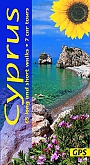
Wandelgids Cyprus Sunflower Car tours and WalksSunflower reisgidsen zijn handige handzame gidsen. Een combinatie van autotochten en wandeltochten. Rondwandelingen en lijnwandelingen. De lengte van de wandelingen variërend van 4 tot 20 kilometer. Moeilijkheidsgraad van de wandeling staat vermeldt. Met gedetailleerde kaartjes. Degelijk informatie over de bezienswaardigheden onderweg. Schaal: 1:50.000 |
19,99 |
|
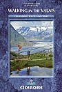
Wandelgids Wallis Walking in the Valais Cicerone GuidebooksWith the greatest collection of 4000m peaks in Western Europe and charming valleys and hillsides dotted with chalets and hay barns, the Valais represents the quintessential Alps. This walkers" paradise in southern Switzerland is located on both sides of the Rhone valley and includes the whole of the Pennine Alps, with France and Italy forming its southern and western borders. The region is crowned by iconic mountains including the Matterhorn, Dent Blanche, Monte Rosa and the Combin. It explores the deep valleys of the region including the Lotschental, Saastal, Mat... |
23,99 |
|
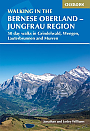
Wandelgids Berner Oberland The Bernese Alps Cicerone Guidebooks | Jungfrau region : 50 day walks in Grindelwald, Wengen, Lauterbrunnen and MurrenOver 100 walking routes in the Bernese Alps are described in this guidebook. It is an indispensable companion to the Bernese Oberland region that boasts famous peaks such as the Eiger, Monch and Jungfrau. But there are lesser-known mountains, too, that are just as scenically dramatic, and in their shadow peaceful villages and seemingly forgotten hamlets are lodged in spectacular locations. Add to that the romantic valleys, lakes, flower-filled meadows and a network of mountain huts and rustic inns for those who want to experience the Alps of the Victorian pioneer... |
23,99 |
|
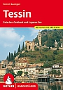
Wandelgids 97 Tessin Zwischen Gotthard und Luganer See Rother Wanderführer | Rother Bergverlag | 50 WandelingenDe vermaarde wandelgiden van Rother Bergverlag zijn uitstekende wandelgidsen voor ieder niveau. Op een kaartje is de wandelroute aangegeven, maar deze is ook beschreven in een beknopte en heldere tekst. Daarnaast is ook de afstand, de verwachte wandeltijd, het niveau, de hoogte en andere praktische informatie aangegeven. Met deze degelijke wandelgids ontdek je de mooiste plekken van jouw bestemming en kun je de spannendste wandeluitdagingen zoeken. Sonne, Palmen, italienische Lebensart und eine fantastische Bergwelt: Das Tessin gehort zu den grossartigsten Kultur- und ... |
14,90 Tijdelijk niet leverbaar |
|
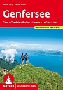
Wandelgids 45 Rund Um Den Genfer See Rother Wanderführer | Rother Bergverlag | 60 wandelingen | Geneve Chablais Riviera Lavaux La Côte JuraDe vermaarde wandelgiden van Rother Bergverlag zijn uitstekende wandelgidsen voor ieder niveau. Op een kaartje is de wandelroute aangegeven, maar deze is ook beschreven in een beknopte en heldere tekst. Daarnaast is ook de afstand, de verwachte wandeltijd, het niveau, de hoogte en andere praktische informatie aangegeven. Met deze degelijke wandelgids ontdek je de mooiste plekken van jouw bestemming en kun je de spannendste wandeluitdagingen zoeken. Zu jeder Jahreszeit vermag der Genfersee Wanderer und Bergurlauber zu begeistern. 60 besonders attraktive Wanderunge... |
16,90 |
|
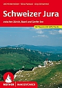
Wandelgids 56 Schweizer Jura Rother Wanderführer | Rother Bergverlag | zwischen Zürich, Basel und Genfer See 50 wandelingenDe vermaarde wandelgiden van Rother Bergverlag zijn uitstekende wandelgidsen voor ieder niveau. Op een kaartje is de wandelroute aangegeven, maar deze is ook beschreven in een beknopte en heldere tekst. Daarnaast is ook de afstand, de verwachte wandeltijd, het niveau, de hoogte en andere praktische informatie aangegeven. Met deze degelijke wandelgids ontdek je de mooiste plekken van jouw bestemming en kun je de spannendste wandeluitdagingen zoeken. Die ganze Schweiz ist von schroffen Bergen besetzt. Die ganze Schweiz? Nein im Nordwesten des Landes, zwischen Zurich, Bas... |
14,90 |
|
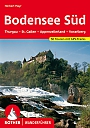
Wandelgids 17 Bodensee Sud Rother Wanderführer | Rother Bergverlag | 50 Wandelingen | Thurgau - St. Gallen - Appenzeller Land - VorarlbergDe vermaarde wandelgiden van Rother Bergverlag zijn uitstekende wandelgidsen voor ieder niveau. Op een kaartje is de wandelroute aangegeven, maar deze is ook beschreven in een beknopte en heldere tekst. Daarnaast is ook de afstand, de verwachte wandeltijd, het niveau, de hoogte en andere praktische informatie aangegeven. Met deze degelijke wandelgids ontdek je de mooiste plekken van jouw bestemming en kun je de spannendste wandeluitdagingen zoeken. |
14,90 |
|
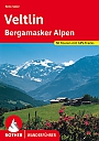
Wandelgids 99 Veltlin mit Bergamasker Alpen und Val Camonica Rother Wanderführer | Rother Bergverlag | 50 wandelingenDe vermaarde wandelgiden van Rother Bergverlag zijn uitstekende wandelgidsen voor ieder niveau. Op een kaartje is de wandelroute aangegeven, maar deze is ook beschreven in een beknopte en heldere tekst. Daarnaast is ook de afstand, de verwachte wandeltijd, het niveau, de hoogte en andere praktische informatie aangegeven. Met deze degelijke wandelgids ontdek je de mooiste plekken van jouw bestemming en kun je de spannendste wandeluitdagingen zoeken. Wer alpines Italien abseits der bekannten Pfade entdecken will, wird in den in diesem Wanderführer beschriebenen... |
14,90 |
|
Wandelgids Alpinwandern Tessin Schweizer Alpen Club | Einsame Touren südlich des GotthardsAlpinwandern Tessin beschreibt einsame, zum Teil anspruchsvolle Wanderungen, durch wenig besuchte Gebiete in den wildesten Ecken der Schweiz, den Tessiner Alpen. Die Auswahl umfasst eine grosse Rundwanderung vom Monte Generoso der Kantonsgrenze entlang nordwärts bis zum Gotthard und wieder südwärts hinab zum Monte Tamaro. Zusätlich werden Rundtouren um die Massive von Pizzo Campo Tencia und Cristallina sowie Wege und Kreten in den Haupttälern Blenio, Leventina, Verzasca und Maggia vorgestellt. 352 Seiten, 161 Farbfotos, 11 Fotos schwarz-weiss, 61 Übersichtskarten... |
49,99 |
|
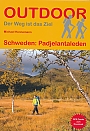
Wandelgids Zweden Padjelantaleden Outdoor Conrad Stein Verlag | Band 261Der Padjelantaleden gilt als einer der schönsten Wanderwege Lapplands. Er verläuft von Ritsem im Norden durch den Padjelanta Nationalpark nach Kvikkjokk und kann natürlich auch in umgekehrte Richtung erwandert werden. Der Padjelantaleden (Padjelanta = Das höhere Land) führt über faszinierende und seenreiche Hochebenen und verläuft in weiten Teilen oberhalb der Baumgrenze. Dadurch ergeben sich zahlreiche atemberaubende Aussichten auf die Bergwelt des angrenzenden Sarek Nationalparks. Die Länge von rund 140 km, die perfekte Infrastruktur und das dezente Höhenpro... |
11,99 |
|
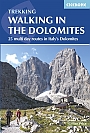
Wandelgids Trekking in the Dolomites | Cicerone Press | 25 multi-day routes in Italy's DolomitesGuidebook to 25 multi day walks in the Dolomites mountains of northeast of Italy. The walks are mostly circular and 2 to 4 days long, and take in the Marmarole, Marmolada, Civet, Sella and Cortina Dolomites among others. Includes notes on accommodation, wildlife, transport, equipment, a glossary and other practical information. This guidebook describes 25 hut-to-hut treks in the Dolomites of northern Italy, covering 15 regions including Cortina, Sella, Sesto, Marmolada and Latemar. Ranging from 11.3km to 40.8km and from two to four days, the graded routes are suitable ... |
22,99 |
|
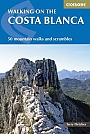
Wandelgids Walking on the Costa Blanca | Cicerone Guidebooks | 50 mountain walks and scrambles50 circular walks and scrambles that explore the Costa Blanca mountains, around the resorts of Alicante, Benidorm and Calp, a popular European winter sun adventure destination. From 1500m peaks and knife edge ridges to deep gorges, the walks range from gentle strolls to demanding days with steep climbs, and from 3 to 20km in distance. The perfect escape from British snow and rain. The Costa Blanca Mountains are at their best during the late autumn, winter and early spring when they are covered in wildflowers and blossom and walkers enjoy T-shirt days under blue skies. ... |
22,99 |
|
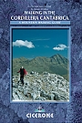
Wandelgids Walking in the Cordillera Cantabrica Cicerone Guidebooks | A mountaineering guideWalking in the Cordillera Cantabrica is a mountaineering guide to one of Spain"s premier ranges, and includes detailed descriptions for 60 routes spread around the whole of this magnificent mountain chain. Based on selected valley bases, the routes are readily accessed, thus minimising travel time. All of the routes can be done in a day and all are circular, whilst in difficulty they vary from straightforward, half-day outings to strenuous, full-day ascents demanding fitness, good overall mountain skills, and the ability to deal with short sections of scrambling. Â... |
20,99 Tijdelijk niet leverbaar |
|
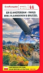
Wandelgids GR12 Amsterdam - Parijs deel Vlaanderen & Brussel | Grote Routepaden | Van Bergen op Zoom tot Braine-le-Chãteau 204 kmDeze wandelgids beschrijft het deel van de internationale wandelroute GR 12 Amsterdam - Parijs tussen de laatste Nederlandse stad, Bergen op Zoom, en het eerste Waalse dorp Braine-le-Chateau. De route is in twee richtingen beschreven. De tekst van de routebeschrijving wordt aangevuld met korte achtergrondinformatie over bezienswaardigheden, natuur en landschap. GR 12 is ingedeeld in 5 deeltrajecten. Van elk traject is een overzichtskaart gemaakt, die je terugvindt aan het begin van elk deel. Tijdens je tocht kun je gebruik maken van de detailkaarten die je telkens op d... |
23,50 |
|
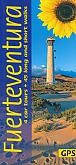
Wandelgids Fuerteventura Sunflower Car tours and WalksSunflower reisgidsen zijn handige handzame gidsen. Een combinatie van autotochten en wandeltochten. Rondwandelingen en lijnwandelingen. De lengte van de wandelingen variërend van 4 tot 20 kilometer. Moeilijkheidsgraad van de wandeling staat vermeldt. Met gedetailleerde kaartjes. Degelijk informatie over de bezienswaardigheden onderweg. Fuerteventura is different from all the other islands in the Canaries. Being the closest to Africa, there’s a definite taste of the Sahara about it. The countryside is lonely but warm, bleak but friendly and, in its own way, b... Schaal: 1:50.000 |
17,99 Tijdelijk niet leverbaar |

|
Wandelgids 296 Fuerteventura Rother Wanderführer | Rother Bergverlag | 40 Wandelingen | Die schönsten Küsten- und BergwanderungenDe vermaarde wandelgiden van Rother Bergverlag zijn uitstekende wandelgidsen voor ieder niveau. Op een kaartje is de wandelroute aangegeven, maar deze is ook beschreven in een beknopte en heldere tekst. Daarnaast is ook de afstand, de verwachte wandeltijd, het niveau, de hoogte en andere praktische informatie aangegeven. Met deze degelijke wandelgids ontdek je de mooiste plekken van jouw bestemming en kun je de spannendste wandeluitdagingen zoeken. Im Kanarischen Archipel ist Fuerteventura die Bade- und Surfinsel schlechthin. Keine andere der Nachbarinseln kann e... |
16,90 |
|
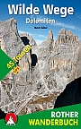
Wandelgids Wilde Wege Dolomiten | Rother Bergverlag | 45 wandelingenDe vermaarde wandelgiden van Rother Bergverlag zijn uitstekende wandelgidsen voor ieder niveau. Op een kaartje is de wandelroute aangegeven, maar deze is ook beschreven in een beknopte en heldere tekst. Daarnaast is ook de afstand, de verwachte wandeltijd, het niveau, de hoogte en andere praktische informatie aangegeven. Met deze degelijke wandelgids ontdek je de mooiste plekken van jouw bestemming en kun je de spannendste wandeluitdagingen zoeken. 45 wandelingen . Ausgetretene Pfade verlassen, auf fast vergessenen Steigen wandern, über Schrofen und leichten Fels auf ... |
17,99 |
|
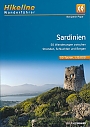
Wandelgids Sardinie Hikeline Bikeline | 50 wandelingen | GPS-Tracks und Live-UpdatesDeze compacte en handzame wandelgids bevat duidelijke kaarten, hoogteprofielen en additionele wandel- en verblijfsinformatieve. Interessante plekken, zoals bezienswaardigheden en het natuurschoon, worden kort toegelicht. Das vorliegende Buch beschreibt 50 Touren in allen Gebieten der Insel, konzentriert sich jedoch primair auf die attraktiven und mit einer minimalen Tourismus-Infrastruktur ausgestatteten Berg- und Hugelregionen. Sardinien ist eine Flacheninsel, auf der die Tourismusgemeinschaften haufig erstaunlich lange Streckentouren ausweisen. Wir haben grossen Wert... Schaal: 1:35.000 |
12,90 |
|
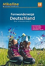
Wandelgids Duitsland Deutschland Fernwanderwege | Hikeline Esterbauer | Das Standardwerk, 63 Fernwanderwege | GPS-Tracks und Live-UpdatesNaslagwerk, 63 lange afstandswandelingen in Duitsland. 448 pagina's voor het plannen van uw wandeltochten. Een standaardwerk! |
11,50 |
|
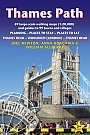
Wandelgids Thames Path Thames Head to the Thames Barrier | TrailblazerPraktische, alles-in-een gids voor het lopen van het Thames Path National Trail van de Costwolds naar de Thames Barrier in Londen, inclusief grootschalige wandelkaarten, verblijfplaatsen, plaatsen om te eten en informatie over het openbaar vervoer. De National Trail van The Thames Path loopt over 294 km van de bron bij Thames Head bij Kemble in de Cotswolds naar de Thames Barrier in Londen. Het landschap is prachtig gevarieerd, variërend van wilde en eenzame delen van de bovenloop van de rivier tot even indrukwekkende stedelijke vergezichten. Je komt langs zoveel ... |
18,95 |
|
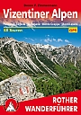
Wandelgids 102 Vizentiner Alpen | Rother Bergverlag | 58 wandelingen | Fleimstal · Lagorai · Valsugana · Monte Grappa · Monti LessiniDe vermaarde wandelgiden van Rother Bergverlag zijn uitstekende wandelgidsen voor ieder niveau. Op een kaartje is de wandelroute aangegeven, maar deze is ook beschreven in een beknopte en heldere tekst. Daarnaast is ook de afstand, de verwachte wandeltijd, het niveau, de hoogte en andere praktische informatie aangegeven. Met deze degelijke wandelgids ontdek je de mooiste plekken van jouw bestemming en kun je de spannendste wandeluitdagingen zoeken. Hinter Bozen links also nicht rechts, wo alle zum Gardasee abbiegen. Die Region sudlich der Dolomiten ist touristisch erst... |
14,90 |
|
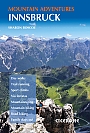
Wandelgids Klimgids Innsbruck Mountain Adventures | CiceroneGuidebook to 60 exciting summer mountain adventures in Innsbruck, Austria. Guide includes: alpine mountaineering routes, overnight hut trips, adventure hikes and multi-pitch scrambles, day walks, rock climbing routes, via ferratas, mountain biking trails, road cycling routes, city and trail running, plus mountain activities and walks for families. With easy access and a wide range of facilities, stunning Alpine scenery and a wonderful choice of activities on offer, Innsbruck - capital of Austria's Tyrol region - is an ideal base for an outdoor holiday. This multi-activ... |
18,99 |
|
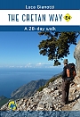
Wandelgids Kreta The Cretan Way E4 | Anavasi | 28 daagse wandeltochtDe Kretenzische Weg is een 500 km lange wandelroute die u van oost naar west door de gevarieerde en spectaculaire landschappen van Kreta voert. Het is de ideale manier om de landelijke, bergachtige en kustgebieden van dit ongelooflijke eiland te ontdekken. Deze gids is de allereerste gids voor de route en bevat kaarten, beschrijvingen, een reisverslag, GPS-tracks, accommodatie-informatie en tips voor het lopen van een van de meest opmerkelijke langeafstandsroutes ter wereld. |
24,95 |
|
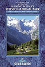
Wandelgids Stelvio National Park | Cicerone Guide | 38 wandelingenThe wide range of 38 summer day walks in this guide explore the renowned Stelvio National Park in the Italian Rhaetian Alps. Bordering the Dolomites to the east, and Switzerland to the west, the Stelvio is one of the largest protected areas in all of the Alps. Its unspoilt landscape ranges from valley farmland to forested hillsides and alpine meadows, and up to a wilderness of rugged glaciated summits and ridges, the highest of which is Ortler, at 3905m. The walks, a selection of routes from each of the Stelvio's valleys, are graded for difficulty and each is desig... |
22,99 |
|
Wandelgids Walking in Torridon Fisherfield Fannichs and An Teallach Cicerone Guidebooks | Including the ridges of Beinn Alligin, Liathach and Beinn Eighe
|
21,99 |
|
Wandelgids Watzmanntrek | Conrad Stein VerlagHandig handzaam wandelgidsje voorzien van wandelkaartjes, overnachtingsmogelijkheden, routebeschrijving. Der Nationalpark Berchtesgaden mit dem berühmten Watzmann und dem Königssee gilt als eine der schönsten Bergregionen in ganz Europa. Der Watzmanntrek erschließt das Gebiet auf einer unvergesslichen Route von Hütte zu Hütte, die immer wieder fantastische Ausblicke auf Berge und Seen bietet. Eine detaillierte Beschreibung des Weges finden Sie in diesem Buch, das neben der Hauptroute auch einige Varianten vorstellt. Genaue Karten und Höhenprofile helfen bei der ... |
11,99 |
|
Wandelgids Arran Coastal Way Rucksack ReadersDeze gids heeft een goede beschrijving van de lange afstands route met overzichtelijke kaarten doch zonder veel detail. De kracht van de Rucksack Readers is de uitgebreide achtergrondinformatie over de flora, fauna en geologische verschijnselen. Dit alles rijkelijk omkleed met kleurrijke foto's en praktische tips. The Arran Coastal Way is perhaps Scotland's finest circular long-distance trail, running 65 miles (105 km) around the Isle of Arran in a memorable week-long hike from Brodick. It's accessible from near Glasgow by the Ardrossan ferry. Famous as`Sco... |
21,50 |
|
Wandelgids Walking on Harris and Lewis Cicerone Guidebooks | 30 day walks on the Isles of Harris and LewisThis guidebook describes 30 day walks all over the Isles of Harris and Lewis, in the Outer Hebrides. The walks range from 2 and 14 miles (4 to 22km) in length, and are easily accessible from Stornaway or Tarbet. Routes vary from short strolls to long wilderness hikes, high-level and low-level, and include the An Cliseam horseshoe, visits to ancient historic monuments like the stone circles of Calanais and the famous Butt of Lewis lighthouse, all illustrated with OS 1:50,000 maps and dramatic photography. |
21,99 |
|
Wandelgids Walking on the Amalfi Coast Cicerone Guidebooks | 32 walks Ischia, Capri, Sorrento, Positano and AmalfiThe 32 routes in this guidebook explore the coastline between Sorrento and Amalfi, together with the islands of Capri and Ischia. Ranging from 3km to 11km, the hikes are all designed to be fitted into a single day, with a panoramic picnic stop halfway round and perhaps a plunge into the sparkling Mediterranean at the end. Hikes are graded on a scale of 1-3 and are suitable for a range of abilities, from family strolls to strenuous treks across rugged terrain. |
19,99 |
|
Wandelgids The GR1 the Sendero Historico Cicerone guide | Northern Spain - Picos to the MediterraneanThis guidebook is for trekkers aiming to tackle all or part of the GR1 or Sendero Historico – 1250km of waymarked route across northern Spain through the Pyrenean foothills from Puerto to Tarna at the western end to near L"Escala on the Mediterranean coast. Broken into 7 sections and 53 stages, the walking goes through remote landscapes, but accommodation is accessible at the end of every day, and the terrain is not difficult. All sections are suitable for novice and experienced walkers alike. Providing all the information trekkers will need, th... |
22,99 |
|
Wandelgids Trekking the Dolomites Alta Via 1 | Knife EdgeDe enige gids exclusief voor de AV1 Alles wat u moet weten om de populairste lange afstandsroute van Italië te plannen en te lopen. Echte kaarten binnenin (Tabacco 1: 25.000): de beste kaarten die beschikbaar zijn voor de Dolomieten. Dit maakt navigatie gemakkelijk en het is niet nodig om extra kaarten mee te nemen. Bevat ook: * Genummerde waypoints die kaarten aan tekst koppelen * Unieke reisplanner: plan een op maat gemaakte reisroute die past bij uw mogelijkheden en vakantieplanning. Alle moeilijke berekeningen van tijd, afstand en hoogtewinst worden voor u ged... |
18,99 |
|
Wandelgids Not the West Highland Way Cicerone GuidebooksThe West Highland Way is one of the finest of Britain's long-distance paths. It passes through six separate mountain ranges, from the tall elegant cone of Ben Lomond and the crag towers of grim Glen Coe to the seductive Mamores. But does it go onto those enticing Stobs and Bens? It does not. It runs along Glens Falloch and Finnan, close to the Highlands' second busiest main road and the West Highland Railway. It may be Scotland's best long-distance path: but this book intends to do better. So here they are: the mountains alongside the way. When the sun shin... |
19,99 |
|
Wandelgids The Tour of The Bernina | Cicerone Guide | 9-day tour in Switzerland and Italy and the Tour of Italy's ValmalencoThis guidebook explores two treks in the Bernina region of the Swiss-Italian Alps. The Tour of the Bernina is an 9-stage trek circling the Piz Bernina massif, 119km long and suitable for beginner trekkers. Also included in this guide is the 8-stage Alta Via Valmalenco just to the south of the Bernina. Although shorter, at 94km long, this is a more challenging route suitable for trekkers with more experience. Whether skirting above St. Moritz and below snow-capped giants on the Tour of the Bernina, or climbing over wild, high passes and through isolated mountains in the... |
20,99 |
|
Wandelgids Alp Und Huttenwanderungen Allgauer Alpen Rother Wanderführer | Rother Bergverlag | 50 Touren zwischen Oberstaufen und LechtalDe vermaarde wandelgiden van Rother Bergverlag zijn uitstekende wandelgidsen voor ieder niveau. Op een kaartje is de wandelroute aangegeven, maar deze is ook beschreven in een beknopte en heldere tekst. Daarnaast is ook de afstand, de verwachte wandeltijd, het niveau, de hoogte en andere praktische informatie aangegeven. Met deze degelijke wandelgids ontdek je de mooiste plekken van jouw bestemming en kun je de spannendste wandeluitdagingen zoeken. Die wasserreichen, vielfaltigen Allgauer Alpen sind mit ihren zahlreichen Almen inmitten blumenreicher Wiesen geradezu pra... |
17,99 |
|
Wandelgids Mercantour Walks and Treks in the Maritime Alps Cicerone GuidebooksRising to over 3000m from the shore, the Maritime Alps straddle the French-Italian border for 190km. Soaring peaks, glittering lakes and picturesque stone villages await the walker, along 600km of footpaths and through two national parks. This is a wonderful area even for novice walkers, with clear waymarking and good maps, worlds away from the crowds at the coast, and this guide offers a wide selection of day walks and treks to explore. |
22,99 |
|
Wandelgids D004 Provence Les Alpes De Haute Provence ... A Pied | FFRP Topoguides | Ref. D004 | Forcalquier, Digne-Les-Bains, Barcelonnette | 36 dagwandelingenFout lopen wordt met deze kwalitatief zeer sterke wandelgids een uitdaging. Met heldere symbolen is weergegeven welke voorzieningen (overnachtingen en openbaar vervoer) er zijn langs of bij de route. De gidsen bevatten de Franse topografische kaarten met een schaal van 1:25.000 waarop de route is aangegeven. Een korte, franstalige, introductie maakt het mogelijk nog meer van het gebied te genieten en wat te leren over de rijke geschiedenis, flora en/of fauna. |
18,99 Tijdelijk niet leverbaar |
|
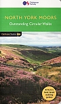
Wandelgids 28 North York Moors Pathfinder Guide | Pathfinder Guide 28 | Met Ordanance Survey kaartenDeze Pathfinder Guide is een goed uitgevoerde gids met verschillende wandelingen in Groot-Britannië. De gids bevat naast goede topografische kaarten van de Britse topografische dienst (Ordanance Survey) ook beschrijvingen van het landschap, de cultuur en/of de flora en fauna. Verder is de gids voorzien van praktische informatie zoals startpunten, verwachte wandeltijd, restaurants en cafés voor onderweg. A total of 175 miles of superb walking in the North York Moors National Park. |
17,99 |
|
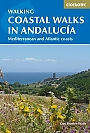
Wandelgids Coastal walks in Andalucia | Cicerone | Mediterranean and Atlantic coastsA guidebook to 40 half and full day coastal walks in Andalucia. The graded routes, which are suitable for any reasonably fit walker, range from 6km to 19.5km and can be walked all year round. The walks are located in seven of the region’s most beautiful National Parks and protected areas (including La Brena y las Marismas, Los Alcornocales y del Estrecho, La Sierra de las Nieves and Nijar-Cabo de Gata) and are mostly circular in nature, negating the need for any logistical legwork. |
19,99 Tijdelijk niet leverbaar |
|
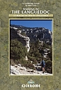
Wandelgids Walking in the Languedoc | Cicerone31 walks in the stunningly beautiful Parc Naturel du Haut-Languedoc. The climate is warm, the vineyards stretch out below you, and above is the towering Espinouse Massif. The Languedoc has for too long been in the shadow of Provence. Sharing the same Mediterranean climate and vegetation, it has not had done to it what Peter Mayle did for the Luberon - yet! Apart from its beaches, it is a quiet, beautiful place which retains more than a hint of the old France. This book is the fruit of 10 years' exploration of the central part of the Languedoc, north of Béziers. Much o... |
16,99 |
|
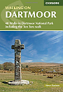
Wandelgids Walking on Dartmoor Cicerone Guidebooks | National Park and surrounding areasA guidebook to 39 day walks and one two-day Ten Tors challenge across the Dartmoor National Park and its surrounding area. The guide contains low-level shorter walks and higher level more strenuous and challenging routes, therefore there's a walk suitable for all abilities, allowing you to explore all of what Devon's national park has to offer. Each walk contains a detailed route description, 1:50,000 OS maps and colour photography, alongside practical information on public transport links and refreshment stops on each walk. Dartmoor, a National Park sin... |
19,99 |
|
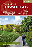
Wandelgids The Cotswolds Way Cicerone Guidebooks | Two-way trail guide - Chipping Campden to BathGuidebook to walking the 102 mile (163km) Cotswold Way National Trail between Chipping Campden and Bath, across the Cotswolds AONB. The guidebook - which includes both a guide to the route and a separate OS 1:25,000 map booklet - describes the route in both directions. The route is described over 13 stages, each following the Cotswold escarpment, with dramatic and far-reaching views across the Severn Vale towards the Welsh hills, plunging down to visit honey-coloured villages, old market towns and the elegant and historic city of Bath. The longest of the 13 stage... |
23,50 |
|
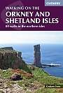
Wandelgids Walking on the Orkney and Shetland Isles Cicerone Guidebooks | 80 WalksA guidebook to 80 walking routes on Scotland's Northern Isles of Orkney and Shetland. Routes are described on the islands of Orkney (Orkney Mainland, Hoy, South Ronaldsay, Burray, Rousay, Eday, Westray, Papa Westray, North Ronaldsay) and the islands of Shetland (Shetland Mainland, West Burra, East Burra, Foula, Fair Isle, Isle of Noss, Bressay, Whalsay, Papa Stour, Muckle Roe, Out Skerries, Esha Ness, Yell, Fetlar and Unst). Â Routes vary in length from 1 mile to 16 miles, with something to suit all abilities. Offering a variety of landscapes t... |
19,99 |
|
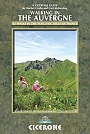
Wandelgids Walking in the Auvergne | Cicerone | 42 wandelingenThis handy guidebook offers the finest day walks in five different areas of the Auvergne, an often-forgotten region in central France perfect for accessible day walking in a unique and spectacular landscape. Towns such as Vichy, Clermont-Ferrand and Puy-en-Velay also offer delightful places to base yourself for that perfect walking holiday. The ridges, rocky peaks and verdant valleys of the Cantal supervolcano dominate south-western Auvergne. The centre of the region hosts the unique chain of 'puys' with their pudding bowl forms and the pristine crater lakes of the San... |
19,99 |
|
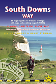
Wandelgids South Downs Way Trailblazer | Winchester to EastbourneDe South Downs Way is een 160 km lange nationale route die de lijn van krijtheuvels volgt die zich uitstrekt van Winchester in Hampshire over Sussex naar Eastbourne. Langs de Downs lopen is de beste manier om dit prachtige landschap te ervaren met zijn mix van glooiende heuvels, steile hangende bossen en winderige velden. Je passeert ook dorpjes met ansichtkaarten met gastvrije pubs, huisjes met rieten daken en typisch Engelse landtuinen. |
20,90 |
|
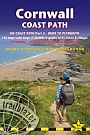
Wandelgids Cornwall Coast Path (Zoutpad) Part 2 Bude to Falmouth TrailblazerThis fully revised new edition has now been considerably expanded to cover the full length of the Cornwall coast, 280 miles. This second part of the South West Coast Path around the south-western tip of Britain, includes some of the best coastal walking in Europe. With constantly changing scenery, the footpath takes in secluded coves, tiny fishing villages, rocky headlands, bustling resorts, wooded estuaries and golden surf-washed beaches. It is an area rich in wildlife with seabirds, wild flowers, dolphins and seals. 15 town plans and 130 large-scale walking maps &nda... |
19,90 |
|
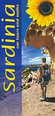
Wandelgids Sardinië Sardinia Sunflower Car tours and WalksSunflower reisgidsen zijn handige handzame gidsen. Een combinatie van autotochten en wandeltochten. Rondwandelingen en lijnwandelingen. De lengte van de wandelingen variërend van 4 tot 20 kilometer. Moeilijkheidsgraad van de wandeling staat vermeldt. Met gedetailleerde kaartjes. Degelijk informatie over de bezienswaardigheden onderweg. Schaal: 1:50.000 |
19,50 Tijdelijk niet leverbaar |
|
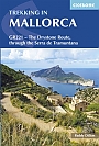
Wandelgids Mallorca, Trekking in Mallorca GR221 Cicerone Guidebooks | The Drystone Route
|
22,90 |