- Gratis verzending vanaf 30 euro
- Levert in Nederland, België etc.
- Meer dan 30.000 titels
- Vakkundige klantenservice
- Snelle levering
- Veilig en eenvoudig betalen

Direct contact?
Bel +31 (0)6 42428571
maandag t/m vrijdag
van 10 tot 17 uur
Wandelkaart Dartmoor - Mountain Map | Harvey Maps
Water- en scheurvaste wandelkaart

De Harvey Map is de wandelkaart voor het wandelen in de mooiste natuurgebieden in het Groot-Brittannië. Duidelijke topografische wandelkaarten met praktische informatie van de route zoals overnachtingsmogelijkheden, eetgelegenheden en bezienswaardigheden. Deze wandelkaart is scheur- en watervast. Met GPS compatible (UTM-Grid). This Harvey map has the whole of Dartmoor on one map and is printed in cooperation with the British Mountaineering Council. It also includes a geological map of the area specially designed by the British Geological Survey, climbing crags are also marked on the map. The map also has tips on using your map and compass, mountain incident and first aid advice as well as useful local phone numbers and websites.
Schaal: 1:40.000
Engelstalig


Op voorraad
Levertijd 2 dagen (Nederland)
- Vakkundige klantenservice
- Groot assortiment
- Gratis retourneren binnen 14 dagen
- Aangesloten bij WebwinkelKEUR
€ 28,99
Meer producten die interessant kunnen zijn
Wandelgidsen Devon / Cornwall
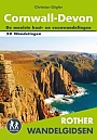
Wandelgids Cornwall Devon Rother Wandelgids
50 Wandelingen | De mooiste kust- en veenwandelingen
€ 18,99
Wandelgids The South West Coast Path (Zoutpad) Cicerone Guidebooks
From Minehead to South Haven Point
€ 21,99


Wandelgids Cornwall Coast Path (Zoutpad) Part 2 Bude to Falmouth Trailblazer
€ 19,90
Tijdelijk niet leverbaar
Reisgidsen Devon / Cornwall


Reisgids Slow Devon South & Dartmoor Bradt Travel Guide
Local, Characterful Guides To Britain's Special Places
€ 16,99
Tijdelijk niet leverbaar
Topografische kaarten Devon / Cornwall
Topografische Wandelkaart 102 Land's End - Explorer Map
Wandelkaart & Fietskaart | Ordnance Survey (OS) Groot-Brittannië
€ 18,99
Topografische Wandelkaart OL28 van Groot-Brittannië (1:25.000) Dartmoor - Explorer Map OL 28
Wandelkaart | Ordnance Survey (OS) Groot-Brittannië
€ 18,99
Topografische Wandelkaart 204 Truro / Falmouth Roseland Peninsula - Landranger Map
Wandelkaart & Fietskaart | Ordnance Survey (OS) Groot-Brittannië
€ 18,99
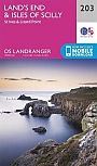
Topografische Wandelkaart 203 Land's End / Isles of Scilly St Ives & Lizard Point - Landranger Map
Wandelkaart & Fietskaart | Ordnance Survey (OS) Groot-Brittannië
€ 18,99