- Gratis verzending vanaf 30 euro
- Levert in Nederland, België etc.
- Meer dan 30.000 titels
- Vakkundige klantenservice
- Snelle levering
- Veilig en eenvoudig betalen

Direct contact?
Bel +31 (0)6 42428571
maandag t/m vrijdag
van 10 tot 17 uur
Wandelgids Walking on Dartmoor Cicerone Guidebooks
National Park and surrounding areas

A guidebook to 39 day walks and one two-day Ten Tors challenge across the Dartmoor National Park and its surrounding area. The guide contains low-level shorter walks and higher level more strenuous and challenging routes, therefore there's a walk suitable for all abilities, allowing you to explore all of what Devon's national park has to offer. Each walk contains a detailed route description, 1:50,000 OS maps and colour photography, alongside practical information on public transport links and refreshment stops on each walk. Dartmoor, a National Park since 1951, is wild, and at times isolated. Its a land of blanket bogs and grass moors dotted with fascinating tors, old stone clapper bridges, tree-shaded river valleys and a diverse range of wildlife. Our ancestors have left behind a fascinating treasure trove from intriguing stone rows to fascinating stones circles and burial cairns to hut circles. There are also the stark ruins of Dartmoor's mining heritage, picturesque villages and hamlets that are home to interesting old churches and cosy pubs. You'll be able to stand on High Willhays which, at 621m (2039 ft), is not only a mountain, but also the highest point in Southern England. On a clear day from many of Dartmoor's summits there are great views out over Devon's rural landscape and west into Cornwall to Bodmin Moor.e.
Engelstalig
EAN: 9781786311085
Auteur(s): Earle, j.
Uitgeverij: Cicerone Press
Verschijningsdatum: 2023
Meest recente editie
Engelstalig
256 pagina's


Op voorraad
Overmorgen in huis (Nederland)
- Vakkundige klantenservice
- Groot assortiment
- Gratis retourneren binnen 14 dagen
- Aangesloten bij WebwinkelKEUR
€ 19,99
Meer producten die interessant kunnen zijn
Reisgidsen Devon / Cornwall


Reisgids Slow Devon South & Dartmoor Bradt Travel Guide
Local, Characterful Guides To Britain's Special Places
€ 16,99
Tijdelijk niet leverbaar
Topografische kaarten Devon / Cornwall
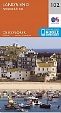
Topografische Wandelkaart 102 Land's End - Explorer Map
Wandelkaart & Fietskaart | Ordnance Survey (OS) Groot-Brittannië
€ 18,99
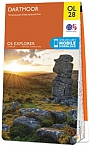
Topografische Wandelkaart OL28 van Groot-Brittannië (1:25.000) Dartmoor - Explorer Map OL 28
Wandelkaart | Ordnance Survey (OS) Groot-Brittannië
€ 18,99
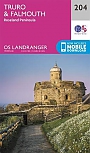
Topografische Wandelkaart 204 Truro / Falmouth Roseland Peninsula - Landranger Map
Wandelkaart & Fietskaart | Ordnance Survey (OS) Groot-Brittannië
€ 18,99
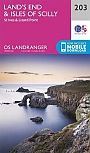
Topografische Wandelkaart 203 Land's End / Isles of Scilly St Ives & Lizard Point - Landranger Map
Wandelkaart & Fietskaart | Ordnance Survey (OS) Groot-Brittannië
€ 18,99
Wegenkaarten Devon / Cornwall


Wandelkaarten Devon / Cornwall
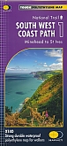
Wandelkaart South West Coast Path 1 Minehead to St Ives - National Trail Maps (Zoutpad) | Harvey Maps
Water- en scheurvaste wandelkaart
€ 25,99
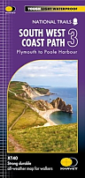
Wandelkaart South West Coast Path 3 Plymouth to Poole Harbour - National Trail Maps (Zoutpad) | Harvey Maps
Water- en scheurvaste wandelkaart
€ 25,99

Wandelkaart South West Coast Path 2 St Ives - Plymouth - National Trail Maps (Zoutpad) | Harvey Maps
Water- en scheurvaste wandelkaart
€ 25,99