- Gratis verzending vanaf 30 euro
- Levert in Nederland, België etc.
- Meer dan 30.000 titels
- Vakkundige klantenservice
- Snelle levering
- Veilig en eenvoudig betalen

Direct contact?
Bel +31 (0)6 42428571
maandag t/m vrijdag
van 10 tot 17 uur
Europa / Ierland / Zuid-West Ierland / Clare / Kerry / Dingle / Wegenatlassen
Zuid-West Ierland / Clare / Kerry / Dingle Wegenatlassen bestsellers
|
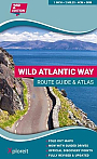
Wegenatlas Atlas The Wild Atlantic Way Ierland | Xploreit Maps | Met SpiraalbindingThe Wild Atlantic Way is the world’s longest defined coastal route. It includes Ireland’s most northerly point, Malin Head, in Donegal and it’s most southerly point, Mizen Head in Cork. All along the way you will find a myriad of spectacular discovery points with incredible scenic views. This atlas splits up the route into 30 foldout maps that are detailed yet easy to read. The coastal roads are classified so that you are instantly aware of any narrow sections and you can also see where the really scenic stretches are located. Each section is drivable... Schaal: 1:126.720 |
24,95 |