- Gratis verzending vanaf 30 euro
- Levert in Nederland, België etc.
- Meer dan 30.000 titels
- Vakkundige klantenservice
- Snelle levering
- Veilig en eenvoudig betalen

Direct contact?
Bel +31 (0)6 42428571
maandag t/m vrijdag
van 10 tot 17 uur
Europa / Groot-Brittannië / Snowdonia
Snowdonia bestsellers
Topografische Wandelkaart OL17 van Groot-Brittannië (1:25.000) Snowdonia / Conwy Valley / Dyffryn Conwy - Explorer Map OL 17
Wandelkaart | Ordnance Survey (OS) Groot-Brittannië
18,99
Topografische Wandelkaart OL18 Groot-Brittannië (1:25.000) Snowdonia Harlech / Porthmadog & Bala / Y Bala - Explorer Map OL 18
Wandelkaart | Ordnance Survey (OS) Groot-Brittannië
18,99
Wandelgids Snowdonia Way | Cicerone
A walking route through Snowdonia from Machynlleth to Conwy
19,99
|
|
Wandelgids Snowdonia Way | Cicerone | A walking route through Snowdonia from Machynlleth to ConwyThis guidebook describes the Snowdonia Way in Wales, a long-distance route through Snowdonia National Park from Machynlleth to Conwy. A low-level route of 97 miles (in 6 stages of between 13 and 21 miles) passes through the heart of Snowdonia"s stunning mountain scenery and includes Pass of Aberglaslyn, Ogwen Valley and Aber Falls. It is suitable for walkers of average fitness and stamina, though days are long. An alternative mountain route covers 122 miles in 9 stages of 12–18 miles giving a spectacular journey over the most famous peaks such as Cadair Idris, S... |
19,99 |
|
Wandelkaart Snowdonia North Snowdon, Glyders, Carnedds - Walking Maps Superwalker | Harvey Maps | Water- en scheurvaste wandelkaartDe Harvey Map is de wandelkaart voor het lange afstand wandelpad in het Groot-Brittannië. Duidelijke topografische wandelkaarten met praktische informatie van de route zoals overnachtingsmogelijkheden, eetgelegenheden en bezienswaardigheden. Deze wandelkaart is scheur- en watervast. Met GPS compatible (UTM-Grid). Detailed map for walking, scrambling and climbing. This map covers Snowdon, the Glyders and the Carnedds, and includes all the Welsh 3000' mountains on one sheet. Schaal: 1:25.000 |
25,99 |

|
Wandelkaart Snowdonia North - Mountain Map | Harvey Maps | Water- en scheurvaste wandelkaartDe Harvey Map is de wandelkaart voor het wandelen in de mooiste natuurgebieden in het Groot-Brittannië. Duidelijke topografische wandelkaarten met praktische informatie van de route zoals overnachtingsmogelijkheden, eetgelegenheden en bezienswaardigheden. Deze wandelkaart is scheur- en watervast. Met GPS compatible (UTM-Grid). Waterproof mountain map of Snowdonia from Harvey at 1:40,000, with a geological map of the region on the reverse, enlargements of Snowdon and Tryfan, and advice on navigating the region safely. Schaal: 1:40.000 |
28,99 |
|
|
Topografische Wandelkaart OL17 van Groot-Brittannië (1:25.000) Snowdonia / Conwy Valley / Dyffryn Conwy - Explorer Map OL 17 | Wandelkaart | Ordnance Survey (OS) Groot-BrittanniëDeze gedetailleerde en informatieve topografische kaart (stafkaart, schaal 1:25.000) van Groot-Brittanni« bevat alle topografische elementen van het landschap en geeft daarmee een nauwkeurig beeld van het terrein. Daarnaast heeft Ordnance Survey (OS) ook toeristische informatie op de meeste kaart verwerkt, zoals de aanduiding voor campings en ingetekende wandelpaden . Deze kaart is ideaal voor wandelaars of fietsers, maar ook voor de scouting of sportverenigingen die activiteiten in Groot-Brittanni« gaan uitvoeren. De kaarten zijn voorzien van... Schaal: 1:25.000 |
18,99 |
|
|
Topografische Wandelkaart OL18 Groot-Brittannië (1:25.000) Snowdonia Harlech / Porthmadog & Bala / Y Bala - Explorer Map OL 18 | Wandelkaart | Ordnance Survey (OS) Groot-BrittanniëDeze gedetailleerde en informatieve topografische kaart (stafkaart, schaal 1:25.000) van Groot-Brittannië bevat alle topografische elementen van het landschap en geeft daarmee een nauwkeurig beeld van het terrein. Daarnaast heeft Ordnance Survey (OS) ook toeristische informatie op de meeste kaart verwerkt, zoals de aanduiding voor campings en ingetekende wandelpaden . Deze kaart is ideaal voor wandelaars of fietsers, maar ook voor de scouting of sportverenigingen die activiteiten in Groot-Brittannië gaan uitvoeren. De kaarten zijn voorzien van een GPS aanduid... Schaal: 1:25.000 |
18,99 |
|
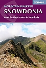
Wandelgids Snowdonia mountain walking 40 finest routes Cicerone Guidebooks | 40 wandelingenThis guidebook describes 40 day walks exploring Snowdonia. It showcases some of the best mountain walks in the area, with routes up Snowdon and Tryfan alongside other classic peaks like Y Garn, Cadair Idris and the Glyders. Routes are graded easy to strenuous and include airy and pulse-quickening scrambles such as Crib Goch and Bristly Ridge as well as the Snowdon Horseshoe, the Nantlle Ridge and a 2-day traverse of all 15 of Snowdon"s peaks over 3000ft. |
17,99 |
|
Wandelgids 10 Snowdonia Pathfinder Guide | Pathfinder Guide 10 | Met Ordanance Survey kaartenDeze Pathfinder Guide is een goed uitgevoerde gids met verschillende wandelingen in Groot-Britannië. De gids bevat naast goede topografische kaarten van de Britse topografische dienst (Ordanance Survey) ook beschrijvingen van het landschap, de cultuur en/of de flora en fauna. Verder is de gids voorzien van praktische informatie zoals startpunten, verwachte wandeltijd, restaurants en cafés voor onderweg. Pathfinder Snowdonia covering Bont Newydd, Aber and Tal-y-lln. This selection offers interest, regional variety and balance of routes in Snowdonia providing... |
17,99 |
|
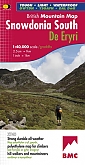
Wandelkaart Snowdonia South - Mountain Map | Harvey Maps | Water- en scheurvaste wandelkaartDe Harvey Map is de wandelkaart voor het wandelen in de mooiste natuurgebieden in het Groot-Brittannië. Duidelijke topografische wandelkaarten met praktische informatie van de route zoals overnachtingsmogelijkheden, eetgelegenheden en bezienswaardigheden. Deze wandelkaart is scheur- en watervast. Met GPS compatible (UTM-Grid). Waterproof mountain map of Snowdonia South from Harvey at 1:40,000, with a geological map of the region on the reverse, as well as an extension to the main map covering Aberdovey and advice on navigating the region safely. Schaal: 1:40.000 |
28,99 |
|
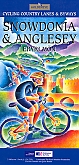
Fietskaart Snowdonia & Anglesey cycling map | GoldeneyeDe Goldeneye kaarten zijn uitstekende vrijetijdskaarten voor Groot-Brittannië, met name goed te gebruiken voor het fietsen door de overzichtelijke schaal. De De kaarten zijn helder, overzichtelijk en gedrukt op stevig papier. De MapGuide-kaarten bevatten toeristische informatie op de achterzijde van de kaart. De CyclingMaps bevatten fietspaden die over het algemeen vrij liggen van drukke wegen en/of gemotoriseerd verkeer en daarnaast ook de fietspaden van NCN (De Britse 'National Cycle Network'). Een handig register met plaatsnamen maakt het eenvoudig om plaatsen op t... Schaal: 1:126.720 |
10,99 |
|
Wandelgids 14 Snowdonia Pathfinder Guide (Short Walks) | 20 korte wandelingen 7.5 kmDeze Pathfinder Guide is een goed uitgevoerde gids met verschillende wandelingen in Groot-Britannie. De gids bevat naast goede topografische kaarten van de Britse topografische dienst (Ordanance Survey) ook beschrijvingen van het landschap, de cultuur en/of de flora en fauna. Verder is de gids voorzien van praktische informatie zoals startpunten, verwachte wandeltijd, restaurants en cafes voor onderweg. Short Walks Snowdonia covering parts of Abergynolwyn, Conwy and Snowdon. This selection offers interest and regional variety in Snowdonia, providing the best short walk... |
11,50 |
|
Wandelgids 50 Walks in Snowdonia and North Wales | AA PublishingOverzichtelijke wandelgids met duidelijke beschrijvingen en wandelkaarten. Wandeltochten van 5 tot 13 kilometer. Featuring a variety of mapped walks to suit all abilities, this helpful guide features all the necessary practical details for a successful trip, including information on distance, gradient, level of difficulty, landscape, dog friendliness, parking availability, and restroom locations. Fascinating background on the history and wildlife of each area is provided, and local points of interest are indicated on accompanying full-color maps. All wa... |
18,99 Tijdelijk niet leverbaar |
|
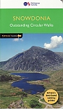
Wandelgids Great Mountain Days in Snowdonia Cicerone Guidebooks | 40 Classic Routes exploring SnowdonioaInviting the reader to experience less well-known regions as much as those that are eternally popular, this inspirational guide offers 40 memorable excursions among the valleys and heights of Snowdonia. These mainly circular routes have been chosen to encourage independent exploration of the National Park, while offering the safe hand of guidance for those who prefer their walking days to be tailor-made. The walks are all graded, making the guide equally suitable for less experienced walkers looking for adventure, new discoveries and the joy of exploration. This title ... |
25,99 |