- Gratis verzending vanaf 30 euro
- Levert in Nederland, België etc.
- Meer dan 30.000 titels
- Vakkundige klantenservice
- Snelle levering
- Veilig en eenvoudig betalen

Direct contact?
Bel +31 (0)6 42428571
maandag t/m vrijdag
van 10 tot 17 uur
Europa / Ierland / Noord-West Ierland / Donegal / Mayo / Galway / Wandelen / Wandelkaarten
Noord-West Ierland / Donegal / Mayo / Galway Wandelkaarten bestsellers
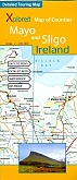
Fiets- en wandelkaart Mayo en Sligo Xploreit Map of County
Een kaart van waterproof materiaal!
22,99
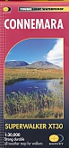
Wandelkaart Connemara - Walkings Maps Superwalker | Harvey Maps
Water- en scheurvaste wandelkaart
22,99
|
|
Wandelkaart Connemara - Walkings Maps Superwalker | Harvey Maps | Water- en scheurvaste wandelkaartDe Harvey Map is de wandelkaart voor het wandelen in de mooiste natuurgebieden in het Groot-Brittannië. Duidelijke topografische wandelkaarten met praktische informatie van de route zoals overnachtingsmogelijkheden, eetgelegenheden en bezienswaardigheden. Deze wandelkaart is scheur- en watervast. Met GPS compatible (UTM-Grid). The most detailed map available of this area. The National Park, the Twelve Bens plus the Maumturks, on one sheet. An inset of Clifden is included. Names are in Gaelic and English and major access routes are shown. Schaal: 1:30.000 |
22,99 |
|
|
Fiets- en wandelkaart Mayo en Sligo Xploreit Map of County | Een kaart van waterproof materiaal!Mayo"s wealth of unspoiled, natural beauty is a fitting compliment to Sligo"s magnificent scenery providing a wonderfully varied landscape to be enjoyed by visitors. This map shows where all the famous landmarks and hidden gems are to be found when touring the area. A comprehensive compilation of waymarked trails with local walking loops , cycle routes, scenic drives, beaches, medieval buildings, megalithic sites, historic houses and numerous other points of interest are illustrated. Discover the haunts of W.B. Yeats like Lissadell, Drumcliff and Lough Gill along with ... Schaal: 1:100.000 |
22,99 |