- Gratis verzending vanaf 30 euro
- Levert in Nederland, België etc.
- Meer dan 30.000 titels
- Vakkundige klantenservice
- Snelle levering
- Veilig en eenvoudig betalen

Direct contact?
Bel +31 (0)6 42428571
maandag t/m vrijdag
van 10 tot 17 uur
Europa / Groot-Brittannië / Engeland / Noord-Engeland / Wandelen / Wandelgidsen
Noord-Engeland Wandelgidsen bestsellers
Wandelgids 60 Lake District Pathfinder Guide
Pathfinder Guide 60 | Met Ordanance Survey kaarten
17,99
Wandelgids Coast to Coast Walk Cicerone Guidebooks
From St Bees Head in Cumbria to Robin Hood’s Bay on Yorkshire’s
22,99
|
Wandelgids Hadrian's Wall Path Trailblazer | Two-way guide: Bowness to Newcastle and Newcastle to BownessPractical guide with 58 large scale maps (1:20,000). Includes accommodation guides, pubs and restaurants and public transport information. Hadrian's Wall Path is a magnificent 84 mile national trail that follows the course of northern Europe's largest surviving Roman monument, the 2nd century fortification built on the orders of the Emperor Hadrian in AD122 and now listed as a UNESCO World Heritage Site. The guide includes 58 detailed walking maps, unique mapping features such as walking times, directions, tricky junctions, places to stay, places to eat, points... |
19,50 |
|
|
Wandelgids 60 Lake District Pathfinder Guide | Pathfinder Guide 60 | Met Ordanance Survey kaartenDeze Pathfinder Guide is een goed uitgevoerde gids met verschillende wandelingen in Groot-Britannië. De gids bevat naast goede topografische kaarten van de Britse topografische dienst (Ordanance Survey) ook beschrijvingen van het landschap, de cultuur en/of de flora en fauna. Verder is de gids voorzien van praktische informatie zoals startpunten, verwachte wandeltijd, restaurants en cafés voor onderweg. Pathfinder Lake District covering Coniston, Kewswick and Devoke Water. This selection offers interest, regional variety and balance of routes in the Lake Di... |
17,99 |
|
Wandelgids Kintyre Way Rucksack ReadersRucksack Readers zijn handig uitgevoerd in een klapper met ringband. Deze gids heeft een goede beschrijving van de lange afstands route met overzichtelijke kaarten doch zonder veel detail. De kracht van de Rucksack Readers is de uitgebreide achtergrondinformatie over de flora, fauna en geologische verschijnselen. Dit alles rijkelijk omkleed met kleurrijke foto's en praktische tips. The Kintyre Way is a fully waymarked trail that criss-crosses the Kintyre peninsula for 100 miles (161 km). Starting from Tarbert in the north, it visits coastal villages and inland loch... |
23,90 |
|
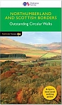
Wandelgids 35 Northumberland & the Scottish Borders Pathfinder Guide | Pathfinder Guide 35 | Met Ordanance Survey kaartenDeze Pathfinder Guide is een goed uitgevoerde gids met verschillende wandelingen in Groot-Britannie. De gids bevat naast goede topografische kaarten van de Britse topografische dienst (Ordanance Survey) ook beschrijvingen van het landschap, de cultuur en/of de flora en fauna. Verder is de gids voorzien van praktische informatie zoals startpunten, verwachte wandeltijd, restaurants en cafes voor onderweg. 28 wandelingen. Pathfinder(R) Northumberland and the Scottish Borders covering Blanchland, Melrose and Hartside. This selection offers interest, regional variety and ba... |
17,99 |
|
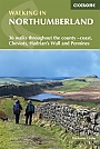
Wandelgids Walking in Northumberland | Ciceorone | 36 walks throughout the national park - coast, Cheviots, Hadrian's Wall and PenninesGuidebook to walking in Northumberland. 36 graded walks of 4 to 14 miles, from the beautiful coast with its immense, empty beaches and dramatic, crag-top castles to the remote hills of the Cheviots and Pennines. Includes Hadrian's Wall, Lindisfarne Priory, Kielder, Berwick, Bamburgh and Dunstanburgh Castles and more. Lindisfarne, Craster, Berwick-upon-Tweed, Seahouses, Wooler, Rothbury, Allendale, Haltwhistle, Alwinton, Ingram, Kielder and many other villages. A wide selection of walks including full days on the hills and coast and shorter walks at lower levels. Terrai... |
17,99 |
|
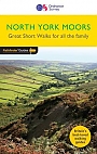
Wandelgids 13 North York Moors Pathfinder Guide (Short Walks) | 20 korte wandelingen 7.5 kmDeze Pathfinder Guide is een goed uitgevoerde gids met verschillende wandelingen in Groot-Britannie. De gids bevat naast goede topografische kaarten van de Britse topografische dienst (Ordanance Survey) ook beschrijvingen van het landschap, de cultuur en/of de flora en fauna. Verder is de gids voorzien van praktische informatie zoals startpunten, verwachte wandeltijd, restaurants en cafes voor onderweg. Short Walks North York Moors covering parts of Danby, Sutton Bank and Bridestone. This selection offers interest and regional variety in the North York Moors, providing... |
11,50 |
|
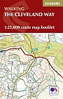
Wandelkaartgids The Cleveland Way Map Booklet | CiceroneHandzaam kaartgidsje. Gedetailleerde topografische wandelkaarten gebonden in een handig boekje. Licht voor onderweg. Map booklet of the Cleveland Way National Trail, a 177km (110 mile) walk around the North York Moors National Park. This booklet is included with the Cicerone guidebook to the Cleveland Way and the Yorkshire Wolds Way, and shows the full route of the Cleveland Way on OS 1:25,000 maps. Schaal: 1:25.000 |
11,99 |
|
Wandelgids St Oswald's Way and St Cuthbert's Way | Cicerone | Heavenfield and Cresswell to Holy Island
|
22,99 |
|
Wandelgids 39 Durham, North Pennines & Tyne & Wear Pathfinder Guide | Pathfinder Guide 39 | Met Ordanance Survey kaartenDeze Pathfinder Guide is een goed uitgevoerde gids met verschillende wandelingen in Groot-Britannie. De gids bevat naast goede topografische kaarten van de Britse topografische dienst (Ordanance Survey) ook beschrijvingen van het landschap, de cultuur en/of de flora en fauna. Verder is de gids voorzien van praktische informatie zoals startpunten, verwachte wandeltijd, restaurants en cafes voor onderweg. 28 dagwandelingen. This Pathfinder walking guide covers both the Cumbrian and Durham sides of the North Pennines, a designated Area of Outstanding Beauty, and also exte... |
17,99 |
|
Wandelgids 50 Walks in the Peak District | AA PublishingOverzichtelijke wandelgids met duidelijke beschrijvingen en wandelkaarten. Wandeltochten van 5 tot 13 kilometer. Featuring all the practical detail you need, accompanied by fascinating background reading on the history and wildlife of the area with clear mapping for ease of use. Every route has been colour coded according to difficulty. All walks are annotated with local points of interest and places to stop for refreshments. |
18,99 |
|
Wandelgids 50 Walks in Yorkshire Dales | AA PublishingOverzichtelijke wandelgids met duidelijke beschrijvingen en wandelkaarten. Wandeltochten van 5 tot 13 kilometer. The books feature all the practical detail you need, accompanied by fascinating background reading on the history and wildlife of the area, and clear mapping for ease of use. Every route has been colour coded according to difficulty. All walks are annotated with local points of interest and places to stop for refreshments. |
18,99 Tijdelijk niet leverbaar |
|
Wandelgids Hadrian's Wall Path Rucksack ReadersRucksack Readers zijn handig uitgevoerd in een klapper met ringband. Deze gids heeft een goede beschrijving van de lange afstands route met overzichtelijke kaarten doch zonder veel detail. De kracht van de Rucksack Readers is de uitgebreide achtergrondinformatie over de flora, fauna en geologische verschijnselen. Dit alles rijkelijk omkleed met kleurrijke foto's en praktische tips. Hadrian’s Wall Path runs for 86 miles (138 km) between Bowness-on-Solway and Wallsend (Newcastle) along the line of the Roman Wall completed in AD122 under the Emperor Hadrian. Thi... |
17,50 |
|
Wandelgids Hadrian's Wall Path Cicerone Guidebooks | National Trail Two-way national trail descriptionThe essential guidebook to walking the 84-mile Hadrian"s Wall Path. One of the UK's most visited National Trails, it runs the length of the Roman Wall from Bowness-on-Solway in Cumbria to Wallsend, Newcastle. Schaal: 1:25.000 |
22,99 |
|
Wandelgids The North York Moors Cicerone Guidebooks | 50 walks throughout the National ParkThis guidebook offers 50 walks in seven regions throughout the North York Moors National Park, enabling walkers to discover and appreciate in turn the Tabular Hills, Hambleton Hills, Cleveland Hills, Northern Moors, High Moors, Eastern Moors and Cleveland Coast. For those walkers who like to rise to a challenge, the course of the classic Lyke Wake Walk is also offered, split over a four-day period to allow a more leisurely appreciation of the moors as it stretches across the national park from east to west. There are almost 750km (465 miles) of walking routes described... |
16,99 |
|
Wandelgids The Ribble Way Cicerone Guidebooks | A one-week walk across Lancashire into Yorkshire from Preston to the source
|
22,99 |
|
|
Wandelgids Coast to Coast Walk Cicerone Guidebooks | From St Bees Head in Cumbria to Robin Hood’s Bay on Yorkshire’sFirst devised by Alfred Wainwright, the Coast to Coast Walk has emerged as a favourite among long-distance walkers. The route stretches some 185 miles (296km) from St Bees, an historic seaside village on Cumbria's west coast to Robin Hood's Bay in North Yorkshire. It is suitable for most fit walkers and can be comfortably walked in around a fortnight. This guidebook presents the full route from west to east in 13 stages of 10 ½-20 ¾ miles (16.8-33.2km), with summaries covering the opposite direction. Alongside step-by-step route description... |
22,99 |
|
Wandelgids East White Peak Walks: Peak District Cicerone GuidebooksThis guidebook provides 35 day walks and 7 longer walks and trails exploring the eastern section of Derbyshire's limestone area. The walks are spread across the area, starting in pleasant towns and villages including Bakewell, Tissington, Eyam and Middleton. Largely travelling along well-marked paths over gentle rolling landscapes, these walks are suitable for walkers of all abilities. The day walks range between 4 and 12 miles in length, and are illustrated with extracts of 1:50,000 OS mapping, while the longer walks and trails are covered by 1:100,000 scal... |
16,99 |
|
Wandelgids Coast to Coast Rucksack ReadersRucksack Readers zijn handig uitgevoerd in een klapper met ringband. Deze gids heeft een goede beschrijving van de lange afstands route met overzichtelijke kaarten doch zonder veel detail. De kracht van de Rucksack Readers is de uitgebreide achtergrondinformatie over de flora, fauna en geologische verschijnselen. Dit alles rijkelijk omkleed met kleurrijke foto's en praktische tips. |
21,99 |
|
Wandelgids Coast to Coast path Two-way trekking guide | Knife Edge | St Bees to Robin Hood's BayThe definitive two-way guide to the Coast to Coast Path: both eastbound and westbound routes are described in full. |
20,99 |
|
Wandelgids Walking in the Yorkshire Dales: South and West | Cicerone | Wharfedale, Littondale, Malhamdale, Dentdale and RibblesdaleThe Yorkshire Dales need little introduction: their picturesque scenery and hundreds of miles of footpaths, tracks and bridleways have been attracting walkers for decades. Part of a two-volume set, this guidebook presents over 40 routes in the south and west of the National Park, with bases including Sedburgh, Malham, Grassington, Skipton, Settle and Kirkby Lonsdale. The walks cover the valleys of Wharfedale, Littondale, Malhamdale, Ribblesdale and Dentdale – each with its own distinctive landscape and character. Also included is the Yorkshire Three Peaks, a 23 ... |
16,99 |
|
Wandelkaartgids The Coast to Coast map Booklet | CiceroneHandzaam kaartgidsje. Gedetailleerde topografische wandelkaarten gebonden in een handig boekje. Licht voor onderweg. Map of the 190 miles (300km) Coast to Coast Walk, between St Bees Head in Cumbria and Robin Hood's Bay in Yorkshire. This booklet is included with the Cicerone guidebook to the trail, and shows the full route on Ordnance Survey 1:25,000 maps. This popular long-distance route typically takes a fortnight to walk. Schaal: 1:25.000 |
14,99 |
|
Wandelgids Walking St Cuthbert's Way | Cicerone | Melrose and Jedburgh to Holy IslandThis guidebook describes the long-distance trail of St Cuthbert's Way through Northumberland and the Borders. The route starts in Melrose and travels 100km (62 miles) through the Northumberland National Park to Holy Island. It also includes a description of the route from Holy Island up the coast to Berwick-upon-Tweed. |
21,99 |
|
Wandelgids 63 Peak District Pathfinder Guide | Pathfinder Guide 63 | Met Ordanance Survey kaartenDeze Pathfinder Guide is een goed uitgevoerde gids met verschillende wandelingen in Groot-Britannië. De gids bevat naast goede topografische kaarten van de Britse topografische dienst (Ordanance Survey) ook beschrijvingen van het landschap, de cultuur en/of de flora en fauna. Verder is de gids voorzien van praktische informatie zoals startpunten, verwachte wandeltijd, restaurants en cafés voor onderweg. 28 beautiful country walks around the Peak District, graded by length and ranging from 3 to 11 miles. All routes come with a clear, large-scale OS map, GPS ... |
17,99 |
|
Wandelgids Coast to Coast Path Trailblazer | St Bees to Robin Hood's Bay, Planning, Places to Stay
|
19,90 |
|
Wandelgids Noord-Engeland Rother Wandelgids | 60 wandelingenDe 60 mooiste wandelingen in Noord-Engeland, met het lake District, de Yorkshire Dales en Northumberland. Zoals gebruikelijk zijn er verschillende wandelingen voor beginnende en ervaren wandelaars en is er onmisbare informatie over de streek, de bezienswaardigheden en recreatiemogelijkheden. met het Lake District, Yorkshire Dales, Northumberland. De betrouwbare routebeschrijvingen, gedetailleerde kaarten en hoogteprofielen zorgen voor een onvergetelijke wandelervaring. |
18,99 |

|
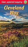
Wandelgids Cleveland Way | TrailblazerThe Cleveland Way is a National Trail set in the beautiful wild countryside of the North York Moors National Park. It runs 107.4 miles (127.9km) from Helmsley near Thirsk around the western edge of the park to reach the coast at Saltburn-by-the-Sea. It then continues along the eastern edge of the park south down the coast through Whitby, Robin Hood’s Bay and Scarborough to finish in Filey. Combining moorland and coast, there’s wonderful scenic variety to this walk, with crumbling castles and idyllic fishing villages to explore. Includes 48 detailed walking ... |
16,99 |
|
Wandelgids Dales Way | Trailblazer | Ilkley to Bowness-on-Windermere: 38 Large-scale Maps & Guides to 32 Towns and Villages - Planning - Places to Stay - Places to EThe popular Dales Way long-distance footpath begins in Ilkley, West Yorkshire and runs for 84 miles (135km) to end in the Lake District, in Bowness-on-Windermere. It follows riverside paths along the River Wharf towards Ribblehead and the watershed of northern England, then meanders along the river valleys of Dentdale, the River Mint and the River Kent dropping down into the Lake District to end beside Lake Windermere. It's a relatively easy walk that takes about a week. Includes 40 large-scale maps (3 1/8 inches to 1 mile); 9 town plans and 8 overview maps. Full d... Schaal: 1:20.000 |
18,95 |
|
Wandelgids The Border Country: A Walker’s Guide Cicerone GuidebooksCovering the border hills, northern Northumberland and the Southern Uplands, this full-colour third edition of the guide offers a broad selection of around 50 routes, as well as outlines of a number of long-distance trails which cross the region. The Border country that lies between England and Scotland is a countryside surrounded by ridge after high ridge rythmically fading into gently folding valleys, through which the Tweed and Teviot rivers flow. The area has been the scene of thousands of years of sometimes turbulent history, from the early Iron Age, through the R... |
17,99 |
|
Wandelgids Great Mountain Days in the Pennines | Cicerone | 50 classic walksAn inspirational guidebook to 50 classic walks on the rolling Pennine landscape. The graded routes, between 6 and 13 miles in length, cover classic Pennine fells and moorland such as Whernside, Ilkley Moor and Pendle Hill; exploring the North and South Pennines, Yorkshire Dales, Howgills and Dark Peak. Many routes are also suited to fell running. Walks are grouped into five areas: the North Pennines, the Howgills, the Yorkshire Dales, the South Pennines and the Dark Peak. Walks are graded from 'Moderate' to 'Strenuous' but unlike other mountainous areas where the abili... |
23,99 |
|
Wandelgids The Pennine Way Cicerone Guidebooks | From Edale to Kirk YetholmThe Pennine Way is Britain's oldest, toughest long-distance footpath and arguably its most iconic. Now a National Trail, the 427km (265 ½ mile) route from Edale in Derbyshire to Kirk Yetholm in the Scottish Borders offers wayfarers the opportunity to immerse themselves in wild beauty of the North. The Pennines boast rolling hills, sweeping moorland and wide glacial valleys, and the Pennine Way has come to embody personal challenge and adventure. This guidebook presents the route in 20 daily stages of 10.5-31.5km (6 ½-19 ½ miles). Step-by... |
22,99 |
|
Wandelgids The Reivers Way Cicerone Guidebooks | through historic NorthumberlandWalk in the footsteps of the notorious border reivers and discover how they survived centuries of strife and warfare. The Reivers Way almost encircles the county of Northumberland, offering a wonderful opportunity to walk and explore its wildest and most scenic parts. The trail starts at Corbridge in the North Pennines AONB. After following part of Hadrian"s Wall, a series of little towns and villages are visited, as the route heads in an out of the Northumberland National Park. After catching a glimpse of Lindisfarne, the route traces the scenic Northumberland Heritag... |
14,99 Tijdelijk niet leverbaar |
|
Wandelgids The Teesdale Way Cicerone Guidebooks | From Dufton to the North SeaA new, fully updated, full-colour edition of this guide. The Teesdale Way explores the course of the River Tees for exactly 100 miles from its source in the Cumbrian North Pennines to its outlet at Middlesbrough on the north-east coast. This is a delightful walk through unmatched river scenery including historic sites, SSSIs, pretty villages, woods, rolling farmland and wetlands. Passing as it does from remote Pennine moorland, through traditional Dales towns and finally to Teeside's industrial heartland, the Teesdale Way gives us a fascinating cross-section of the reg... |
16,99 Tijdelijk niet leverbaar |
|
Wandelgids The Cleveland Way and the Yorkshire Wolds Way Cicerone Guidebooks | National TrailGuidebook to the Cleveland Way and Yorkshire Wolds Way National Trails, plus the Tabular Hills Walk link route. The guidebook also contains a 1:25,000 scale OS route map booklet of the Cleveland Way. The Cleveland Way National Trail, described in seven day stages, is a fine 177km (110 miles) walk around the North York Moors National Park from Helmsley to Filey. The Yorkshire Wolds Way is one of the quietest of Britain's National Trails and wanders for 130km (80 miles) through gentle, cultivated and sparsely populated countryside. Described here in nine day stages, f... |
22,99 Tijdelijk niet leverbaar |

|
Wandelgids The Yorkshire Dales - Walking in the North and East | Cicerone | Howgills, Mallerstang, Swaledale, Wensleydale, Coverdale and NidderdaleThis guidebook contains 43 circular day walks in the north and east Yorkshire Dales. It explores the dales, hills and moors between Kirkby Stephen and Pateley Bridge. Walking ranges from gentle three-mile strolls to more strenuous day-long rambles across the Howgills, Wensleydale, Swaledale, Nidderdale, Mallerstang and Coverdale In this guidebook, 43 circular walks, ranging from 3-mile strolls to full-day adventures are explored in the northern and eastern Dales. Few areas in England are as appealing as the Yorkshire Dales and this volume of a two-part guide provide... |
17,99 |
|
Wandelgids Walking in Lancashire | Cicerone Guide | 40 walks throughout the county including the Forest of Bowland and Ribble ValleyGuidebook of 40 walks exploring the dales, moors, uplands and coasts of Lancashire, including Morecambe Bay, the Forest of Bowland, Ribble Valley and the West Pennine Moors. With routes for all seasons of the year and for a variety of abilities, these walks are within easy reach of Preston, Blackburn, Burnley, Lancaster and Clitheroe. Seasons Most of these walks can be completed all year round. Some higher level routes are challenging in winter, while lower level routes may become waterlogged after heavy rain. Centres Walks in the Forest of Bowland, Ribble Valley and W... |
16,99 |
|
Wandelkaartgids Pennine Way map Booklet | CiceroneHandzaam kaartgidsje. Gedetailleerde topografische wandelkaarten gebonden in een handig boekje. Licht voor onderweg. Map of the 270 miles (435km) Pennine Way National Trail, between Edale in the Peak District and Kirk Yetholm in the Scottish Borders. This booklet is included with the Cicerone guidebook to the trail, and shows the full route on Ordnance Survey 1:25,000 maps. This popular long-distance route typically takes three weeks to complete. Schaal: 1:25.000 |
17,99 Tijdelijk niet leverbaar |
|
Wandelgids 49 Vale of York and the Yorkshire Wolds Pathfinder Guide | Pathfinder Guide 49 | Met Ordanance Survey kaartenDeze Pathfinder Guide is een goed uitgevoerde gids met verschillende wandelingen in Groot-Britannië. De gids bevat naast goede topografische kaarten van de Britse topografische dienst (Ordanance Survey) ook beschrijvingen van het landschap, de cultuur en/of de flora en fauna. Verder is de gids voorzien van praktische informatie zoals startpunten, verwachte wandeltijd, restaurants en cafés voor onderweg. 28 DAGWANDELINGEN. With 28 circular, graded walks all tried and tested by seasoned walkers, this guidebook for the Vale of York and the Yorkshire Wolds will help you ... |
17,99 Tijdelijk niet leverbaar |
|
Wandelgids Walking in County Durham | Cicerone | 40 walking routesGuidebook of walking routes in County Durham. The 40 day walks, ranging between 5 and 24km in length, explore all corners of this varied county, encompassing wild moorland, rolling pastures, riverbanks and the low cliff coast. With such a range of possibilities, there are walks here for all abilities. They take in highlights such as Beamish, Durham City, Tan Hill and High Force. Featuring 1:50K OS mapping, step-by-step route descriptions, as well as information on the history of the region, the guidebook details everything you need to walk in the region. The coun... Schaal: 1:50.000 |
18,99 |
|
Wandelgids 64 South Pennines Pathfinder Guide | Pathfinder Guide 64 | Met Ordanance Survey kaartenDeze Pathfinder Guide is een goed uitgevoerde gids met verschillende wandelingen in Groot-Britannië. De gids bevat naast goede topografische kaarten van de Britse topografische dienst (Ordanance Survey) ook beschrijvingen van het landschap, de cultuur en/of de flora en fauna. Verder is de gids voorzien van praktische informatie zoals startpunten, verwachte wandeltijd, restaurants en cafés voor onderweg. Pathfinder are Britain's best-loved walking guides. Enjoy 28 circular walks from 3 to 10 miles around the beautiful South Pennines. |
17,99 Tijdelijk niet leverbaar |
|
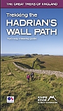
Wandelgids Trekking the Hadrian’s Wall Path | Knife Edge | Two-way guidebook
Schaal: 1:25.000 |
18,95 |
|
Wandelgids Cleveland Way North York Moors National Park | Rucksack ReadersRucksack Readers zijn handzame wandelgidsen. Deze gids heeft een goede beschrijving van de lange afstands route met overzichtelijke kaarten doch zonder veel detail. De kracht van de Rucksack Readers is de uitgebreide achtergrondinformatie over de flora, fauna en geologische verschijnselen. Dit alles rijkelijk omkleed met kleurrijke foto's en praktische tips. The Cleveland Way is one of England’s oldest and best-loved National Trails. It runs for 108 miles (174 km) around the North York Moors National Park, starting inland at Helmsley, offering panoramic views... |
18,99 |