- Gratis verzending vanaf 30 euro
- Levert in Nederland, België etc.
- Meer dan 30.000 titels
- Vakkundige klantenservice
- Snelle levering
- Veilig en eenvoudig betalen

Direct contact?
Bel +31 (0)6 42428571
maandag t/m vrijdag
van 10 tot 17 uur
Ierland Stadsplattegronden bestsellers
|
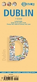
Stadsplattegrond Dublin Borch Maps | Water- en scheurvaste stadsplattegrondDe kaarten van Borch zijn handzaam in gebruik, water- en scheurvast en hebben een heldere cartografie. Op de kaarten is toeristische informatie aangegeven zoals musea, ambassades, monumenten, kerken en andere praktische informatie. De kaart is ook voorzien van een uitgebreide legenda, kleine en overzichtelijke stadsplattegronden en regionale uitvergrotingen. De kaarten bevatten daarnaast ook uitstekende aanduiding voor het openbaarvervoer (zoals metroverbindingen). Schaal: 1:12.000 |
9,99 |
|
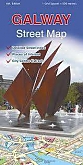
Stadsplattegrond Galway | Ordnance Survey of IrelandAn easy-to-use street and general purpose map with tourist information. Each map shows each street and road with bus route information, tourist features, public buildings and an index to roads and streets. Schaal: 1:12.000 |
11,99 |
|
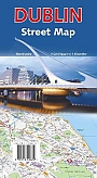
Stadsplattegrond Dublin | Ordnance Survey of IrelandEen gebruiksvriendelijke straat- en algemene kaart met toeristische informatie. Elke kaart toont elke straat en weg met busroute-informatie, toeristische kenmerken, openbare gebouwen en een index van wegen en straten. Schaal: 1:20.000 |
18,99 |
|
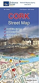
Stadsplattegrond Cork | Ordnance Survey of IrelandAn easy-to-use street and general purpose map with tourist information. Each map shows each street and road with bus route information, tourist features, public buildings and an index to roads and streets. Schaal: 1:15.000 |
12,99 |
|
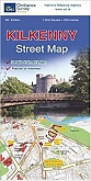
Stadsplattegrond Kilkenny | Ordnance Survey of IrelandKilkenny Street Map - a detailed map of Kilkenny City and surrounding area complete with street index and places of interest. An easy-to-use street and general purpose map with tourist information. Each map shows each street and road with bus route information, tourist features, public buildings and an index to roads and streets. Schaal: 1:7.000 |
11,99 |
|
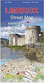
Stadsplattegrond Limerick | Ordnance Survey of IrelandAn easy-to-use street and general purpose map with tourist information. Each map shows each street and road with bus route information, tourist features, public buildings and an index to roads and streets. Schaal: 1:13.000 |
11,99 |
|
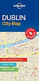
Stadsplattegrond Dublin City Map | Lonely Planet | Water- en scheurvaste stadsplattegrond van TyvekNieuwe reeks stadsplattegronden van Lonely Planet. Overzichtelijke centrum kaart met heldere kleuren, pictogrammen geven de bezienswaardigheden en openbaar vervoer aan. De straatnamen zijn duidelijk vermeld, plus er is een straatnaamregister aanwezig. De kaart is superlicht en handzaam van formaat. Op de achterzijde staat informatie over de toeristische hoogtepunten. Covers: City Centre, Merrion Square, Temple Bar, Kilmainham, the Liberties, North of the Liffey, Phoenix Park, Docklands. Schaal: 1:11.000 |
8,99 |
Bij een bezoek aan Ierland mag je zeker niet missen: de adembenemende Cliffs of Moher, het historische kasteel van Dublin, en de ruige landschappen van de Ring of Kerry. Ontdek de rijke geschiedenis in het Nationaal Museum van Ierland en het Kilmainham Gaol. De natuurpracht omvat het nationale park Connemara en de groene heuvels van Wicklow. Outdoor activiteiten omvatten wandelen, fietsen, en vissen. Overnachtingsmogelijkheden variëren van charmante B&B's tot moderne hotels in stedelijke gebieden en gezellige pubs met kamers in schilderachtige dorpjes. Raadpleeg lokale toeristische informatie voor reisadviezen en de warme gastvrijheid van de Ierse cultuur.