- Gratis verzending vanaf 30 euro
- Levert in Nederland, België etc.
- Meer dan 30.000 titels
- Vakkundige klantenservice
- Snelle levering
- Veilig en eenvoudig betalen

Direct contact?
Bel +31 (0)6 42428571
maandag t/m vrijdag
van 10 tot 17 uur
Europa / Groot-Brittannië / Centraal-Schotland / Ben Nevis / Wandelen / Wandelgidsen
Centraal-Schotland / Ben Nevis Wandelgidsen bestsellers
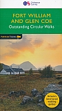
Wandelgids 07 Fort William & Glen Coe Walks Pathfinder Guide
Pathfinder Guide 7 | Met Ordanance Survey kaarten
17,95
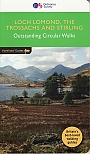
Wandelgids 23 Loch Lomond, The Trossachs and Stirling Pathfinder Guide
Pathfinder Guide 23 | Met Ordanance Survey kaarten
17,99
|
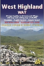
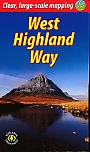
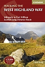
Wandelgids West Highland Way Trailblazer | Glasgow to Fort WilliamVolledig herziene 8e editie. De West Highland Way passeert een aantal van de meest spectaculaire landschappen in heel Groot-Brittannië. Vanuit de buitenwijken van Glasgow slingert het 154,5 km lang langs de beboste oevers van Loch Lomond, over de wildernis van Rannoch Moor, over de bergen boven Glencoe tot een dramatische finish langs Ben Nevis - de hoogste berg van Groot-Brittannië - naar het centrum van Fort William. * 4 grootschalige stadsplattegronden, 8 overzichtskaarten en 53 grootschalige wandelkaarten - bijna 1: 20.000 - met routetijden, verblijfplaat... |
18,50 |
|
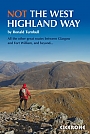
Wandelgids Not the West Highland Way Cicerone GuidebooksThe West Highland Way is one of the finest of Britain's long-distance paths. It passes through six separate mountain ranges, from the tall elegant cone of Ben Lomond and the crag towers of grim Glen Coe to the seductive Mamores. But does it go onto those enticing Stobs and Bens? It does not. It runs along Glens Falloch and Finnan, close to the Highlands' second busiest main road and the West Highland Railway. It may be Scotland's best long-distance path: but this book intends to do better. So here they are: the mountains alongside the way. When the sun shin... |
19,99 |
|
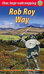
Wandelgids Rob Roy Way Rucksack ReadersRucksack Readers zijn handig uitgevoerd in een klapper met ringband. Deze gids heeft een goede beschrijving van de lange afstands route met overzichtelijke kaarten doch zonder veel detail. De kracht van de Rucksack Readers is de uitgebreide achtergrondinformatie over de flora, fauna en geologische verschijnselen. Dit alles rijkelijk omkleed met kleurrijke foto's en praktische tips. The Rob Roy Way was recognised as one of Scotland’s Great Trails in 2012 when the route was fully waymarked. Our third edition fully documents some important route improvements, no... |
21,99 |
|
Wandelgids West Highland Way Rucksack ReadersRucksack Readers zijn handig uitgevoerd in een klapper met ringband. Deze gids heeft een goede beschrijving van de lange afstands route met overzichtelijke kaarten doch zonder veel detail. De kracht van de Rucksack Readers is de uitgebreide achtergrondinformatie over de flora, fauna en geologische verschijnselen. Dit alles rijkelijk omkleed met kleurrijke foto's en praktische tips. The West Highland Way is the first and most famous of Scotland’s Great Trails. It stretches for 96 miles (154 km) of superb scenery, from Milngavie on the outskirts of Glasgow, Sco... |
21,95 |
|
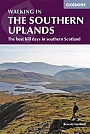
Wandelgids Walking in the Southern Uplands Cicerone | 44 best hill days in southern ScotlandGuidebook to 44 varied day walks and over 100 summits in the Southern Uplands of Scotland, stretching south-west from Edinburgh to the English border, including the Galloway and Pentland Hills. Between 2 and 29km, there is something for all seasons and all abilities in remote and rugged hill country. Newton Stewart and Glentrool, Nithsdale (Dumfriesshire), Biggar, Moffat, Peebles, Edinburgh, Kirk Yetholm. spring to autumn, plus winter days with good weather and snow conditions. hill walks below 900m, ranging from straightforward on good paths (Lowther Hill, Pentlands) ... |
20,99 |
|
|
Wandelgids 23 Loch Lomond, The Trossachs and Stirling Pathfinder Guide | Pathfinder Guide 23 | Met Ordanance Survey kaartenDeze Pathfinder Guide is een goed uitgevoerde gids met verschillende wandelingen in Groot-Britannië. De gids bevat naast goede topografische kaarten van de Britse topografische dienst (Ordanance Survey) ook beschrijvingen van het landschap, de cultuur en/of de flora en fauna. Verder is de gids voorzien van praktische informatie zoals startpunten, verwachte wandeltijd, restaurants en cafés voor onderweg. Walking in Scotland is quite different from walking south of the border. In England there are only eight summits that top 3000 ft, while in Scotland there a... |
17,99 |
|
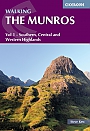
Wandelgids Walking the Munros Southern, Central and Western Highlands Volume 1 Cicerone GuidebooksHalf of a two-volume set describing challenging and inspiring routes to climb Scotland's 282 3000ft+ mountains, this guide covers the southern, central and western Highlands (south of the Great Glen), taking in stunning areas such as Glen Coe, Glen Shee, Lochaber and Mull. |
18,99 |
|
Wandelgids Ben Nevis and Glen Coe Cicerone Guidebooks | A Walking GuidebookGuidebook to walking in Scotland's Ben Nevis and Glen Coe region, featuring 100 graded walks of 2 to 21 miles. Routes include low-level, mid-level and high-level walks, with the high-level walks showcasing 44 Munro summits. Routes are organised by location, being in and around: Fort William and Glen Nevis; Ben Nevis and the Aonachs; Grey Corries and Spean Bridge; Mamores; Kinlochleven; Glen Coe; Bidean nam Bian; and Glen Etive. Home to some of the finest walking in the UK, the Ben Nevis and Glen Coe region offers the thrill of summiting many a Munro, as well innumerabl... |
19,99 |
|
Wandelgids Cateran Trail Rucksack ReadersRucksack Readers zijn handig uitgevoerd in een klapper met ringband. Deze gids heeft een goede beschrijving van de lange afstands route met overzichtelijke kaarten doch zonder veel detail. De kracht van de Rucksack Readers is de uitgebreide achtergrondinformatie over de flora, fauna en geologische verschijnselen. Dit alles rijkelijk omkleed met kleurrijke foto's en praktische tips. The Cateran Trail is one of Scotland’s Great Trails – a circular walk of 64 miles (104 km) starting in Blairgowrie, near Perth, following in the footsteps of cattle-rustlers ... |
18,95 |
|
Wandelgids Loch Lomond and The Cowal Way with Isle of Bute Rucksack Readers | Waterproof met spiraalbindingDeze gids heeft een goede beschrijving van de lange afstands route met overzichtelijke kaarten doch zonder veel detail. De kracht van de Rucksack Readers is de uitgebreide achtergrondinformatie over de flora, fauna en geologische verschijnselen. Dit alles rijkelijk omkleed met kleurrijke foto's en praktische tips. Waterproof met spiraalbinding. The Cowal Way runs for 57 miles (92 km) across the Cowal peninsula, which lies west of Glasgow and has ferry links with the Isle of Bute. The route starts at Portavadie on Loch Fyne and ends at Inveruglas on Loch Lomond. The... |
19,90 |
|
Wandelgids St Cuthbert's Way Rucksack ReadersRucksack Readers zijn handig uitgevoerd in een klapper met ringband. Deze gids heeft een goede beschrijving van de lange afstands route met overzichtelijke kaarten doch zonder veel detail. De kracht van de Rucksack Readers is de uitgebreide achtergrondinformatie over de flora, fauna en geologische verschijnselen. Dit alles rijkelijk omkleed met kleurrijke foto's en praktische tips. Follow the footsteps of St Cuthbert in this easy-going walk of 63 miles (101 km) from Melrose Abbey in the Scottish Borders to the Holy Island of Lindisfarne in Northumberland. St ... |
23,99 |
|
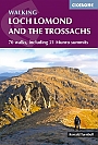
Wandelgids Walking Loch Lomond and the Trossachs Cicerone Guidebooks | The Lomond Trossachs National Park, Glen Artney, Ben Lui and the Cowal PeninsulaGuidebook to over 70 walking routes in the hills of Loch Lomond and the Trossachs National Park in Scotland's Southern Highlands. Including 21 Munros on less-popular routes, as well as plenty of Corbetts and Grahams. Hill summits of Ben Lomond, the Cobbler, Ben Lui and the Arrochar Alps have plenty of routes to explore. The routes in this guide range from 1 to 17 miles, and are clearly graded for distance and difficulty, as well as dividing between low-level, mid-level and mountain walks. From short, loch-side strolls suitable for all walkers, to long, challenging moun... |
20,99 |
|
Wandelgids The West Highland Way Cicerone Guidebooks | Milngavie to Fort William. Incl. map booklet 1:25.000A guidebook to Scotland"s West Highland Way, a 95-mile walk from Milngavie near Glasgow to Fort William, passing Loch Lomond, crossing Rannoch Moor and finishing in the shadow of Britain"s highest mountain. The walk, which takes roughly one week to complete, is described in seven stages, with each stage ranging from 8 to 20 miles. The guide details the "classic" south-north direction but also provides a summary description for those wanting to walk the route in the opposite direction. The guidebook, which features step-by-step route descriptio... |
19,99 |
|
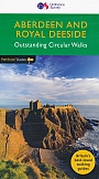
Wandelgids 46 Aberdeen / Royal Deeside Pathfinder Guide | Pathfinder Guide 46 | Met Ordanance Survey kaartenDeze Pathfinder Guide is een goed uitgevoerde gids met verschillende wandelingen in Groot-Britannie. De gids bevat naast goede topografische kaarten van de Britse topografische dienst (Ordanance Survey) ook beschrijvingen van het landschap, de cultuur en/of de flora en fauna. Verder is de gids voorzien van praktische informatie zoals startpunten, verwachte wandeltijd, restaurants en cafes voor onderweg. The Aberdeen and Grampian Tourist Board describes the area as 'Royal Deeside, Whisky, Castles and Coast' and it is easy to see why. The royal connection is most obvious... |
17,99 |
|
|
Wandelgids 07 Fort William & Glen Coe Walks Pathfinder Guide | Pathfinder Guide 7 | Met Ordanance Survey kaartenDeze Pathfinder Guide is een goed uitgevoerde gids met verschillende wandelingen in Groot-Britannië. De gids bevat naast goede topografische kaarten van de Britse topografische dienst (Ordanance Survey) ook beschrijvingen van het landschap, de cultuur en/of de flora en fauna. Verder is de gids voorzien van praktische informatie zoals startpunten, verwachte wandeltijd, restaurants en cafés voor onderweg. Fort William and Glen Coe encompass one of the greatest areas of sea and mountain landscape in Scotland, backed by some of the biggest and most deman... |
17,95 |
|
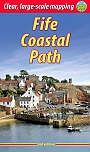
Wandelgids Fife Coastal Path Trail Rucksack ReadersRucksack Readers zijn handzame wandelgidsen. Deze gids heeft een goede beschrijving van de lange afstands route met overzichtelijke kaarten doch zonder veel detail. De kracht van de Rucksack Readers is de uitgebreide achtergrondinformatie over de flora, fauna en geologische verschijnselen. Dit alles rijkelijk omkleed met kleurrijke foto's en praktische tips. The Fife Coastal Path runs around the coastline of eastern Scotland for 117 miles (187 km) from Kincardine on the Forth to Newburgh on the Tay. Starting west of the famous Forth bridges, the route heads t... |
21,50 |
|
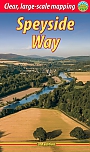
Wandelgids The Speyside Way | Rucksack Readers | Buckie to AviemoreDeze gids heeft een goede beschrijving van de lange afstands route met overzichtelijke kaarten doch zonder veel detail. De kracht van de Rucksack Readers is de uitgebreide achtergrondinformatie over de flora, fauna en geologische verschijnselen. Dit alles rijkelijk omkleed met kleurrijke foto's en praktische tips. The Speyside Way is one of Scotland’s Great Trails. Its main spine runs for 85 miles (136 km) from the fishing port of Buckie to Newtonmore in the Cairngorm National Park, with an optional 16-mile spur to Tomintoul via Glenlivet. Following the lovel... |
21,50 |
Bij een bezoek aan Ben Nevis, de hoogste berg van het Verenigd Koninkrijk, mag je zeker niet missen: de beklimming van Ben Nevis zelf voor adembenemende uitzichten, wandelingen in de omliggende Glen Nevis-vallei, en het Commando Memorial voor militaire geschiedenis. Geniet van outdooractiviteiten zoals wandelen, bergbeklimmen en mountainbiken. Er zijn geen musea in de directe omgeving, maar Fort William biedt accommodaties variërend van hotels zoals het Alexandra Hotel tot campings. Ontdek de historische stad Fort William en de nabijgelegen Great Glen, met het beroemde Loch Ness. Verken ook de nabijgelegen Glen Coe en de Schotse Hooglanden.