- Gratis verzending vanaf 30 euro
- Levert in Nederland, België etc.
- Meer dan 30.000 titels
- Vakkundige klantenservice
- Snelle levering
- Veilig en eenvoudig betalen

Direct contact?
Bel +31 (0)6 42428571
maandag t/m vrijdag
van 10 tot 17 uur
Wandelgids Alpe-Adria Trail | Bradt Travelguides
From the Alps to the Adriatic - Hiking Austria, Slovenia, Italy

This is the first English-language guide to the epic new 750-km hiking route through the mountains of Austria, Slovenia and Italy, from the foot of the Grossglockner (at 3,798m, the highest peak in Austria and the Eastern Alps) to Muggia near Trieste on the Adriatic coast. Detailed maps and route descriptions for all 44 stages of the route are included, with a clear breakdown of time, distance and ascent for each stage.
Published in a small, handy-sized format which is easy to pack and carry, it is written by an expert who has authored over half a dozen hiking guides and who specialises in Eastern and Central Europe. He has been a regular visitor to the borderlands of Slovenia, Austria and Italy for over 15 years, as well as living for two years in neighbouring Croatia. The Alpe-Adria route is well marked, relatively easy to walk and is suitable for hikers of all abilities as well as families - a point which is emphasised in the guide.
The route takes in spectacular, unspoilt mountain scenery, alpine lakes, rolling coastal hills, beautiful villages and several national parks and nature reserves. An introduction covering the history, wildlife, flora and geography of the area is included, along with accommodation details for each stage and information on local public transport, culture, food and language.
Engelstalig
EAN: 9781784776718
Uitgeverij: Bradt Travelguides
Verschijningsdatum: 2020
Meest recente editie
Engelstalig
308 pagina's

Op voorraad
Overmorgen in huis (Nederland)
- Vakkundige klantenservice
- Groot assortiment
- Gratis retourneren binnen 14 dagen
- Aangesloten bij WebwinkelKEUR
€ 19,99
Meer producten die interessant kunnen zijn
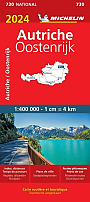
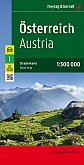
Wegenatlassen Oostenrijk
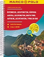
Wegenatlas Oostenrijk Österreich, Liechtenstein, Südtirol | Marco Polo Reiseatlas
A4 Formaat spiraalbinding
€ 16,50
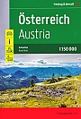
Wegenatlas Oostenrijk Österreich Großer Reise-Atlas Autoatlas | Freytag & Berndt
A5 formaat met gelijnde rug.
€ 28,50
Tijdelijk niet leverbaar
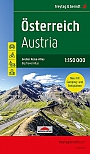
Wegenatlas Oostenrijk Österreich | Freytag & Berndt
met gelijmd rug - paperback
€ 14,90
Tijdelijk niet leverbaar
Wegenkaarten Oostenrijk
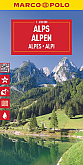
Wegenkaart - Landkaart Alpen Alps | Marco Polo Maps
Tijdelijk niet leverbaar

Wegenkaart - Landkaart Alpen - World Mapping Project (Reise Know-How)
Water- en scheurvaste wegenkaart
€ 13,50
Fietsgidsen Oostenrijk

Fietsgids Donau Radweg 2 Passau - Wien Wenen Bikeline Esterbauer
Teil 2: Österreichische Donau - Von Passau nach Wien, 325 km, wetterfest/reißfest, GPS-Tracks Download, LiveUpdate
€ 16,90
Fietsgids Onbegrensd fietsen van Salzburg naar Venetië / Istrië + Alpe-Adria | Benjaminse Uitgeverij
Met Spiraalbinding. 500 kilometer.
€ 23,50

Koopjes Oostenrijk
Klettersteigen Oostenrijk

Klimgids Klettersteige Bayern Vorarlberg Tirol Salzburg Rother Wanderführer Special | Rother Bergverlag
92 Klettersteige zwischen Rhein und Salzach
€ 18,95
Reisgidsen Oostenrijk

Reliëfkaarten Oostenrijk
Reliefkaart Oostenrijk postkaart ansichtkaart formaat 15 cm x 10,5 cm | Georelief
postkaart formaat 15 cm x 10,5 cm
€ 4,99
