- Gratis verzending vanaf 30 euro
- Levert in Nederland, België etc.
- Meer dan 30.000 titels
- Vakkundige klantenservice
- Snelle levering
- Veilig en eenvoudig betalen

Direct contact?
Bel +31 (0)6 42428571
maandag t/m vrijdag
van 10 tot 17 uur
Wandelgids Jungfrau Tour of the Jungfrau Region Cicerone Guidebooks
10 days trekking in the Bernese Oberland
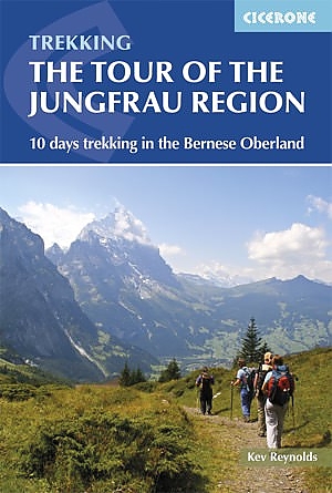
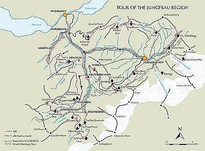
The Tour of the Jungfrau Region is fast becoming one of the classic walks of Europe. During this 9-12 day trek, walkers travel amongst some of the most spectacular mountain scenery in all of the Swiss Alps. It visits pastures, ridges, summits and passes, skirts exquisite mountain lakes, and gazes on waterfalls, gorges and glaciers all in the shadow of such iconic peaks as Wetterhorn, Eiger, Monch and Jungfrau. The Tour of the Jungfrau Region is described as a clockwise circuit, beginning at Schynige Platte and ending at Wilderswil, and is broken into 10 stages (with a number of alternatives offered), each of which equates to a day"s walking of uneven length. It makes a journey of around 111km through this area, in constant admiration of mountain and valley, of lake, river and feathery cascade. By choosing the most scenic trails and some of the most atmospheric places for an overnight stay, it has all the ingredients to ensure a memorable nine or twelve day trek. On most stages it"s possible to take an alternative route should the weather or conditions on the mountains suggest it would be unwise to follow the standard itinerary. These alternative options are described where they occur within the main route text. Although the route described in this guidebook makes a journey through one of Europe"s most challenging mountain districts, no technical skills are demanded of the trekker tackling the Tour of the Jungfrau Region. However, there are several short exposed sections (mostly safeguarded with a fixed cable handrail), and a few places where metal rungs or ladders aid the ascent or descent of a rock slab or, as on the ascent of the Schilthorn, a steep section of ridge. Apart from these, the trails are mostly straightforward and well maintained, but if wet from rain or snowmelt or skimmed with a glaze of ice, there could be some potentially dangerous sections that demand extra care. Activities
trekking, backpacking, hut-to-hut tours Seasons
late June to end of September with all facilities open July to August, but trails busier and prices higher; September is recommended Centres
fly in to Geneva, Zurich or Basle - there are popular resorts at Interlaken, Grindelwald, Murren, Lauterbrunnen and Wengen. Difficulty
challenging mountain walking, but no technical skills needed, with several short exposed sections (most with fixed cable) Must See
views of famous Alpine peaks such as: the Eiger, Monch and Jungfrau; the Lauterbrunnen Valley; the Jungrau-Aletsch-Bietschhorn Unesco World Natural Heritage Site; glaciers such as Eigergletscher and waterfalls such as the Trummelbach Falls; also alpine flowers.
Engelstalig
EAN: 9781852848644
Auteur(s): Reynolds, k.
Uitgeverij: Cicerone Press
Verschijningsdatum: 2018
Meest recente editie
Engelstalig
128 pagina's

Op voorraad
Overmorgen in huis (Nederland)
- Vakkundige klantenservice
- Groot assortiment
- Gratis retourneren binnen 14 dagen
- Aangesloten bij WebwinkelKEUR
€ 19,99
Meer producten die interessant kunnen zijn
Topografische kaarten Berner Oberland
Topografische Wandelkaart Zwitserland 1249 Finsteraarhorn Lötschenlücke - Jungfraujoch Konkordiaplatz - Landeskarte der Schweiz
Wandelkaart | Bundesamt fur Landestopografie Swisstopo
€ 14,99
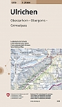
Topografische Wandelkaart Zwitserland 1250 Ulrichen Oberaarhorn Obergoms Grimselpass - Landeskarte der Schweiz
Wandelkaart | Bundesamt fur Landestopografie Swisstopo
€ 14,99
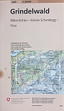
Topografische Wandelkaart Zwitserland 1229 Grindelwald Mannlichen Kleine Scheidegg First Eiger Landeskarte der Schweiz
Wandelkaart | Bundesamt fur Landestopografie Swisstopo
€ 14,99
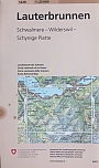
Topografische Wandelkaart Zwitserland 1228 Lauterbrunnen Schwalmere Wilderswil Schynige Platte - Landeskarte der Schweiz
Wandelkaart | Bundesamt fur Landestopografie Swisstopo
€ 14,99
Wandelkaarten Berner Oberland
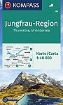
Wandelkaart 84 Jungfrau-Region Thunersee Brienzersee Kompass
Wandern. Orts- u. Namensregister. GPS-genau
€ 16,50
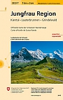
Topografische Wandelkaart Zwitserland 3323T Jungfrau Region - Landeskarte der Schweiz
Water- en scheurvaste wandelkaart | Bundesamt fur Landestopografie Swisstopo
€ 14,50
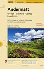
Topografische Wandelkaart Zwitserland 3314T Andermatt - Landeskarte der Schweiz
Water- en scheurvaste wandelkaart | Bundesamt fur Landestopografie Swisstopo
€ 14,50
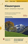
Topografische Wandelkaart Zwitserland 3313T St. Klausenpass Altdorf Schächental Braunwald- Landeskarte der Schweiz
Water- en scheurvaste wandelkaart | Bundesamt fur Landestopografie Swisstopo
€ 14,50
Sportklimmen Berner Oberland

Kletterführer Berner Oberland Multipack Nord und Sud | Schweizer Alpen Club
Berner Oberland Nord und Süd
€ 99,00
Skikaarten Berner Oberland
Skikaart Zwitserland 254S Interlaken Grindelwald Saxeten Habken - Landeskarte der Schweiz
Freizeitkarte | Skitourenkarten der Schweiz | Bundesamt fur Landestopografie Swisstopo
€ 25,99
Skikaart Zwitserland 255S Sustenpass Gauli Tirlis Andermatt - Landeskarte der Schweiz
Freizeitkarte | Skitourenkarten der Schweiz | Bundesamt fur Landestopografie Swisstopo
€ 25,99
Skigidsen Berner Oberland
Alpinisme Berner Oberland