- Gratis verzending vanaf 30 euro
- Levert in Nederland, België etc.
- Meer dan 30.000 titels
- Vakkundige klantenservice
- Snelle levering
- Veilig en eenvoudig betalen

Direct contact?
Bel +31 (0)6 42428571
maandag t/m vrijdag
van 10 tot 17 uur
Wandelkaart Brecon Beacons - Mountain Map | Harvey Maps
Water- en scheurvaste wandelkaart

De Harvey Map is de wandelkaart voor het wandelen in de mooiste natuurgebieden in het Groot-Brittannië. Duidelijke topografische wandelkaarten met praktische informatie van de route zoals overnachtingsmogelijkheden, eetgelegenheden en bezienswaardigheden. Deze wandelkaart is scheur- en watervast. Met GPS compatible (UTM-Grid). Printed on polyethylene - durable, tear-proof and 100% waterproof
Less than half the weight of a laminated map
Colour shading for easy identification of hills and valleys
Climbing crags named
Climbing crag diagrams
Geological map of the area specially designed by the British Geological Survey
Tips on using your map and compass
Mountain incident and first aid advice
Scale 1:40,000
Useful local phone numbers and websites
"The Brecon Beacons have an irrestible draw and this is where I began my journey to the roof of the world. The breathtaking landscape provides challenges and adventures for all ages and abilities and this expertly designed map is the key to exploring it." Tori James, the first Welsh woman to climb Mount Everest
"The 1:40,000 scale used by British Mountain Maps is excellent for hill walking. The map provides clear, detailed information to one of the most popular hill walking areas in Britain." Chris Bonington
Schaal: 1:40.000
Engelstalig


Op voorraad
Levertijd 3 dagen (Nederland)
- Vakkundige klantenservice
- Groot assortiment
- Gratis retourneren binnen 14 dagen
- Aangesloten bij WebwinkelKEUR
€ 28,99
Meer producten die interessant kunnen zijn
Wandelgidsen Wales
Wandelgids 34 Pembrokeshire and Carmarthenshire Pathfinder Guide
Pathfinder Guide 34 | Met Ordanance Survey kaarten
€ 17,99
Wandelgids 269 Wales Rother Bergverlag | Rother Bergverlag
Die schonsten Küsten- und Bergwanderungen. 50 Touren. Mit GPS-Daten
€ 14,90
Wegenkaarten Wales
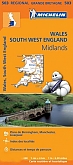
Wegenkaart - Landkaart 503 Wales & The Midlands - Michelin Regional
Wales, the Midlands, South West England 503
€ 11,50

Topografische kaarten Wales
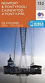
Topografische Wandelkaart 152 Newport / Pontypool - Explorer Map
Wandelkaart & Fietskaart | Ordnance Survey (OS) Groot-Brittannië
€ 18,99
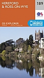
Topografische Wandelkaart 189 Hereford & Ross-on-Wye - Explorer Map
Wandelkaart & Fietskaart | Ordnance Survey (OS) Groot-Brittannië
€ 18,99
Topografische Wandelkaart 215 Newtown / Machynlleth Llanfair Caereinion - Explorer Map
Wandelkaart & Fietskaart | Ordnance Survey (OS) Groot-Brittannië
€ 18,99
Topografische Wandelkaart 262 Anglesey West Holyhead - Explorer Map
Wandelkaart & Fietskaart | Ordnance Survey (OS) Groot-Brittannië
€ 18,99
Reisgidsen Wales

Reisgids Engeland Noord & Wales Trotter
De no-nonsensegids voor een allesomvattende trip.
€ 18,99
Tijdelijk niet leverbaar