- Gratis verzending vanaf 30 euro
- Levert in Nederland, België etc.
- Meer dan 30.000 titels
- Vakkundige klantenservice
- Snelle levering
- Veilig en eenvoudig betalen

Direct contact?
Bel +31 (0)6 42428571
maandag t/m vrijdag
van 10 tot 17 uur
Wandelkaart White Peak - Mountain Map | Harvey Maps
Water- en scheurvaste wandelkaart

De Harvey Map is de wandelkaart voor het wandelen in de mooiste natuurgebieden in het Groot-Brittannië. Duidelijke topografische wandelkaarten met praktische informatie van de route zoals overnachtingsmogelijkheden, eetgelegenheden en bezienswaardigheden. Deze wandelkaart is scheur- en watervast. Met GPS compatible (UTM-Grid). The White Peak area of the Peak District at 1:40,000 from Harvey Map Services printed on light, waterproof and tear-resistant synthetic paper, with on the reverse a geological map of the region, plus extensive advice on safety, first aid and map reading, useful contact addresses, etc.
MAIN MAP: topography is shown by contours at 15m intervals, enhanced by light altitude colouring within the Open Access area, numerous spot heights, plus graphics and/or coloiring for different type of terrain and vegetation (boulder field, scree, rough pasture, scrub, woodland, etc). The map indicates different types of Right of Way paths and routes: public footpaths and bridleways with or without path on the ground, permissive paths, long-distance hiking paths, cycle routes and other right of way access. Symbols show locations of campsites and caravan sites, youth hostels and bunkhouses, public toilets, information offices, car parks and golf courses. The map has 1-km National Grid lines.
Schaal: 1:40.000
Engelstalig

Op voorraad
Overmorgen in huis (Nederland)
- Vakkundige klantenservice
- Groot assortiment
- Gratis retourneren binnen 14 dagen
- Aangesloten bij WebwinkelKEUR
€ 28,99
Meer producten die interessant kunnen zijn
Koopjes Noord-Ierland
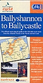
Fietskaart Noord-Ierland Belfast to Ballyshannon NN9B Cycle Map | Sustrans
van 10.99 voor 3.99!
€ 3,99
Wandelgidsen Noord-Ierland
Topografische kaarten Noord-Ierland
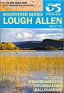
Topografische Wandelkaart Noord-Ierland 26 Lough Allen Discovery Map Northern Ireland
Wandelkaart & Fietskaart | Ordnance Survey (OS) Ireland
€ 18,99