- Gratis verzending vanaf 30 euro
- Levert in Nederland, België etc.
- Meer dan 30.000 titels
- Vakkundige klantenservice
- Snelle levering
- Veilig en eenvoudig betalen

Direct contact?
Bel +31 (0)6 42428571
maandag t/m vrijdag
van 10 tot 17 uur
Wandelgids Tour of the Queyras Cicerone Guidebooks
The GR58 and GR541 in the French Alps
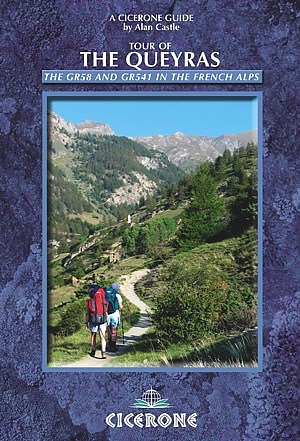
A guide to a backpacking tour of the Queyras region of the Haute Alps on the border between Italy and France, following the GR58 and GR541 trails. The route includes the highest point reached on any grand randonée with 24 cols above 2000m and options to climb up to 17 summits, five above 3000m.
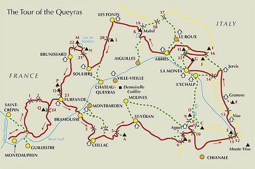
The Queyras is a dramatic, unspoilt region in the shadow of Monte Viso, sheltered to the west by the Ecrins, and is one of the
sunniest areas of the Alps. The absence of glaciers makes ideal hillwalking country, with several high mountain summits accessible
to the ordinary walker and scrambler and it's one of France"s best kept secrets! route described in 12 stages, with altitude profiles. High level, but generally moderate grade mountain walking. full details of facilities en route. several alternative routes and excursions. ideal as a first-time alpine walking tour or for the experienced mountain walker.
Engelstalig
EAN: 9781852845100
Auteur(s): Castle, a.
Uitgeverij: Cicerone Press
Verschijningsdatum: 2009
Meest recente editie
Engelstalig
189 pagina's
(Tijdelijk) niet leverbaar
- Vakkundige klantenservice
- Groot assortiment
- Gratis retourneren binnen 14 dagen
- Aangesloten bij WebwinkelKEUR
Meer producten die interessant kunnen zijn
Topografische kaarten Queyras / Haute Alpes

Topografische Wandelkaart van Frankrijk 3438ET - Embrun / Les Orres / Lac de Serre-Poncon Chorges, le Lauzet-Ubaye
Carte de Randonnee | Wandelkaart | Institut Geographique National (IGN) Frankrijk
€ 16,50

Topografische Wandelkaart van Frankrijk 3540OT - Barcelonnette / Pra-Loup / Le Sauze / Allos
Carte de Randonnee | Wandelkaart | Institut Geographique National (IGN) Frankrijk
€ 16,50

Topografische Wandelkaart van Frankrijk 3637OT - Mont Viso / St-Veran / Aiguilles / PNR du Queyras
Carte de Randonnee | Wandelkaart | Institut Geographique National (IGN) Frankrijk
€ 16,50

Topografische Wandelkaart van Frankrijk 3340ET - Digne-les-Bains Volonne / Sisteron / Les Mees Volonne
Carte de Randonnee | Wandelkaart | Institut Geographique National (IGN) Frankrijk
€ 16,50
Wandelkaarten Queyras / Haute Alpes
Wandelkaart Fietskaart 05 Brianconnais Queyras Top 75 | IGN
Institut Geographique National (IGN)
€ 11,99

Wandelkaart 06 Queyras Ubaye - Randonnee et Patrimoine | Libris Didier Richard
Tour du Viso | Tour du Queyras | Tour de l' Ubaye
€ 16,50
Wandelkaart Fietskaart 08 Ubaye Val d' Allos Lac de Serre-Poncon Top 75 | IGN
Institut Geographique National (IGN)
€ 11,99
Wandelroute GR5 Queyras / Haute Alpes
Wandelgids 505 GR 58 & GR 541 Tour Du Queyras | FFRP Topoguides
GR58 & GR541 | Ref. 505 | FFRP Topoguides
€ 18,99
Tijdelijk niet leverbaar