- Gratis verzending vanaf 30 euro
- Levert in Nederland, België etc.
- Meer dan 30.000 titels
- Vakkundige klantenservice
- Snelle levering
- Veilig en eenvoudig betalen

Direct contact?
Bel +31 (0)6 42428571
maandag t/m vrijdag
van 10 tot 17 uur
Wandelgids Wallis Walking in the Valais Cicerone Guidebooks

With the greatest collection of 4000m peaks in Western Europe and charming valleys and hillsides dotted with chalets and hay barns, the Valais represents the quintessential Alps. This walkers" paradise in southern Switzerland is located on both sides of the Rhone valley and includes the whole of the Pennine Alps, with France and Italy forming its southern and western borders. The region is crowned by iconic mountains including the Matterhorn, Dent Blanche, Monte Rosa and the Combin. It explores the deep valleys of the region including the Lotschental, Saastal, Mattertal, Val d'Anniviers, Val d"Hérens and Trient. There are pristine snowfields and long glacier tongues, meadows full of flowers and marmots that will eat out of your hand. Accommodation is plentiful, ranging from simple mountain huts and back-country dormitories and campsites, to the grandest of hotels, and the integrated public transport system is world-renowned. Routes wander from the popular Mattertal and Saastal valleys, to the quiet reaches of the Fieschertal and the picture-perfect Val d'Herens. A popular guidebook, this fourth edition continues to provide excellent routes for walkers of any ability gentle valley strolls, walks of moderate difficulty and strenuous, steep routes from accessible and tourist-friendly bases such as Saas Fee, Zermatt and Arolla. 111 day walks described in full, arranged valley by valley, with other route suggestions 10 multi-day tours for longer trips detailed guidance on valley bases, mountain huts, access and facilities
Engelstalig
EAN: 9781852847333
Auteur(s): Reynolds, k.
Uitgeverij: Cicerone Press
Verschijningsdatum: 2014
Meest recente editie
Engelstalig
316 pagina's


Op voorraad
Overmorgen in huis (Nederland)
- Vakkundige klantenservice
- Groot assortiment
- Gratis retourneren binnen 14 dagen
- Aangesloten bij WebwinkelKEUR
€ 23,99
Meer producten die interessant kunnen zijn
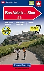
Topografische kaarten Wallis

Topografische Wandelkaart Zwitserland 2515 Zermatt Gornergrat (Samengestelde kaart) - Landeskarte der Schweiz
Wandelkaart | Bundesamt fur Landestopografie Swisstopo
€ 26,99
Topografische Wandelkaart Zwitserland 1269 Aletschgletscher Belalp - Riederalp - Bettmeralp - Fiesch - Landeskarte der Schweiz
Wandelkaart | Bundesamt fur Landestopografie Swisstopo
€ 14,99
Topografische Wandelkaart Zwitserland 292 Courmayeur Mont Blanc Mont Dolent Col du Gd. St. Bernard - Landeskarte der Schweiz
Wandelkaart en fietskaart | Bundesamt fur Landestopografie Swisstopo
€ 14,99
Topografische Wandelkaart Zwitserland 1346 Chanrion Grand Combin Lac de Mauvoisin Col de Riedmatten - Landeskarte der Schweiz
Wandelkaart | Bundesamt fur Landestopografie Swisstopo
€ 14,99
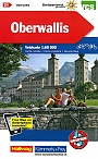
Wandelkaarten Wallis
Wandelkaart du Rhone aux Muverans TopoRando | Edition MPA
Tijdelijk niet leverbaar
Skikaarten Wallis
Skikaart Zwitserland 274S Visp Turtmann Fletschhorn Simplon - Landeskarte der Schweiz
Freizeitkarte | Skitourenkarten der Schweiz | Bundesamt fur Landestopografie Swisstopo
€ 25,99
Skikaart Zwitserland 283S Arolla (met: 293 Valpelline) Haute Route Evoléne Zinal - Landeskarte der Schweiz
Freizeitkarte | Skitourenkarten der Schweiz | Bundesamt fur Landestopografie Swisstopo
€ 25,99
Skikaart Zwitserland 273S Montana Wildhorn Vallon de Réchy Bella Tola - Landeskarte der Schweiz
Freizeitkarte | Skitourenkarten der Schweiz | Bundesamt fur Landestopografie Swisstopo
€ 25,99
Skikaart Zwitserland 282S Martigny Argentiére (F) Val Ferret Val d´Entremont - Landeskarte der Schweiz
Freizeitkarte | Skitourenkarten der Schweiz | Bundesamt fur Landestopografie Swisstopo
€ 25,99
Fietskaarten Wallis
Alpinisme Wallis
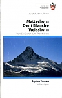
Klimgids Matterhorn/Dent Blanche/Weisshorn Schweizer Alpen Club
Alpine Touren zwischen Col Collon und Theodulpass
€ 49,99
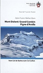
Klimgids Clubführer Walliser Alpen 1 & 2 Mont Dolent / Grand Combin / Pigne d'Arolla |Schweizer Alpen Club
vom Trient zum Col Collon
€ 49,99
Skigidsen Wallis
Skigids Walliser Alpen Rother Skiführer | Rother Bergverlag
53 Skitouren zwischen Furka und Grossem St. Bernhard
€ 14,90
Mountainbiken Wallis