- Gratis verzending vanaf 30 euro
- Levert in Nederland, België etc.
- Meer dan 30.000 titels
- Vakkundige klantenservice
- Snelle levering
- Veilig en eenvoudig betalen

Direct contact?
Bel +31 (0)6 42428571
maandag t/m vrijdag
van 10 tot 17 uur
Wandelgids The Cambrian Way Classic Wales mountain trek: Cardiff - Conwy | Cicerone

Dubbed 'the mountain connoisseurs' walk', the Cambrian Way stretches 479km between the mighty castles of Cardiff in the south and Conwy on the north coast. Traversing the heartland of Wales, the challenging route crosses the Brecon Beacons, the Cambrian Mountains and Snowdonia, passing through two national parks and visiting many of the country's iconic summits, including Pen y Fan, Pumlumon, Cadair Idris and Snowdon itself. It can be walked in three weeks (or in shorter sections) and is suitable for experienced hillwalkers with sound navigational skills. The guide presents the route in 21 stages, offering comprehensive route description illustrated with OS 1:50,000 mapping and elevation profiles. Details of accommodation and facilities are provided, along with a helpful trek planner showing their distribution along the route: although the trail passes through remote areas, it is possible to stay under a roof every night – though camping is also a possibility, should you prefer. There are background notes on Wales's history and geology and local points of interest, and a glossary of Welsh place-names, useful contacts and accommodation listings can be found in the appendices. From the Black Mountains to the Rhinogs, Glyderau and Carneddau, the route takes in lofty ridges, striking peaks and picturesque lakes. There are also fascinating glimpses into the country's ancient and more recent past: Iron Age hillforts, Norman castles, a Cistercian abbey, the Chartist Cave and relics from the mining industry. Offering superlative scenery, the Cambrian Way is a celebration of some of the best mountain walking Wales has to offer and promises a unique opportunity to immerse yourself in these celebrated landscapes.
Engelstalig
EAN: 9781852849900
Uitgeverij: Cicerone Press
Verschijningsdatum: 2019
Meest recente editie
Engelstalig


Op voorraad
Levertijd 4 dagen (Nederland)
- Vakkundige klantenservice
- Groot assortiment
- Gratis retourneren binnen 14 dagen
- Aangesloten bij WebwinkelKEUR
€ 19,99
Meer producten die interessant kunnen zijn
Wegenkaarten Wales
Wegenkaart - Landkaart 503 Wales & The Midlands - Michelin Regional
Wales, the Midlands, South West England 503
€ 11,50

Reisgidsen Wales


Reisgids Engeland Noord & Wales Trotter
De no-nonsensegids voor een allesomvattende trip.
€ 18,99
Tijdelijk niet leverbaar
Topografische kaarten Wales

Topografische Wandelkaart OL23 van Groot-Brittannië (1:25.000) Cadair Idris / Llyn Tegid - Explorer Map OL 23
Wandelkaart | Ordnance Survey (OS) Groot-Brittannië
€ 18,99

Topografische Wandelkaart 152 Newport / Pontypool - Explorer Map
Wandelkaart & Fietskaart | Ordnance Survey (OS) Groot-Brittannië
€ 18,99

Topografische Wandelkaart 189 Hereford & Ross-on-Wye - Explorer Map
Wandelkaart & Fietskaart | Ordnance Survey (OS) Groot-Brittannië
€ 18,99
Topografische Wandelkaart 215 Newtown / Machynlleth Llanfair Caereinion - Explorer Map
Wandelkaart & Fietskaart | Ordnance Survey (OS) Groot-Brittannië
€ 18,99
Fietskaarten Wales
Wandelkaarten Wales
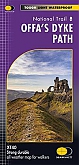
Wandelkaart Offa's Dyke Path National Trail Maps | Harvey Maps
Water- en scheurvaste wandelkaart
€ 25,99
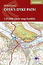
Wandelkaartgids Offa's Dyke Path - Wales | Cicerone
Handzaam wandelgidsje, alleen topografische kaarten met de wandelroute
€ 13,99