- Gratis verzending vanaf 30 euro
- Levert in Nederland, België etc.
- Meer dan 30.000 titels
- Vakkundige klantenservice
- Snelle levering
- Veilig en eenvoudig betalen

Direct contact?
Bel +31 (0)6 42428571
maandag t/m vrijdag
van 10 tot 17 uur
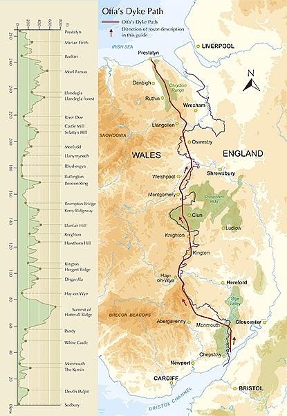
Wandelgids Offa's Dyke Path Cicerone Guidebooks
A journey through the border country of England and Wales

This guidebook to the Offas Dyke Path National Trail has been designed to allow some flexibility in following the official route, offering suggestions for circular walks covering sections of the dyke. The walk typically takes around two weeks to complete, while this is fully described, alternative routes to places of interest, or to find accommodation are included and form part of the total mileage quoted. Offas Dyke was constructed by the powerful King of Mercia in the late eighth century to mark out the western boundary of his kingdom. Hundreds of years later this is the inspiration for the 170-mile National Trail traversing the border country of England and Wales. Signed and waymarked throughout, the trail was opened in July 1971. The Offas Dike Path makes its way through varied, sometimes wild, often remote, and frequently superb scenery, linked by a succession of historic towns and attractive villages. Undertaken in its entirety the route offers an attractive, and at times demanding, prospect for the long-distance walker. Useful information on parking, maps required and distances are included.
Engelstalig
EAN: 9781852847760
Auteur(s): David hunter
Uitgeverij: Cicerone Press
Verschijningsdatum: 2016
Meest recente editie
Engelstalig
186 pagina's

Op voorraad
Levertijd 2 dagen (Nederland)
- Vakkundige klantenservice
- Groot assortiment
- Gratis retourneren binnen 14 dagen
- Aangesloten bij WebwinkelKEUR
€ 19,99
Meer producten die interessant kunnen zijn
Wegenkaarten Wales
Wegenkaart - Landkaart 503 Wales & The Midlands - Michelin Regional
Wales, the Midlands, South West England 503
€ 11,50

Reisgidsen Wales


Reisgids Engeland Noord & Wales Trotter
De no-nonsensegids voor een allesomvattende trip.
€ 18,99
Tijdelijk niet leverbaar
Topografische kaarten Wales

Topografische Wandelkaart OL23 van Groot-Brittannië (1:25.000) Cadair Idris / Llyn Tegid - Explorer Map OL 23
Wandelkaart | Ordnance Survey (OS) Groot-Brittannië
€ 18,99

Topografische Wandelkaart 152 Newport / Pontypool - Explorer Map
Wandelkaart & Fietskaart | Ordnance Survey (OS) Groot-Brittannië
€ 18,99

Topografische Wandelkaart 189 Hereford & Ross-on-Wye - Explorer Map
Wandelkaart & Fietskaart | Ordnance Survey (OS) Groot-Brittannië
€ 18,99
Topografische Wandelkaart 215 Newtown / Machynlleth Llanfair Caereinion - Explorer Map
Wandelkaart & Fietskaart | Ordnance Survey (OS) Groot-Brittannië
€ 18,99
Fietskaarten Wales

Wandelkaarten Wales
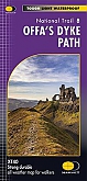
Wandelkaart Offa's Dyke Path National Trail Maps | Harvey Maps
Water- en scheurvaste wandelkaart
€ 25,99
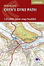
Wandelkaartgids Offa's Dyke Path - Wales | Cicerone
Handzaam wandelgidsje, alleen topografische kaarten met de wandelroute
€ 13,99