- Gratis verzending vanaf 30 euro
- Levert in Nederland, België etc.
- Meer dan 30.000 titels
- Vakkundige klantenservice
- Snelle levering
- Veilig en eenvoudig betalen

Direct contact?
Bel +31 (0)6 42428571
maandag t/m vrijdag
van 10 tot 17 uur
Wandelgids The Pembrokeshire Coast Path Cicerone Guidebooks
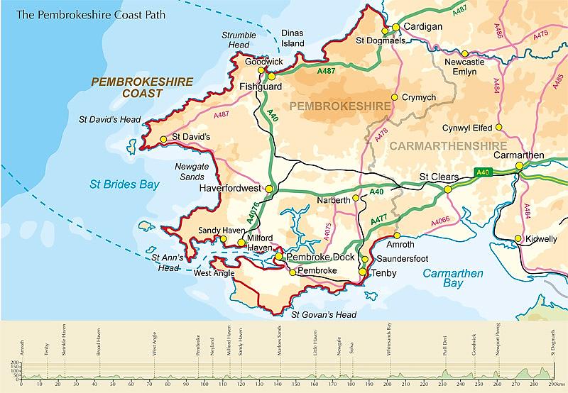
From Amroth to St Dogmaels
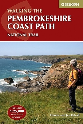
his guidebook describes the Pembrokeshire Coast Path National Trail, a scenic 180-mile long-distance walk from Amroth, near Tenby, to St Dogmaels, north of Newport. The route, which takes roughly two weeks to complete, is divided into 14 stages of between 9 and 16 miles. Neither technically demanding nor difficult to navigate, the trail is suitable both for experienced distance walkers and those looking to cut their teeth on a long-distance route.  Detailed two-way route instructions are accompanied by 1:100,000 OS mapping. A route summary table and comprehensive trek planner are also included, with invaluable information on transport, accommodation and facilities en route. The guidebook is packed with interesting snippets of information about the places, landscapes and wildlife encountered along the way. It also includes a 1:25,000 OS map booklet which shows the full route, providing all the mapping needed to complete the trail.  Showcasing the region's spectacular coastal scenery, this National Trail takes in soaring rugged cliffs, serene inlets, broad sandy beaches and quaint coastal villages as it follows the twists and turns of this magical coastal path.
Engelstalig
EAN: 9781852848156
Auteur(s): Dennis kelsall
Uitgeverij: Cicerone Press
Verschijningsdatum: 2016
Meest recente editie
Engelstalig
272 pagina's

(Tijdelijk) niet leverbaar
- Vakkundige klantenservice
- Groot assortiment
- Gratis retourneren binnen 14 dagen
- Aangesloten bij WebwinkelKEUR
Meer producten die interessant kunnen zijn
Wegenkaarten Wales

Wegenkaart - Landkaart 503 Wales & The Midlands - Michelin Regional
Wales, the Midlands, South West England 503
€ 11,50


Reisgidsen Wales


Reisgids Engeland Noord & Wales Trotter
De no-nonsensegids voor een allesomvattende trip.
€ 18,99
Tijdelijk niet leverbaar


Topografische kaarten Wales

Topografische Wandelkaart 152 Newport / Pontypool - Explorer Map
Wandelkaart & Fietskaart | Ordnance Survey (OS) Groot-Brittannië
€ 18,99

Topografische Wandelkaart 189 Hereford & Ross-on-Wye - Explorer Map
Wandelkaart & Fietskaart | Ordnance Survey (OS) Groot-Brittannië
€ 18,99
Topografische Wandelkaart 215 Newtown / Machynlleth Llanfair Caereinion - Explorer Map
Wandelkaart & Fietskaart | Ordnance Survey (OS) Groot-Brittannië
€ 18,99

Topografische Wandelkaart 262 Anglesey West Holyhead - Explorer Map
Wandelkaart & Fietskaart | Ordnance Survey (OS) Groot-Brittannië
€ 18,99
Fietskaarten Wales

Wandelkaarten Wales
Wandelkaart Offa's Dyke Path National Trail Maps | Harvey Maps
Water- en scheurvaste wandelkaart
€ 25,99