- Gratis verzending vanaf 30 euro
- Levert in Nederland, België etc.
- Meer dan 30.000 titels
- Vakkundige klantenservice
- Snelle levering
- Veilig en eenvoudig betalen

Direct contact?
Bel +31 (0)6 42428571
maandag t/m vrijdag
van 10 tot 17 uur
Wegenkaart Karjala Karelië ( Rusland ) | Karttakeskus Ulkoilukartta
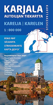
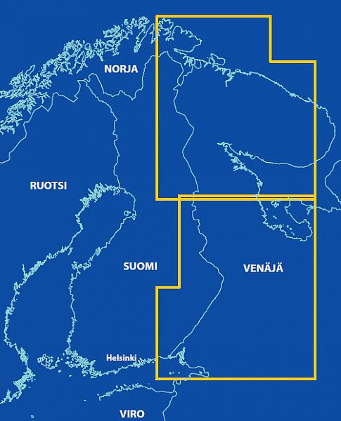
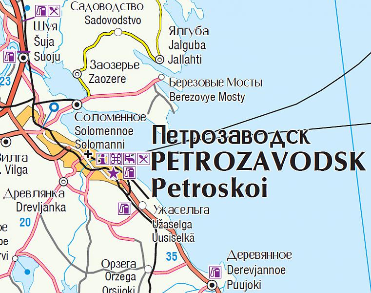
Heldere overzichtelijke wegenkaart van Karelië. Toeristische informatie door middel van pictogrammen. Stretching from Saint Petersburg to the Arctic Ocean, the map shows Russian Karelia and Murmansk Region. In the east it stretches to the east side of Lake Onega and the eastern part of the Kola Peninsula. Also the Finnish areas close to the national border are shown. The scale of the map is 1:800,000 (1 cm on the map = 8 km on the ground). Place names on the road map are both in the Russian and in the Latin alphabet, and also the old Finnish place names have been included. Roads are all clearly marked, as well as border crossings, petrol stations, sights and accommodations, for instance. The Karelian Road Map comes with nine detailed city maps: Saint Petersburg, Vyborg, Sortavala, Priozersk, Murmansk, Petrozavodsk, Pitkäranta, Lahdenpohja and Olonets.
Schaal: 1:800.000
Engelstalig Fins
EAN: 9789522665751
Uitgeverij: Karttakeskus Ulkoilukartta
Meest recente editie
Engelstalig Fins

Op voorraad
Overmorgen in huis (Nederland)
- Vakkundige klantenservice
- Groot assortiment
- Gratis retourneren binnen 14 dagen
- Aangesloten bij WebwinkelKEUR
€ 21,99