- Gratis verzending vanaf 30 euro
- Levert in Nederland, België etc.
- Meer dan 30.000 titels
- Vakkundige klantenservice
- Snelle levering
- Veilig en eenvoudig betalen

Direct contact?
Bel +31 (0)6 42428571
maandag t/m vrijdag
van 10 tot 17 uur
Gratis verzending vanaf 30 euro!
Wandelkaart Jura XT25 | Harvey Maps
Water- en scheurvaste wandelkaart

Shows the Paps of Jura and includes 1 Corbett and 2 Grahams.
This detailed map for hillwalkers shows the whole of the Isle of Jura at the popular 1:25,000 scale.
Jura's unusual raised beaches are well marked on the map.
Tough, light, durable and 100% waterproof. Genuine, original, HARVEY mapping. Opens directly to either side of the sheet. Easy to re-fold.
Schaal: 1:25.000
Engelstalig
Op voorraad
Overmorgen in huis (Nederland)
- Vakkundige klantenservice
- Groot assortiment
- Gratis retourneren binnen 14 dagen
- Aangesloten bij WebwinkelKEUR
€ 23,99
Meer producten die interessant kunnen zijn
Wandelgidsen Hebriden / Skye
Wandelgids Walking The Skye Trail | Cicerone Guidebook
A challenging backpacking route from Rubha Hunish to Broadford
€ 19,95
Wandelgids 03 Isle of Skye Pathfinder Guide
Pathfinder Guide 03 | Met Ordanance Survey kaarten
€ 17,99
Wandelgids Walking on the Isle of Arran Cicerone Guidebooks
The best low level walks and challenging mountain routes, including the Arran Coastal Way
€ 23,95
Wandelgids Walking on Harris and Lewis Cicerone Guidebooks
30 day walks on the Isles of Harris and Lewis
€ 21,99
Topografische kaarten Hebriden / Skye
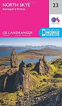
Topografische Wandelkaart 23 North Skye Dunvegan & Portree - Landranger Map
Wandelkaart & Fietskaart | Ordnance Survey (OS) Groot-Brittannië
€ 18,99
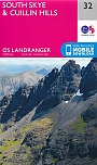
Topografische Wandelkaart 32 South Skye / Cuillin Hills - Landranger Map
Wandelkaart & Fietskaart | Ordnance Survey (OS) Groot-Brittannië
€ 18,99
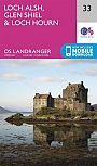
Topografische Wandelkaart 33 Loch Alsh / Glen Shiel / Loch Hourn - Landranger Map
Wandelkaart & Fietskaart | Ordnance Survey (OS) Groot-Brittannië
€ 18,99
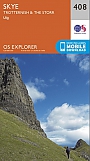
Topografische Wandelkaart 408 Skye / Trotternish / The Storr Uig - Explorer Map
Wandelkaart & Fietskaart | Ordnance Survey (OS) Groot-Brittannië
€ 18,99
Reisgidsen Hebriden / Skye
Reisgids Outer Hebrides | Bradt Travel Guide
The Western Isles of Scotland from Lewis to Barra
€ 20,99
Reisgids Isle of Skye & de Noordelijke eilanden van de Hebriden | Edicola
€ 24,50
Tijdelijk niet leverbaar
Wegenkaarten Hebriden / Skye
Fietsgidsen Hebriden / Skye
Alpinisme Hebriden / Skye
Klimgids Skye's Cuillin Ridge Traverse | Cicerone Guidebooks
Strategies, advice, detailed topo booklet and 10 classic scrambles
€ 25,99