- Gratis verzending vanaf 30 euro
- Levert in Nederland, België etc.
- Meer dan 30.000 titels
- Vakkundige klantenservice
- Snelle levering
- Veilig en eenvoudig betalen

Direct contact?
Bel +31 (0)6 42428571
maandag t/m vrijdag
van 10 tot 17 uur
Wandelgids Trekking in the Vanoise Tour of the Vanoise Cicerone Guidebooks
Tour of the Vanoise and the Tour des Glaciers de la Vanoise

This guide describes the eleven-day 163km Tour of the Vanoise and the five-day 72km Tour des Glaciers de la Vanoise, two fantastic hut-to-hut treks through the pristine Alpine landscapes of France's Vanoise National Park. Three other short treks - the Tour of the Eastern Vanoise, the Tour of the Western Vanoise and a Traverse of the Vanoise via the GR5 and GR55 - are also summarised. The routes tackle several passes in excess of 2500m but there are no glacier crossings, no significant scrambling and no lengthy paths exposed to either stonefall or vertigo-inspiring exposure (though optional variants may involve some slightly more challenging sections), and waymarking is usually clear - making this an ideal route for those new to Alpine trekking.
The guide contains everything you need to plan and walk the routes, with advice on travel to the region, accommodation and recommended kit. Clear route description, mapping and overview statistics are provided for each day stage, there are notes on the region's plants and wildlife and other points of interest, and accommodation listings and a handy glossary can be found in the appendices. Completing the package, the beautiful colour photos will call to your wanderlust.
The Vanoise is less well known than its neighbours Mont Blanc and the Ecrins massif but is equally beautiful. The scenery is quintessentially Alpine, with 3000m peaks decorated with gleaming glaciers and snowfields, valleys glistening with lakes and streams, towering moraine walls, impossibly steep rock slabs and, in the early summer, meadows extravagant with a riot of alpine flowers. A well-appointed network of refuges promises a warm welcome at the end of each day's walking. It's a perfect place to experience the pleasures of Alpine trekking and these routes offer the ideal opportunity to explore this magnificent region.
Engelstalig
EAN: 9781852848637
Auteur(s): Reynolds, k.
Uitgeverij: Cicerone Press
Verschijningsdatum: 2021
Meest recente editie
Engelstalig
192 pagina's


Op voorraad
Overmorgen in huis (Nederland)
- Vakkundige klantenservice
- Groot assortiment
- Gratis retourneren binnen 14 dagen
- Aangesloten bij WebwinkelKEUR
€ 23,50
Meer producten die interessant kunnen zijn
Topografische kaarten Ecrins / Vanoise / Haute Alpes
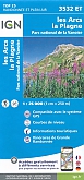
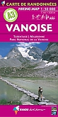
Topografische Wandelkaart van Frankrijk 3532ET - Les Arcs / La Plagne / PN de La Vanoise Tignes
Carte de Randonnee | Wandelkaart | Institut Geographique National (IGN) Frankrijk
€ 16,90
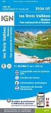
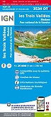
Topografische Wandelkaart van Frankrijk 3534OT - Les Trois Vallees / Modane PN de La Vanoise Courchevel Val Thorens Meribel-les-
Carte de Randonnee | Wandelkaart | Institut Geographique National (IGN) Frankrijk
€ 16,90
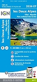
Topografische Wandelkaart van Frankrijk 3336ET - Deux Alpes-Olan-Muzelle Valjouffrey / PN des Ecrins
Carte de Randonnee | Wandelkaart | Institut Geographique National (IGN) Frankrijk
€ 16,90
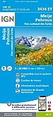
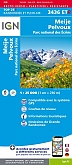
Topografische Wandelkaart van Frankrijk 3436ET - Meije / Pelvoux / PNR des Ecrins
Carte de Randonnee | Wandelkaart | Institut Geographique National (IGN) Frankrijk
€ 16,90
Wandelkaarten Ecrins / Vanoise / Haute Alpes
Wandelkaart 3436ETR Meije / Pelvoux / PNR des Ecrins Geplastificeerd | IGN
Geplastificeerde Wandelkaart | Institut Geographique National (IGN) Frankrijk
€ 21,50
Topografische wandelkaart 3534OTR Les Trois Vallees / Modane PN de La Vanoise Geplastificeerd | IGN
Geplastificeerde Wandelkaart | Institut Geographique National (IGN) Frankrijk | dubbelzijdig bedrukt
€ 21,50
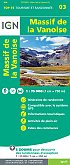
Wandelkaart Fietskaart 03 Massif de la Vanoise Top 75 | IGN
Institut Geographique National (IGN)
€ 11,99
Wandelroute GR5 Ecrins / Vanoise / Haute Alpes
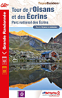
Wandelgids 508 Ecrins GR54 & GR541 Tour De L'oisans Et Des Ecrins | FFRP Topoguides
GR54 & GR541 | Ref. 508 | FFRP Topoguides
€ 18,99
Fietskaarten Ecrins / Vanoise / Haute Alpes
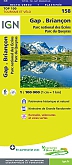
Fietskaart 158 Gap Briancon Parc National des Ecrins Parc de Queyras l'Alpe d'Huez - IGN Top 100 - Tourisme et Velo
Water- en scheurvaste fietskaart
€ 10,50