- Gratis verzending vanaf 30 euro
- Levert in Nederland, België etc.
- Meer dan 30.000 titels
- Vakkundige klantenservice
- Snelle levering
- Veilig en eenvoudig betalen

Direct contact?
Bel +31 (0)6 42428571
maandag t/m vrijdag
van 10 tot 17 uur
Wandelgids Alta Via 1 - Trekking in the Dolomites | Cicerone
Includes 1:25,000 map booklet

The Alta Via 1 is one of Italy's most famous and most popular long-distance routes and is the easiest of six Alta Via routes that traverse the magnificent Dolomites. The hut-to-hut trail extends 115km from Lago di Braies to La Pissa, boasting spectacular alpine vistas. Although it demands a moderate level of fitness, it is well waymarked and follows clear well-trodden paths, making for an ideal introduction to trekking in the Dolomites.
Welcoming refuges offer meals and accommodation along the way, though camping is also possible on the middle stages (restrictions apply elsewhere). The route is presented in 11 stages, each with overview statistics, a brief summary of the day's walking and detailed route description illustrated with clear mapping. There are also comprehensive notes on the huts the route passes, with contact details and tips on facilities available.
The intro includes advice on transport, accommodation and equipment, plus suggestions for creating shorter itineraries should time be limited, and there are facts about local points of interest and background information on the region's geology, plants and wildlife. A handy map booklet is also included, showing the full route of AV1 on 1:25,000 Kompass mapping, so you don't have to carry paper maps. Famed for their striking jagged peaks and sheer rock faces, the Dolomites also bear stark reminders of the turbulent World War I years in the shape of trenches and barracks.
The AV1 is a wonderful way to experience the celebrated scenery: (weather permitting) an estimated 80% of the Dolomites can be seen from the trail, with highlights including fantastic views of the Tofane, Pelmo and Civetta and the iconic Marmolada with its glacier. If this is your first visit to the region, you'll soon see why so many fall under its spell!
Schaal: 1:25.000
Engelstalig
EAN: 9781786310811
Uitgeverij: Cicerone Press
Verschijningsdatum: 2022
Meest recente editie
Engelstalig
112 pagina's


Op voorraad
Levertijd 3 dagen (Nederland)
- Vakkundige klantenservice
- Groot assortiment
- Gratis retourneren binnen 14 dagen
- Aangesloten bij WebwinkelKEUR
€ 22,90
Meer producten die interessant kunnen zijn
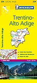
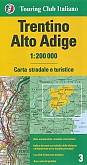
Wandelkaarten Dolomieten / Südtirol / Trentino

Koopjes Dolomieten / Südtirol / Trentino
Wegenkaarten Dolomieten / Südtirol / Trentino
Klettersteigen Dolomieten / Südtirol / Trentino
Klimgids Via Ferratas of the Italian Dolomites: Volume 1 Cicerone Guidebooks
75 routes - north, central and east ranges
€ 24,90
Wandelgids Via Ferratas of the Italian Dolomites: Volume 2 Cicerone Guidebooks
Southern Dolomites, Brenta and Lake Garda area
€ 23,99
Klimgids Klettersteige Dolomieten Brenta Gardasee Rother Wanderführer Special | Rother Bergverlag
80 ausgewählte Klettersteige zwischen Sexten und Riva
€ 19,90
Fietsgidsen Dolomieten / Südtirol / Trentino
Fietsgids Sudtirol Radatlas Bikeline Esterbauer
Radwandern im Eisacktal, Brenner-Bozen, Pustertal, Etschtal und im Vinschgau, 880km, 1:75.000, GPS-Tracks Download
€ 16,90

Fietsgids Via Claudia Augusta Bikeline Esterbauer
Bike Line Gids: Von der Donau über die Alpen an die Adria (800 km)
€ 15,90
Fietskaarten Dolomieten / Südtirol / Trentino
Fietskaart 28 Südtirol, Trentino, Gardasee | ADFC Radtourenkarte - BVA Bielefelder Verlag
Water- en scheurvaste fietskaart
€ 13,90
Fietskaart Sudtirol Dolomiten Bikeline Esterbauer
Bike Line Kaart: Bozen, Bruneck, Eisacktal, Pustertal
€ 8,99