- Gratis verzending vanaf 30 euro
- Levert in Nederland, België etc.
- Meer dan 30.000 titels
- Vakkundige klantenservice
- Snelle levering
- Veilig en eenvoudig betalen

Direct contact?
Bel +31 (0)6 42428571
maandag t/m vrijdag
van 10 tot 17 uur
Wandelgids The Isle of Mull Cicerone Guidebooks
Mull, Ulva, Gometra, Iona & Erraid

Guidebook describing over 40 walking routes on Scotland's beautiful Isle of Mull, as well as neighbouring Ulva, Gometra, Iona and Erraid. Walks range from 2 to 16 miles and from short circuits to demanding mountain traverses, but without technical difficulties. The Isle of Mull is wild, rugged and great for wildlife spotting. Activities walking Seasons walking possible throughout the year, although the winter months call for winter mountaineering skills and equipment on the higher mountains Centres Tobermory; smaller settlements at Dervaig, Salen, the ferryport Craignure, Bunessan and Ffionphort, the ferry point for Iona; accommodation plentiful, but camp sites and budget hostels few and far between Difficulty few technical difficulties; walks cross rough, trackless terrain requiring walkers to be properly equipped and able to use map and compass Must See Mull's only Munro, Ben More, and a fine cast of lower heights; great glens for linear walks as good as anything on mainland Scotland; spectacular coastline; wildlife
Engelstalig
EAN: 9781852849610
Auteur(s): Terry marsh
Uitgeverij: Cicerone Press
Verschijningsdatum: 2017
Meest recente editie
Engelstalig
208 pagina's


Op voorraad
Overmorgen in huis (Nederland)
- Vakkundige klantenservice
- Groot assortiment
- Gratis retourneren binnen 14 dagen
- Aangesloten bij WebwinkelKEUR
€ 19,99
Meer producten die interessant kunnen zijn
Topografische kaarten Hebriden / Skye
Topografische Wandelkaart 23 North Skye Dunvegan & Portree - Landranger Map
Wandelkaart & Fietskaart | Ordnance Survey (OS) Groot-Brittannië
€ 18,99
Topografische Wandelkaart 32 South Skye / Cuillin Hills - Landranger Map
Wandelkaart & Fietskaart | Ordnance Survey (OS) Groot-Brittannië
€ 18,99
Topografische Wandelkaart 33 Loch Alsh / Glen Shiel / Loch Hourn - Landranger Map
Wandelkaart & Fietskaart | Ordnance Survey (OS) Groot-Brittannië
€ 18,99
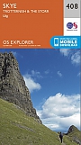
Topografische Wandelkaart 408 Skye / Trotternish / The Storr Uig - Explorer Map
Wandelkaart & Fietskaart | Ordnance Survey (OS) Groot-Brittannië
€ 18,99
Reisgidsen Hebriden / Skye
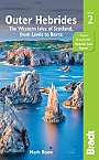
Reisgids Outer Hebrides | Bradt Travel Guide
The Western Isles of Scotland from Lewis to Barra
€ 20,99
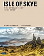
Reisgids Isle of Skye & de Noordelijke eilanden van de Hebriden | Edicola
€ 24,50
Tijdelijk niet leverbaar
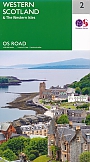
Wegenkaarten Hebriden / Skye
Wandelkaarten Hebriden / Skye
Alpinisme Hebriden / Skye
Klimgids Skye's Cuillin Ridge Traverse | Cicerone Guidebooks
Strategies, advice, detailed topo booklet and 10 classic scrambles
€ 25,99