- Gratis verzending vanaf 30 euro
- Levert in Nederland, België etc.
- Meer dan 30.000 titels
- Vakkundige klantenservice
- Snelle levering
- Veilig en eenvoudig betalen

Direct contact?
Bel +31 (0)6 42428571
maandag t/m vrijdag
van 10 tot 17 uur
Wandelgids St Cuthbert's Way Rucksack Readers

Rucksack Readers zijn handig uitgevoerd in een klapper met ringband. Deze gids heeft een goede beschrijving van de lange afstands route met overzichtelijke kaarten doch zonder veel detail. De kracht van de Rucksack Readers is de uitgebreide achtergrondinformatie over de flora, fauna en geologische verschijnselen. Dit alles rijkelijk omkleed met kleurrijke foto's en praktische tips. Follow the footsteps of St Cuthbert in this easy-going walk of 63 miles (101 km) from Melrose Abbey in the Scottish Borders to the Holy Island of Lindisfarne in Northumberland. St Cuthbert's Way is one of Scotland's Great Trails, and it is also one of England's great trails. Starting from the ruins of Melrose Abbey, it winds alongside the River Tweed, and after about 31 miles you walk across the border into England on high ground.
The Way includes a section of Roman road and passes castles, hill forts and historic ruins along the way. Most people will complete it comfortably within 5 or 6 days. Its summit is Wideopen Hill (369m/1210ft), and its barefoot finale is the Pilgrim Way to Lindisfarne with its priory and castle.
The route is fully waymarked, the gradients are modest and it has welcoming B&Bs and pubs at strategic intervals. This second edition was thoroughly revised in 2023 and it contains custom mapping at 1:40,000 and many post-Covid updates. It is bound in our lighter, pocket-friendly format and printed on rainproof paper.
Engelstalig
EAN: 9781913817138
Auteur(s): Turnbull, r.
Uitgeverij: Rucksack Readers
Serie: Rucksack Readers Schot
Verschijningsdatum: 2023
Meest recente editie
Engelstalig
72 pagina's


Op voorraad
Overmorgen in huis (Nederland)
- Vakkundige klantenservice
- Groot assortiment
- Gratis retourneren binnen 14 dagen
- Aangesloten bij WebwinkelKEUR
€ 23,99
Verder in deze serie

- Wandelgids Arran Coastal Way Rucksack Readers
- Wandelgids Borders Abbeys Way Rucksack Readers
- Wandelgids Cateran Trail Rucksack Readers
- Wandelgids Fife Coastal Path Trail Rucksack Readers
- Wandelgids Great Glen Way Rucksack Readers
- Wandelgids John Muir Trail Rucksack Readers
- Wandelgids Kintyre Way Rucksack Readers
- Wandelgids Rob Roy Way Rucksack Readers
- Wandelgids West Highland Way Rucksack Readers
Meer producten die interessant kunnen zijn
Topografische kaarten Centraal-Schotland / Ben Nevis
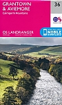
Topografische Wandelkaart 36 Grantown / Aviemore Cairngorm Mountains - Landranger Map
Wandelkaart & Fietskaart | Ordnance Survey (OS) Groot-Brittannië
€ 18,99
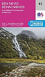
Topografische Wandelkaart 41 Ben Nevis / Fort William / Glen Coe - Landranger Map
Wandelkaart & Fietskaart | Ordnance Survey (OS) Groot-Brittannië
€ 18,99

Topografische Wandelkaart 392 Ben Nevis / Fort William The Mamores & The Grey Corries Kinlochleven & Spean Bridge - Explorer Map
Wandelkaart & Fietskaart | Ordnance Survey (OS) Groot-Brittannië
€ 18,99
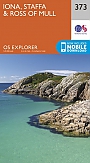
Topografische Wandelkaart 373 Iona / Staffa / Ross of Mull - Explorer Map
Wandelkaart & Fietskaart | Ordnance Survey (OS) Groot-Brittannië
€ 18,99
Wandelkaarten Centraal-Schotland / Ben Nevis
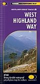
Wandelkaart West Highland Way - National Trail Maps | Harvey Maps
Water- en scheurvaste wandelkaart
€ 25,99
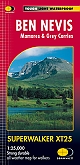
Wandelkaart Ben Nevis - Walking Maps Superwalker | Harvey Maps
Water- en scheurvaste wandelkaart
€ 25,99
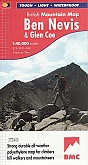
Wandelkaart Ben Nevis and Glen Coe - Mountain Map | Harvey Maps
Water- en scheurvaste wandelkaart
€ 28,99
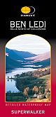
Wandelkaart Ben Ledi & Hills North of Callander - Walking Maps Superwalker | Harvey Maps
Water- en scheurvaste wandelkaart
€ 17,99