- Gratis verzending vanaf 30 euro
- Levert in Nederland, België etc.
- Meer dan 30.000 titels
- Vakkundige klantenservice
- Snelle levering
- Veilig en eenvoudig betalen

Direct contact?
Bel +31 (0)6 42428571
maandag t/m vrijdag
van 10 tot 17 uur
Wandelkaart Jasper National Park Map and Guide | Gem Trek Publishing
Water- en scheurvaste wandelkaart

Whether you are a first-time visitor or a long-time local, you’ll find Gem Trek’s Jasper National Park Map to be an invaluable tool. Researched and designed by locals, and printed in Canada, this map features accurate cartography and subtly colored relief that puts the mountainous region in perspective. The map is printed on high-quality synthetic waterproof paper that can be folded and refolded hundreds of times.
The 1:250,000 scale is ideal for discovering the very best of Jasper National Park. Highlights and our recommended hiking trails are marked by numbered stars, then cross-referenced on the reverse side with descriptions. Also included are all mountains and their elevations, along with natural features such as waterfalls, hot springs, and glaciers.
In addition to descriptions for the top highlights and most popular hiking trails, the reverse side has inset maps for the town of Jasper and the Columbia Icefield. There are also descriptions of the park’s geology, history, wildlife, and eco-regions. Practical information on outdoor activities, weather, campgrounds, lodging, and transportation allows map users to plan their trip accordingly. Map Coverage The Jasper National Park Map covers all of Jasper National Park in the Canadian Rockies. Coverage extends from Willmore Wilderness Park in the north to Banff National Park in the south. It also includes sections of Mount Robson Provincial Park and Hamber Provincial Park, which are all on the western side of the Continental Divide in British Columbia. Eastern coverage extends to the Coal Branch and Hinton. Map Features The Jasper National Park Map features: - waterproof and tear-resistant paper - relief shading to better show the topography - full colour on both sides - hydrology rivers, rapids and waterfalls - mountain names and all available mountain elevations - all campgrounds with a handy chart showing campground details - points of interest and attractions as well as day use areas and highway viewpoints.
Schaal: 1:210.000
Engelstalig
EAN: 9781990161018
Uitgeverij: Gem Trek Publishing (Canada)
Serie: Gem Trek Wandelkaart
Verschijningsdatum: 2023
Meest recente editie
Engelstalig


Op voorraad
Levertijd 2 dagen (Nederland)
- Vakkundige klantenservice
- Groot assortiment
- Gratis retourneren binnen 14 dagen
- Aangesloten bij WebwinkelKEUR
€ 15,99
Verder in deze serie

- Wandelkaart 1 Jasper National Park & Maligne Lake | Gem Trek Publishing
- Wandelkaart 2 Columbia Icefield Guide & Map | Gem Trek Publishing
- Wandelkaart 3 Bow Lake & Saskatchewan Crossing | Gem Trek Publishing
- Wandelkaart 4 Lake Louise & Yoho | Gem Trek Publishing
- Wandelkaart 5 Banff & Mount Assiniboine | Gem Trek Publishing
- Wandelkaart 6 Canmore & Kananaskis Village | Gem Trek Publishing
- Wandelkaart 7 Kananaskis Lakes (Peter Lougheed Provincial Park) | Gem Trek Publishing
- Wandelkaart 8 Bragg Creek & Sheep Valley | Gem Trek Publishing
- Wandelkaart 8 Bragg Creek & Sheep Valley | Gem Trek Publishing
- Wandelkaart 9 Highwood & Cataract Creek | Gem Trek Publishing
- Wandelkaart 10 Kootenay National Park | Gem Trek Publishing
- Wandelkaart 10 Kootenay National Park | Gem Trek Publishing
- Wandelkaart 11 Banff Up-Close | Gem Trek Publishing
- Wandelkaart 12 Best of Jasper | Gem Trek Publishing
- Wandelkaart 13 Best of Lake Louise | Gem Trek Publishing
- Wandelkaart 14 Lake O'hara | Gem Trek Publishing
- Wandelkaart 16 Waterton Lakes National Park | Gem Trek Publishing
- Wandelkaart 17 Banff: Egypt Lake | Gem Trek Map
- Wegenkaart Best of Icefield Parkway | Gem Trek Publishing
Meer producten die interessant kunnen zijn
Wegenkaarten British-Columbia
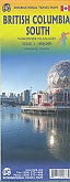
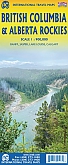
Wegenkaart - landkaart British Columbia & Alberta Rockies | ITMB
Banff Jasper Lake Louise Calgary
€ 13,50
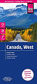
Wegenkaart - Landkaart West Canada - World Mapping Project (Reise Know-How)
Water- en scheurvaste wegenkaart
€ 13,50
Reisgidsen British-Columbia
Reisgids British Columbia & the Canadian Rockies Lonely Planet (Country Guide)
€ 20,90
Tijdelijk niet leverbaar
Wildlife-gidsen British-Columbia
Natuurgids British Columbia Wildlife | Waterford Press
A Folding Pocket Guide to Familiar Animals
€ 9,95
Wandelgidsen British-Columbia
Topografische kaarten British-Columbia
Topografische Wandelkaart Canadian Rockies Banff, Kootenay, Yoho Park 82J/K/N/O - ITMB Map
Water- en scheurvaste wandelkaart
€ 13,50