- Gratis verzending vanaf 30 euro
- Levert in Nederland, België etc.
- Meer dan 30.000 titels
- Vakkundige klantenservice
- Snelle levering
- Veilig en eenvoudig betalen

Direct contact?
Bel +31 (0)6 42428571
maandag t/m vrijdag
van 10 tot 17 uur
Wandelkaart 14 Lake O'hara | Gem Trek Publishing
Water- en scheurvaste wandelkaart

Detailed map of the Lake O"Hara area publoshed by Gem Trek. On the front is a 1:20,000-scale topographic map covering the entire Lake O"Hara trail network with all of the hiking trails and alpine routes labelled. The contour interval on the map is 25 metres (80 feet).
On the back of the map are descriptions of all the trails shown on the map Lake O"Hara Lakeshore, Lake Oesa, Lake McArthur, Opabin Plateau, and Linda Lake to Cathedral Prospect. Also described is the entire alpine route Wiwaxy Gap/Huber Ledges, Yukness Ledges, All Souls" and Odaray Grandview Prospect.
Schaal: 1:20.000
Engelstalig
EAN: 9781895526950
Uitgeverij: Gem Trek Publishing (Canada)
Serie: Gem Trek Wandelkaart
Meest recente editie
Engelstalig


Op voorraad
Levertijd 3 dagen (Nederland)
- Vakkundige klantenservice
- Groot assortiment
- Gratis retourneren binnen 14 dagen
- Aangesloten bij WebwinkelKEUR
€ 8,99
Verder in deze serie

- Wandelkaart 1 Jasper National Park & Maligne Lake | Gem Trek Publishing
- Wandelkaart 2 Columbia Icefield Guide & Map | Gem Trek Publishing
- Wandelkaart 3 Bow Lake & Saskatchewan Crossing | Gem Trek Publishing
- Wandelkaart 4 Lake Louise & Yoho | Gem Trek Publishing
- Wandelkaart 5 Banff & Mount Assiniboine | Gem Trek Publishing
- Wandelkaart 6 Canmore & Kananaskis Village | Gem Trek Publishing
- Wandelkaart 7 Kananaskis Lakes (Peter Lougheed Provincial Park) | Gem Trek Publishing
- Wandelkaart 8 Bragg Creek & Sheep Valley | Gem Trek Publishing
- Wandelkaart 8 Bragg Creek & Sheep Valley | Gem Trek Publishing
- Wandelkaart 9 Highwood & Cataract Creek | Gem Trek Publishing
- Wandelkaart 10 Kootenay National Park | Gem Trek Publishing
- Wandelkaart 10 Kootenay National Park | Gem Trek Publishing
- Wandelkaart 11 Banff Up-Close | Gem Trek Publishing
- Wandelkaart 12 Best of Jasper | Gem Trek Publishing
- Wandelkaart 13 Best of Lake Louise | Gem Trek Publishing
- Wandelkaart 16 Waterton Lakes National Park | Gem Trek Publishing
- Wandelkaart 17 Banff: Egypt Lake | Gem Trek Map
- Wandelkaart Jasper National Park Map and Guide | Gem Trek Publishing
- Wegenkaart Best of Icefield Parkway | Gem Trek Publishing
Meer producten die interessant kunnen zijn
Wegenkaarten British-Columbia
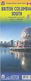
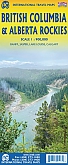
Wegenkaart - landkaart British Columbia & Alberta Rockies | ITMB
Banff Jasper Lake Louise Calgary
€ 13,50
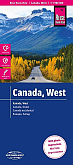
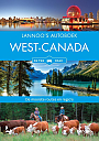
Wegenkaart - Landkaart West Canada - World Mapping Project (Reise Know-How)
Water- en scheurvaste wegenkaart
€ 13,50
Reisgidsen British-Columbia
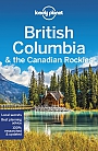
Reisgids British Columbia & the Canadian Rockies Lonely Planet (Country Guide)
€ 20,90
Tijdelijk niet leverbaar
Wildlife-gidsen British-Columbia
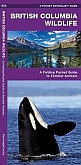
Natuurgids British Columbia Wildlife | Waterford Press
A Folding Pocket Guide to Familiar Animals
€ 9,95
Wandelgidsen British-Columbia
Topografische kaarten British-Columbia
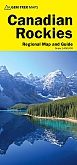
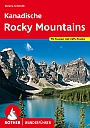
Topografische Wandelkaart Canadian Rockies Banff, Kootenay, Yoho Park 82J/K/N/O - ITMB Map
Water- en scheurvaste wandelkaart
€ 13,50