- Gratis verzending vanaf 30 euro
- Levert in Nederland, België etc.
- Meer dan 30.000 titels
- Vakkundige klantenservice
- Snelle levering
- Veilig en eenvoudig betalen

Direct contact?
Bel +31 (0)6 42428571
maandag t/m vrijdag
van 10 tot 17 uur
Wegenkaart - landkaart British Columbia & Alberta Rockies | ITMB
Banff Jasper Lake Louise Calgary

De ITMB kaarten kenmerken zich door een kleurrijke en volle cartografische weergave. Het zijn degelijke kaarten, zeker voor gebieden waarvoor kaarten lastig te krijgen zijn, met aanduidingen van onder andere nationale parken en natuurgebieden, vliegvelden, toeristische bezienswaardigheden en een goede aanduiding van het wegennet. Daarnaast bevatten enkele kaarten ook stadsplattegronden (hoofdsteden of belangrijke centra). Bevat voor sommige landen ook aanduidingen in de orginele taal. The Rocky Mountain chain forms the boundary between the Canadian provinces of Alberta and British Columbia. There are only three passes through the mountain chain, which somewhat isolates BC from the rest of Canada (a mixed blessing). The Rockies are also the paramount travel attraction of Canada, nice though our many lakes, waterfalls, and cities happen to be. This double-sided map covers the three national parks of Banff, Jasper, and Yoho, and several provincial parks on both sides of the border, which also forms the continental divide between rivers flowing to the Pacific or to the Atlantic, covering from Calgary to the northern portion of the Fraser Canyon on one side, and the more northerly stretch of the Rockies from Fort St. John to the Yukon. Good inset maps of Calgary, Banff, Jasper, and Lake Louise are included. The focus of this map is its many recreational opportunities, with an emphasis on campgrounds, ski areas, historic sites, and secondary roads. The area of coverage is vast; the size of Western Europe, and straddles two time zones.
Schaal: 1:900.000
Engelstalig
EAN: 9781771291064
Uitgeverij: ITMB (International Tavel Maps & Books)
Serie: British-Columbia ITM
Verschijningsdatum: 2023
Meest recente editie
Engelstalig


Op voorraad
Levertijd 2 dagen (Nederland)
- Vakkundige klantenservice
- Groot assortiment
- Gratis retourneren binnen 14 dagen
- Aangesloten bij WebwinkelKEUR
€ 13,50
Verder in deze serie
- Topografische Wandelkaart 92G/7 N Vancouver Pt. Coquitlam - ITMB Map
- Topografische Wandelkaart Bowron Lakes Travel Refer. map 93H2/3/6/7 - ITMB Map
- Topografische Wandelkaart Lower Mainland Richmond and New Westminster BC 92G/G2/G3 - ITMB Map
- Wandelkaart - Fietskaart North & West Vancouver Biking & Hiking - ITMB Map
- Wandelkaart 83D Wells Gray Park - ITMB Map
- Wandelkaart Garibaldi Provincial Park (BC) - ITMB Map
- Wandelkaart Gulf Islands (BC) - ITMB Map
- Wandelkaart Prince Edward Island - ITMB Map
- Wandelkaart West Coast Trail & Carmanah Valley - ITMB Map
- Wandelkaart Whistler Sea to Sky Highway - ITMB Map
- Wegenkaart - Landkaart British Columbia South - ITMB Map Best Map!!
- Wegenkaart - Landkaart British Columbia Vancouver | ITMB Map
- Wegenkaart - Landkaart Fraser Valley / Vancouver's North Shore hiking Trails - ITMB Map
- Wegenkaart - Landkaart Sunshine Coast / British Columbia Zuidwest | ITM
- Wegenkaart - Landkaart Vancouver's Northshore Hiking Trails - ITMB Map
- Wegenkaart - Landkaart Vancouver Island Victoria Tofino Region - ITMB Map
- Wegenkaart - landkaart Jasper National Park & Northern Alberta Edmonton | ITMB
- Wegenkaart - landkaart Northern British Columbia | ITMB
- Wegenkaart - landkaart Queen Charlotte Islands - Haida Gwai | ITMB
- Wegenkaart - landkaart Vancouver Island south - Victoria | ITMB
- Wegenkaart - landkaart Washington State - British Columbia southwest | ITMB
Meer producten die interessant kunnen zijn
Wandelkaarten British-Columbia
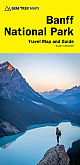
Wegenkaart - Landkaart 1 Banff National Park Map and Guide | Gem Trek Publishing
Water- en scheurvaste wandelkaart
€ 15,99
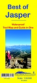
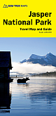
Wandelkaart Jasper National Park Map and Guide | Gem Trek Publishing
Water- en scheurvaste wandelkaart
€ 15,99
Reisgidsen British-Columbia
Reisgids British Columbia & the Canadian Rockies Lonely Planet (Country Guide)
€ 20,90
Tijdelijk niet leverbaar
Wandelgidsen British-Columbia
Wildlife-gidsen British-Columbia
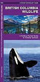
Natuurgids British Columbia Wildlife | Waterford Press
A Folding Pocket Guide to Familiar Animals
€ 9,95
Topografische kaarten British-Columbia
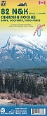
Topografische Wandelkaart Canadian Rockies Banff, Kootenay, Yoho Park 82J/K/N/O - ITMB Map
Water- en scheurvaste wandelkaart
€ 13,50