Wegenkaart - Landkaart 1 Banff National Park Map and Guide | Gem Trek Publishing
Water- en scheurvaste wandelkaart
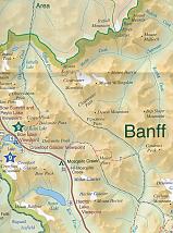
Topographic map and guide of Banff National Park (Alberta, British Columbia) published by Gem Trek. Contours, campgrounds, hiking trails and detailed legend. This user-friendly map-guide includes a 1:250,00-scale poster-quality map of Canada"s most popular national park, as well as useful and entertaining information about everything from mountain building to Banff Park wildlife.
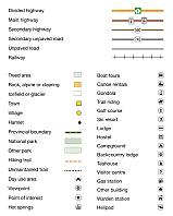
The map covers Banff National Park as well as Yoho and Kootenay national parks. It shows roads, viewpoints, attractions, lodges and glaciers, and gives the name and elevation of mountains.
Contour lines at 200-metre (650-ft) intervals. The map also shows official park trails, although it is not intended as a hiking map.
On the back of the map are photos and descriptions of the highlights of the park, including sights and attractions in Banff townsite and area, Lake Louise, and along the Icefields Parkway.
Schaal: 1:250.000
Engelstalig
EAN: 9781895526998
Auteur(s): Algemeen
Uitgeverij: Gem Trek Publishing (Canada)
Serie: Gem Trek Wegenkaart
Verschijningsdatum: 2023
Meest recente editie
Engelstalig
Op voorraad
Vóór 17 uur besteld, morgen in huis (Nederland)
- Vakkundige klantenservice
- Groot assortiment
- Gratis retourneren binnen 14 dagen
- Aangesloten bij WebwinkelKEUR
€ 15,99
Verder in deze serie
Meer producten die interessant kunnen zijn
Wegenkaarten British-Columbia
Wegenkaart - landkaart British Columbia & Alberta Rockies | ITMB
Banff Jasper Lake Louise Calgary
€ 13,50
Wandelgidsen British-Columbia
Topografische kaarten British-Columbia
Topografische Wandelkaart Canadian Rockies Banff, Kootenay, Yoho Park 82J/K/N/O - ITMB Map
Water- en scheurvaste wandelkaart
€ 13,50


