- Gratis verzending vanaf 30 euro
- Levert in Nederland, België etc.
- Meer dan 30.000 titels
- Vakkundige klantenservice
- Snelle levering
- Veilig en eenvoudig betalen

Direct contact?
Bel +31 (0)6 42428571
maandag t/m vrijdag
van 10 tot 17 uur
Wandelkaart 9 Highwood & Cataract Creek | Gem Trek Publishing
Water- en scheurvaste wandelkaart

Hiking Map & Guide of South Kananaskis (Alberta, British Columbia) published by Gem Trek. Contour lines at 25-metre intervals (80 ft.), hiking trails with detailed explanations, campsites, hotels, outdoor activities and detailed legend. This map in Gem Trek"s Kananaskis Country series, covers south Kananaskis Country from Sheep River Falls in the north to Plateau Mountain in the south. It extends coverage south where the Bragg Creek-Sheep Valley map leaves off, and east where the Kananaskis Lakes map leaves off. It covers the trails southeast of Highwood Pass.
Popular trails on this map include Sheep River Trail, Junction Fire Lookout, Picklejar Lakes, Mt. Lipsett, Mist Ridge, Zephyr Creek, Grass Pass, Bull Creek Hills, Mt. Burke and Raspberry Ridge.
On the back of the map are trail descriptions and photos of 18 recommended day hikes, plus contact information for visitor centres, campgrounds, hotels and lodges.
Schaal: 1:50.000
Engelstalig
EAN: 9781895526066
Uitgeverij: Gem Trek Publishing (Canada)
Serie: Gem Trek Wandelkaart
Meest recente editie
Engelstalig


(Tijdelijk) niet leverbaar
- Vakkundige klantenservice
- Groot assortiment
- Gratis retourneren binnen 14 dagen
- Aangesloten bij WebwinkelKEUR
Verder in deze serie

- Wandelkaart 1 Jasper National Park & Maligne Lake | Gem Trek Publishing
- Wandelkaart 2 Columbia Icefield Guide & Map | Gem Trek Publishing
- Wandelkaart 3 Bow Lake & Saskatchewan Crossing | Gem Trek Publishing
- Wandelkaart 4 Lake Louise & Yoho | Gem Trek Publishing
- Wandelkaart 5 Banff & Mount Assiniboine | Gem Trek Publishing
- Wandelkaart 6 Canmore & Kananaskis Village | Gem Trek Publishing
- Wandelkaart 7 Kananaskis Lakes (Peter Lougheed Provincial Park) | Gem Trek Publishing
- Wandelkaart 8 Bragg Creek & Sheep Valley | Gem Trek Publishing
- Wandelkaart 8 Bragg Creek & Sheep Valley | Gem Trek Publishing
- Wandelkaart 10 Kootenay National Park | Gem Trek Publishing
- Wandelkaart 10 Kootenay National Park | Gem Trek Publishing
- Wandelkaart 11 Banff Up-Close | Gem Trek Publishing
- Wandelkaart 12 Best of Jasper | Gem Trek Publishing
- Wandelkaart 13 Best of Lake Louise | Gem Trek Publishing
- Wandelkaart 14 Lake O'hara | Gem Trek Publishing
- Wandelkaart 16 Waterton Lakes National Park | Gem Trek Publishing
- Wandelkaart 17 Banff: Egypt Lake | Gem Trek Map
- Wandelkaart Jasper National Park Map and Guide | Gem Trek Publishing
- Wegenkaart Best of Icefield Parkway | Gem Trek Publishing
Meer producten die interessant kunnen zijn
Wegenkaarten British-Columbia
Wegenkaart - landkaart British Columbia & Alberta Rockies | ITMB
Banff Jasper Lake Louise Calgary
€ 13,50
Wegenkaart - Landkaart West Canada - World Mapping Project (Reise Know-How)
Water- en scheurvaste wegenkaart
€ 13,50
Reisgidsen British-Columbia
Reisgids British Columbia & the Canadian Rockies Lonely Planet (Country Guide)
€ 20,90
Tijdelijk niet leverbaar
Wildlife-gidsen British-Columbia
Natuurgids British Columbia Wildlife | Waterford Press
A Folding Pocket Guide to Familiar Animals
€ 9,95
Wandelgidsen British-Columbia
Topografische kaarten British-Columbia
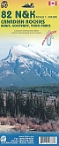
Topografische Wandelkaart Canadian Rockies Banff, Kootenay, Yoho Park 82J/K/N/O - ITMB Map
Water- en scheurvaste wandelkaart
€ 13,50