- Gratis verzending vanaf 30 euro
- Levert in Nederland, België etc.
- Meer dan 30.000 titels
- Vakkundige klantenservice
- Snelle levering
- Veilig en eenvoudig betalen

Direct contact?
Bel +31 (0)6 42428571
maandag t/m vrijdag
van 10 tot 17 uur
Wegenkaart - Landkaart Puerto Rico & US Virgin Islands - ITMB Map
Water- en scheurvaste wegenkaart
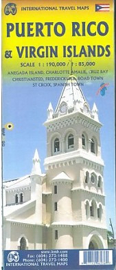
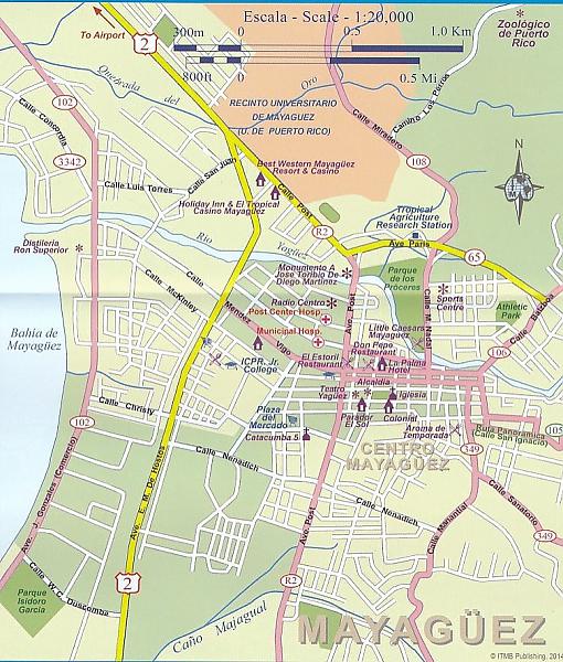
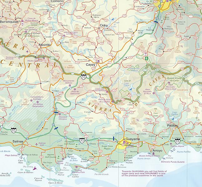
De ITMB kaarten kenmerken zich door een kleurrijke en volle cartografische weergave. Het zijn degelijke kaarten, zeker voor gebieden waarvoor kaarten lastig te krijgen zijn, met aanduidingen van onder andere nationale parken en natuurgebieden, vliegvelden, toeristische bezienswaardigheden en een goede aanduiding van het wegennet. Daarnaast bevatten enkele kaarten ook stadsplattegronden (hoofdsteden of belangrijke centra). Bevat voor sommige landen ook aanduidingen in de orginele taal. Water- en scheurvaste wegenkaart. We are really pleased with this new edition of Puerto Rico. We spent part of August, 2013, touring the island and geo-referencing its many highways. The island is bigger and more densely road-networked than we thought, so we'll have to complete the job on our next visit, but the roads are now much more precisely shown accurately than was possible before satellite imagery. The map looks great on an Ipad screen as well. The map also shows updated inset maps of San Juan, Ponce, Mayaguez, Aguadilla, and Arecibo. Puerto Rico is part of the United States, so has all the benefits, but is internally self-governing. With this edition we are including a map of the other US colonial territory, the US Virgin Islands. The Danish West Indies was purchased from Denmark in 1917 and is an integral part of the USA, with all its benefits, but is, like Puerto Rico, neither fish nor fowl. It is internally self-governing and a great retirement location for Americans, but it retains much of its Danish heritage. The map includes insets of Charlotte Amalie, Frederiksted, Cruz Bay, and Christiansted. The ITMB map of the entire Virgin Islands area will continue to be marketed separately; this version is mostly for the convenience of cruise ship passengers visiting both 'countries'. Legend Includes: Roads by classification, Main highways, Secondary roads, Ferry routes, Lakes and big rivers, Airports, Hotels, Churches, Viewpoints, Zoos and much more...
Schaal: 1:190.000
Engelstalig
EAN: 9781771296236
Uitgeverij: ITMB (International Tavel Maps & Books)
Meest recente editie
Engelstalig
EAN: 9781771296236
Uitgeverij: ITMB (International Tavel Maps & Books)
Engelstalig
direct leverbaar
13,50