- Gratis verzending vanaf 30 euro
- Levert in Nederland, België etc.
- Meer dan 30.000 titels
- Vakkundige klantenservice
- Snelle levering
- Veilig en eenvoudig betalen

Direct contact?
Bel +31 (0)6 42428571
maandag t/m vrijdag
van 10 tot 17 uur
Wegenkaart - Landkaart Cairns tot Broome (Savannah Way) met National Park - Hema Maps
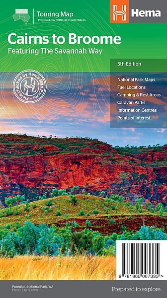
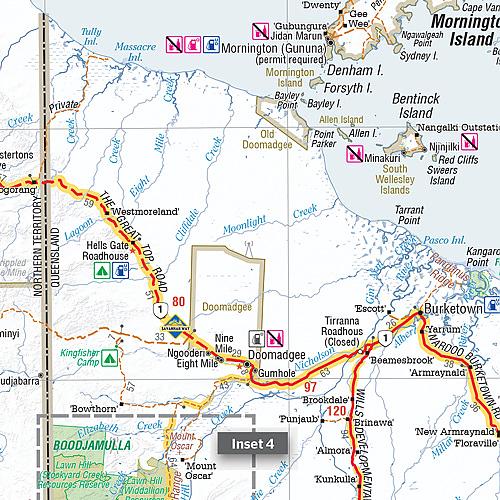
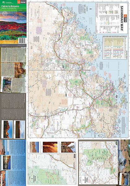
Hema Maps, een uitgever uit Australie, maakt fantastische kaarten welke zich kenmerken door het overzichtelijke en rustige karakter. Op de meeste kaarten zijn de dorpen en steden duidelijk aangegeven, inclusief de additionele informatie voor onderweg. Hierbij kun je denken aan een afstandstabel, tankstations, campsites, wegtype, tolwegen, regionale verbindingswegen rondom de steden, spoorwegen en andere belangrijke orientatiepunten. Daarnaast staan op de meeste kaarten ook toeristische bezienswaardigheden aangegeven, zoals natuurparken, natuurfenomen, musea, monumenten, opgravingen enzovoorts. Find out all you need to know about travelling the Savannah Way between Cairns and Broome. As well as providing a detailed road map for the entire length of the Savannah Way, this map includes handy advice on road conditions, average rainfall and safe driving tips. The useful information also highlights the features you pass in Queensland, Northern Territory and Western Australia. Routes between Cairns and Broome in Hema’s range of very popular touring maps showing roads connecting Australia’s main centres of population along some of the most spectacular routes such as the Great Ocean Road or the Savannah Way. The maps highlight 24-hour fuel supplies, roadside rest areas, camping facilities, places of interest, etc., and include distance charts and, in some titles, city maps. Road network indicates unsurfaced roads and tracks. The maps also show railway lines. There is no topographical information beyond names of mountain ranges and selected peaks, plus rivers and lakes, but national and state parks, conservation areas and reserves, and aboriginal lands are all highlighted. The maps have a grid showing latitude and longitude at intervals of 1º or 2º. In this title: double-sided map showing the road network along Australia’s northern coastline and highlighting the facilities along the Savannah Way, its variants, and other main roads and tracks such as the Explorer Highway, the Matilda Highway, etc. Fuel symbols indicate the type of fuel available at stations. Both local railway lines and the Australasia Railway from Darwin towards the centre and Adelaide are also shown. Tables provide list of facilities within the national parks in all three states covered by the map, distances and rainfall along the Savannah Way, plus notes on driving conditions, places of interest, etc. Latitude/longitude grid is at 1º intervals.
Schaal: 1:2.200.000
Engelstalig
EAN: 9781865007335
Uitgeverij: Hema Maps Australia
Meest recente editie
Engelstalig

Op voorraad
Overmorgen in huis (Nederland)
- Vakkundige klantenservice
- Groot assortiment
- Gratis retourneren binnen 14 dagen
- Aangesloten bij WebwinkelKEUR
€ 13,90