- Gratis verzending vanaf 30 euro
- Levert in Nederland, België etc.
- Meer dan 30.000 titels
- Vakkundige klantenservice
- Snelle levering
- Veilig en eenvoudig betalen

Direct contact?
Bel +31 (0)6 42428571
maandag t/m vrijdag
van 10 tot 17 uur
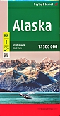
Wegenatlas Alaska Highways Atlas - ITMB Map
A5 Formaat geniet

De ITMB wegatlassen kenmerken zich door een kleurrijke en volle cartografische weergave. De wegenatlas bevat degelijke kaarten, zeker voor gebieden waarvoor kaarten lastig te krijgen zijn, met aanduidingen van onder andere nationale parken en natuurgebieden, vliegvelden, toeristische bezienswaardigheden en een goede aanduiding van het wegennet. Daarnaast bevat de wegenatlas ook stadsplattegronden van de hoofdstad en andere belangrijke centra. Bevat voor sommige landen ook aanduidingen in de orginele taal. A5 Formaat geniet. Dempster and Dalton highways.
This booklet is the same size as all other ITMB atlases and is designed to fit comfortably in a user's backpack, purse, or car door storage bin. The famous Alaska Highway of WW2 fame has been largely paved and straightened by now, but is still one of the paramount exploration adventures in the world and is far more accessible than the Karakoram or mid-Australia routes. The original highway, from Dawson Creek in northern British Columbia to close to Fairbanks, Alaska, has been supplemented by several off-shoots: the Dempster Highway leading to Inuvik, in Canada's Northwest Territories, the Dalton Highway, leading north to the high Arctic at Prudhoe Bay in Alaska, and the Stewart Highway leading south through the Coastal Mountains to Prince Rupert, BC are all closely integrated with the traditional Alaska Highway. All of these are shown in great detail in this atlas. Road conditions, distances, campgrounds, convenient hiking trails, heights of land, parks, and everything else that we could think of to make this booklet useful has been included. It has also been very attractively priced, which I hope is being noted. This is a light-weight and nicely-presented attempt to move mapping forwards into its bright future as value-added information of use to users and affordably priced. In spite of the resemblance, the person shown on the cover is not Lan.
Legend Includes:
Roads by classification,California and State highways, Museums, Waterfalls,Hospitals, Seaports, International and Domestic Airports, Ferry and much more
Schaal: 1:1.5 Miljoen
Engelstalig
EAN: 9781553419044
Uitgeverij: ITMB (International Tavel Maps & Books)
Meest recente editie
Engelstalig

Op voorraad
Levertijd 4 dagen (Nederland)
- Vakkundige klantenservice
- Groot assortiment
- Gratis retourneren binnen 14 dagen
- Aangesloten bij WebwinkelKEUR
€ 13,90
Meer producten die interessant kunnen zijn
Wegenkaarten Alaska
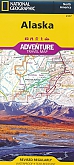
Wegenkaart - Landkaart Alaska - Adventure Map National Geographic
Deze kaart is gemaakt van scheur- en watervast materiaal
€ 16,99
Wegenkaart - Landkaart 11 USA Alaska - World Mapping Project (Reise Know-How)
Water- en scheurvaste wegenkaart
€ 11,25
Wandelkaarten Alaska
Wandelkaart 222 Alaska Denali (Alaska) - Trails Illustrated Map / National Park Maps National Geographic
Water- en scheurvaste wandelkaart
€ 16,99

Wandelkaart 255 Alaska Glacier Bay (Alaska) - Trails Illustrated Map / National Park Maps National Geographic
Water- en scheurvaste wandelkaart
€ 16,99
Wandelkaart 761 Alaska Prince William Sound, West (Alaska) - Trails Illustrated Map / National Park Maps National Geographic
Water- en scheurvaste wandelkaart
€ 16,99