- Gratis verzending vanaf 30 euro
- Levert in Nederland, België etc.
- Meer dan 30.000 titels
- Vakkundige klantenservice
- Snelle levering
- Veilig en eenvoudig betalen

Direct contact?
Bel +31 (0)6 42428571
maandag t/m vrijdag
van 10 tot 17 uur
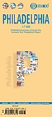
Wegenkaart - Landkaart Philadelphia & Pennsylvania - ITMB Map
Water- en scheurvaste wegenkaart

De ITMB kaarten kenmerken zich door een kleurrijke en volle cartografische weergave. Het zijn degelijke kaarten, zeker voor gebieden waarvoor kaarten lastig te krijgen zijn, met aanduidingen van onder andere nationale parken en natuurgebieden, vliegvelden, toeristische bezienswaardigheden en een goede aanduiding van het wegennet. Daarnaast bevatten enkele kaarten ook stadsplattegronden (hoofdsteden of belangrijke centra). Bevat voor sommige landen ook aanduidingen in de orginele taal. Water- en scheurvaste wegenkaart. This map began as a result of a map conference held in Philadelphia a few years ago. Maps of the city at that time tended to concentrate on the entire spread-out urban area, resulting in the historic core, which was of interest mostly to visitors, crowded into a small portion of the map. Our map covers from the zoo and art gallery in the north to West Oregon St in South Phillie, so takes on much more than the historic area and the downtown, but does so at an excellent scale, so everything from the Liberty Bell to the University of Pennsylvania campus shows up clearly and easy to read. The other side of the map is also a brand new map for ITMB. The East Coast of the USA is so densely packed with urban areas and attractions that it is difficult to portray on one map. ITMB has already published Northeast USA at 1:1M scale; this is the adjacent sheet south, as Great Lakes is the Adjacent sheet west. No one seems to have an agreed-upon definition as to what should be included as a Mid-Atlantic State. We included New York State because we wanted NYC to be included and by the shape of the USA had to include parts of Connecticut and Massachusetts unintentionally. The focus of the map is NYC to Raleigh, NC, with New Jersey, Pennsylvania, Washington DC, Delaware, Maryland, Virginia and North Carolina making up the map. In terms of cities, Syracuse and Buffalo are in the north, Pittsburgh (interesting city, by the way) in the far west, and Winston-Salem and Norfolk in the south. This is Civil War country and we have done our best to portray memorials important to both sides of that divisive conflict. This is a regional map, not a thematic one, so our focus has been on showing roads appropriate for a 1:1M scale map. Legend Includes: Roads by classification, Airports, Aerodromes and small aircrafts, Ferrie routes, Bus terminals, Metro Stations, Railway stations, Gas stations, Car Parks, Border crossing, State parks with or without campsites, Hospitals, Shopping centres, Postoffices, Police stations, FireStations, Museums, Tourist information centers, Points of interest, , Churches, Mosques, Synagogues, Chinese Temples, Points of Interest, Waterfalls, World heritage sites, Lighthouses, Hot springs, Mines and quarries, Native American reserves, Restaurants, Theatres, Banks, Caves, Embassies, Libraries, Shools, Universities, Banks, Cinemas Hotels, Notable buildings, Zoo, swimming pools, Beaches, Skiing, Tennis courts, Ball fields, Golf courses, Stadiums and much more.
Schaal: 1:750.000
Engelstalig
EAN: 9781771296250
Uitgeverij: ITMB (International Tavel Maps & Books)
Meest recente editie
Engelstalig


Op voorraad
Overmorgen in huis (Nederland)
- Vakkundige klantenservice
- Groot assortiment
- Gratis retourneren binnen 14 dagen
- Aangesloten bij WebwinkelKEUR
€ 13,50
Meer producten die interessant kunnen zijn
Stadsplattegronden Oostkust
Reisgidsen Oostkust
Reisgids USA Oost ANWB Wereldgids
De uitgebreide reisgids voor diegene die buiten de gebaande paden wil komen.
€ 28,49